+7 928 691 44 05
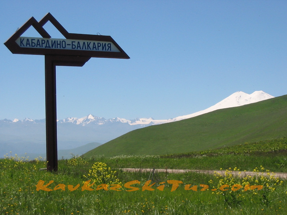
 Russia, KBR, city Nalchik


Schedule of climbing Elbrus from the North 2025
|
|
|
Why choose this route?
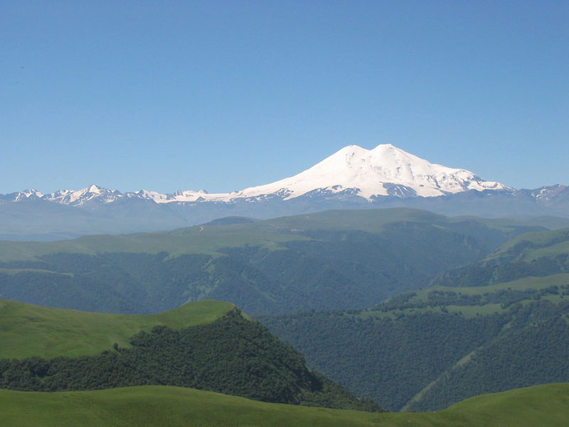
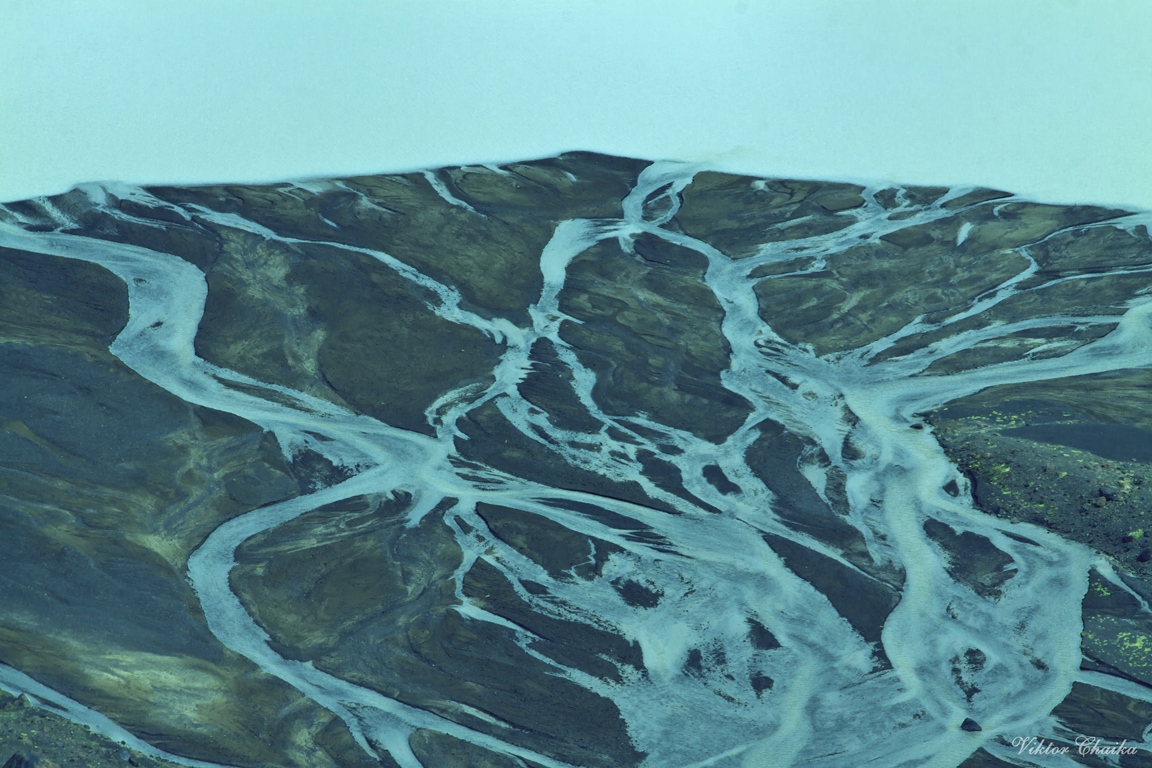
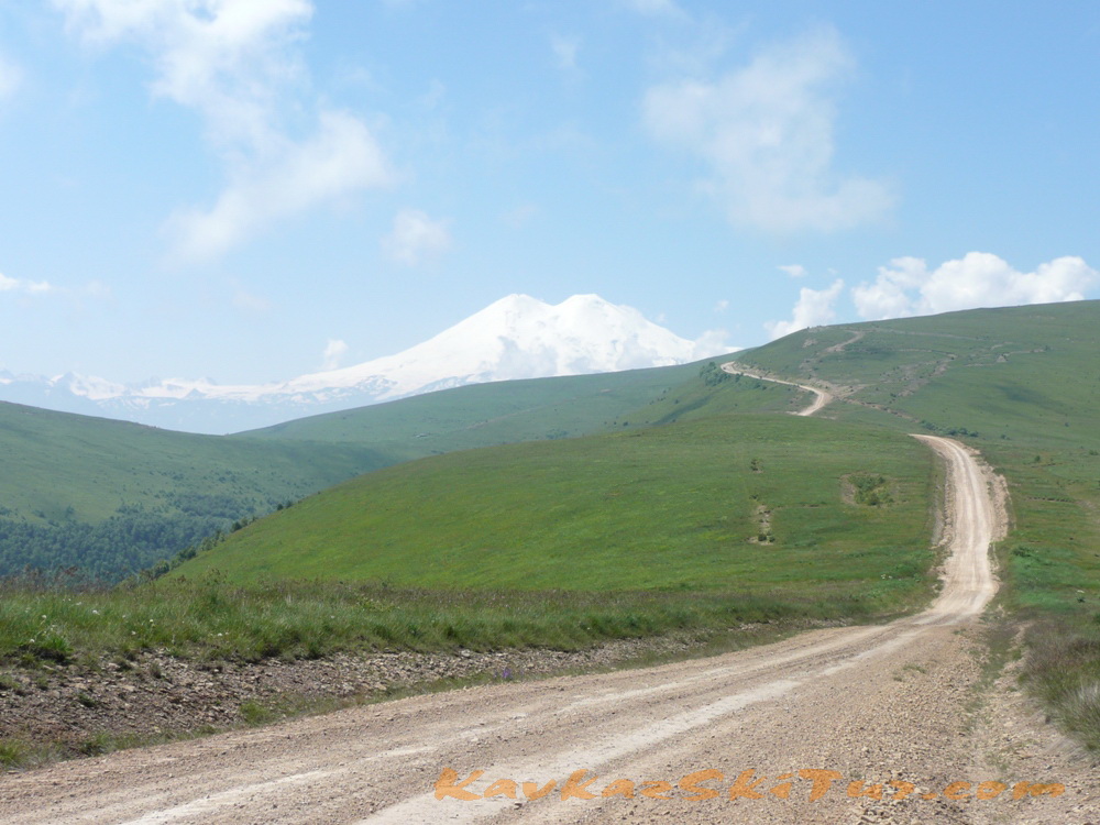
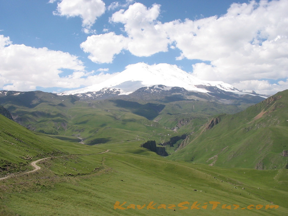
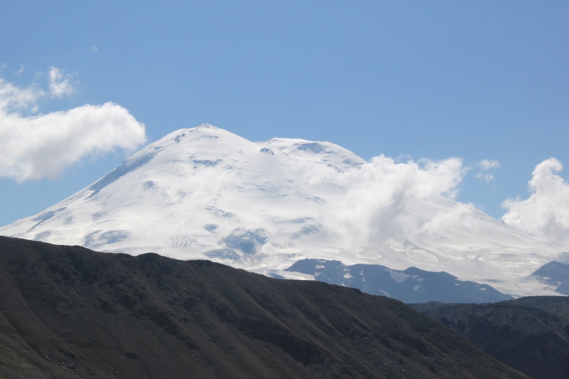
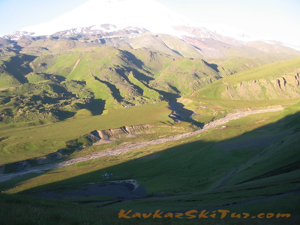
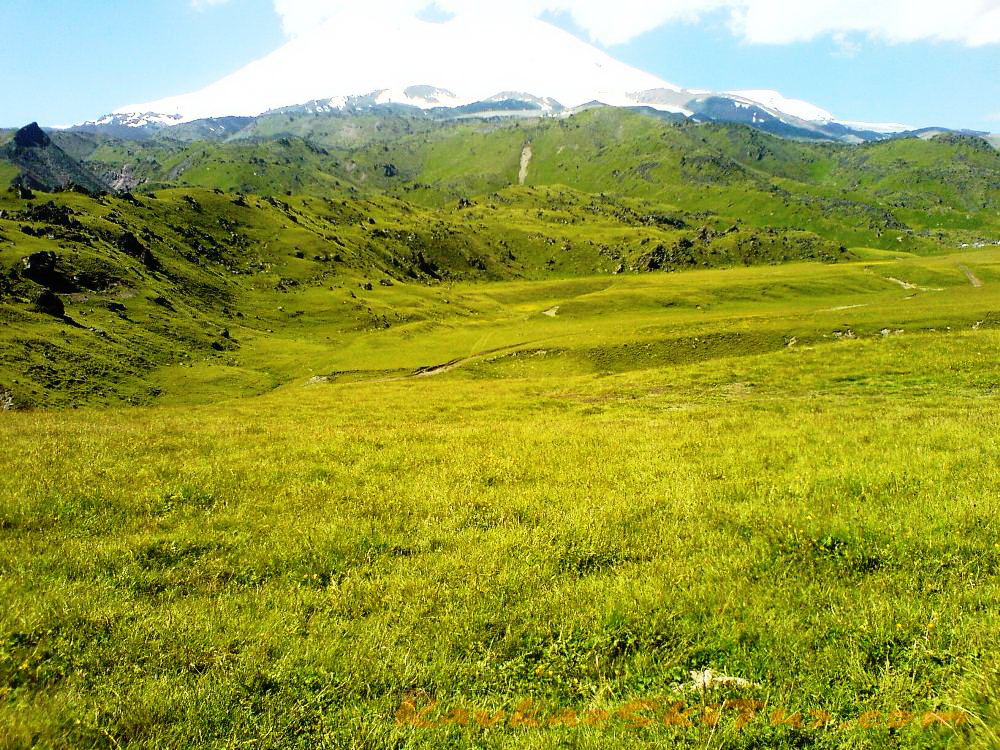
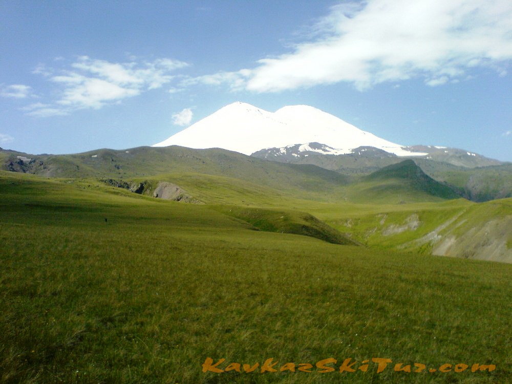
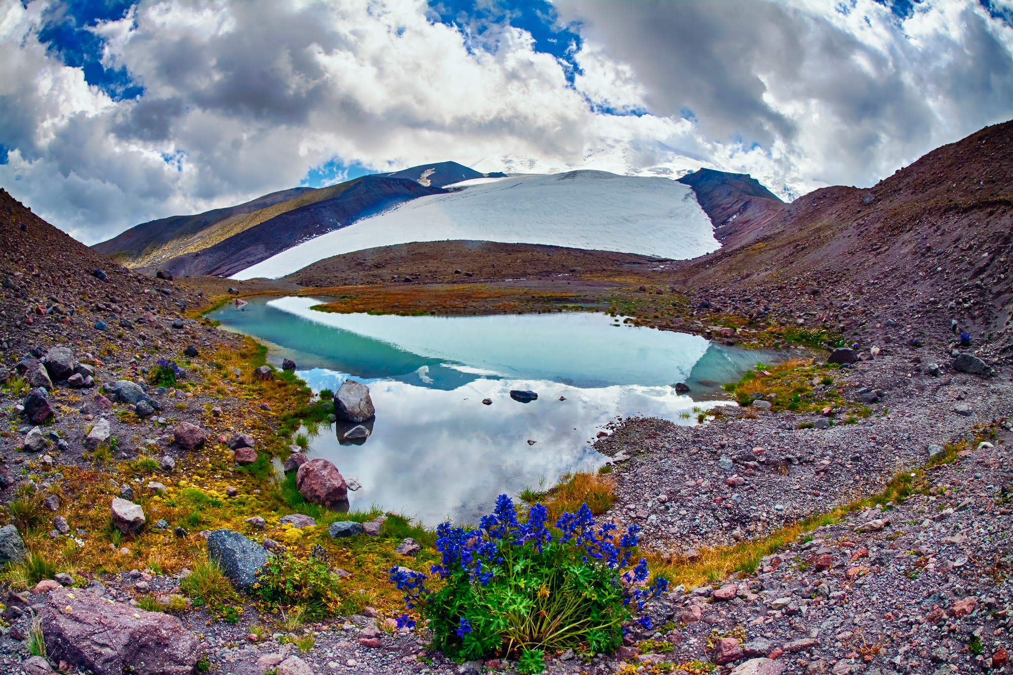
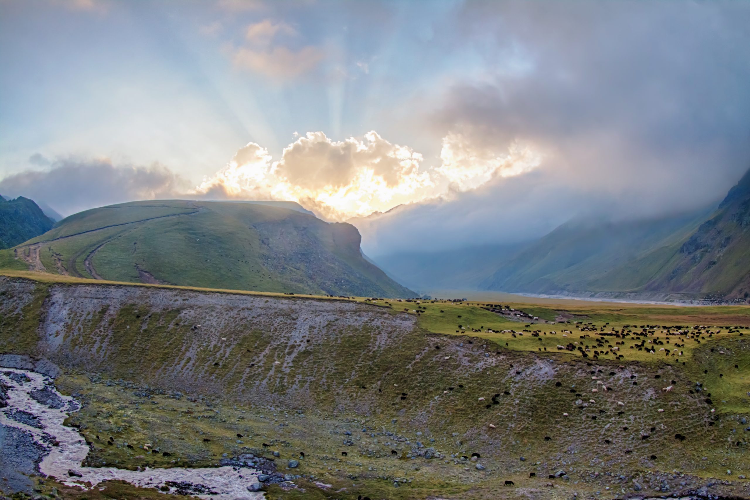
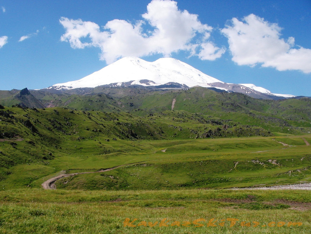
There is a big attraction in the landscape and nature of northern Elbrus – the route is going through the natural beauty and wild mountain region. Large plateau with stunning views of Mount Elbrus, glacial and spring lakes, wild rivers, crystal clear streams with trout, birch alpine forests, alpine meadows, glaciers, waterfalls, mineral springs, ancient ruins of villages, menhirs, passes: that’s just a small part of what you see in this expedition.
Program Elbrus north. Climbing the peak of Mount Elbrus towards the first ascent of the Russian expedition under the command of General of Cavalry Georgy Emanuel in 1829.
The program is designed for 10 days, one day spare in case of bad weather or extra acclimatization. Time of way up orientate and may change, depending on the specific conditions that day.
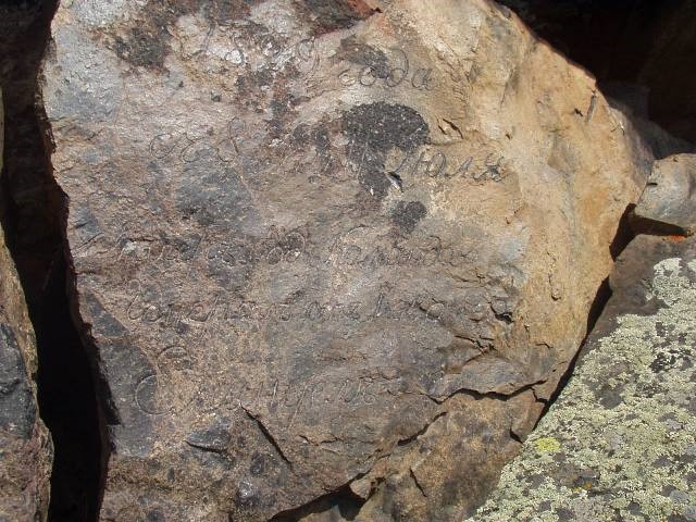
Next to the plateau Irahiktyuz located in the northern slopes of Mount Elbrus, on a small glade there is a stone on which is written: “in 1829 from 8 to 11 July Camp under the command of General of Cavalry Emanuel”. The stone was discovered only in 1932. Emanuel Group – the first people who climbed Mount Elbrus, to the eastern peak, and this inscription is the eternal report of the first successful ascent of Mount Elbrus.
Since that time many years passed and many people climbed Elbrus. Mount attracted and continues to attract all those who are able to hear her voice, everyone who is able to see the beauty, to achieve beautiful, throwing all his strength to it, when “that day will come”. And, despite of all its changeable and sometimes unpredictable nature, hundreds of people try to climb it. To some of them it is given relatively easily due to good physical preparation, due to successful weather; for others its harder, because of the absence of any of those factors; to some others its not given at all, but someone ends his life on the slopes of this mountain. Some may leave successfully ascending on one of the peaks, with the thought that “It’s an easy mountain”. Others will get another mood of the mountain, and from them you can hear something like “Why is it so big”, “There’s always such a wind here?”, “What evil weather!”, “It’s very difficult”, “We were not ready for this”.
Today, the mount is like a kind mother, will smile at you with hot sun, even at the top, and you can go almost in t-shirt; and tomorrow it suddenly and unexpectedly turns into a hysterical woman who doesn’t forgive neither “us” or “them” and mows everybody with powerful changeable snow storm, flying at a speed of 50 meters per second roaring fierce wind, lightning, covering a thick shroud of fog in which no longer you can tell where the “earth” and where “the sky.” And sometimes the mood of the game and conditions can change at the opposite just within few minutes. There can’t be easy mountains; there can be only exceptional luck. Elbrus – not easy one and a big mountain, which at times may seem calm and clear, but always carries within itself the storm that knows no compassion and mercy.

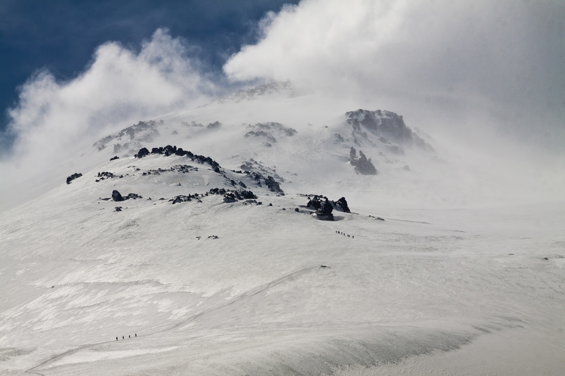
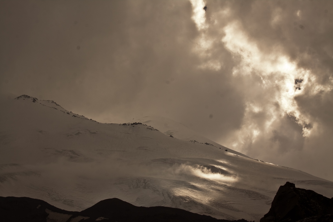
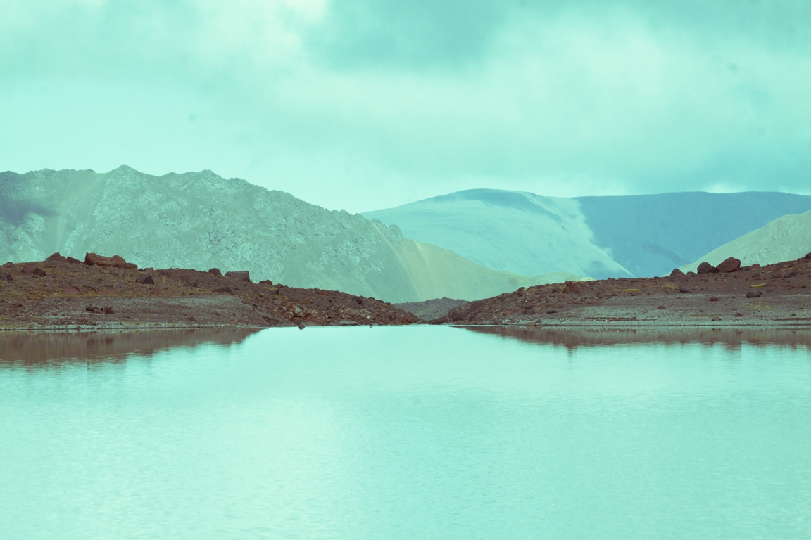
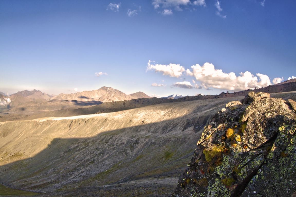
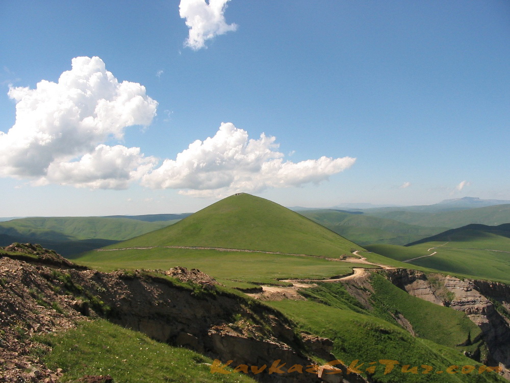
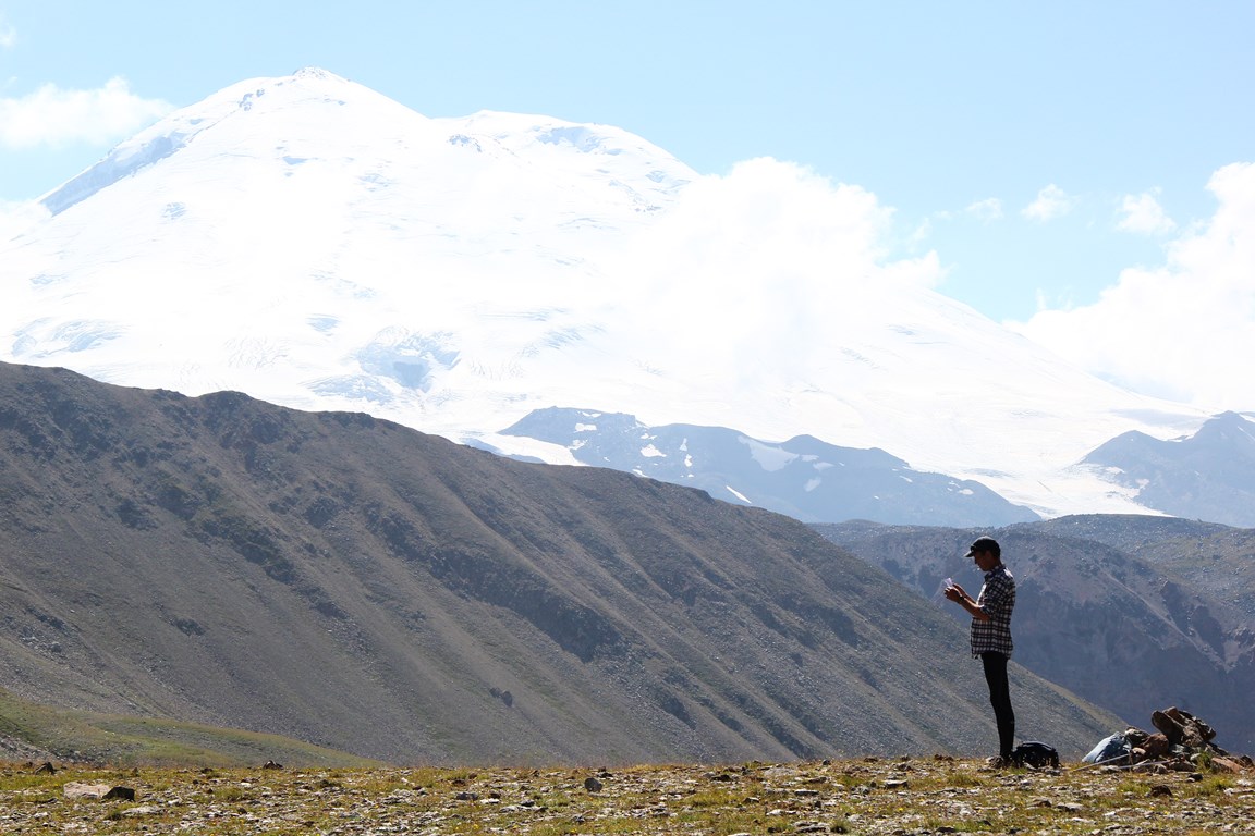
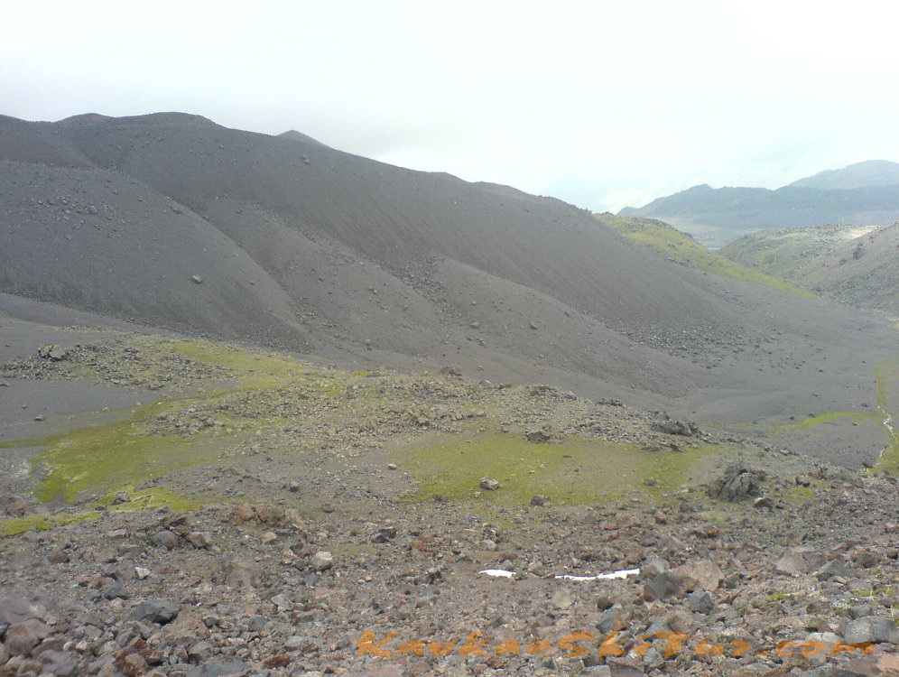
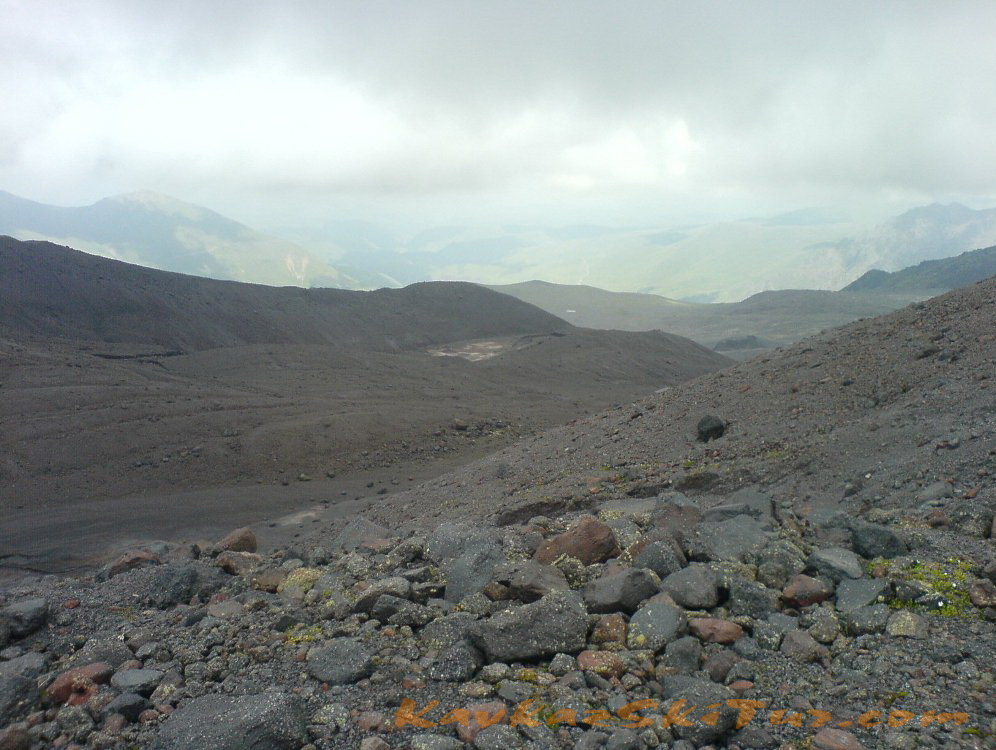
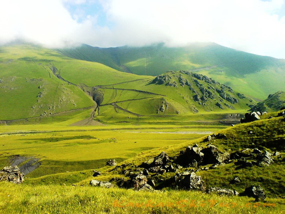
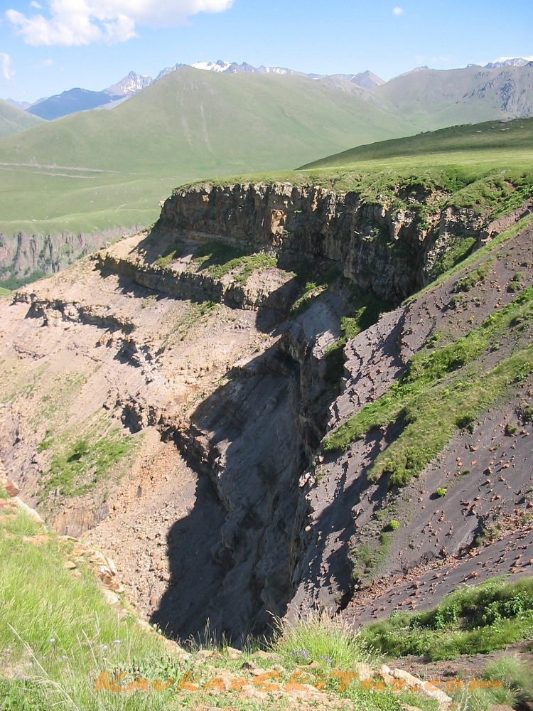
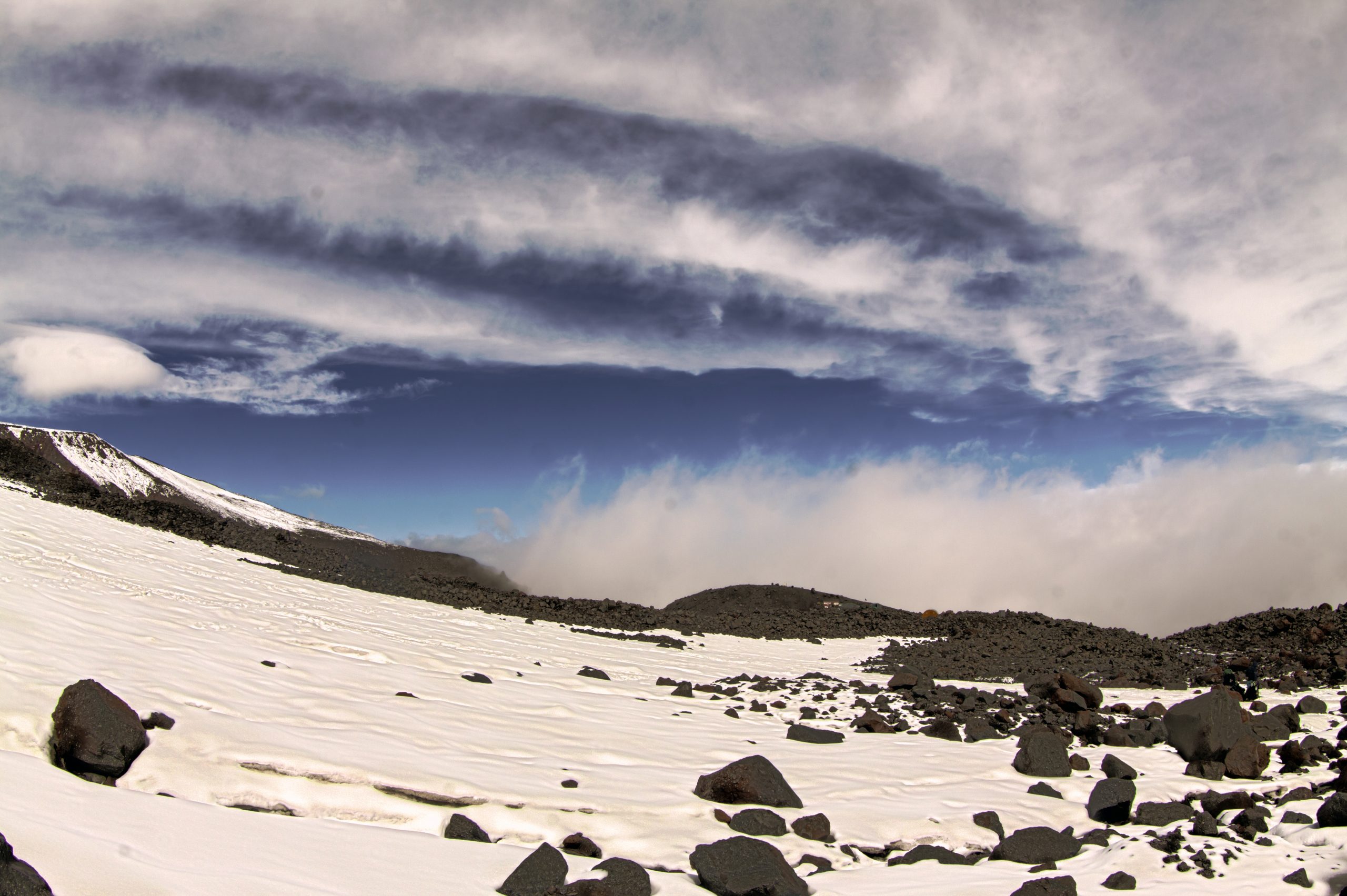
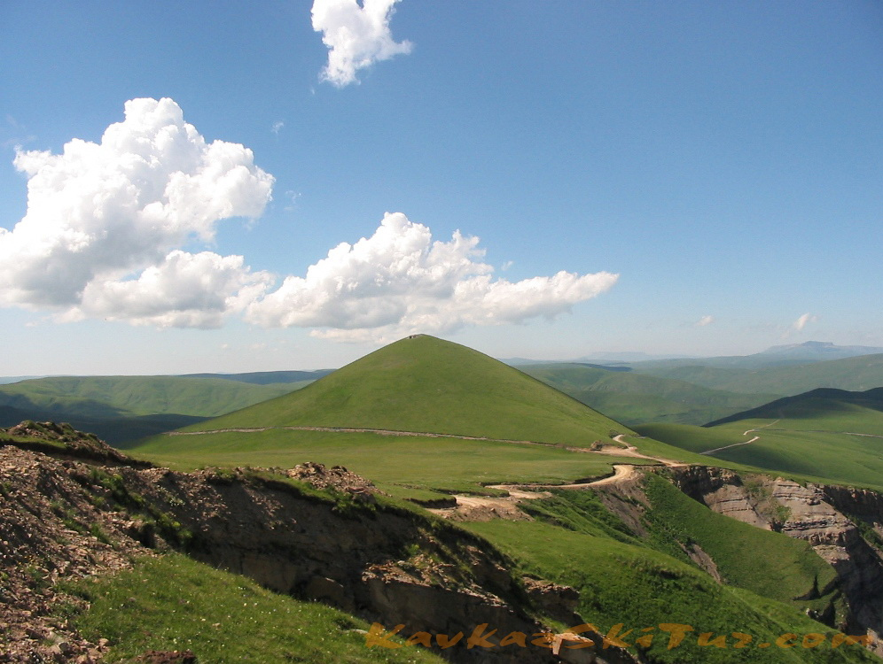
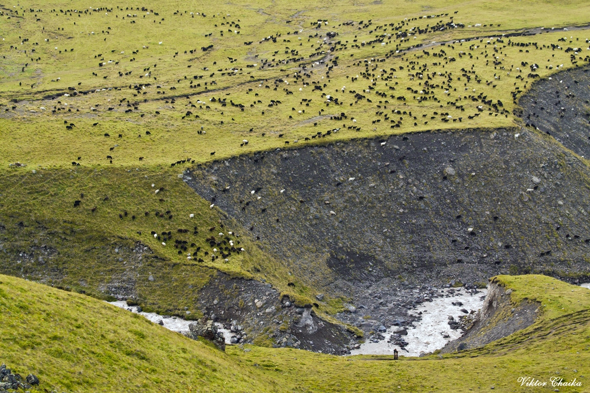
The program provides an opportunity to climb Elbrus by the first ascent route. However, later, it was considered as classic climb from the south side route. According to statistics, successful ascents from the South – 80%, from North – about 30%. These numbers show best of all and lead to the conclusion that, the ascent of the North route much more difficult than the ascent from the South. Today, the north side of Elbrus can be considered wild and untouched: hence the ascent can be considered more “honest”. There are no snow cats and cable cars, you need to go here all by yourself. The infrastructure of South allows to reach “in the easy way” to an altitude of 5100m (cable car to an altitude of 3800m, and then – snowcat to a height of 5100). This option is for those for whom attendance at the summit – is the most important from all the rest. For those who crave the hard work, the harsh slopes, spaciousness and grandeur of unspoiled nature – the north side of Elbrus is much more better in order to realize yourself, to get to grips with nature and try to win. Here, the work begins on a height of 2600 m, and all the tracks of acclimatization and climbing is going on your own. The space on the south side of the mountain squeezed into the gorge, is limited by mountain walls, noise and a lot of people, technics and ambitions, which, however, for someone can be quite close. From this north side, the terrain is more changeable and varied: on the background – mounts Kanzhol and Bermamyt, on average – a ridge Tashlysyrt, arrays Karakai and Balyksubashi, foreground – spacious plateau Irahiktyuz and Irahiksyrt, glacial and spring lakes, hot mineral springs, waterfalls, river valleys, crystal streams with trout, floating in the sky griffons, flitting here and there gophers, and a bit further in the woods – wolves and wild boars. Everything here is more severe and, perhaps, more truthful, as closer to the nature.
We have tried to build our program in such a way as to increase the chances of success within the capabilities of each participant. The success of this expedition in our understanding, in addition to the successful ascent, it is when a man took with him not only the picture from the top, but the warmth of the sun in the heart, of this proud Caucasian sun that doesn’t exists anywhere else in the world. When his soul became a little wider and more open like these places. When the person himself, as a man became “higher” and “stronger” like the surrounding granite massifs. When, in the end, he became clearer, as if the air, as if the water here. When he was able to feel here, in these harsh environment like at home, fell in love with it and taken with him. They say here: “There is nothing worse for us, if a person starts to feel here as a guest, we want him to feel like at home”.
“We love these mountains. We love honestly, from the heart, in the most difficult moments leaving nothing for ourselves. Mountains occasionally give back the same. Mountains became our home. Our house – is your home, together we will try to make this big, hard and wonderful adventure…”


Brief description of the tour
Day one:
Day two:
Trekking with small gain of altitude in the nearby surroundings.
Hiking time is 4-5 hours.
Absolute fluctuations in altitude: -300m, +300m.
Length — 12 km.
Day three:
Time — 9-10 hours.
Altitude: +1050 m, -1050 m.
Length — 20 km.
Day four:
Time 5-6 hours.
Height: + 1200 m.
Length: 7 km.
Day five:
Time: 3-6 hours.
Height: +-700-800 m.
Length — 5 km.
Day six:
Day seven:
Eastern peak of Elbrus 5621 m:
Time: 10 – 13 hours.
Height + — 1800 m
Length — 13 km.
Western peak of Elbrus 5642 m:
Time: 12 — 16 hours.
Height + — 1800 m
Length 17 km.
Day eight:
Day nine:
Day ten:

About camps
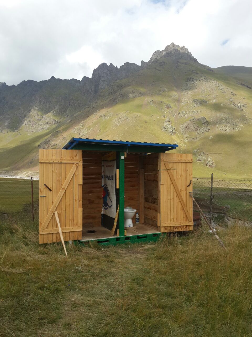
The climbing program relies on the existence of stationary camps and the availability of the necessary infrastructure in them, sufficient to ensure a completely comfortable stay in these not comfortable, in general, natural conditions, and balanced in such a way as not to harm nature.
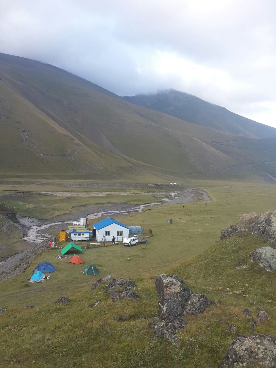
There are two camps :
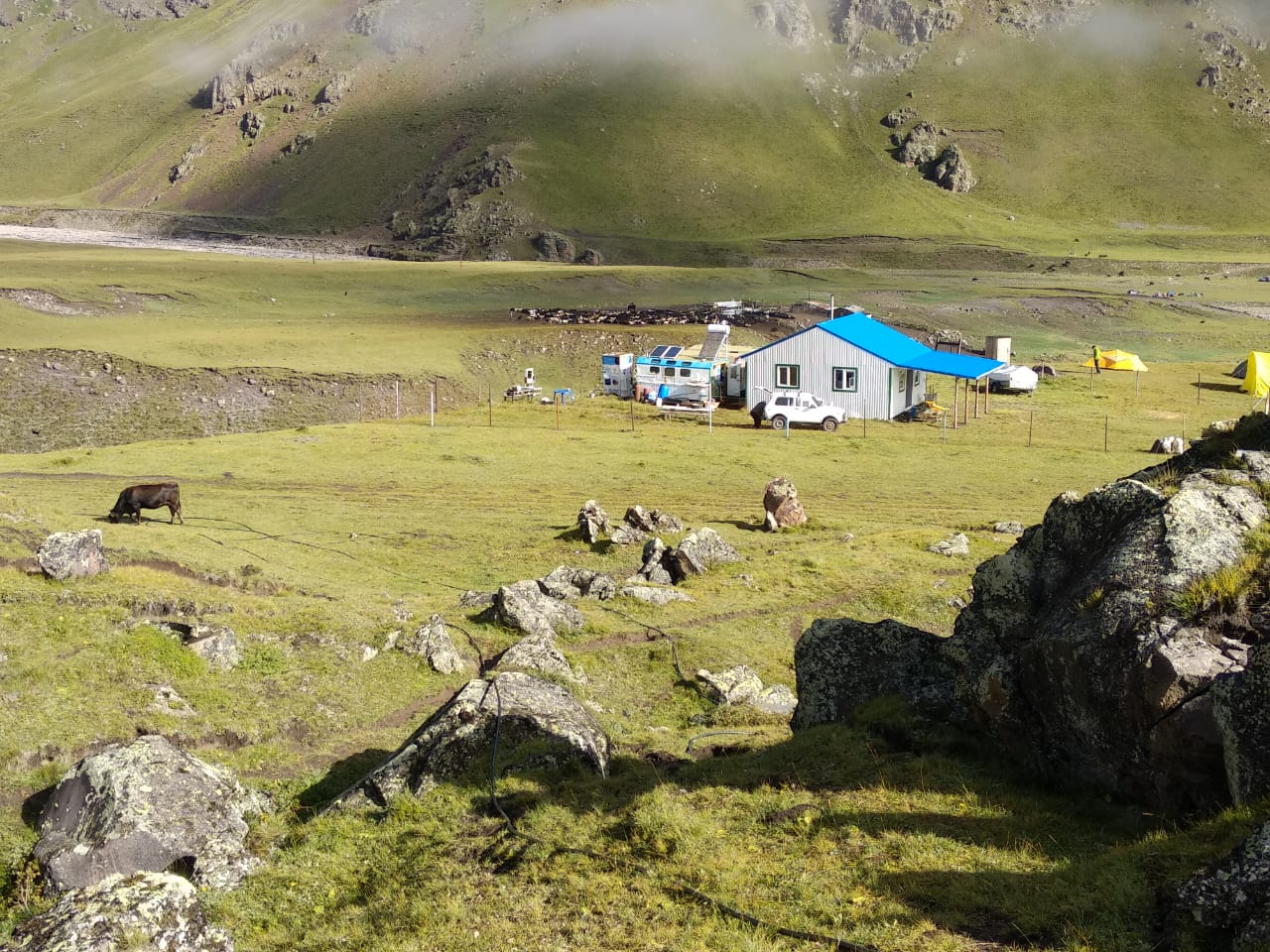
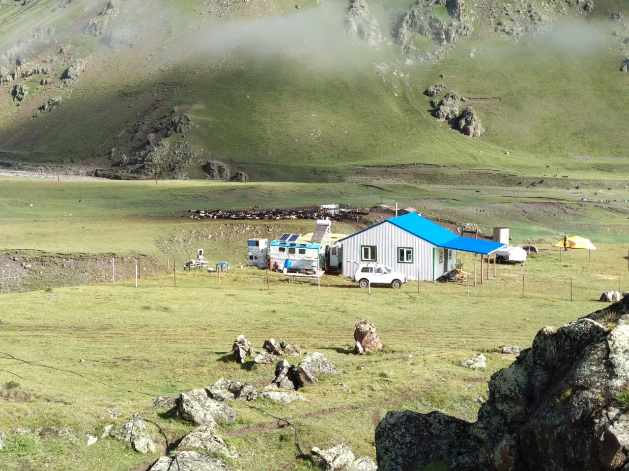
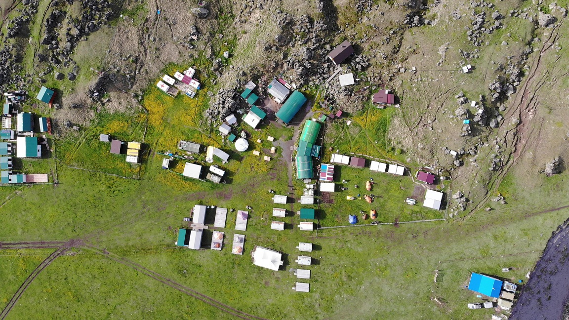
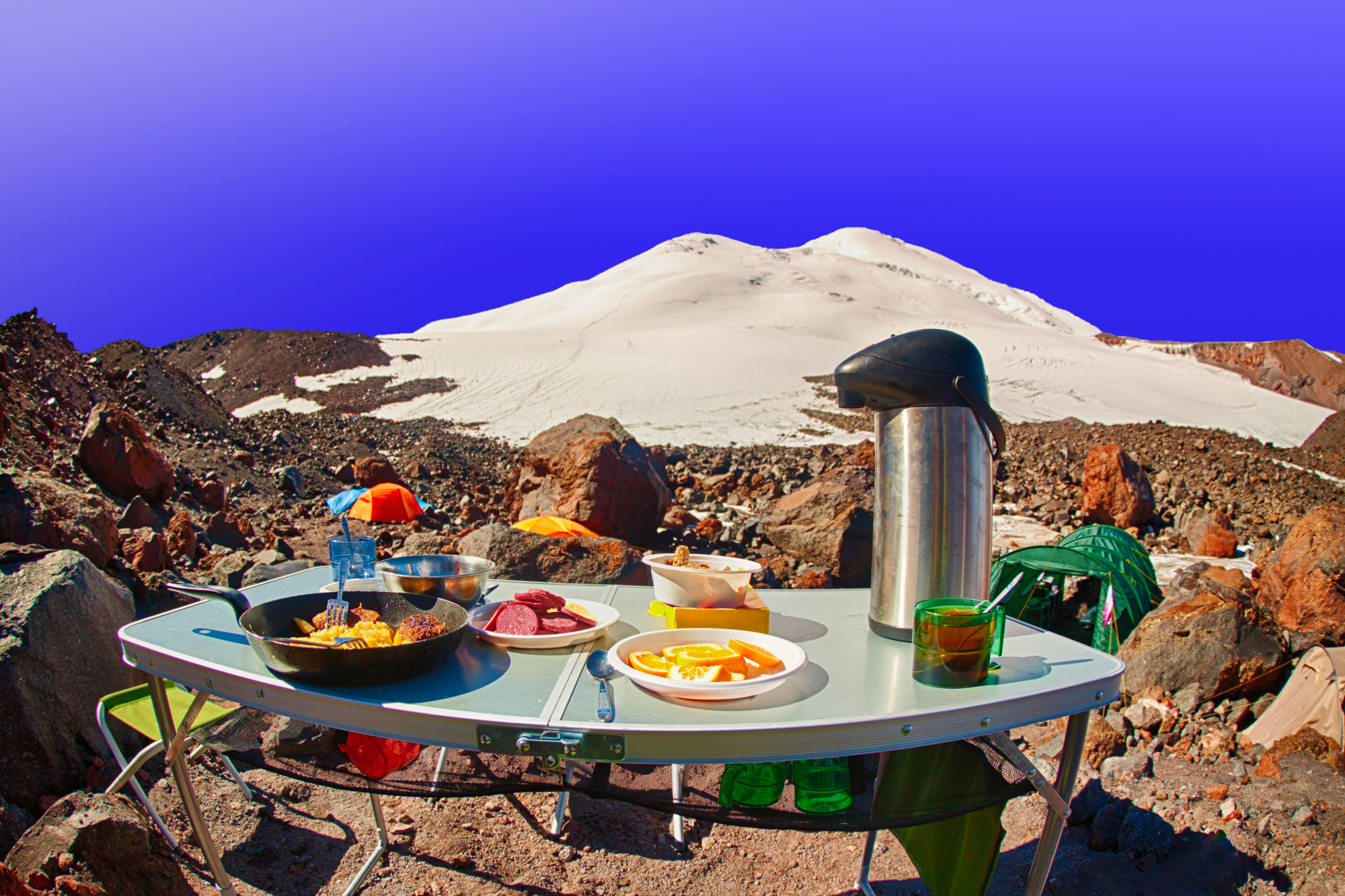
Base camp 2600 м.
Summit camp 3800 м.
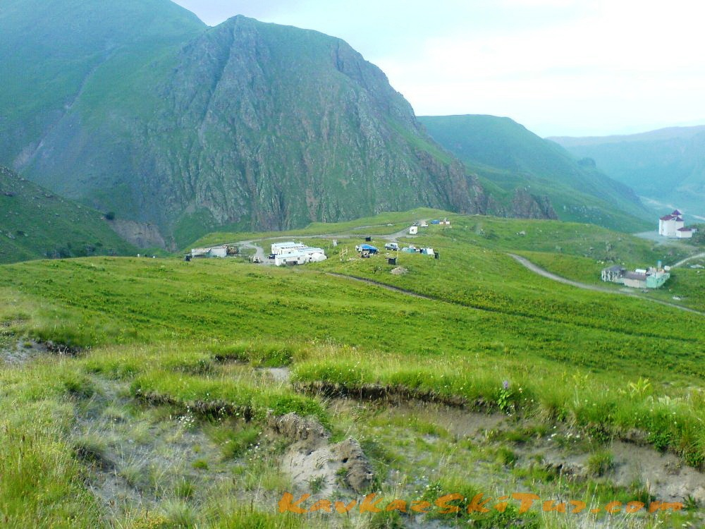
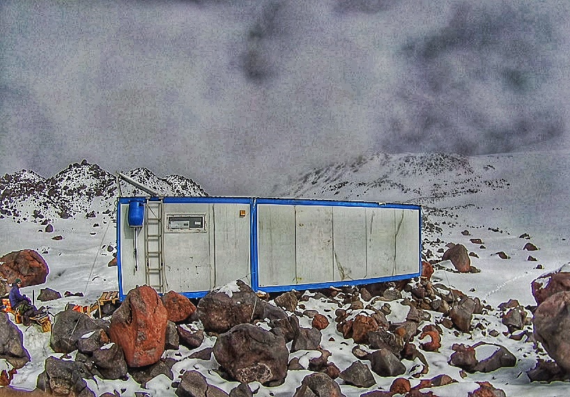
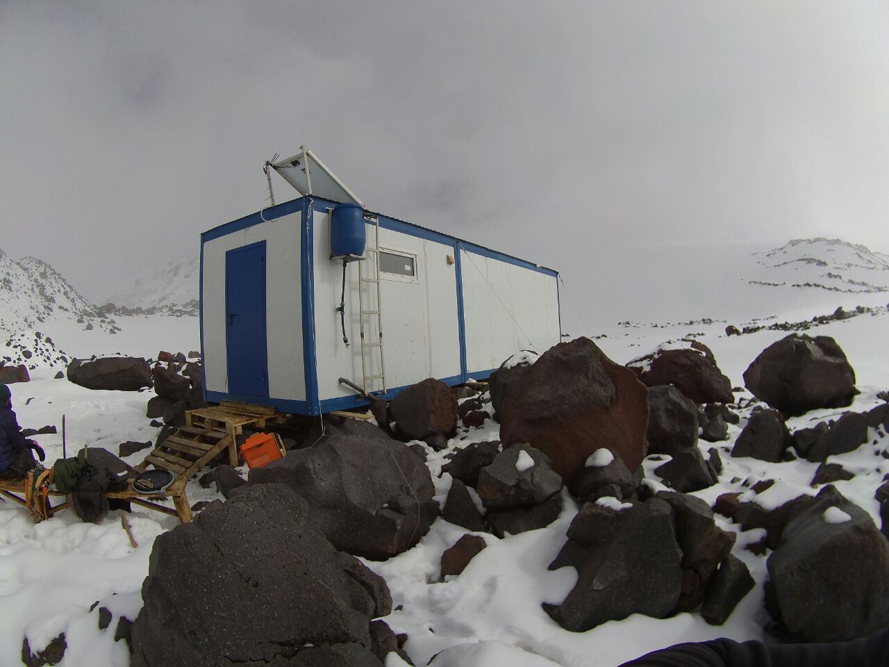
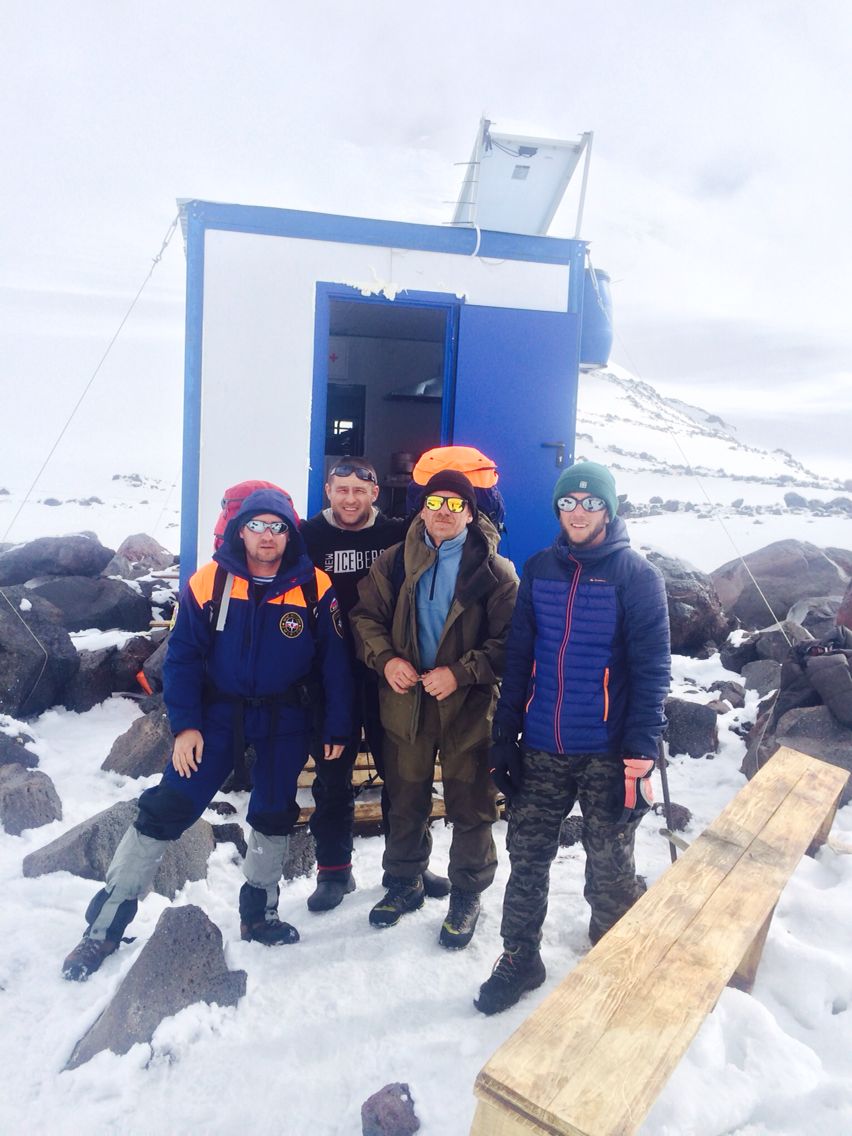
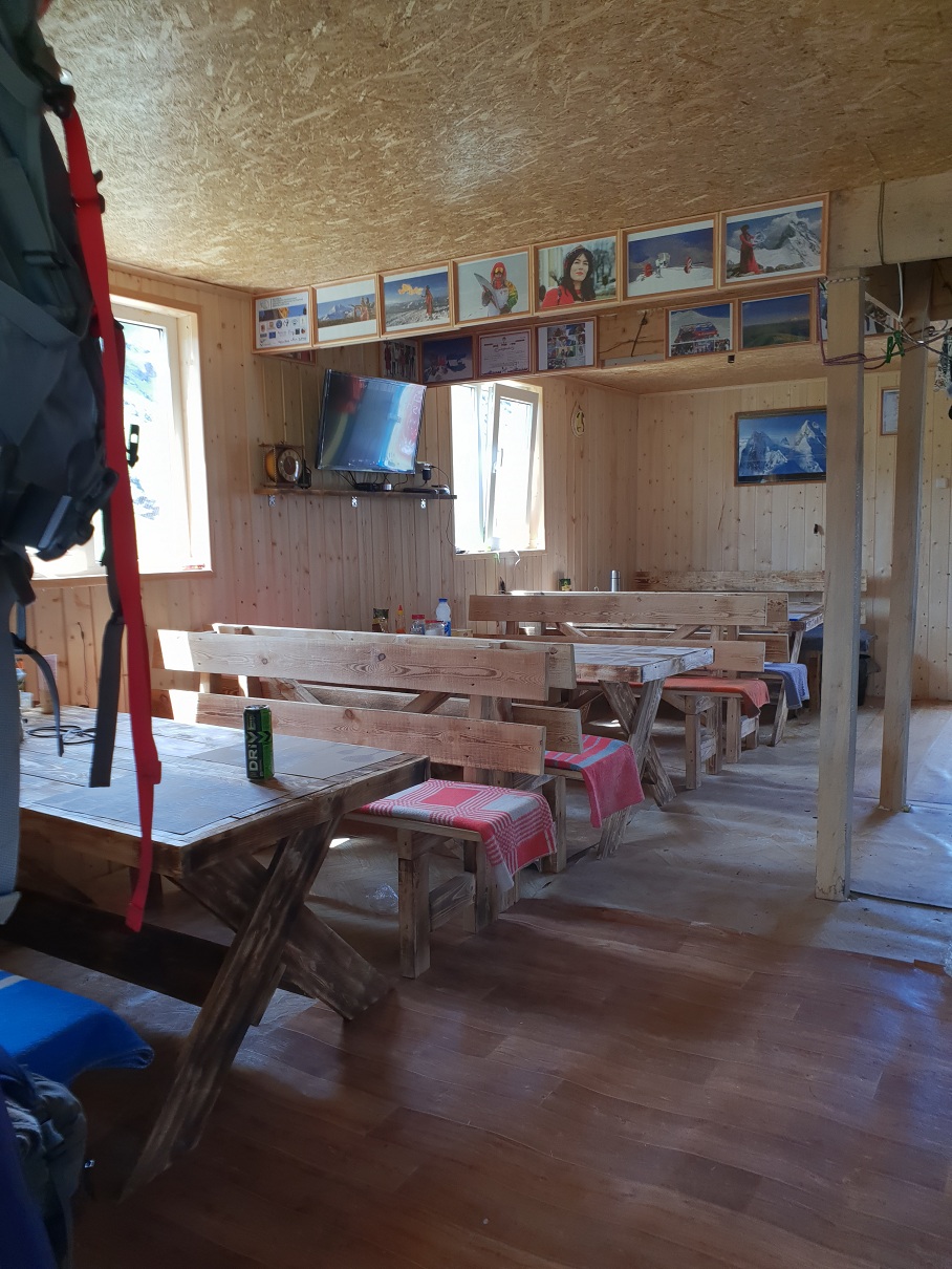
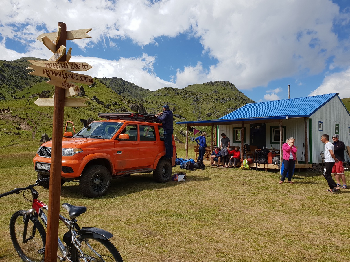
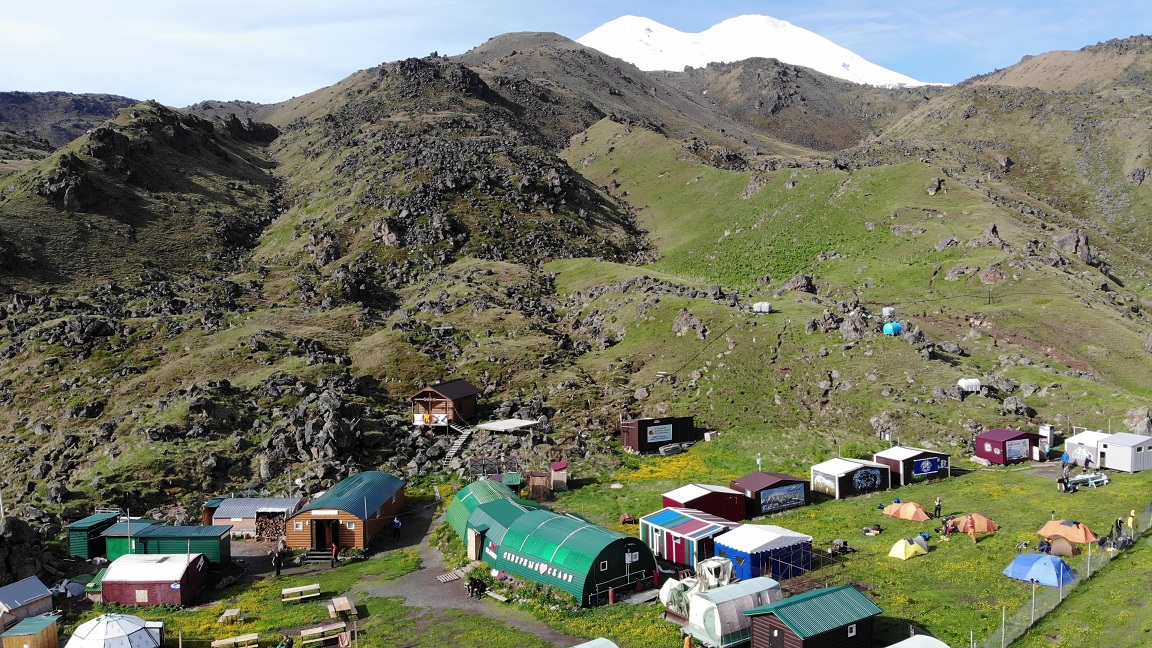
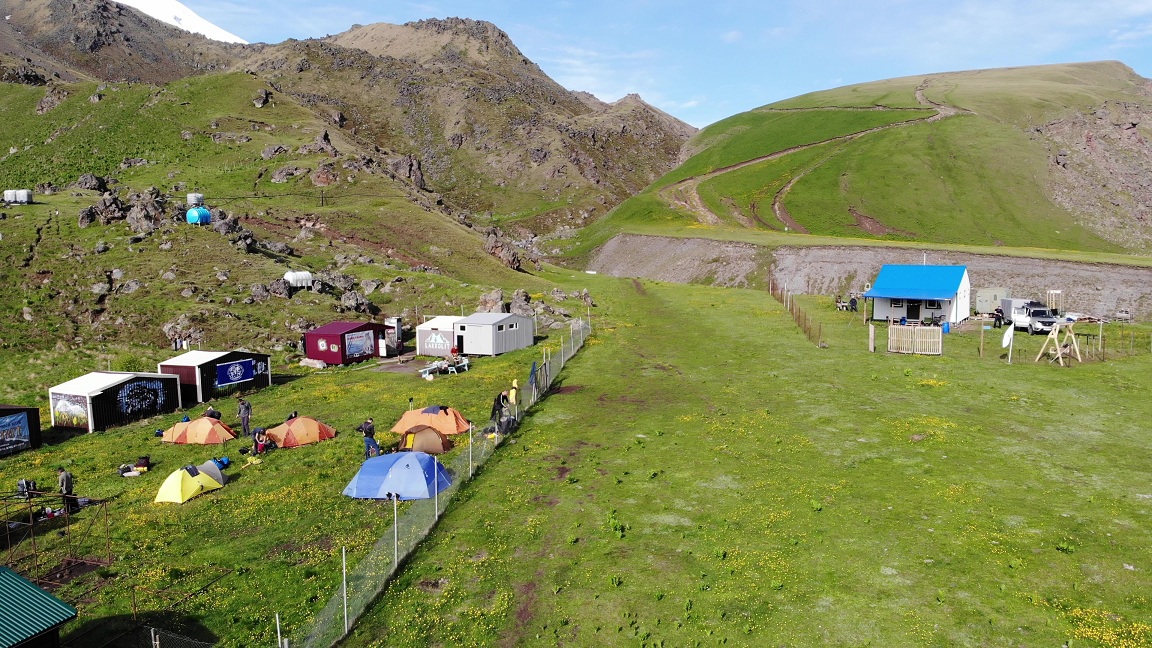
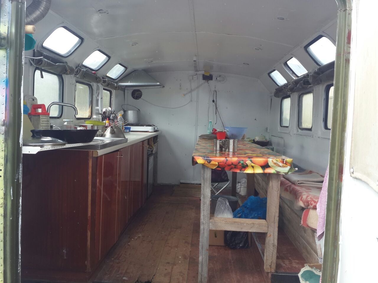
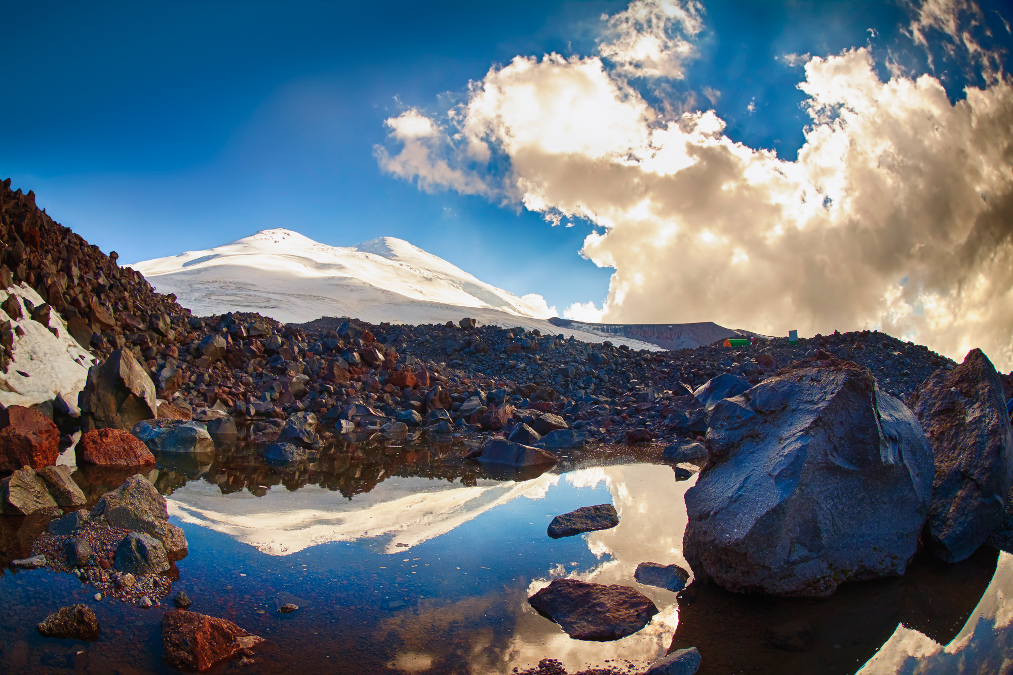
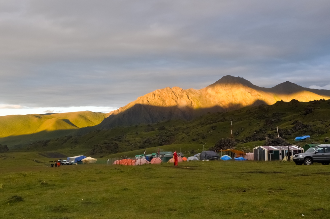
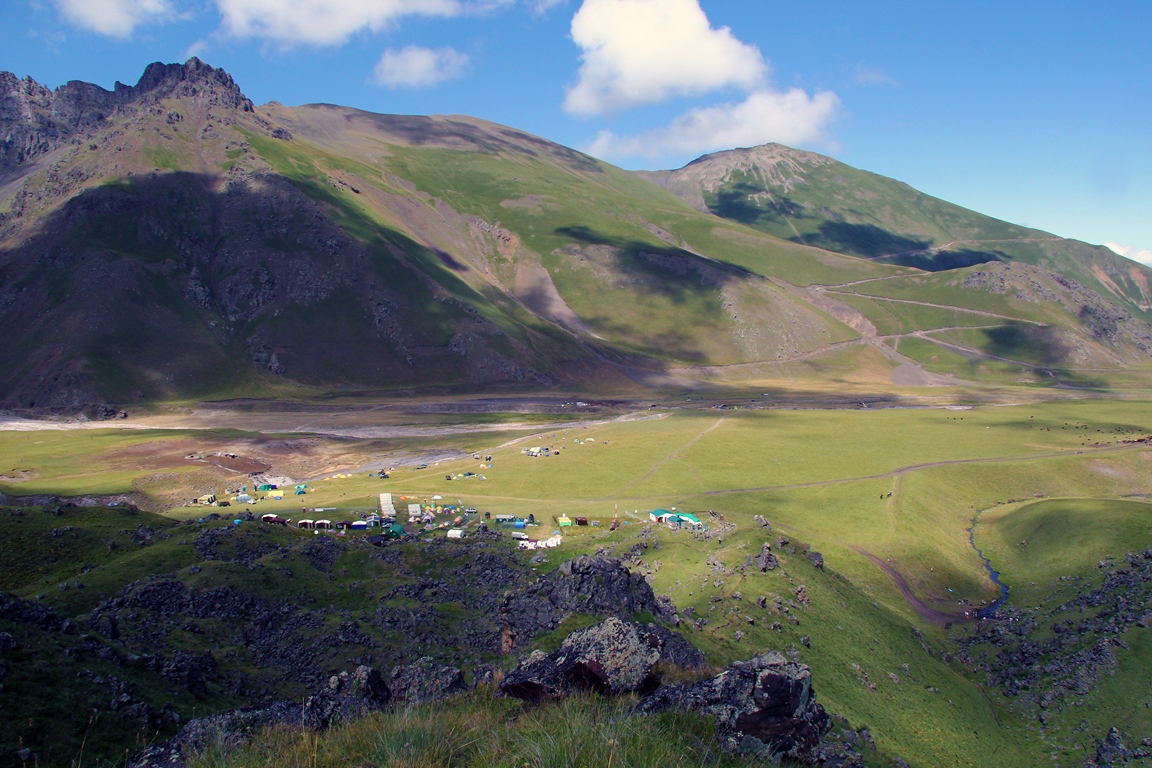
The base camp is located on the Irakhiktuz plateau, which since the time of Emanuel has also slowly begun to be called «Emanuel’s Glade». Being at an altitude of 2600 m, the base can rightfully be considered the highest mountaineering base camp in Europe.
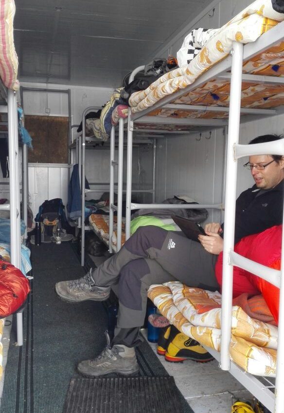
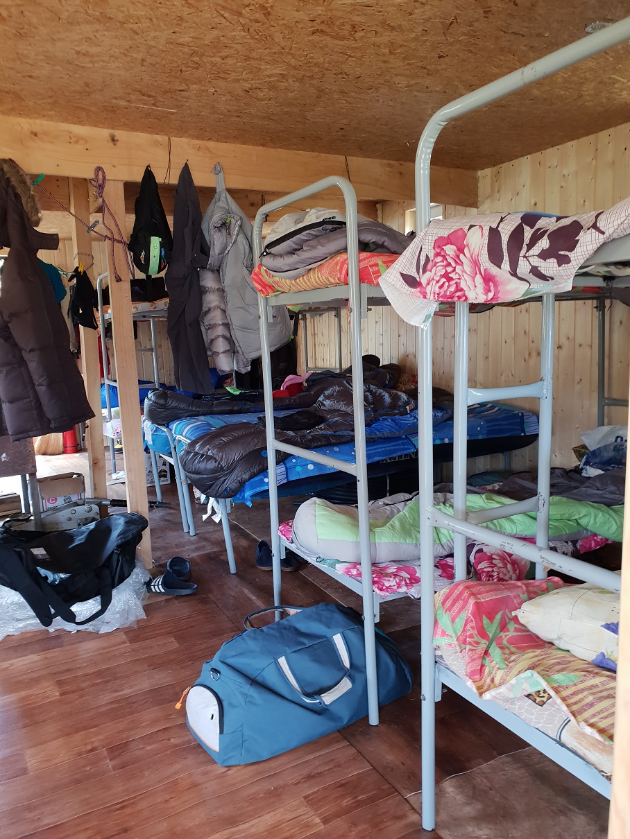
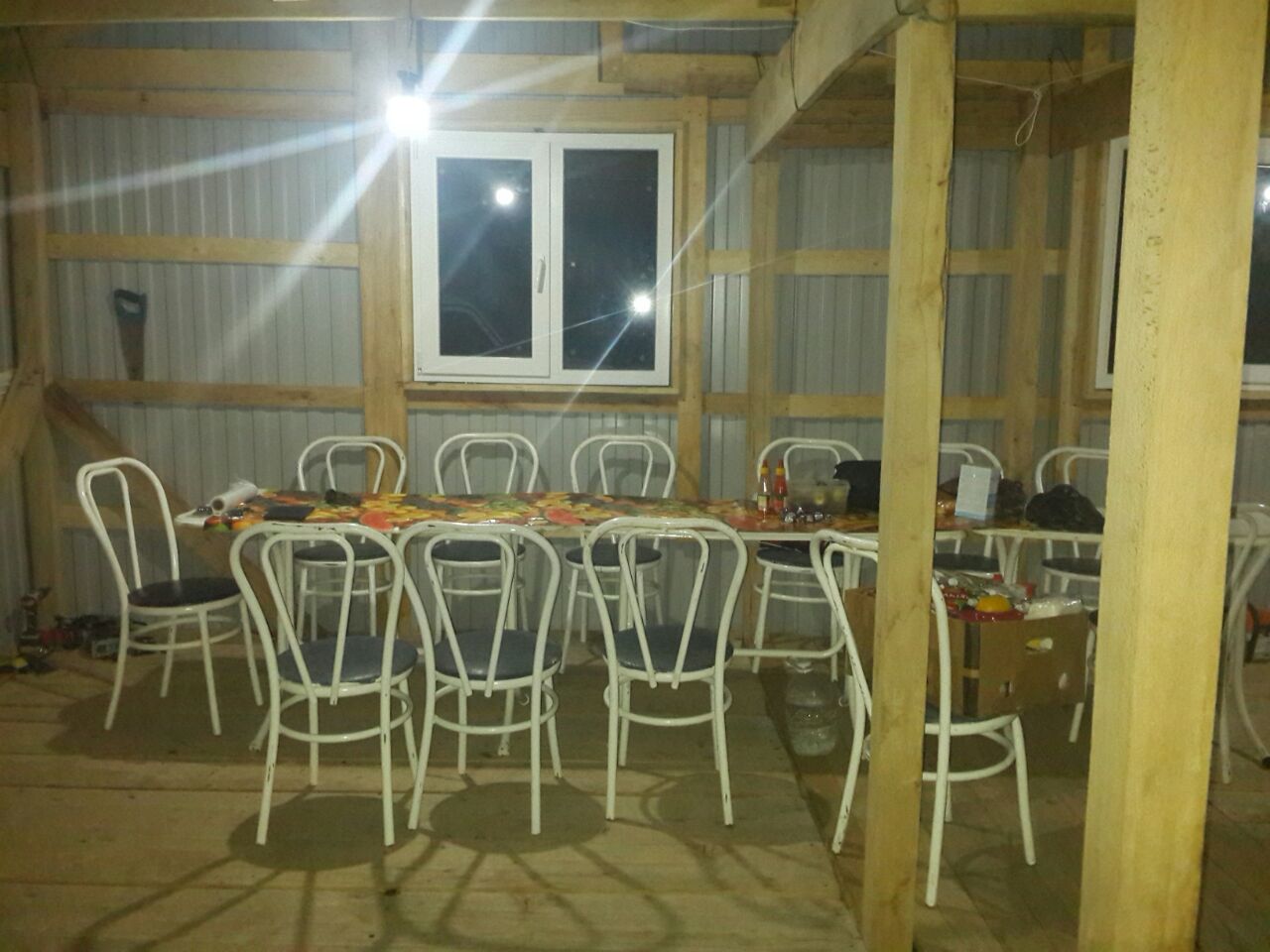
- Accommodation — in stationary houses.
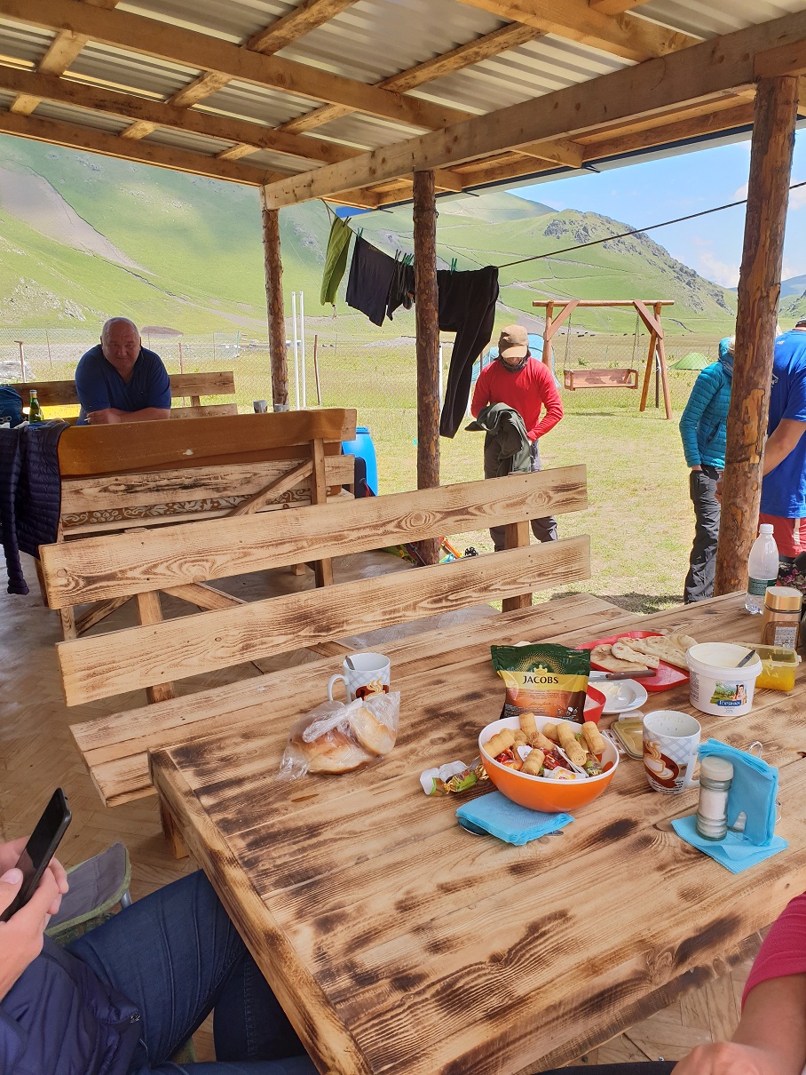
- Three meals a day, plus snacks.
- GSM mobile communications
- Internet
- Electricity (generator)
- Hot shower
- Water — spring
- There is a narzan mineral spring nearby.
- Incredibly starry sky)) Which allows the base to be considered a «thousand-star hotel»))
A five minute walk from the camp there is sheep-yard, where you can taste the food of true mountaineers – cheese, ayran, bread of shepherds, buy lamb (on request it can be prepared and cooked as shashlik – grilled barbecue and shurpa – soup made from mutton), “lamb” after climbing here has already became a pleasant tradition.
Weather and climate in base-camp. During the summer season on the glade of the base camp the weather is very comfortable, even at temperatures above 30 degrees in the sun it does not feel as “heat” because of dry air. At day time – it’s hot, at night – not cold. It is worth noting that the climate of these places is formed not only by the global atmospheric formations such as cyclones, but to a greater extent it is due to local processes, caused by the proximity of ridges, the presence of glaciers, changes in temperature of air, winds, caused by this, and of course the presence of huge volcanic monster nearby, on which we, in fact, going to climb.
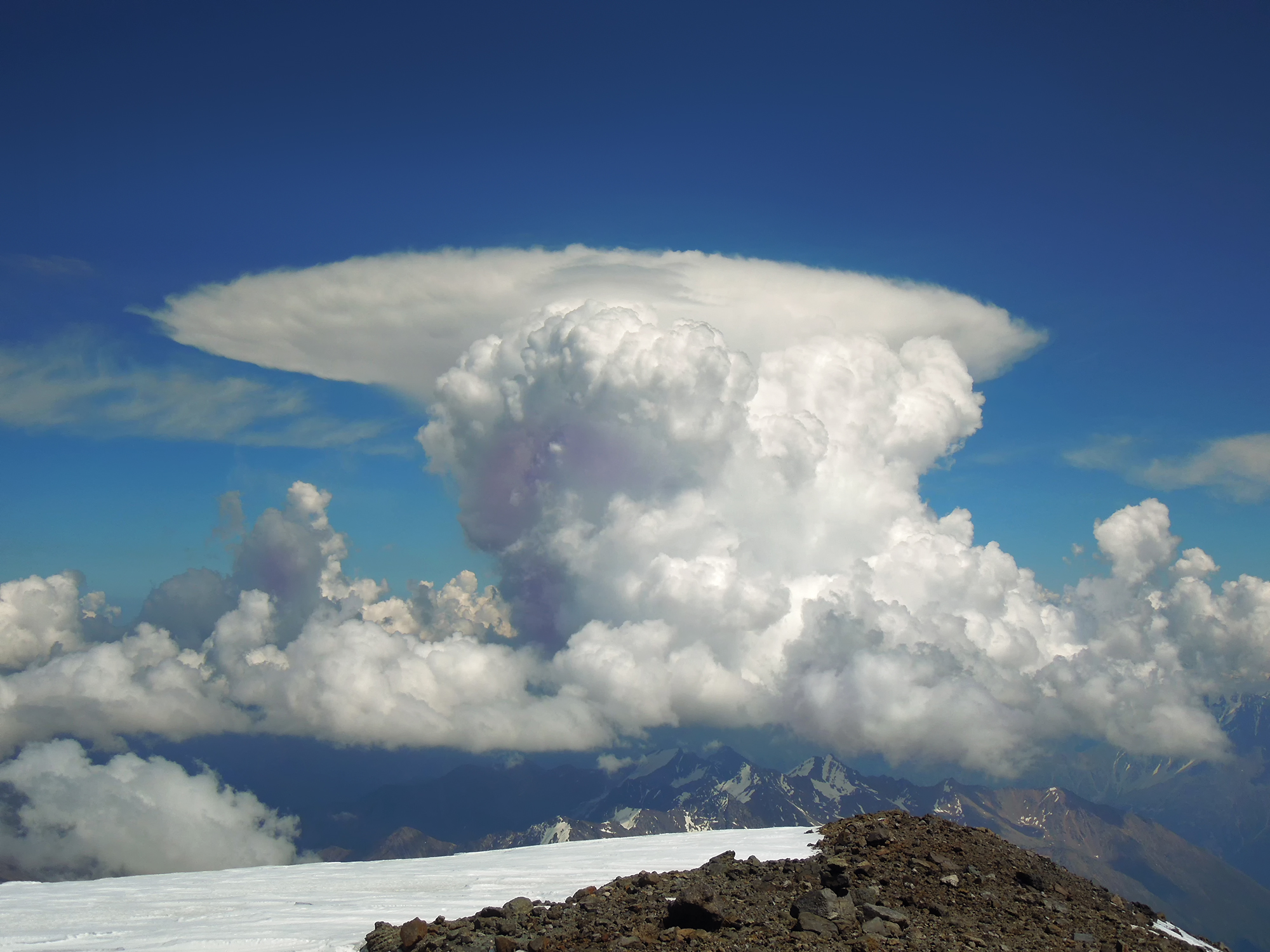
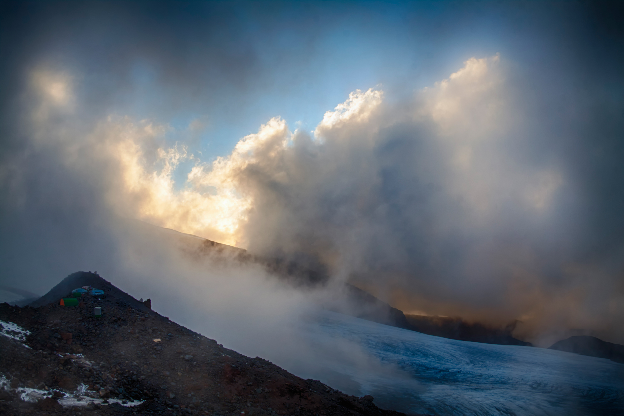
Because of all this the local climate is cyclical here – an average cycle length of about five days, five days of relatively good weather, five days of relatively bad. Although bad weather here cannot be relative, and particularly bad, which, however, does not negate the transitions related to the acclimatization. Relatively good weather can be as follows: first half of the day – the sun is shining, clear and understandable. In the afternoon clouds gather in local formation and there are some precipitation in the form of rain, dust rain, hail. Thunderstorms occur. On the upper half of the mountain hangs cloud. However, the weather can be good and it is currently so for a day or even a few days, when the air is “ringing”, the sun shines all the time, Elbrus is open throughout the day and night.
Acclimatization occurs in any weather. Normally, the presence of raincoat solves all. In general, the climate even in this northern part of the Elbrus a little “softer” than the climate of the central parts of the Caucasus joined to the Main Caucasian ridge. But along with a few days of acclimatization in the “beach” style, sometimes can be all days raining and the wind blows. But, at this stage, we can assume that there can be any weather in this phase of our adventure. Because all of this can be overcome and not critical, even if the weather drops “very bad”.
Sunny weather can deliver the “discomfort” of another kind – a test of high temperature. Although the heat is felt differently here than on the plain, and the moisture from the skin evaporates more effectively, all this does not cancel the fact that the body in such weather conditions associated with physical work, loses a lot of fluid and may slightly “overheated”.
At this stage of trip, the weather is almost cannot be a problem, but still it is better to have its specialties in mind.
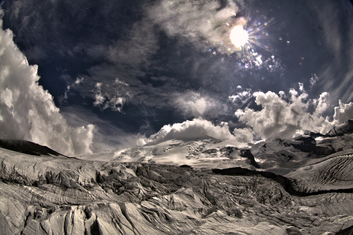
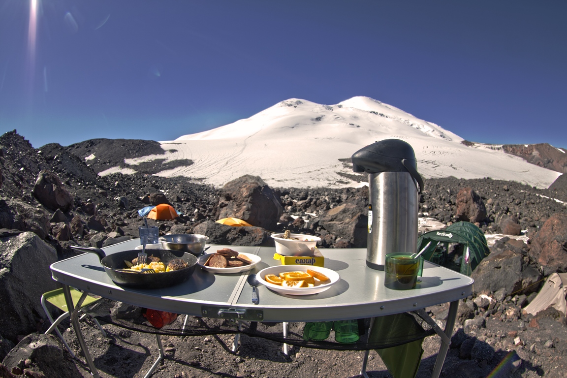
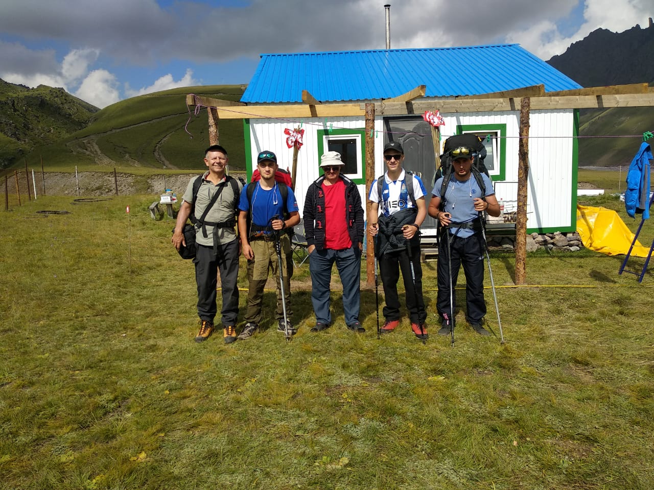
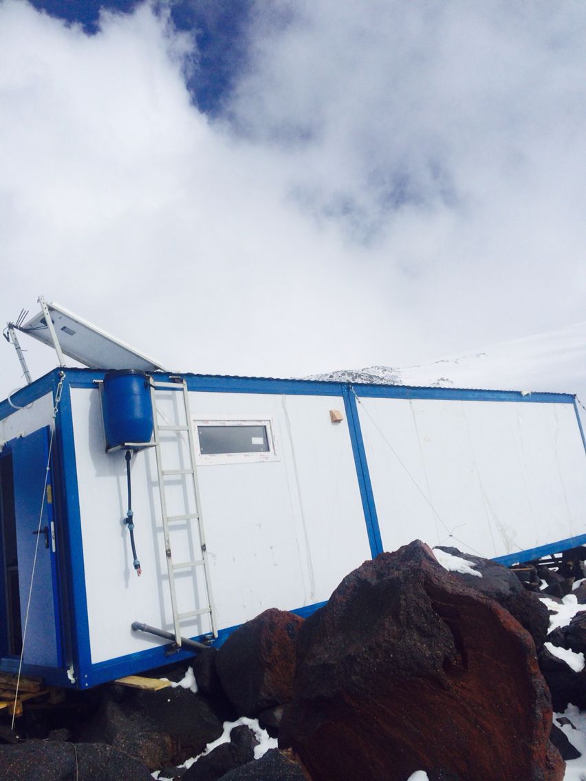
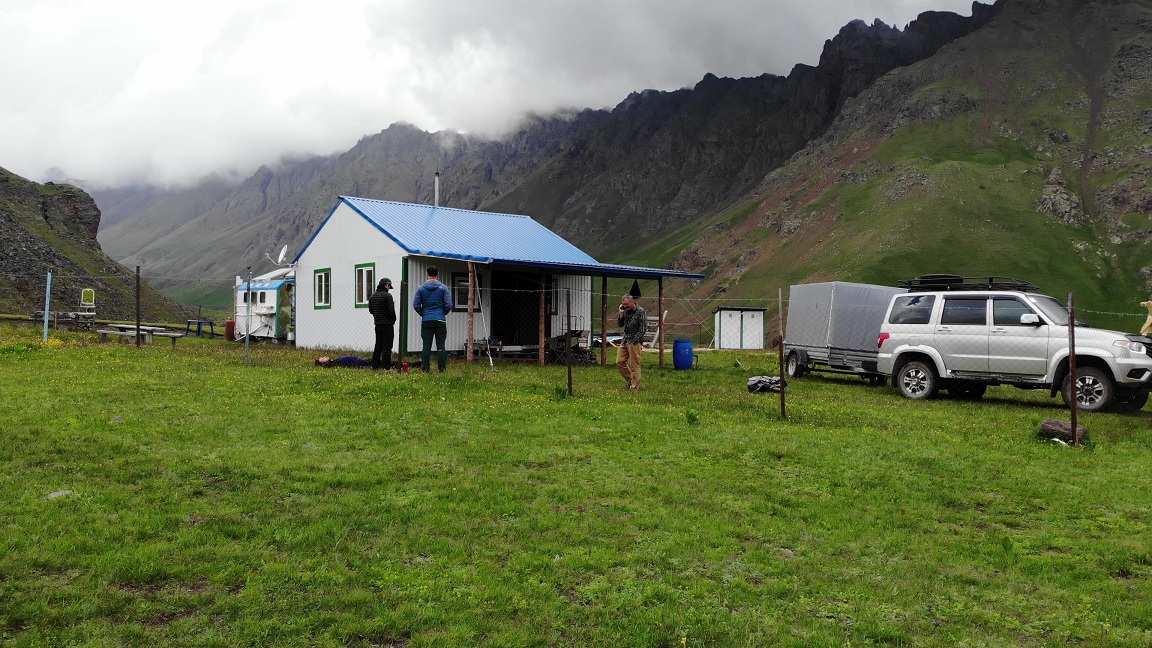
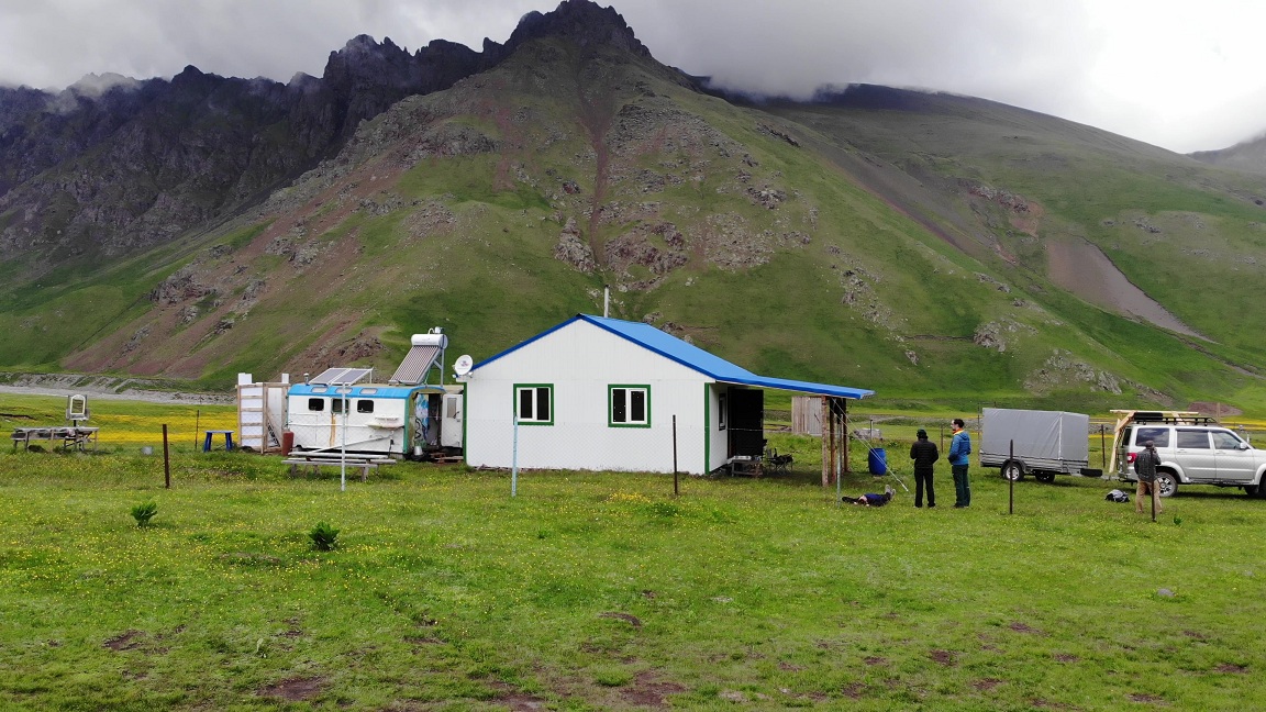
The summit Camp is located on a moraine of glaciers flowing down the northern slopes of Elbrus, at an altitude of 3800 m. If the Base Camp is located in the zone of alpine meadows, then summit camp — in the zone of eternal ice. And that changes everything, except that you still have a house. It happens that even in summer here the wind is fierce in earnest, blows tents and destroys poorly fixed buildings. But you will always have a roof over your head and walls that will protect you from the storms during the period of rest from hard training.
- Accommodation — in stationary houses.
- Electricity (generator).
- Meals — three meals a day, plus snacks. Lunch bags and hot water for acclimatization and climbing.
- Water — glacial, melted, clean.
- Communication — depending on the mobile operator, it can be a little better or worse, it does not work everywhere, but on most of the moraine it is anyway.
Weather (local climate) in summit camp. In sunny day here also can be very hot, so that you can walk in shorts and this despite the presence of huge masses of ice nearby. The cloudy weather can be cold and freezing. All this can also vary throughout the day. Evening (or night) frost is not felt sharply here and often does not feel as cold, although in the night the lakes that are on the moraine are covered with a centimeter layer of ice. The air is dry, so because of that the evening, too, can be quite comfortable even outside the walls of houses.
In the moments when in the lower camp its rain here its snow or hail. It happens that even in the summer time may fall snow almost to the knees in a single session.
Wind. Maybe very calm and quiet, but when comes the turn of the wind, everything becomes violent. Wind drives people from stone to stone, tries to carry tents here and there standing on the moraine, shakes houses.
But the most interesting and difficult, of course, starts where the end of the camp, that is – after 3800 m. So we go, in fact, to the program itself, the ascent and prepare for it.
Join our groups. We have :
- Guaranteed meetings and transfers from Mineralnye Vody or Nalchik any day and time.
- No additional fees for transfers.
- The most experienced and professional guides on Elbrus english speaking.
- We have been in the service since 2003 and therefore have a great experience of successful climbing trips and satisfied tourists.
- You can join the group later or leave early with the return of unused nights from the hotel.
- Convenient number of tourists in groups from 4 pax to 10 pax (not more).
- Support from our KavkazSkiTour office around the clock in the city of Nalchik, with a close location to Elbrus, which allows us quickly resolve any issues that arise during the trip.
- Safety support and quick contact with medical, emergency and insurance agencies.
Preliminary application
TOUR DESCRIPTION
Day 1: Arrival to Nalchik.
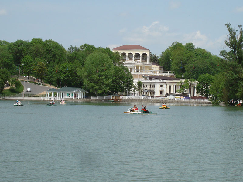
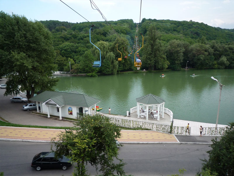
Meeting at the airport or railway station of Mineralnye Vody and/or Nalchik. Transfer to a hotel in the city of Nalchik. The road from Min Vody to Nalchik takes about two hours. Accommodation in a 2-3* hotel in Nalchik in the center and park area. Preparation of equipment, you can leave extra things that will not be needed on Elbrus in storage room of hotel or in our office. Evening city tour. You can have dinner in the park in one of the various cafes with national cuisine (for an additional price).
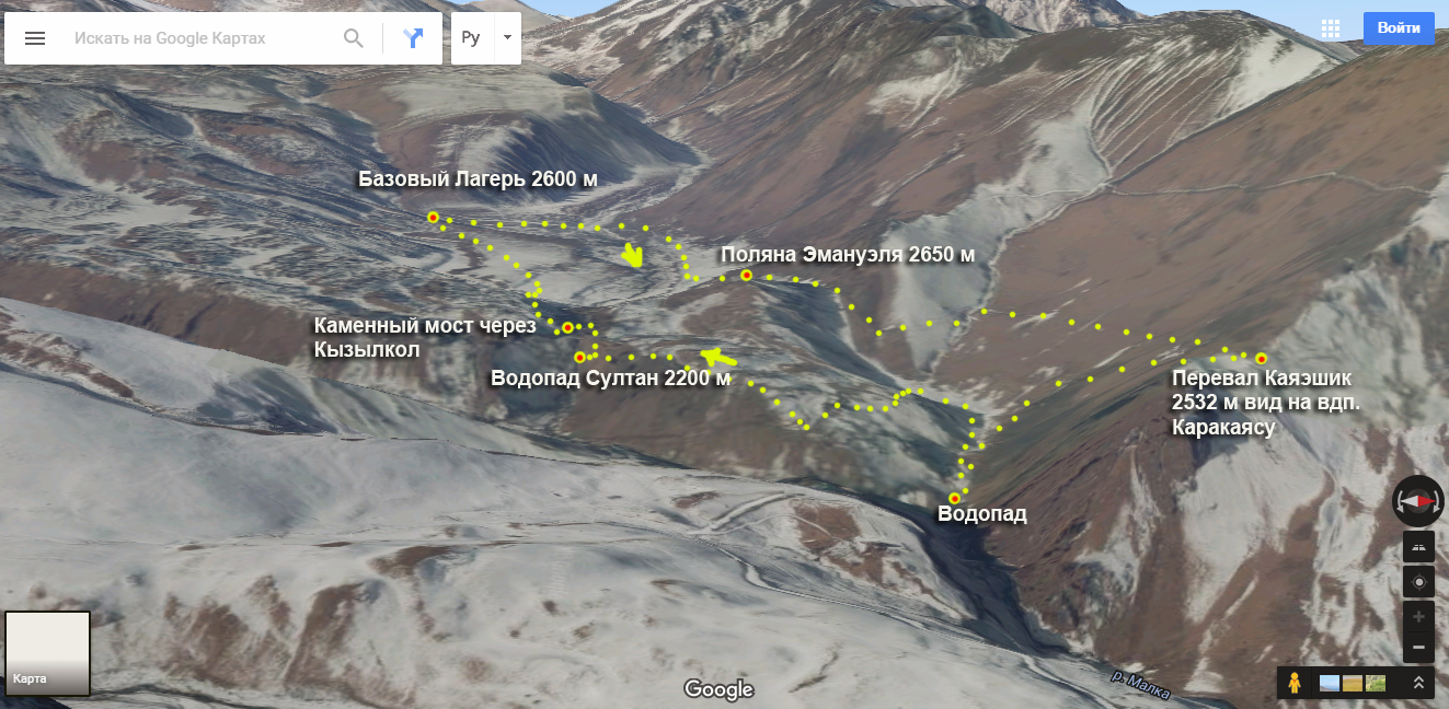
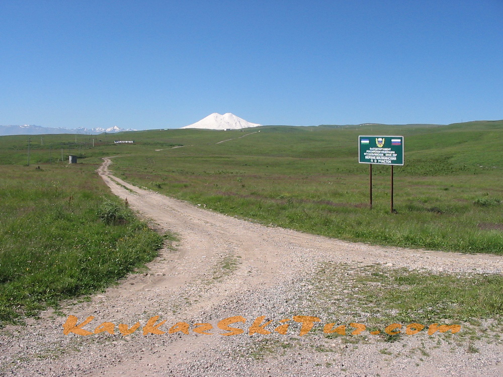
Day 2: Transfer from Nalchik to the North Elbrus.
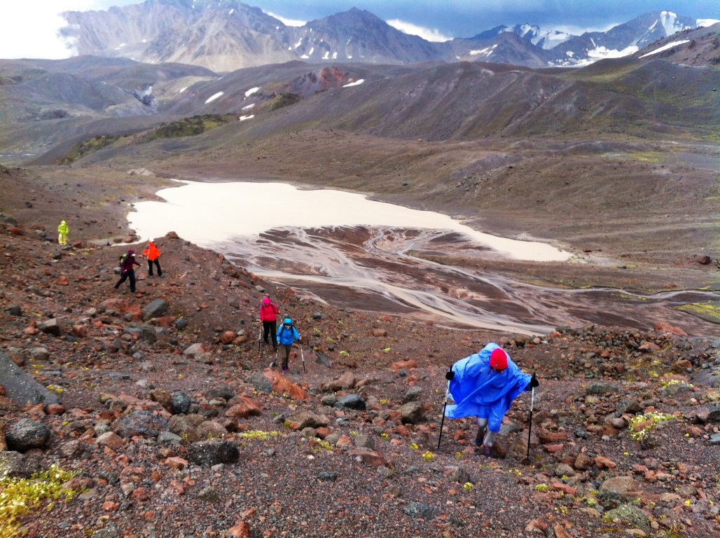
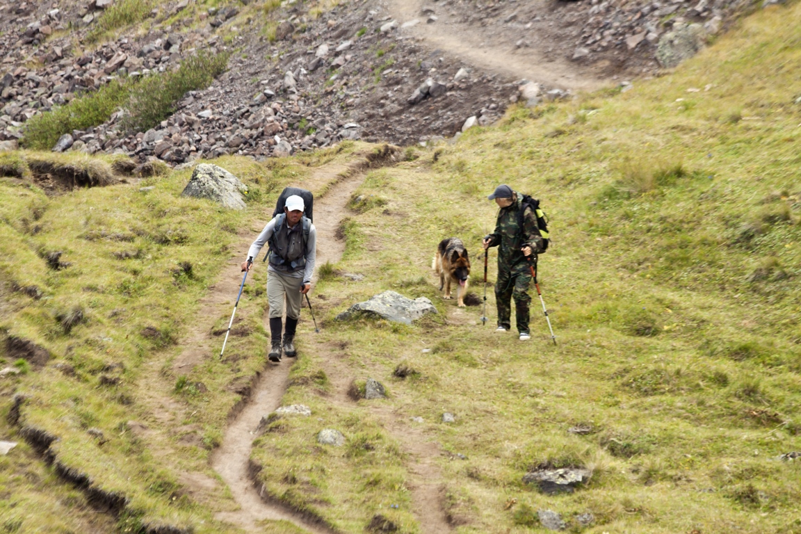
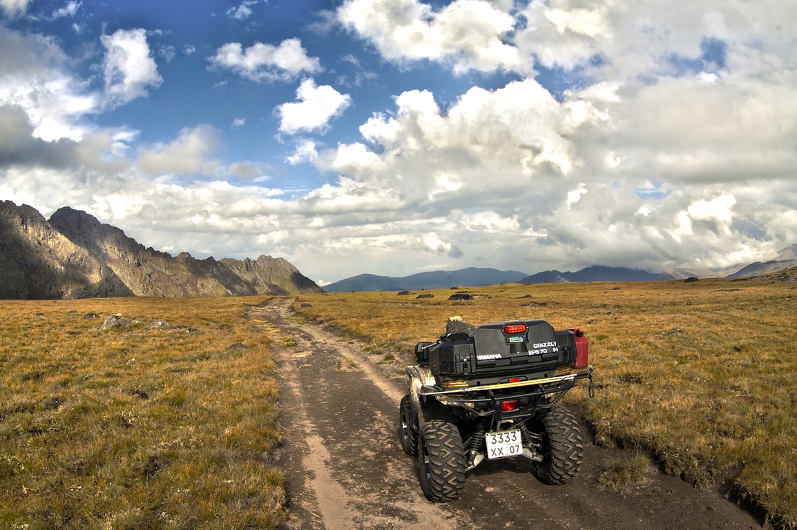
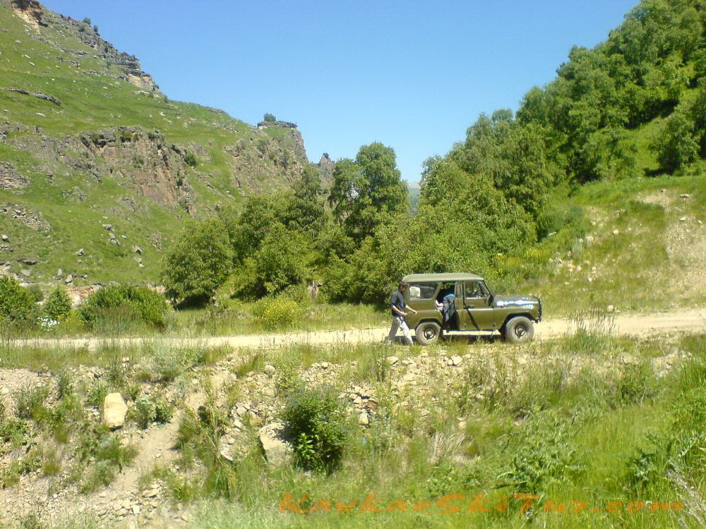
Early breakfast. At 8-30 a.m. transfer to North side of mount Elbrus through village Malka. Time of transfer by 4 wheel cars from Nalchik till Elbrus north takes about 4-5 hours depending from road condition and weather. Arrival to the Base Camp at 2600 m on the plateau Irahiktyuz, accommodation, dinner.

After dinner hiking with small gain of altitude in the surrounding area.
The route of this day:
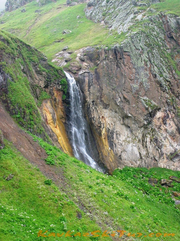
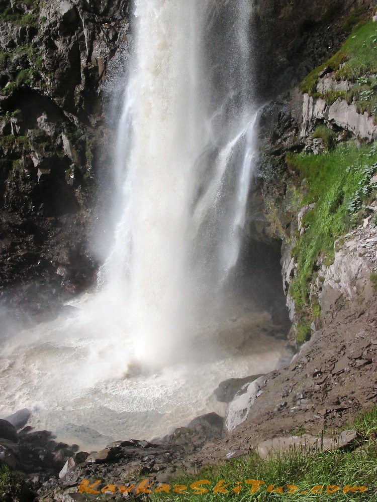
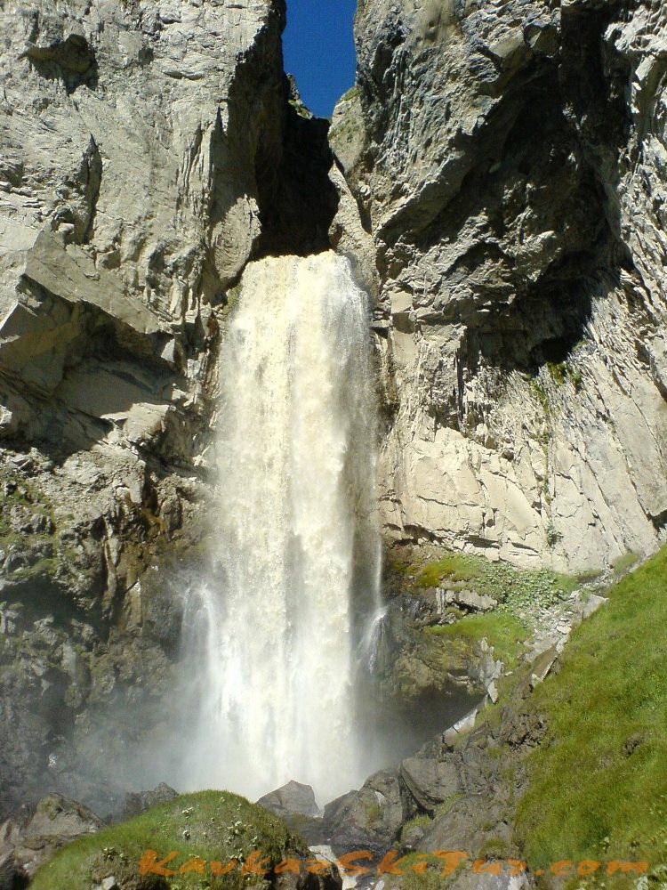
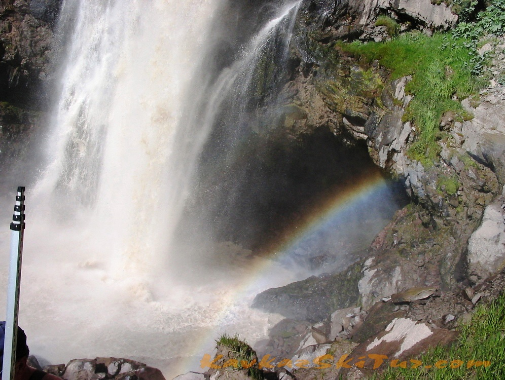
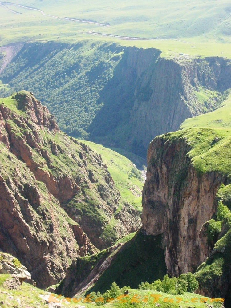
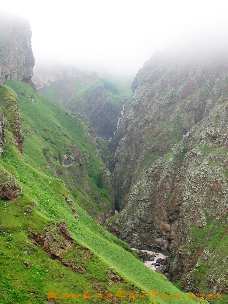
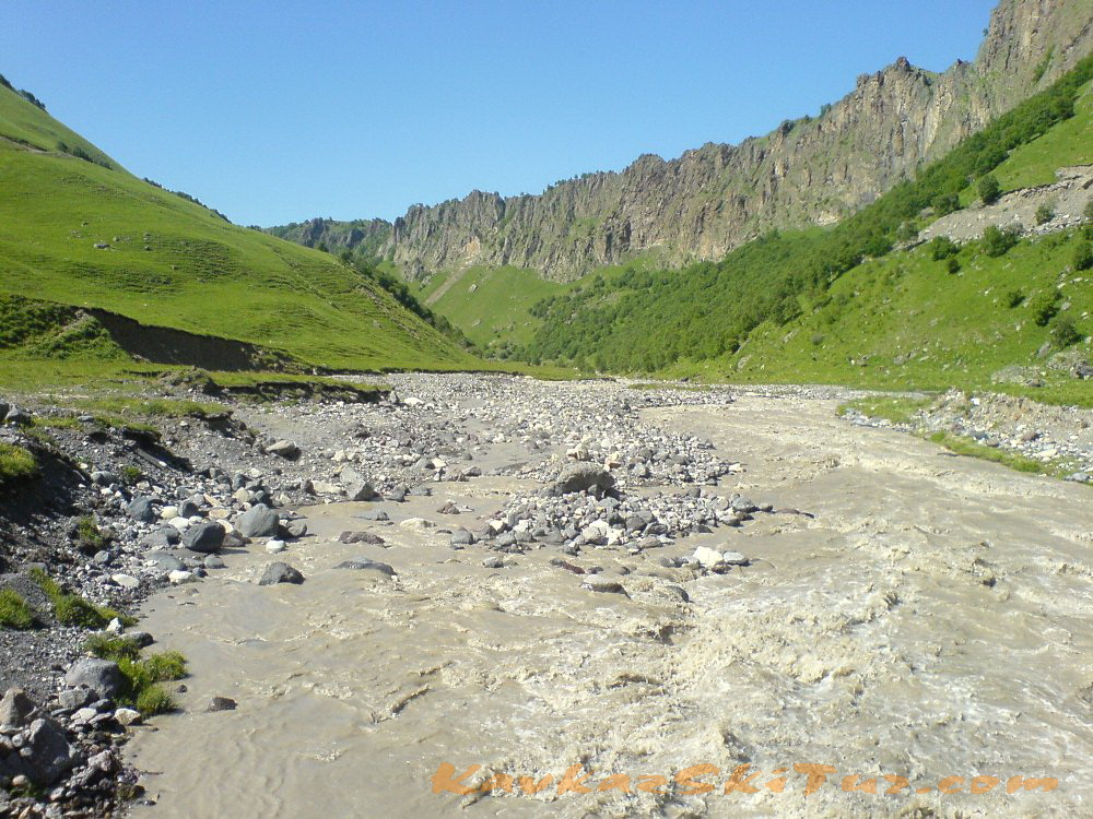
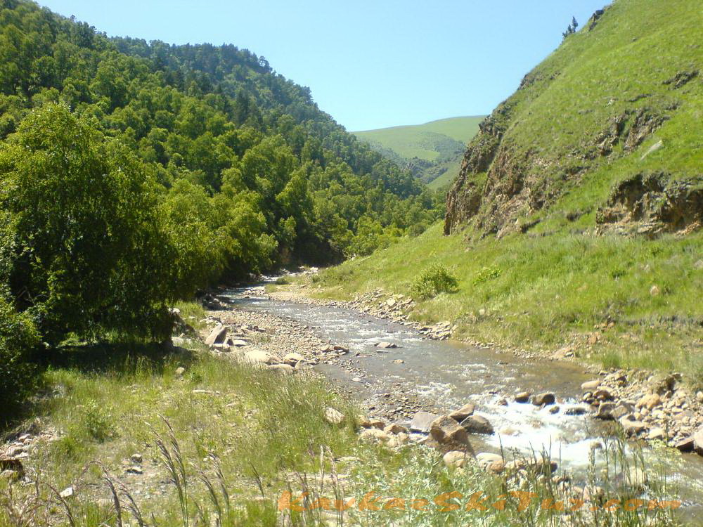
Glade Emanuel, a place where was the base camp of the first expedition to Mount Elbrus, stone Emanuel, Pass Kayaeshik, with views of the Malka canyon and waterfalls (the biggest in Kabardino-Balkaria) on the river Karakaya-su.
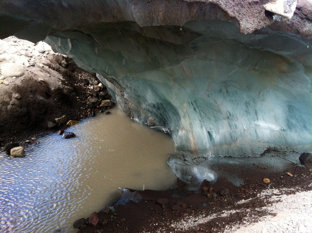
Two waterfalls on the river Kyzylkol.
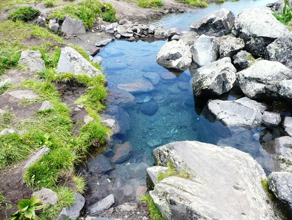
Mineral springs Gil-Su.
Stone Bridge (Kalinov Most) by the river Kyzylkol.
Return to Base Camp.Time 4-5 hours.
Elevation: +-300m
Length – 12 km

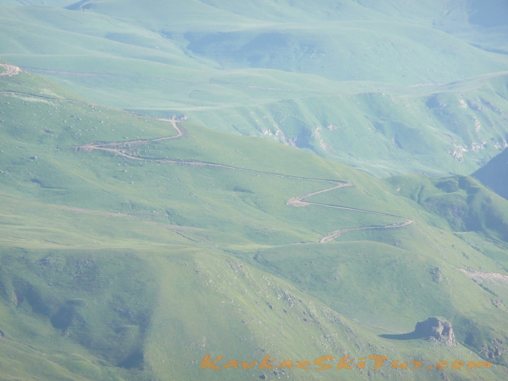
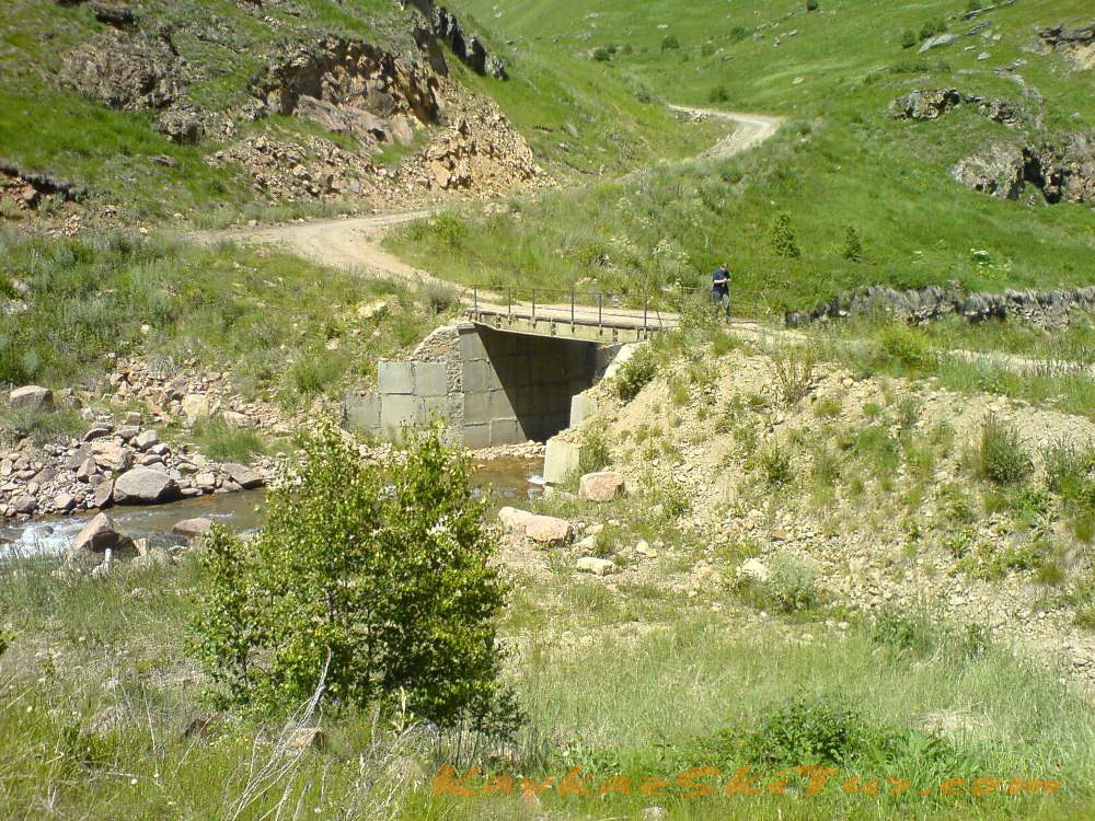
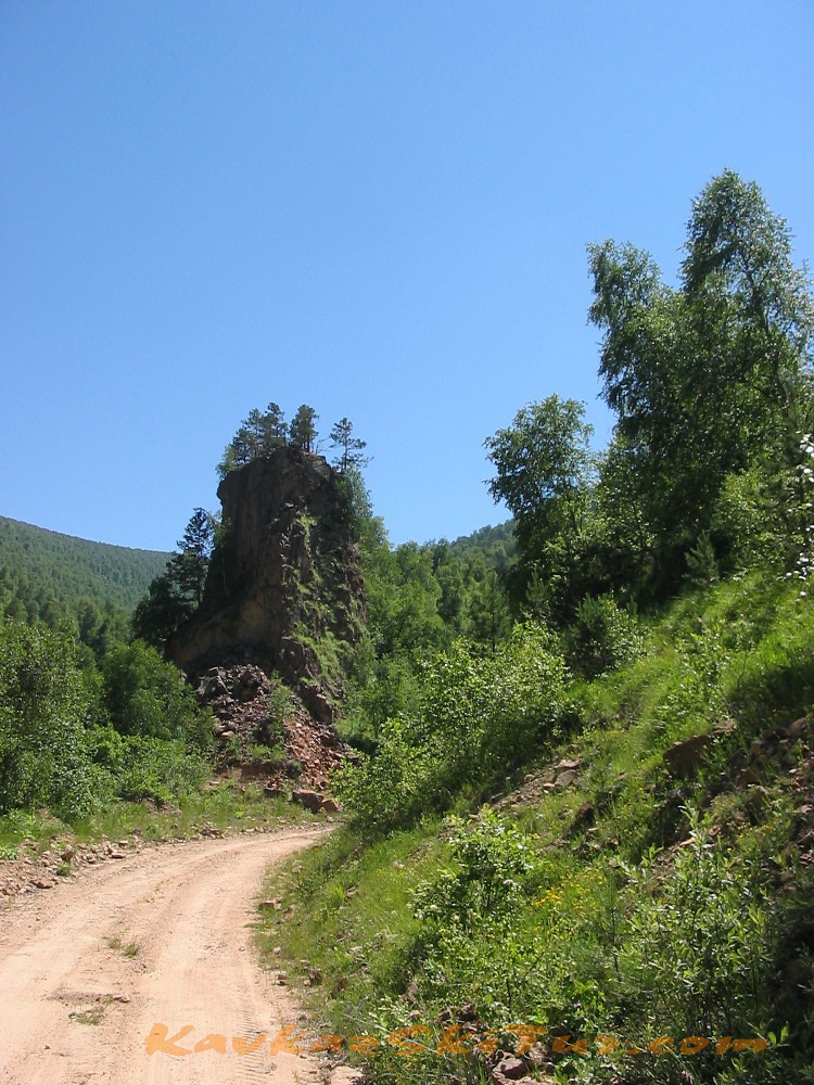
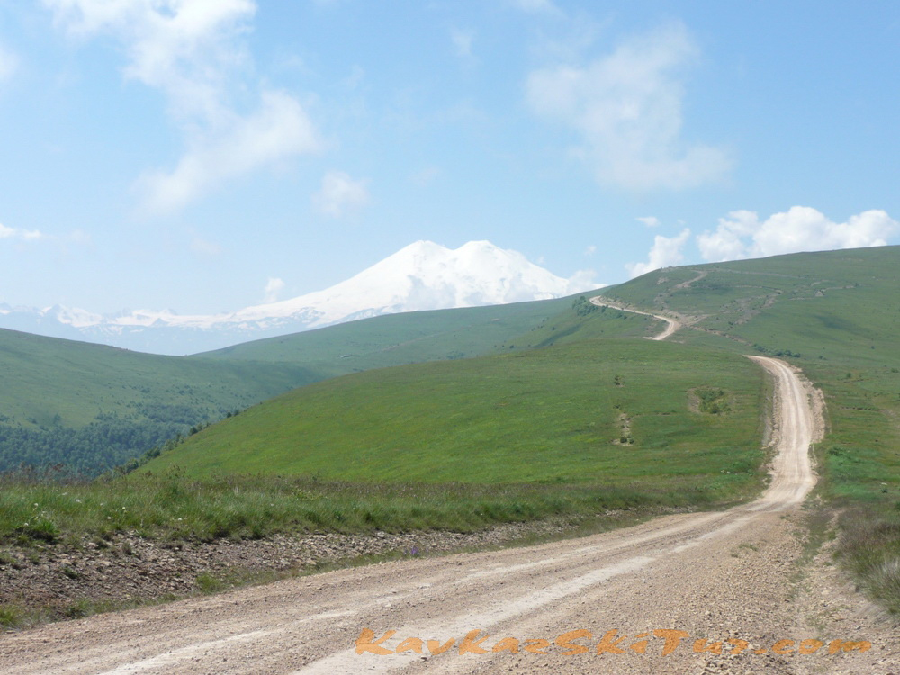
The road to Elbrus North is one of the most difficult and exhausting. To be more exact there was no road at all up to 1980-s. Now there are two roads leading there from two different sides of Malka canyon but they still remain tiresome.
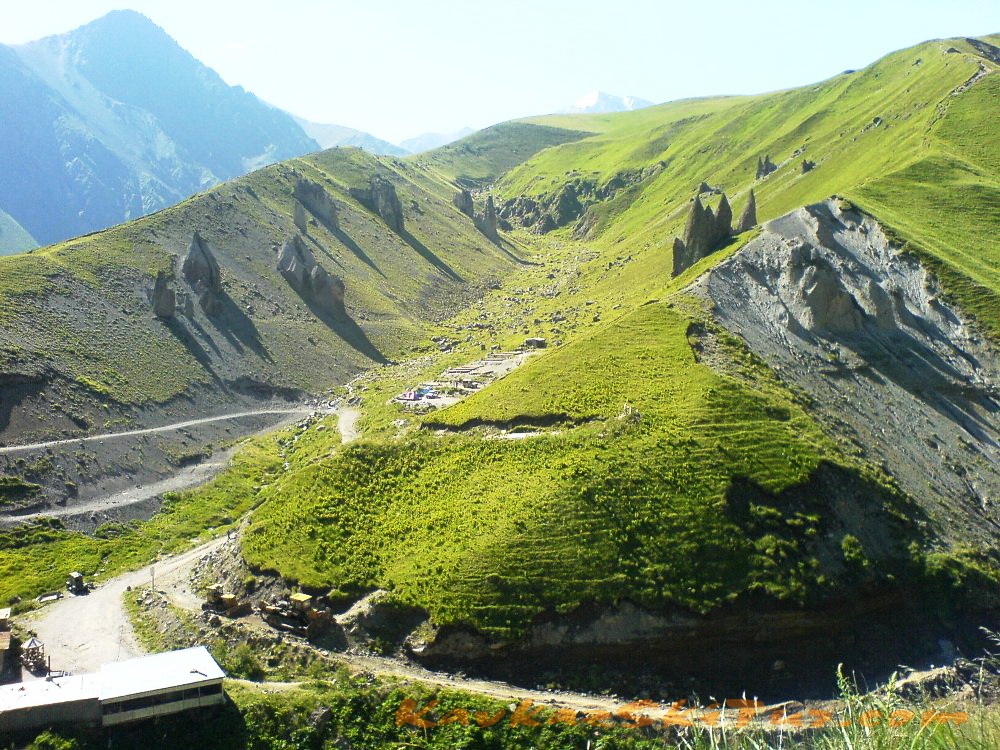
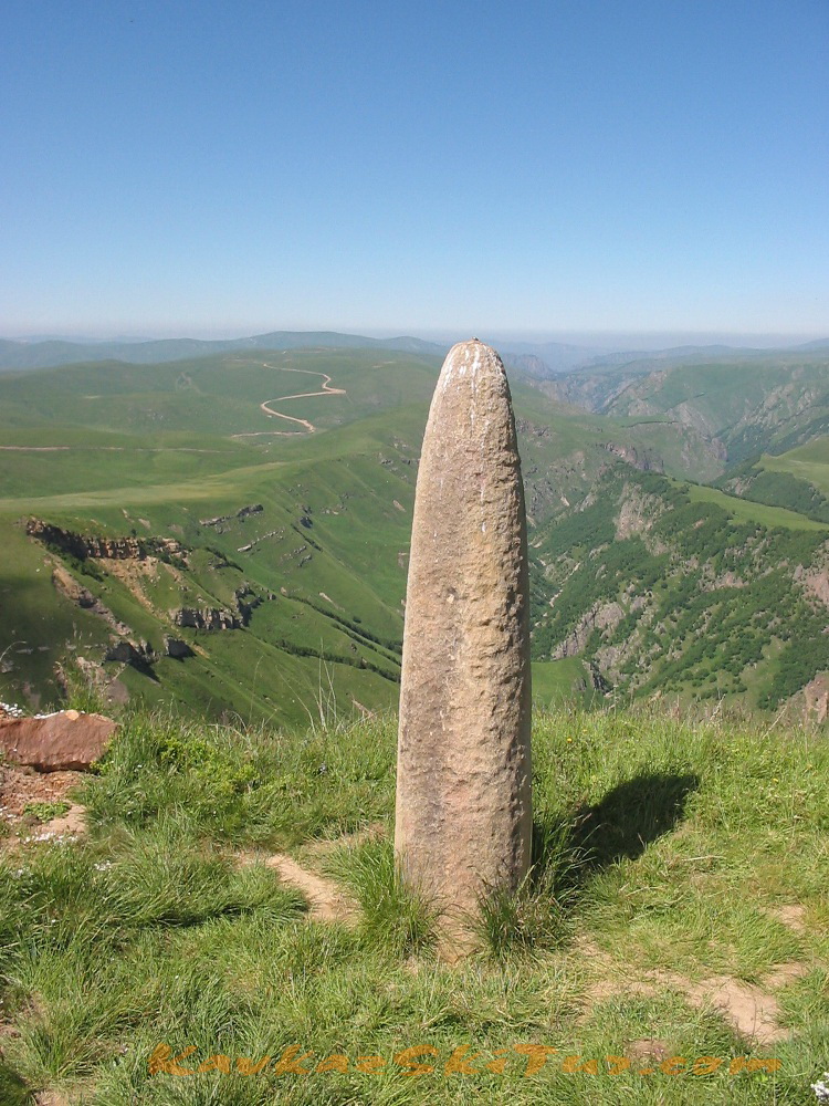
On the way to Elbrus North side camp many interesting places. There is the place we can see one of wonder of Elbrus Country – megaliths. There are several megaliths. Most of them are about three meters high. Its upper part is made like the warrior’s head in helmet. Megaliths is one of the most puzzling mysteries here.
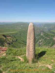 You can get a lot of very interesting information about European megaliths in the WEB but not about Caucasian ones. Judging by the peculiarities of graving we can detect here the traditions of fore-Asiatic and Cimmerian art. This monument – if to judge by the features – may be referred to Scythians. As for the helmet it is the so called Assyrian type. It means that the monument goes back to the beginning of the 7th century BC.
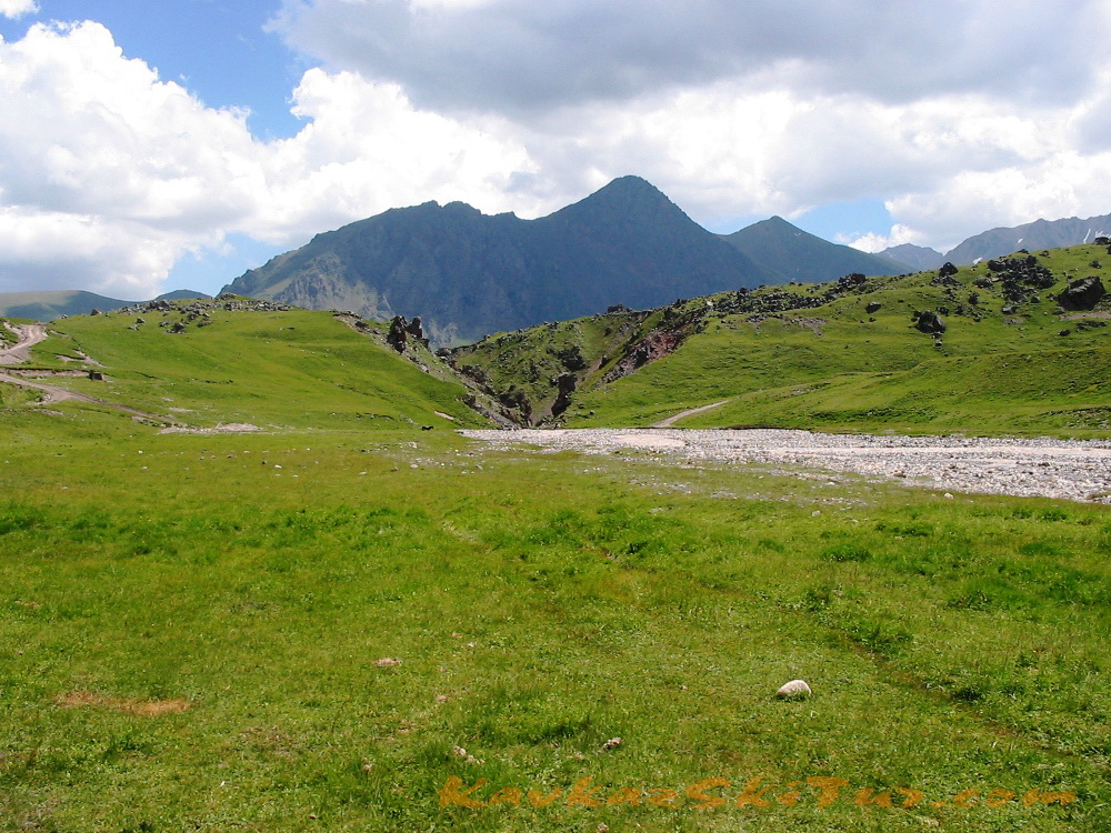
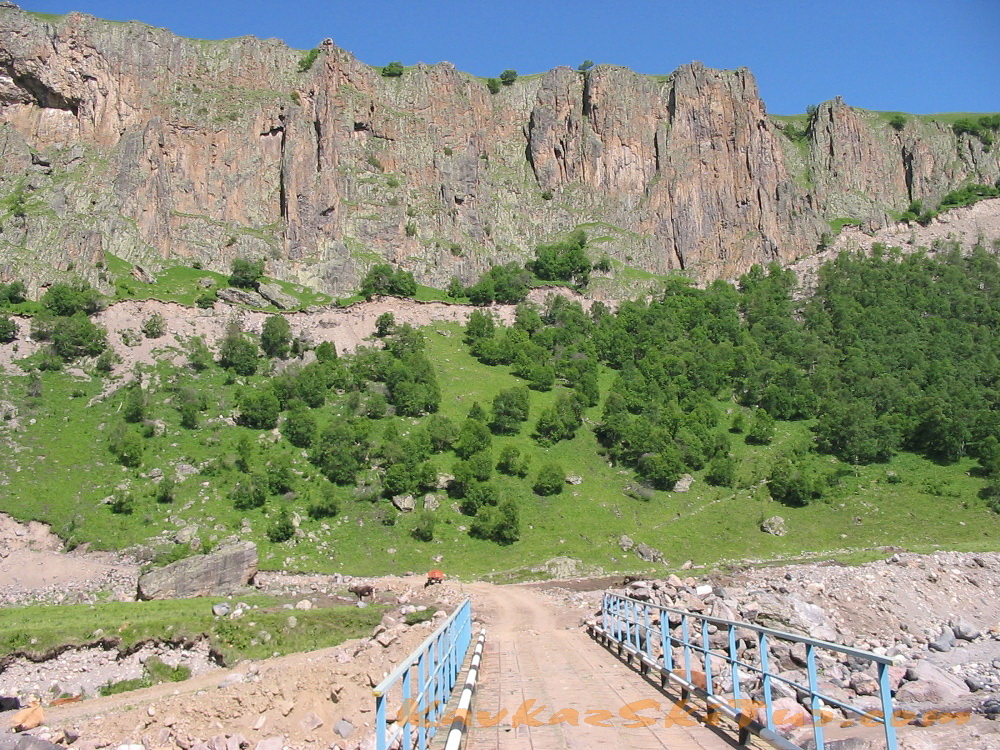
Approaching Gili-Su springs (2380 m) through the plateau with the watershed of the rivers Ingushly and Malka – you’ll get a marvelous view: Rocky Range with two beautiful summits of Western and Eastern Kandjol.
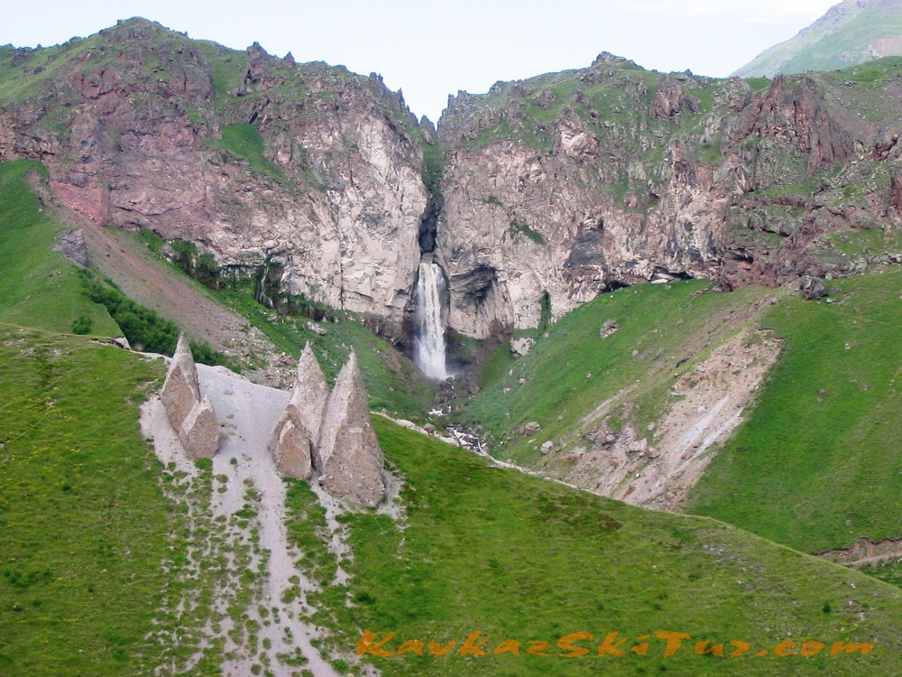
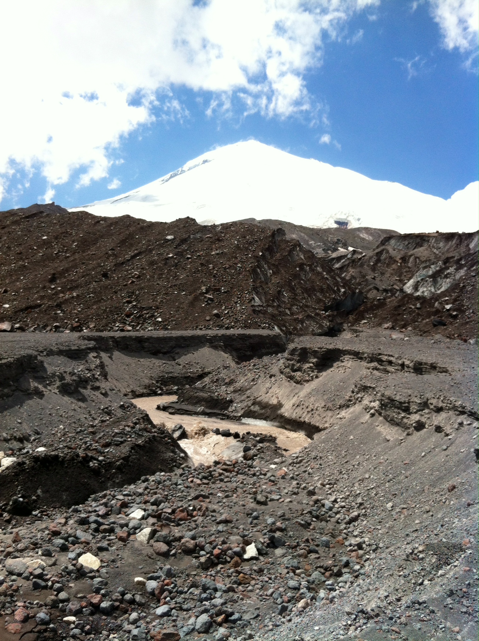
Nowadays it is generally accepted that the formation of Elbrus volcano and its activity began about 4 million years ago and was over about 4,5 -5 thousand years ago. Elbrus is an inactive volcano but some volcanic processes are still going on that can be detected by the temperature of water from the mineral springs (up to 24 grades C). Gili-Su springs are among them.
Just near the springs there is a grand waterfall Sultan – an amazing natural monument (35-40 meters high). River Kizil-kol precipitates down from a great height joining the water of river Birghanli-Su at the outlet of the warm mineral springs. A bit further there is one more waterfall – impetuous current falling into the narrow canyon from the height of 27 meters.
Above the springs, an amazingly beautiful view of the valley of the Malka River.
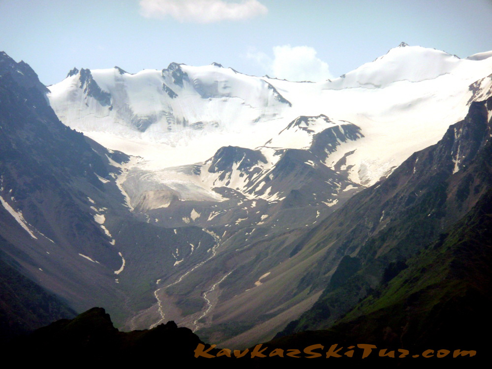
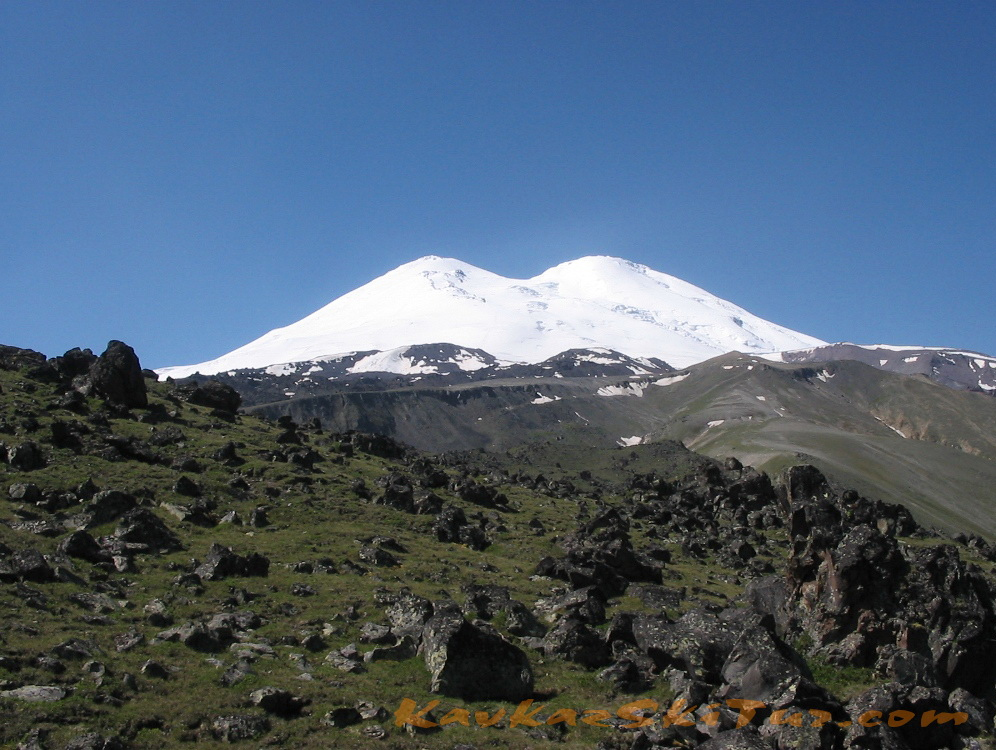
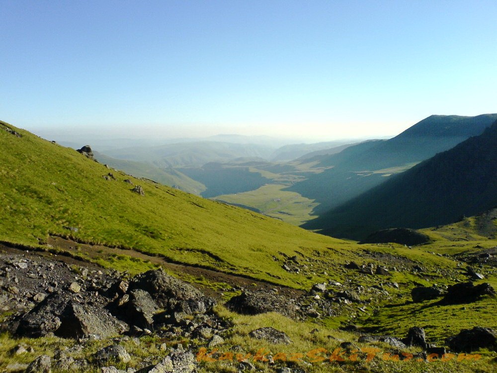
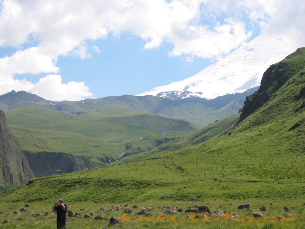
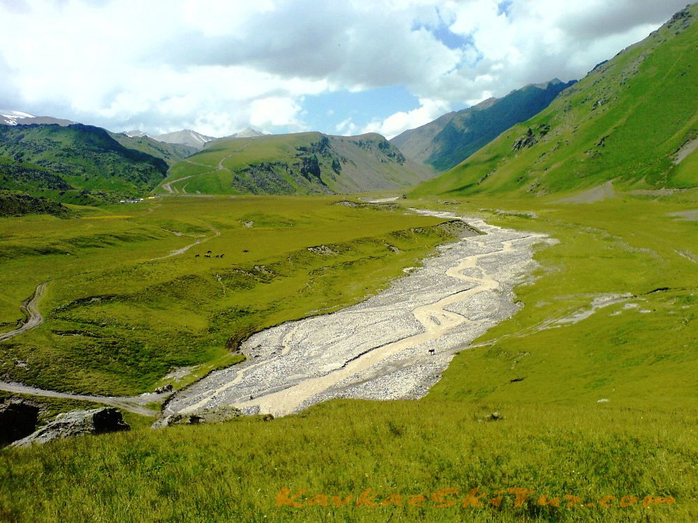
It’s nice to make a camping near the Dgilisu springs. Near the narzan bathes two rivers – Birdgalisu and Kyzyl-Su that are the sources of the river Malka flow together. We cross over the bridge to the left bank and go along the good path to the mouth step of the high-mountain valley of the Kyzyl-Su River (40 minutes). From here you can see the legendary Elbrus. The mountains around Elbrus seem the hills from here. The Elbrus Slopes are the sources of the rivers of the Malka basin. The square of the contemporary Elbrus glaciers is more than 135 square kilometers.
Further on there is the most highland (2600 m above sea) plateau Irakhin-sirt. It is the place where in 1829 the above mentioned expedition of Georgy Emmanuel (the hero general of the Patriotic War of 1812) pitched the camp. The purpose of the expedition was to “obtain a true information about this country: its mountains, valleys, canyons, woods, pastures, mineral springs and other phenomena of nature…”
The path leads to the summer farmyard situated near the Emmanuel’s Rock, on which you can see the inscription in the memory of the first Elbrus ascent: “From 8 to 11 of July in 1829 the general of cavalry Emanuel had been camping here”. This inscription was discovered by chance in 103 years after by the expedition as the layer of lichens covered it. Now the place is called Emanuel glade and many huts for tourists and climbers.
Here we accommodate in hut.
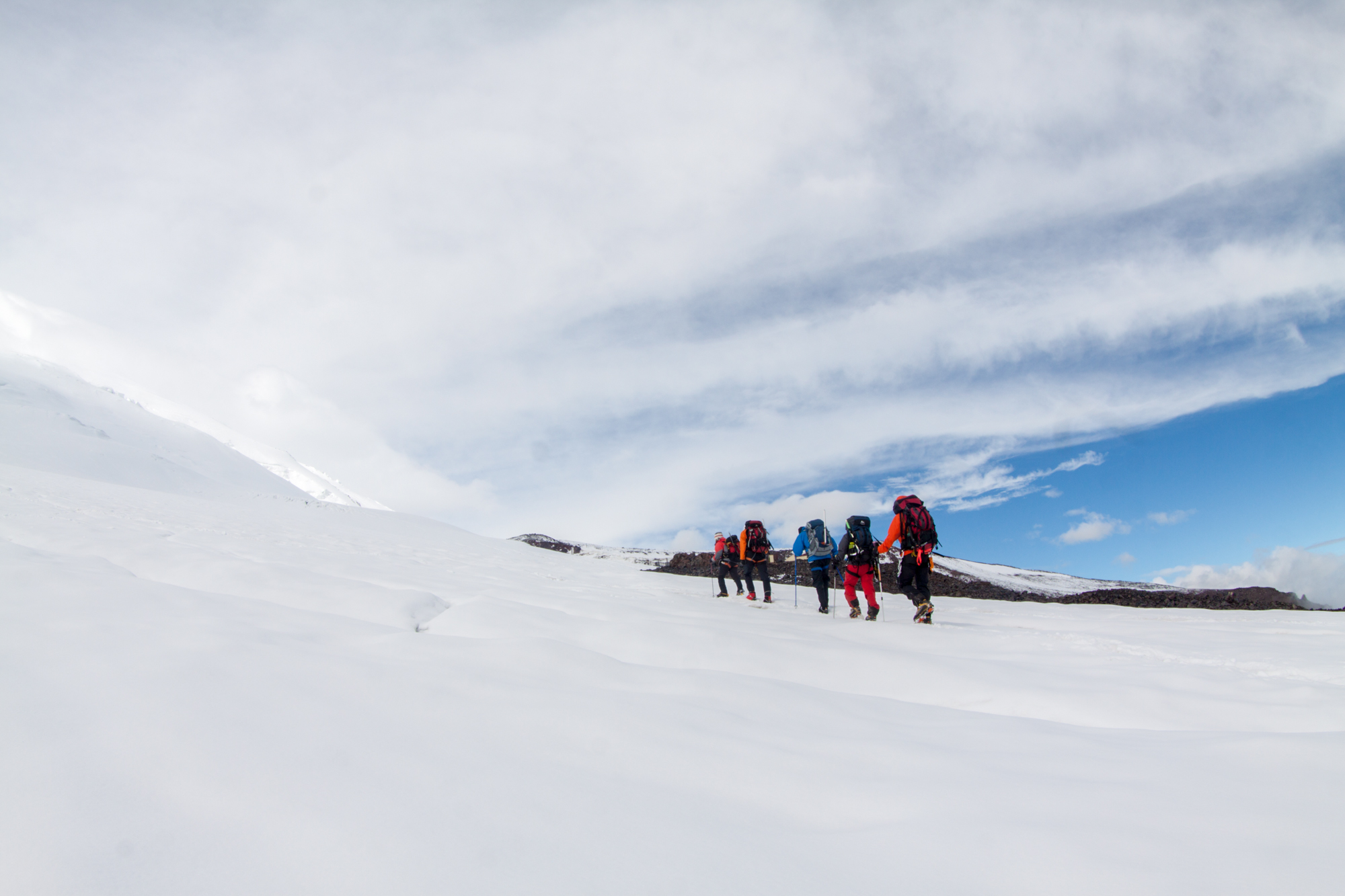
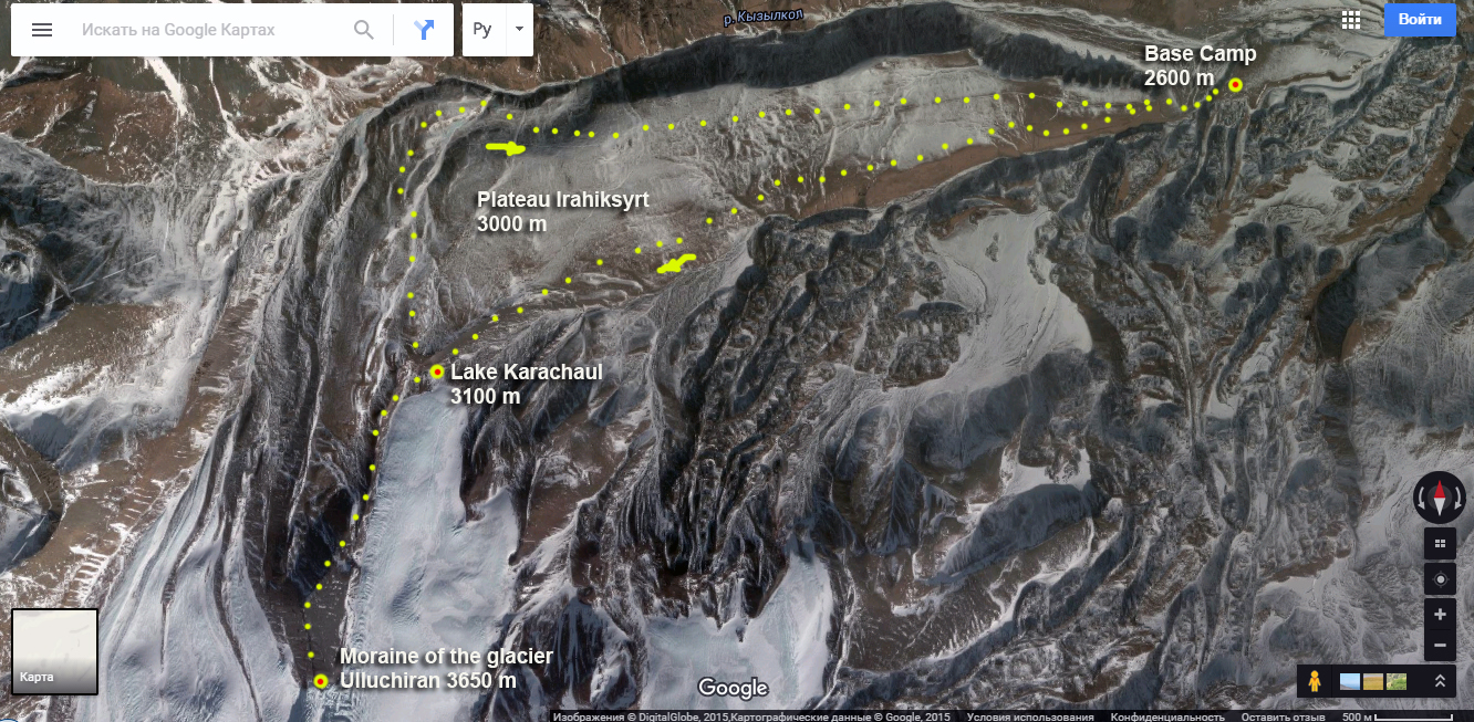
Day 3: Trek to the glacier.
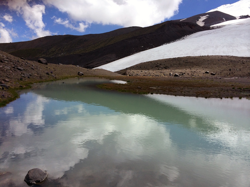
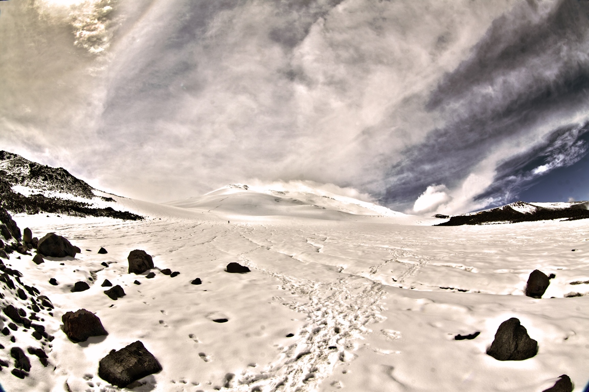
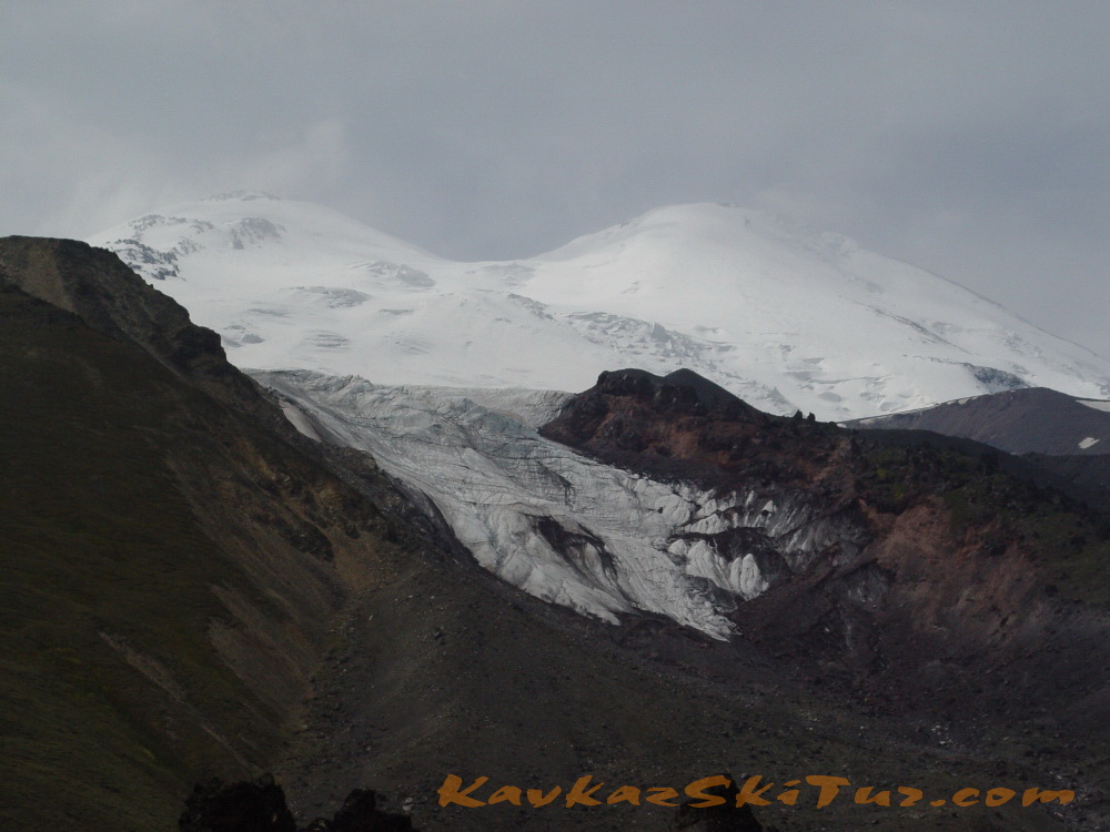
Acclimatization hike on the plateau Irahiksyrt – till the moraine of Ulluchiran glacier 3650 m.
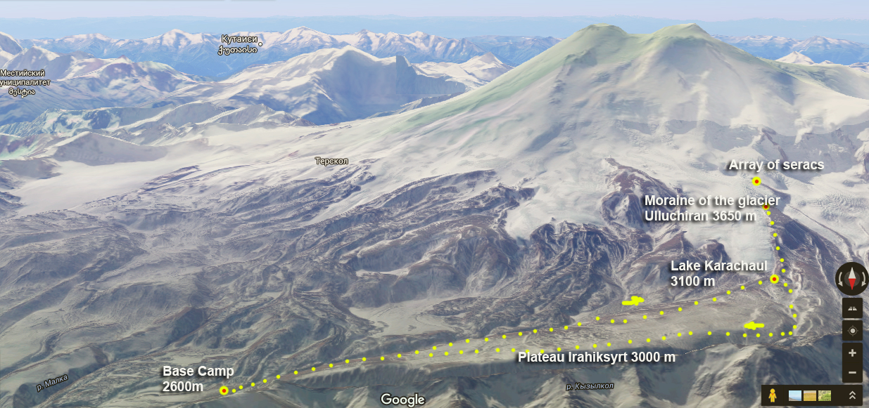
The route of this day:
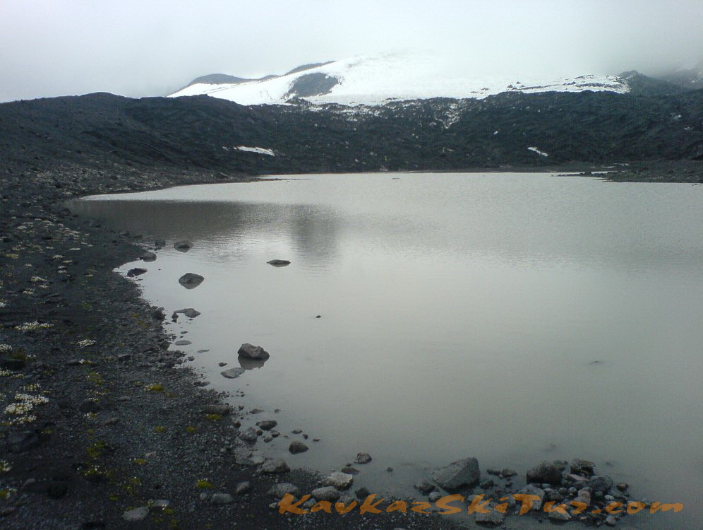
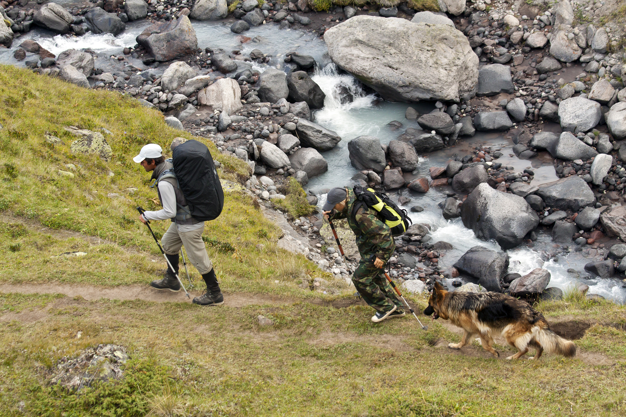
Trekking along the southern edge of the plateau to the lake Karachaul (2 hours, 3,000 m) at the foot of the glacier of the same name. The lake water temperature is higher than the glacial rivers and it can be swim.
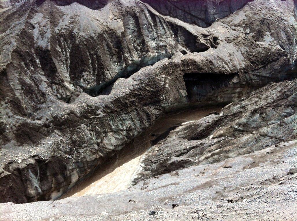
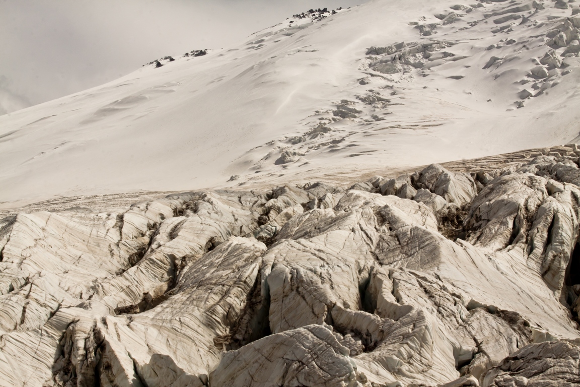
Climbing the moraine to the junction of glaciers Karachaul and Ulluchiran, to a height of 3650 m (another 2 hours). Views of glaciers and great faults with seracs.
Return along the northern edge of the plateau Irahiksyrt to Base Camp.
Time – 9-10 hours.
Elevation: +-1050 m.
The length – 20 km.
Day 4: Transition to the Summit camp 3800 m.
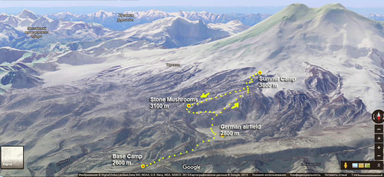
The ascent to the summit camp at 3800 with all the necessary equipment for further acclimatization and climbing. We come back to the lower camp after the summit.
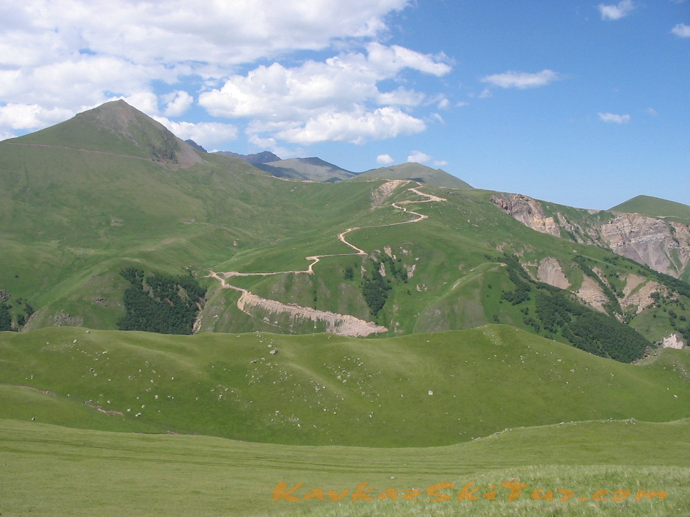
The entire route coincides with the only classical route of ascent to high camps on this side of Mount Elbrus.
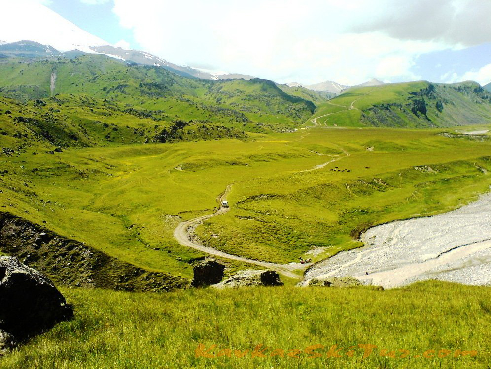
On the way we pass through a few notable places as “German airfield” (according to legend, Hitler sent here Tibetan lamas seeking exceptional opportunities of forces and allegedly landed the planes). Moon glade – a large field covered with volcanic rock obsidian. And in the end we remain in the zone of eternal ice on the moraine of 3800 in the upper camp.
Time 5-6 hours.
Elevation + 1200m
Length: 7 km.
After the small ascent the path crosses the plateau from east to west. This alpine grassland is a good pasture. From here you can see the northern Elbrus glaciers: Ullu-Malgan-Chyran, Ullu-Kol, Kara-Chaul. At the right there is (in front of Elbrus) the meridian range – Tashly-Syrt.
After 2 hours walking you can see all the northern spurs of Elbrus coming to the Tashly-Syrt Range. In its upper part above the Ullu-Chiran Glacier, which is the source of Kyzyl-Su River, is located the Balk -Bashi Pass. In this spur but more lower directly from the motion direction is located the simple Buran-Tash Pass (3086 meters). Across this pass the way leads to the Hydes valley. The river Hydes is the right tributary of the Cuban River. This ancient path leading to the aul Hurzuk has the name Sut-Dgol, which means “the milk road”.
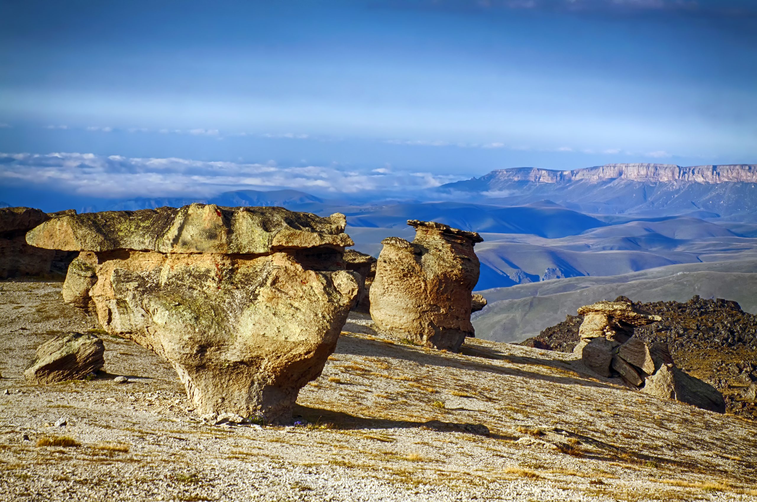
The next interesting object is a top secret airfield, which local shepherds call «German» (2900 m). This is an absolutely flat land, as if made by nature for some mysterious projects. It is 300 or 400 meters wide and over 1 kilometer long. Being there, at the foot of Elbrus, you are as if rooted to the spot being struck by the grandeur of the place: the peaks of Elbrus are incredibly close; a fantastic store of lava in front of them, as if the bizarre workmanship of some Hercules; the endless field extends up to the steep ridge with the «Mushroom Field».
The interest of Adolph Hitler to Tibet is widely known as well as his great interest to Elbrus. Exposed to mysticism, Hitler was simply possessed by Elbrus – the sacred mountain of Aryans. Here is an extract from the book by L.Peauvel and J.Bergier: “When … German troops invaded Caucasus a strange ceremony took place. Three SS mountain climbers ascended Elbrus – the sacred Aryan mountain, the cradle of ancient civilizations, the magic top of the “Lucifer’s Friends” sect. They erected there the banner with swastika… It should have marked the beginning of new era. From that time the seasons should have obeyed the conquerors and fire must have won ice” (Peauvel L, Bergier J. The Morning of Magus: the Power of magic cults in Nazi Germany. M., 1992. P.46).
Numerous stories about German aerodrome, about enigmatic passengers brought to the foot of Elbrus, of their meditation, prophecy and following death are often among the natives, tourists and mountain climbers. Is it really an aerodrome is an arguable question. But sometimes imagination and rumors are better arguments. More than that. There is a lot of “data” about UFO watched over this place. You can get the information about it in the WEB. But according to the natives there are still plenty of places in Gili-Su inaccessible to man. And they still keep their secrets.

Day 5: Acclimatization on the rocks of Lenz 4600 m.
The main part of ascent. Work on the Mount. Some of the errors and how to avoid them.
Acclimatization-training ascent to the lower boundary of the Lenz rocks to the height of 4500-4600 m. (Scheme coincides with the line of the route of ascent).

The start of ascent is optimal at around eight o’clock in the morning in order to use the best, the first half of the day because of the weather. Depending on the condition and training of the climbers this already “fighting” ascent, can take “from the camp to the camp” from three to six hours. Goals of this ascent are several, and they are all important:
1. To practice walking on ice-snow slopes in crampons in the group. It is likely that the area of the crevasses that exist in this part of the route of ascent will be necessary to go in ropes, so during this hiking we will be able to practice in this style of movement, for those who had not faced it before. Mount is different each year. In one year cracking zone can be objectively dangerous, in another year – safe. Also, the state of crevasses on the slope can be varied in a single season: at the beginning of summer the cracks may not be at all, in the end of summer – they can be quite large. In most cases at this place they are not significant danger here and can be walked without ropes. However, the rope at this case also is still taken on the route.
The slope itself is not technically difficult and not steep – an average of about 30 degrees. Since the exposure of the slope – north, in the first half of day the snow, which lies on the ice above 3900, is in the neve condition and movement on it is quite comfortable and does not represent any difficulties. By the time it turns to “mush” it’s usually the descent already, and such a state of the snow cover on the contrary helps.
The best and most optimal way of movement at these slopes – crampons and poles. Ice axes may be required only in one case – the fall in the crevasses. For fell stopping they are not needed, because even in the hardest condition of slopes it is not so greatly steep here to slide down fast. Every day many groups walk on the route, and the state of the snow bridges are more or less known, and information is continually transferred between the guides. Even if the bridge is not in the ideal state, the situation may become more often this way: you go, fell in snow to the knees, felt the emptiness underfoot, crawled through the snow, and went on, nothing extraordinary. Ice-axe is not needed. If we assume a situation where the crack is so bad that someone goes deeper, the ice axes that have guides (leading and trailing) is enough to solve the problem. As practice shows – move with poles brings greater success because of its more rationality and you put less physical efforts, and the worst factor that can be limiting – is tiredness. The more you fresher, the better to think, you have less chance of making a mistake; you are less likely to fail yourself and the team. The optimal pace of movement for the particular group is selected by guide, from his point of view, which is dictated by his personal experience and the experience of the previous days of work with this group.
2. Gain of height to acclimatize (improving the quality of blood in terms of oxygen transfer). According to various researches the rates of acclimatization may be reached in three weeks. But the sources that give such numbers are probably not as much about the restructuring of the blood, as the improvement of local muscular endurance (the construction of new organelles within the muscle fibers, which allow muscles to work with oxygen). According to our own research “on the mount” among people of different ages, training and experience of mountaineering, we can conclude the following: gain of altitude 700-800 m, and followed by a day of rest creates good preconditions for the blood to adapt enough for the time of ascent and adequately ensure the success. It is important to understand the point: the success of the ascent (or how you are going to feel during it) depends on the adaptation of the blood to the height (acclimatization) only perhaps for half of it. Blood only carries oxygen to working muscles, and work – just muscle, they move you up the hill. If they have enough oxygen, but locally they are not ready to use it rationally, it would go too hard. But as part of this training – now, during the program, nothing can be changed already – it’s too late and short time, it cannot be done so quickly. The main part of the training must be done beforehand on the plain, and you need to do this every day. But workability by improving the quality of the blood can be increased rather quickly, these aims are pursuing the entire program of acclimatization in general, and this ascent in particular.
The average objective measures of oxygen according to our measurements are as follows:
Normal oxygenation on the plain in humans 97-99 percent (the percentage of oxygen in the blood) in a conditionally active state (in a state of calm, or in a dream, maybe a little less). When he comes to the high camp its an average of 85-87 percent. By the evening after the rocks Lenz, this number rises to 90-91, and in the evening the next day – a day of rest and to the time of summit, it can be 93-95 percent (we do not take here frankly extreme cases, there have been cases when immediately after summit was 99 percent, or 78 percent after the easy way nearby to the glacier). It is worth noting also that these measures are, in fact, give a fair presentation to the guide about the condition of the climber.
It is worth mentioning also a moment: you should always talk to the guide about your health openly and honestly. No one will look angry on you if you say that you feel bad. Even the strongest guides, too, can feel not good, they just get used to everything. To tell your condition – it means to be responsible of yourself and to the team, because it can play a bad role in the decisive moment. Numbers on the pulse oximeter is just to help better understand how the process of acclimatization and recovery going, caused by physical work. Numbers of oxygenation allow us to understand how adaptable the blood, pulse rate gives an idea of how much a person is tired or recovered.
For example, a person says that he is well, although clearly seen that something is wrong. Measuring oxygen levels show a figure of 70 or less in total, and soon the man was going down with pulmonary edema. If he would watch his state more carefully, this could have been avoided. One of the main problems – it is not understandable when the ambition much higher than the instinct of self-preservation. This often results in problems for the man himself, and for his team, and for those who are responsible for them.
“Many times I have climbed at this summit and many others – all of them are perfect, but there is nothing that is worth dying. But much of what makes life worth living – that’s down there. I absolutely cannot understand the people who will be with the last effort to crawl on the mountain almost on the knees, almost going out of all time frames and limits of his own powers, despite the fact that this mountain can be climbed in an easy way – adequately prepare to the climb on the plain, and then not to do stupid things on the mountain. If you live each day as a strong man – this mountain, even in not very good condition will not break you, and you can afford it. If you live as a weak man, then even if you’ll creep this mountain it will not make you stronger. You need to be strong every day, and every day to try to become stronger, and then the mountain will not seem such an unbearable and successful ascent will be a pleasant consequence of your life in the right direction. I’m talking about training, training and more time training, without which any development in life, as well as any of its summits are inconceivable. “ Our Guide Viktor Chaika.
Out of the above statements comes third goal of acclimatization day:
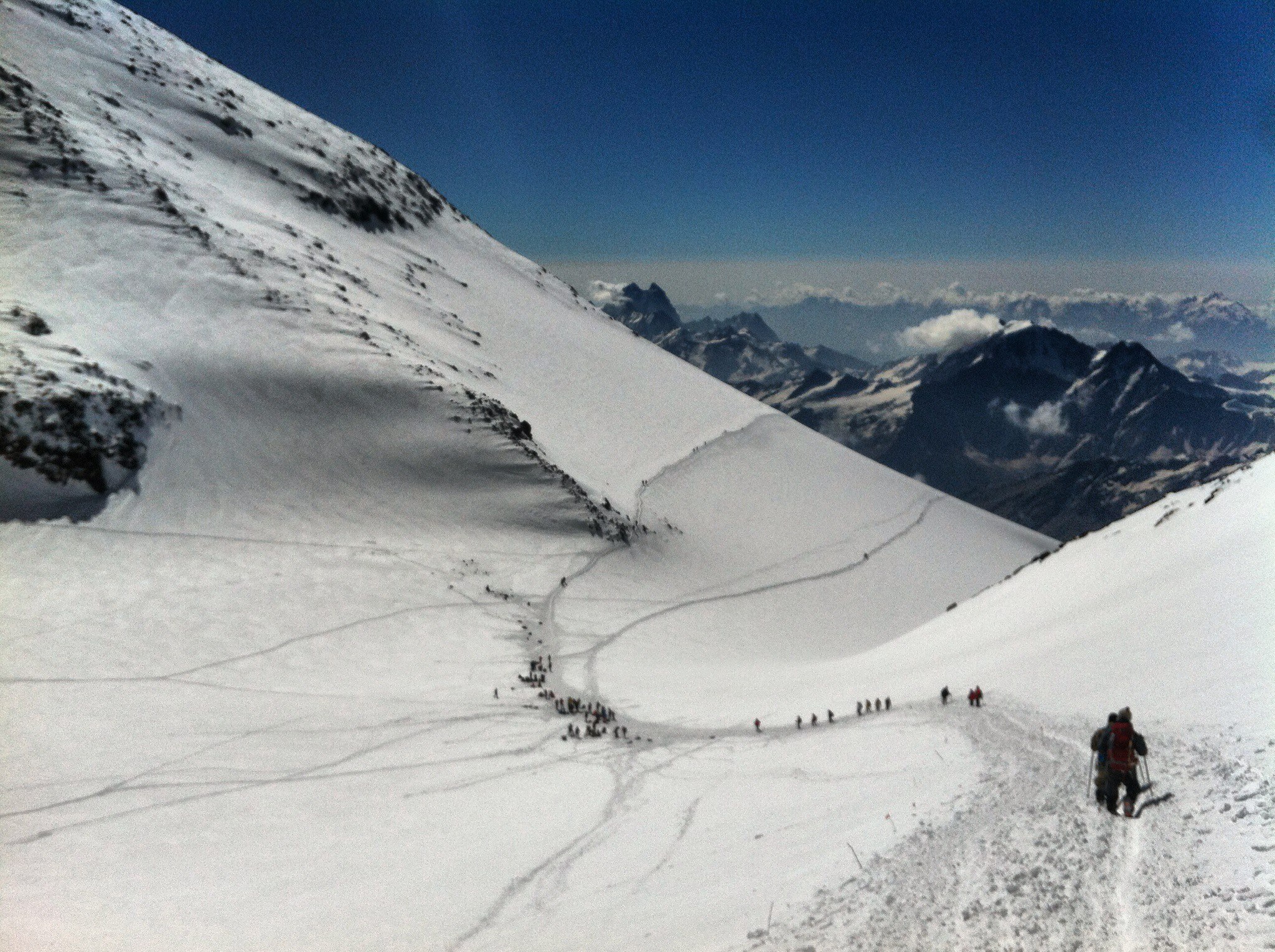
3. Assessment of the situation about the East or West summit by the guide and the climbers themselves. We should stop to lie ourselves about the possibilities in the future climbing. All want to go to the West top. But if we come to the lower Lenz rocks 4600 m in about four and a half hours, such fact for west top means – no chances. On the east top – we can try.
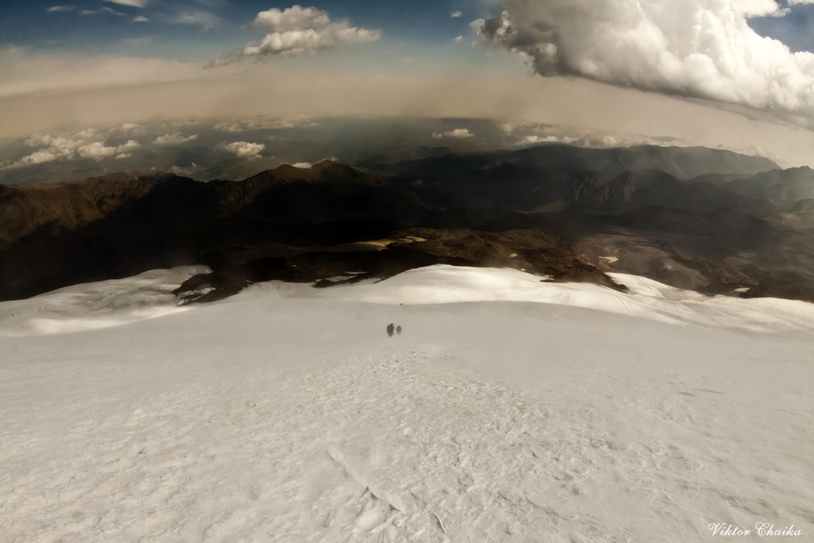
It happens often that the climbers either overestimate their strength or underestimated the extent of the mountain, which neither from the summit camp or on the slope cannot be seen, because you look almost parallel to the slope. In this respect, when you stand in the summit camp and look at the mountain, it seems as if the distance to the lower Lenz rocks – is the biggest part of the whole route. Because the prospect cuts anything else. In reality, it’s not even half of the way and the simplest part, actually, of the route. After middle Lenz rocks (4800) begins a steep climb. After five thousand begins another condition of the body, and when you come to the dome of Eastern peak you think you won. But there is another 400 m climb. You do not want to believe that there is so much. But you go and rock on the knoll’s not approaching. And it seems like it lasts forever. It’s a big, long slope. Even to the eastern peak 6,5 kilometers in one direction and 1800!!! meters gain of altitude in one summit day. There is a saying here: “It is better to go to the East top than not to go the West top”. It’s funny, but often with the wrong assessment of own forces may be happening the second option.
Here is what shows the numbers and experience (statistics). By the time which was spend for a relatively easy hike to the rocks of Lenz its possible to judge whether a group has a chance to go to the western peak, or is it better to take as a basic version the East top. If the group does not exceed from three hours till the bottom of Lenz rocks – it is better to think about the East Summit. This is reasonable. Because, as practice shows, such a group in most cases just come to the saddle (5300), and turn back by their own wish. By the way, the loss of strength and working for ascent to the saddle is roughly equivalent to the ascent the eastern peak. After the saddle, by the way, there is quite a steep climb to the dome of the west top, the view of which is very often carries away the remained desires to climb it to not very prepared climbers who were able somehow get to the saddle. The terms of around two hours to lower Lenz rocks – a good chance to go to the western peak, and is really worth a try. If the group does not exceed from five hours before the rocks of Lenz – its faithful proof that even the eastern peak is not likely to happen. First: such a slow pace “will kill” morally those who could go faster, secondly: on any serious mount exists a “time point”, a time when you have to turn back, wherever you are. Third: the body of the majority of those who come here can work effectively only the first 8 hours, after it its workability begins to go down sharply, up to the complete abandonment of work. By the way, a lot of accidents often occur because of non-compliance of this important moment “point of return”. Everyone has heard and knows that the majority of all the tragedies happening here is on the way back down. Sometimes it happens to guess the weather, which stand clear for the whole day, and you can walk the slope up to the evening without consequences (well, except for dehydration, starvation and horrible tiredness). Sometimes this weather stays only the first half of day. But in general, it is considered relatively as safe point is at 13:00. Because this is the time when usually the weather in the area and at the top of the mountain begins rapidly to get worse. The northern slope just is good for these Rocks of Lenz, which is a powerful natural landmark with a height of 5200 to 4500, but the last 400 meters of ascent (or the first 400 meters of descent, East, for example, top) there are no guidelines. Among those who never came back during bad weather and lost many have been provided with GPS and other technological advances. That is why at 13:00 of the day you need to turn back in any case. When it comes to the fact that the group did not come out from five hours to Lenz rocks, then there is almost no chances up to the top, we mean here the time showed at the day of summit ascension. On this day, today, this number is not a sentence, because tomorrow will be a day of rest, acclimatization gradually improves, and the body will have a little rest.
Clothing. Today all the same clothes as for climbing day. In general, the ascent is going in the whole complete set of clothes and equipment as for the summit, in which you will go directly to the top. The difference of today from climbing day – we leave at eight o’clock in the morning – not as cold as the night when there is a climbing to the mountain. Because of that some warm clothes may not be necessary, but worth to take it anyway, in case of worsens of the weather. Again, depending on the individual thermo regulation, someone may not need a “full” set of recommended clothing and hike of this day makes it also possible to “adjust” your own set of clothes before summit.
Equipment – climbing boots, crampons, harness, poles, headlamp flashlight, and sunglasses.
Food: Hiking will not be so very long to become very hungry, but a thermos of tea and some sweets you can take, again, the question of how the body requires or not the feeding during physical activity.
Time: 3-6 hours
Elevation + -700-800 m.
Length – 5 km
Day 6: Rest day.
Day of rest and sleep. On this day, we have a rest, a little walk on the moraine, there are several small lakes, and one rather big. Dinner at about 18:00 and after it – just sleep because the rise occurs in half past one at night, so that at two o’clock in the morning to be on the route.
Day 7: Summit day.

At night half past one is wake up. Breakfast, preparation, 2:00 – leaving. Earlier in the evening we leave thermoses and hydropacks (if required) to the cook, he will prepare and pour boiling water in thermoses and water in packs. Also, the cook prepares all lunchpacks, which may include for example: candy, chocolate, nuts, dried fruit, apple, juice, a sandwich. Although, it should be noted that the best “power” on the route is the hot sweet tea. Due to the active work of the diaphragm during breathing at this altitude in active working the presence of any (or arrival) of food in the stomach gives the body more disadvantages than benefits, and can often result as spontaneous get rid of it in the form of vomiting. The body is working at full capacity, it uses all the blood for the muscles and it does not have extra reserves to digest food, and even slight increase of the stomach volume begins to interfere to the operation of the diaphragm, causing a gag reflex. A good idea to carry a strong medicine for headache, because it can become a problem interfering to the normal work on the route.
We go in the dark with headlamps the first part of the route. Sun rise approximately at the level of the lower Lenz rocks. In the trough at the lower boundary of the rocks – a little rest, tea, snacks. Then continue to move till a small plateau in the middle rocks of Lenz at an altitude of 4800 m. From here the slope becomes steeper, and it is at this part which can be decisive in the choice of the summit. Often many of those who wanted to go to the west, on the passing of this segment to the upper rocks of Lenz, understand all tallness of the mountain, and make sound decisions to go to the East top. On takeoff with a slope of 45 degrees, we reach the upper border of the rocks Lenz. It is 5200m. If initially it was decided to go to the East, then continue moving to the dome to which will take a 400-meter climb, if there is a chance and reserves of strength, then we can turn to the West Summit here.
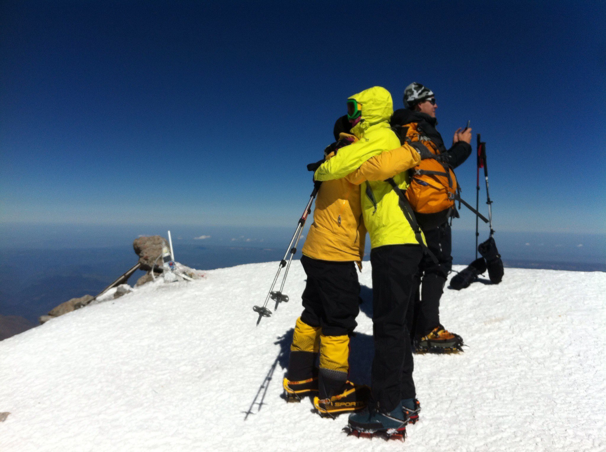
East summit.
From the top of Lenz rocks through not very steep snow slope, about 30 degrees, we rise to the top plateau, we cross it and reach the top. After a short stay begins the descent. Normally, the descent takes one-third of the ascent time. On average, leaving at two in the morning the group comes back at around four o’clock in the afternoon. But it is also good and implementable 8 hours to the top and about three hours for the descent. That is, with respect to an adequate level of training of the group all the climbing with a return to high camp can take up to 12 hours. It is on the eastern peak.
West summit.
It is located further, and climbing can last longer (relatively the ascent to the east) for 3-4 hours or more. Climbers with a good level of preparation can reach the western summit starting from 3800 for 8-9 hours. If it is decided to go west top, the turn to it occurs on the upper rocks of Lenz. After it about an hour traverse of the dome to the saddle 5300, then rise to the dome of western summit, crossing the summit plateau and reaching the summit. Descend along the ascent.
It is important to understand one thing: a guide makes decisions on the basis of objective possibilities of the group, which he understood in most cases more than the climbers themselves. The successful ascent to the planned summit – it is always a personal victory for any guide. But for a good guide the main victory – when all came back alive and healthy. A good guide will never go on customer’s unreasonable demands, although it happens that the customer can even offer some extra money on a mountain only to have him climbed at the top by any means, despite the fact that the guide recommends him to go down. The main task of the guide here on the mountain: well know and feel the mountain and take a clear look at the situation, trying to make the most objective, correct and optimal solution, even if for the climbers it does not seem most joyful at first sight. The most important thing – the safety of people and correct assessment of the situation.
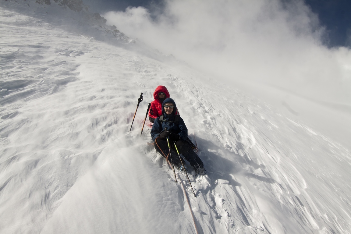
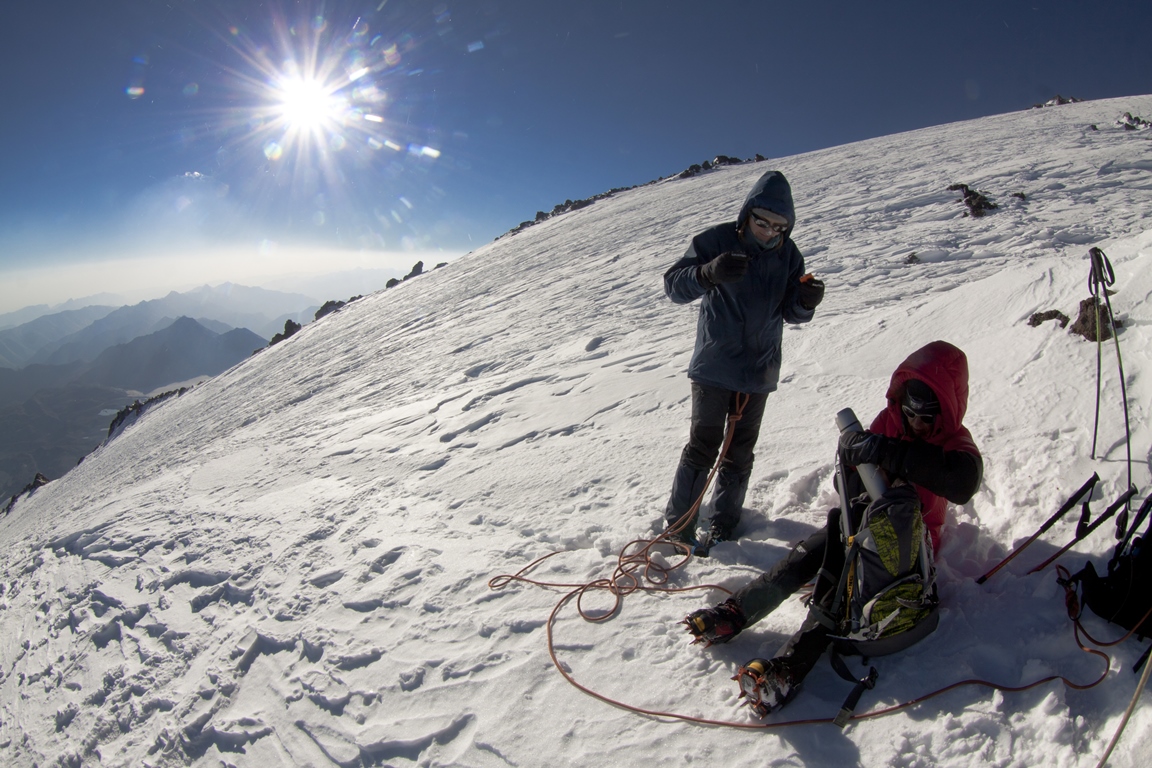
Weather. On the slopes of the north side it can be quite severe and even so it is considered acceptable. For example: a wind of 20 m/s – it is a normal working weather, those who doesn’t know that its permanent here can turn back thinking that he was blown off. Over the slope the situation with the wind may be different. It happens that before the lower Lenz rocks it is relatively calm, and from the border of rocks abruptly begins to blow. Sometimes vice versa – in the camp the strongest wind and slightly higher on the slope it becomes calmer. The air temperature in the upper part of the route can drop to -20 degrees, and in the sun can also be same number but in different direction. When the sun does not shine and comes the wind and clouds you are as if in the freezer. When the sun fries – as if in a stove. So you need to be prepared for such features.
Liquid. Loss of moisture – this is an important moment. In addition to the moisture, which vaporizes the skin during physical activity, the greater amount of it is evaporated through lungs when breathing, especially in a dry air. A trained body is able more efficiently use internal reserves of liquid (and nutrients), but even it cannot adapt to dehydration. Dehydration greatly affects on workability – can begin sick, headache, “heavy” muscles. The presence of these signs has already said that the drink is too late, it is better not to bring it up to it, and occasionally drink liquid on the route.
East summit:
Time: 11-14 hours
Elevation + – 1800 m
Length – 13 km
West summit:
Time: 12 – 16 hours
Elevation + – 1800 m
Length – 17 km.
Day 8: Reserve.
Reserve day in case of bad weather.
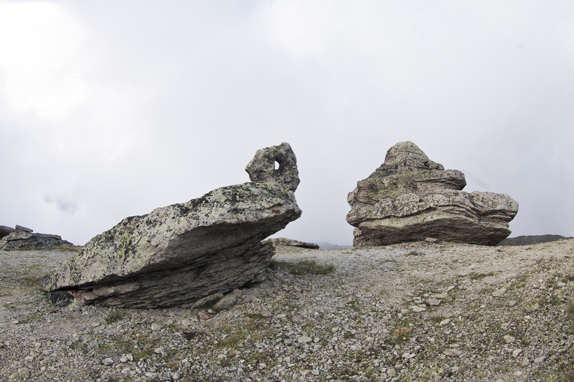
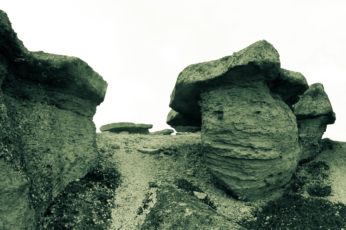
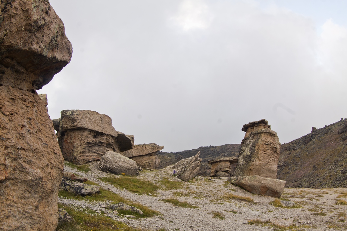
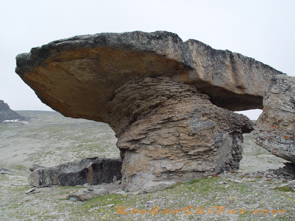
Descent to the Base Camp. On the way down, a transition along Moon glade to Stone Mushrooms — mysterious unusual formations, shaped very similar to giant mushrooms. Descent to the airfield through two small picturesque glades. In the Base Camp — lunch, packing clothes.
Day 9: Transfer from camp.
Transfer to Nalchik. Hotel accommodation. On this day we can visit hot springs near Nalchik or further to canyon till “Blue Lakes”.
Day 10: Departures.
Transfer to airport Min Vody or Nalchik. Departure to Moscow (Istanbul etc).
| SERVICES | STANDARD |
| All transfers: from Min Vody airport to hotel and back to airport; from hotel to north side of Elbrus and back to hotel. | |
| Accommodation in hotel in city Nalchik, according the program 2 days including breakfast. | |
| Campsite Huts on Emanuel glade 2600 m 3 days and on summit camp 3800 m according the program 4 days. | |
| All meals in camps: cooked meal everyday with packed lunches. | |
| Cook in base-camp and summit camp with all kitchen stuff. | |
| Qualified guide-instructor for acclimatization and climbing english speaking. | |
| Extra guides on summit day, 1 guide/3-4 climbers. | |
| Visa support, park fees, registrations. | |
| Rent of group equipment | |
| Rent of personal equipment. | |
| Dinners and lunches in the cities. | |
| Porters for personal equipment. | |
| Accident insurance. | |
| TOTAL PRICE | 95 000 rubles |
| REQUIRED EQUIPMENT FOR THE EXPEDITION «CLIMBING ELBRUS FROM THE NORTH FACE»: | GROUP EQUIPMENT: |
|
|
PRELIMINARY APPLICATION