+7 928 691 44 05
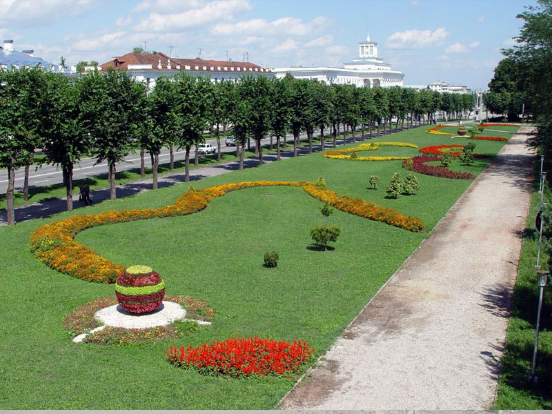
 Russia, KBR, city Nalchik


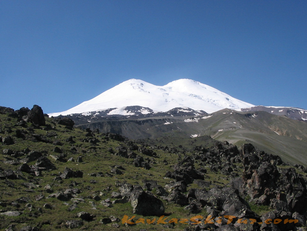
Climbing Elbrus from North with descent to South
|
|
|
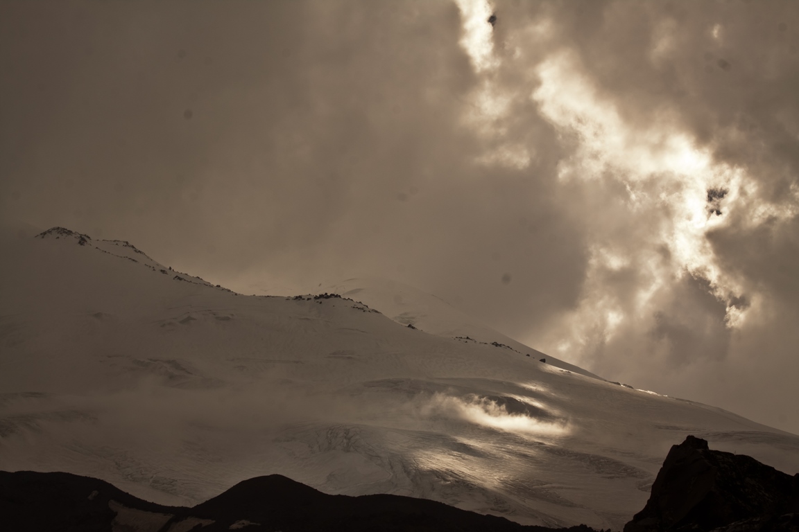
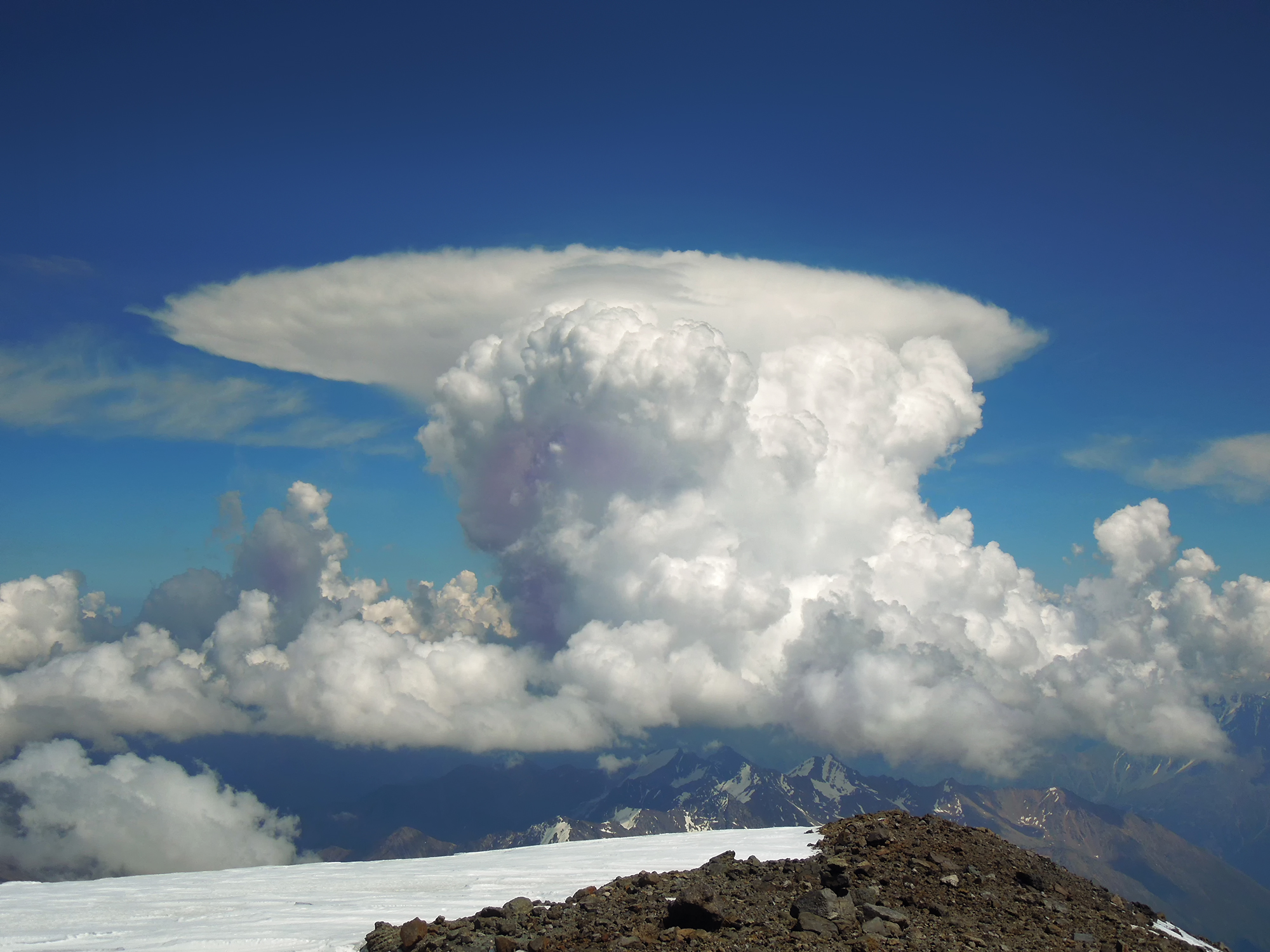
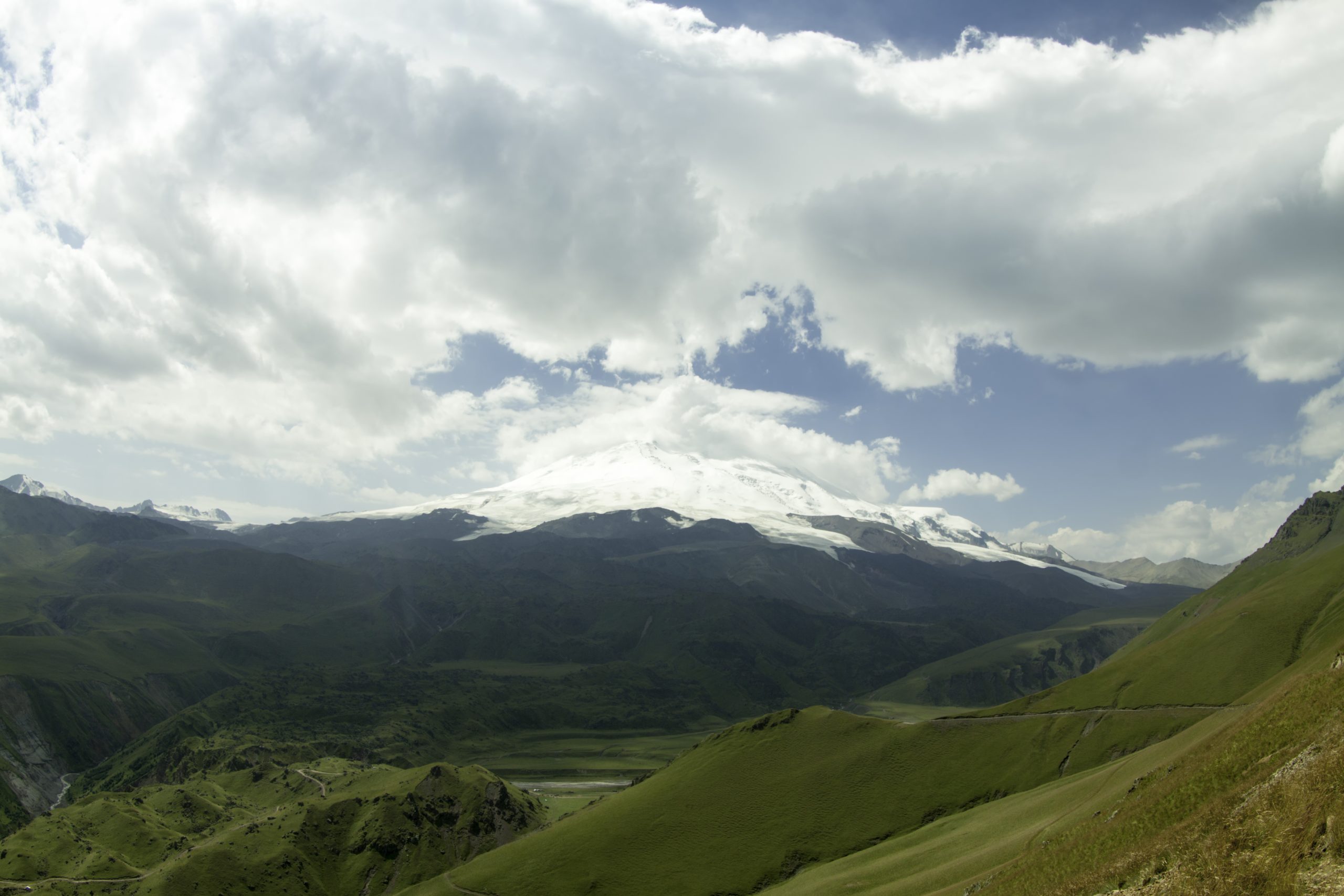
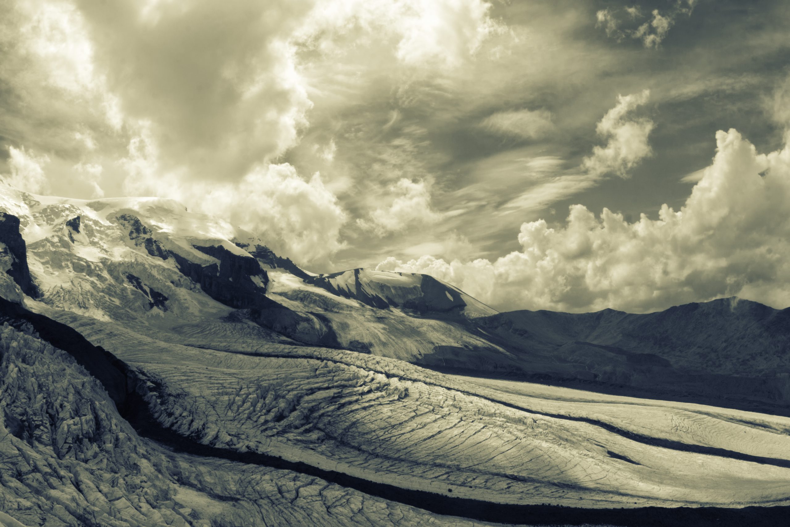
Climbing Elbrus along the Northern slope with traverse to South side is a rather difficult test even for an experienced climber. Although the route is not technically difficult and does not require special skills, it often requires all possible forces and resources of the body, due to its length and large height difference on the day of the summit. Also the decisive factor, can be the weather on the Mount: winds sometimes reach sixty kilometers per hour, and the temperature on a summer night can drop to minus thirty degrees. The sun also requires special respect to it — the layer of the atmosphere here is two times thinner than at sea level, and it shines and warms twice as much. Thanks to the optimal acclimatization program, the route is feasible for a physically healthy person, even if this is the first big mountain in your life, however, you will have to work hard. There are many factors influencing success, a team of professionals working with you always tries to take into account the maximum number of them in order to increase the chances of success.
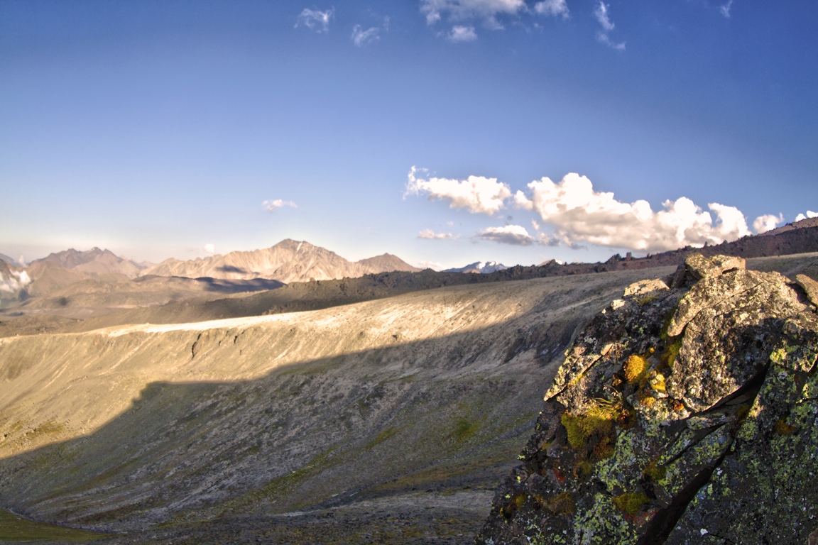
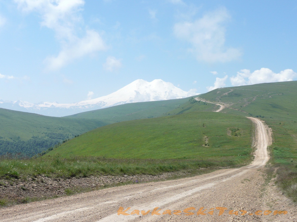
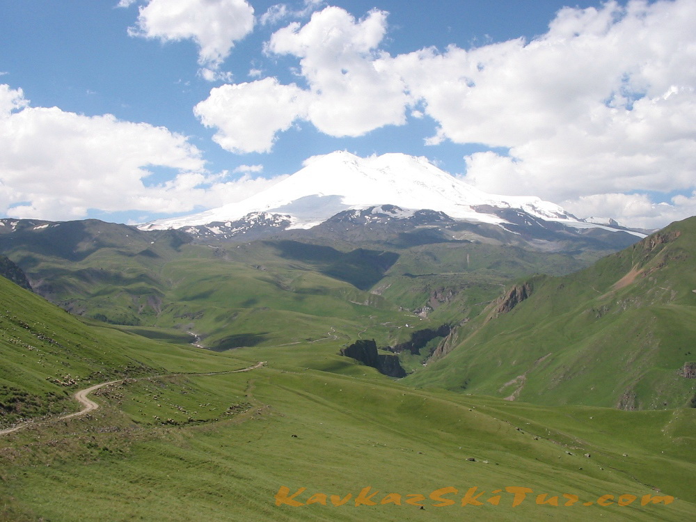
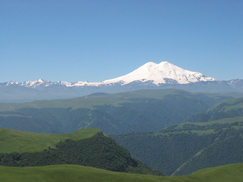
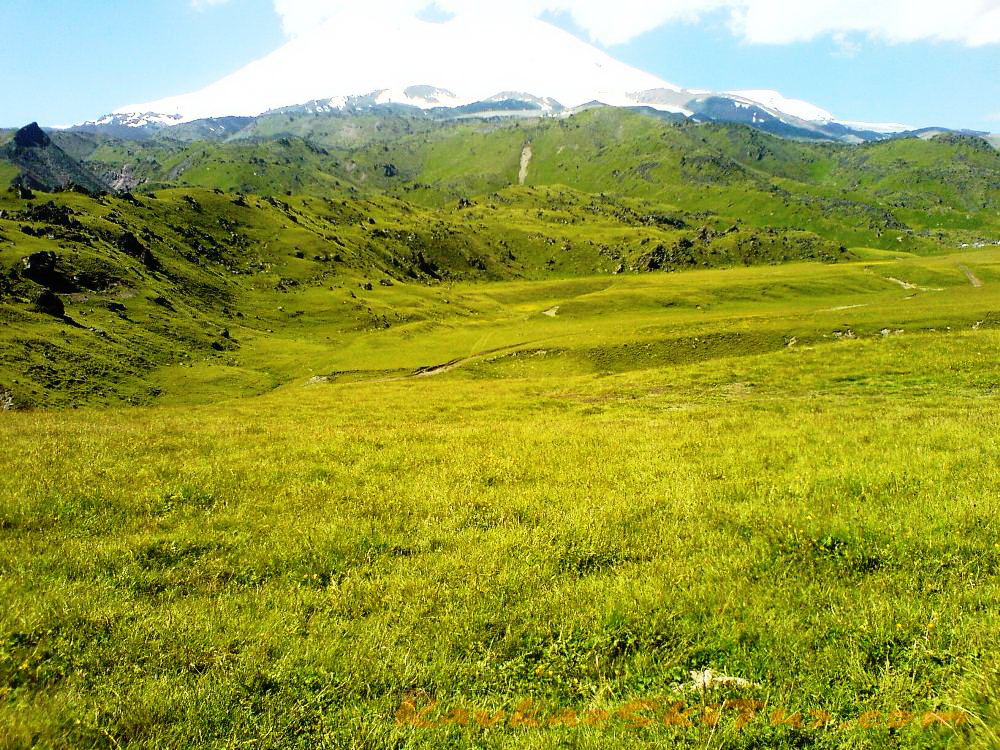
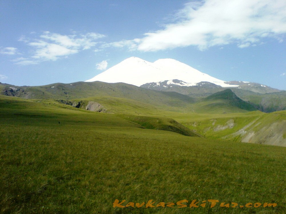
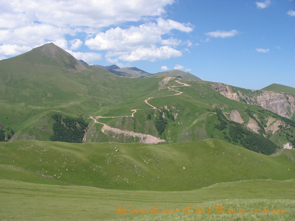
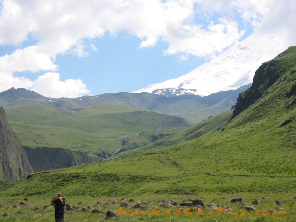
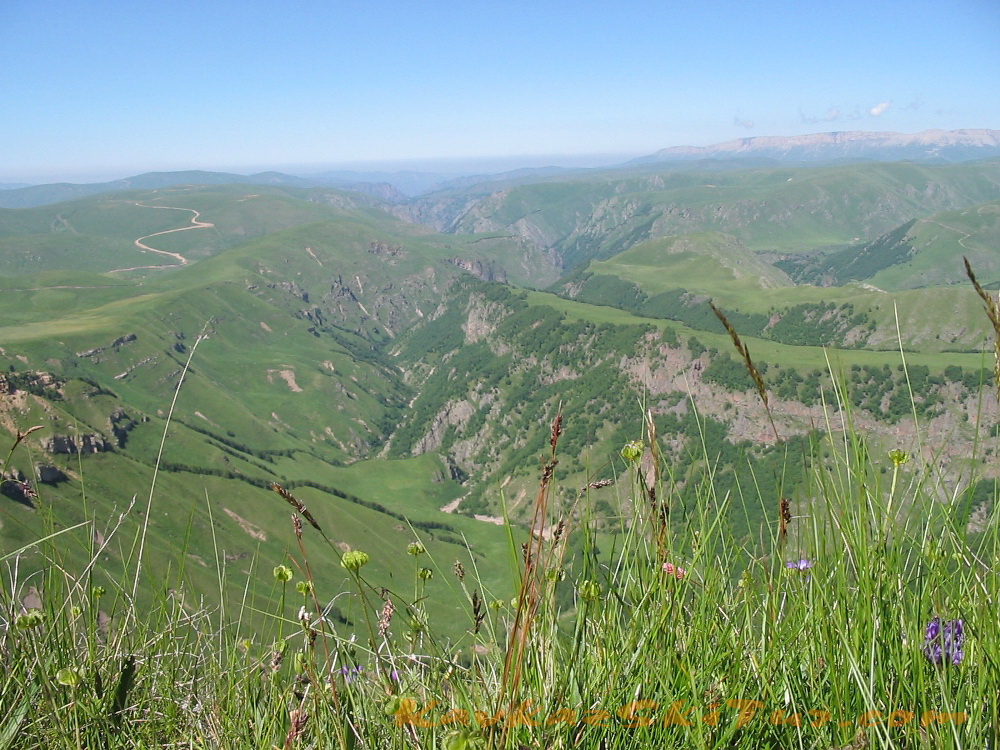
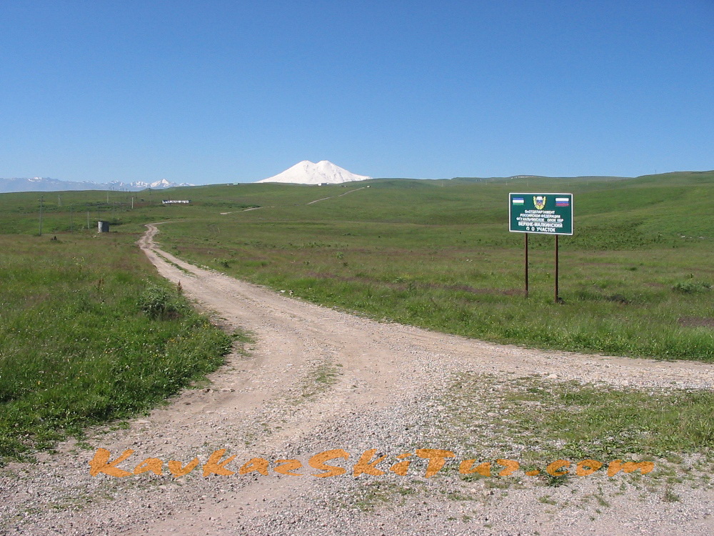
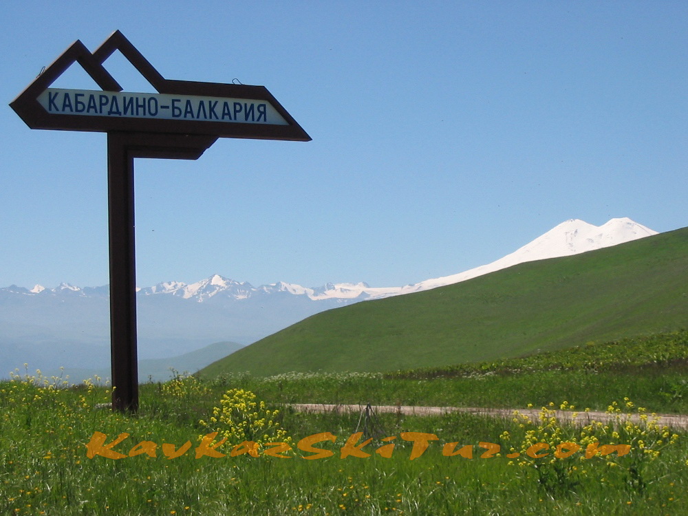
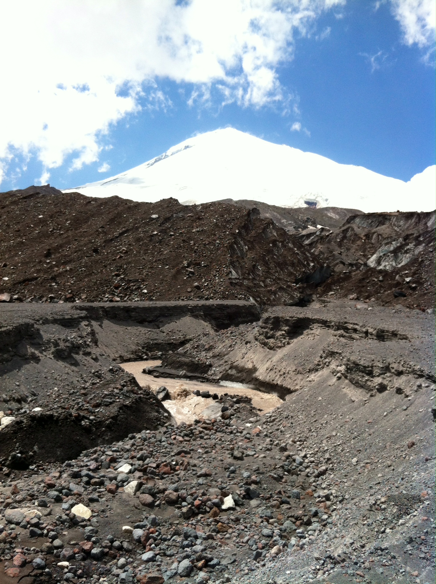
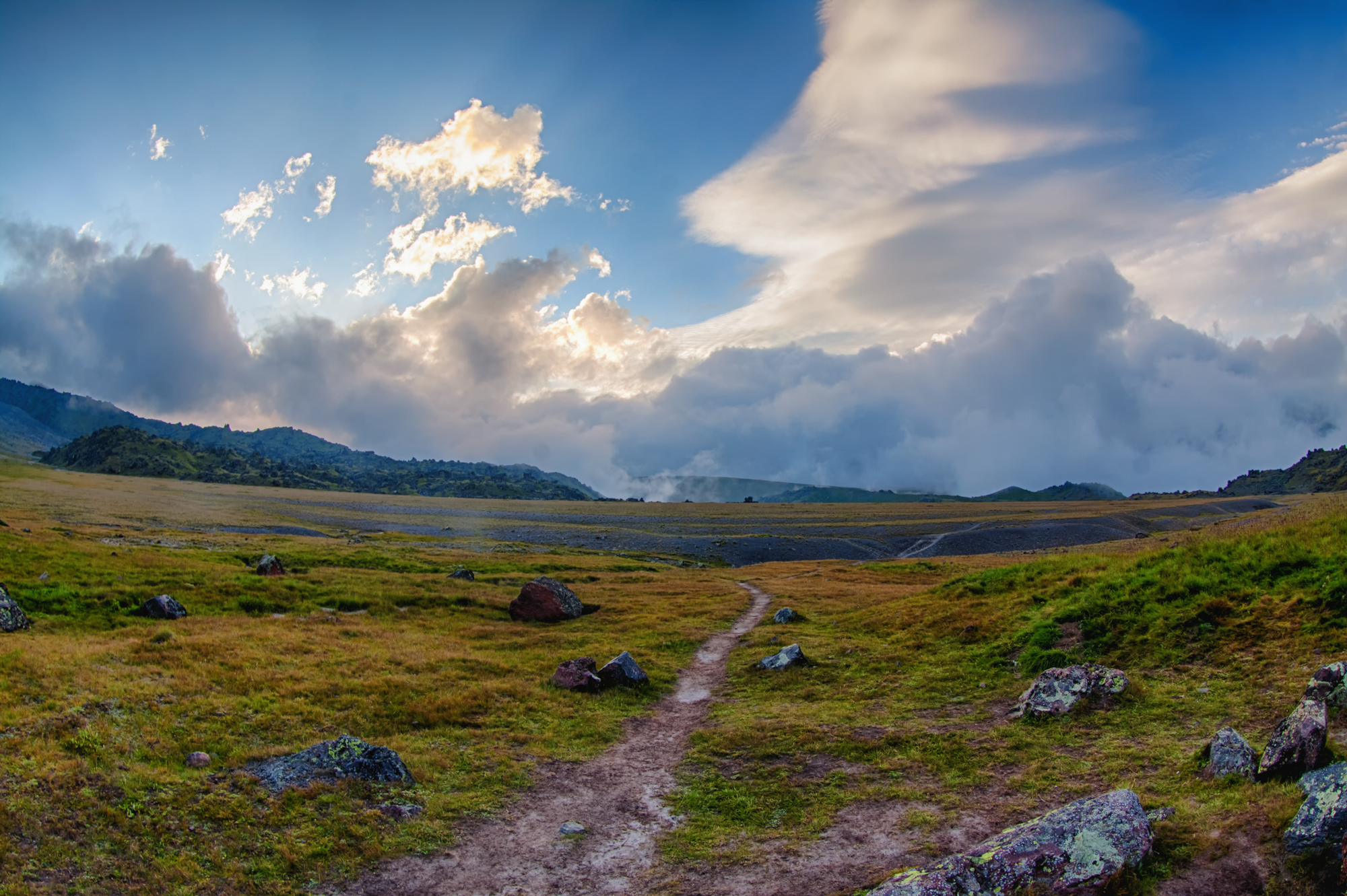
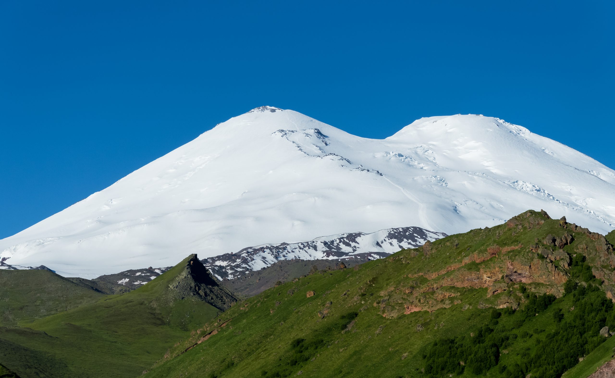
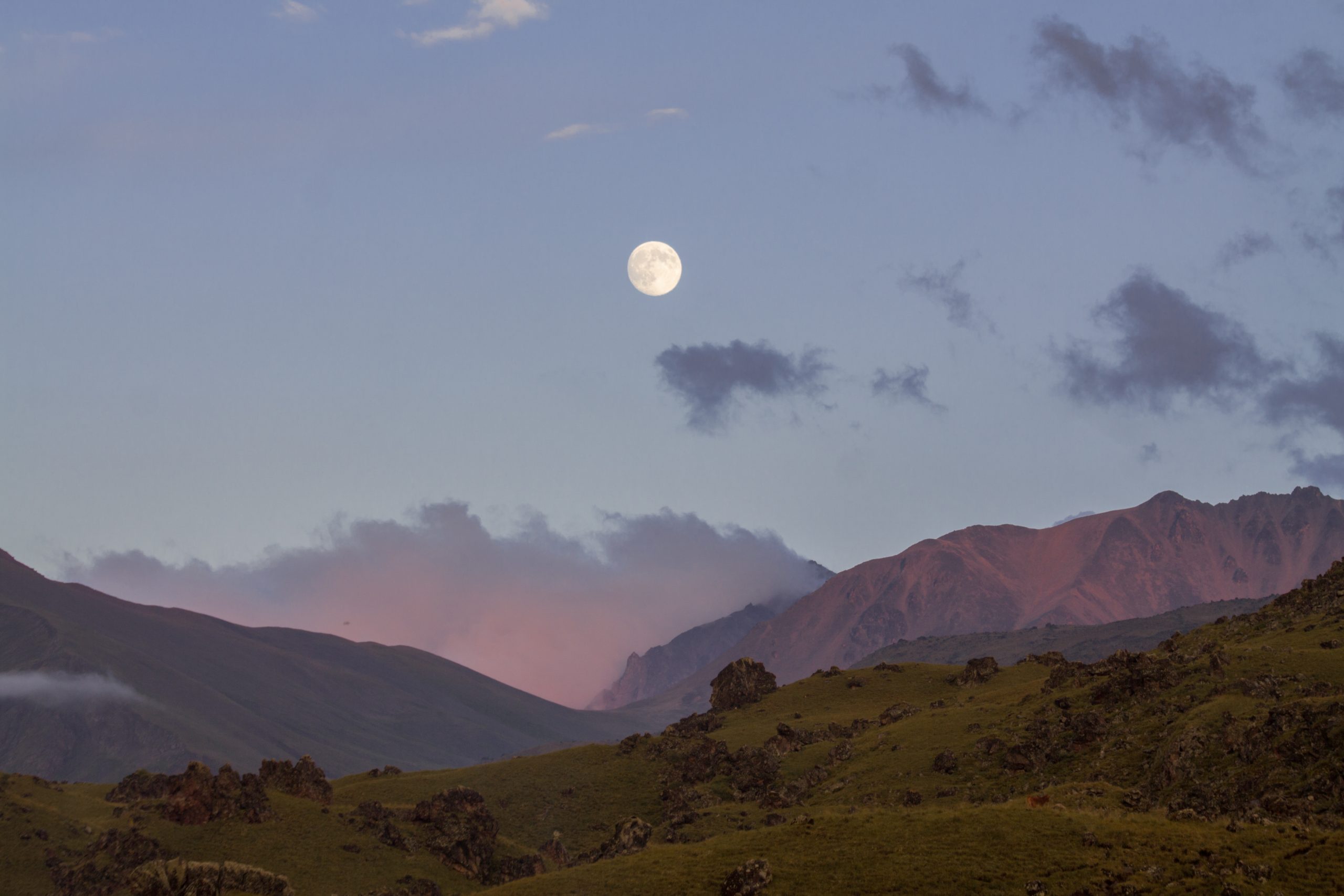
Elbrus is totally different from both sides — North and South. Considered a classic route today, the route from the South side is somewhat facilitated by the availability of infrastructure, depending on the season and the condition of the slope, it can take you and your backpacks up to a height of 4700 — 5100 m. On the northern side, summit begins already from the height of the base camp at 2600 m. Often, people who are mainly interested in the very fact of being at the top choose the southern route. Those for whom this is not enough, who want «real mountains», the northern side will be more to their liking.
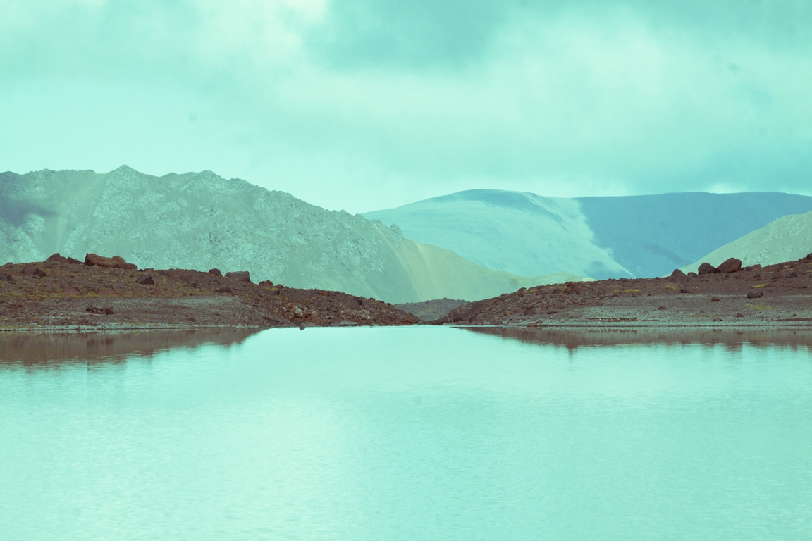
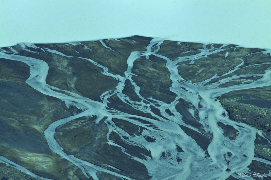
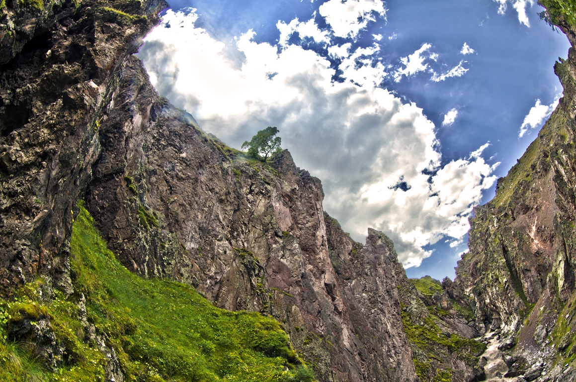
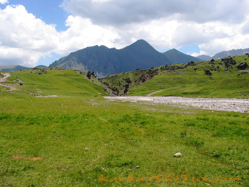
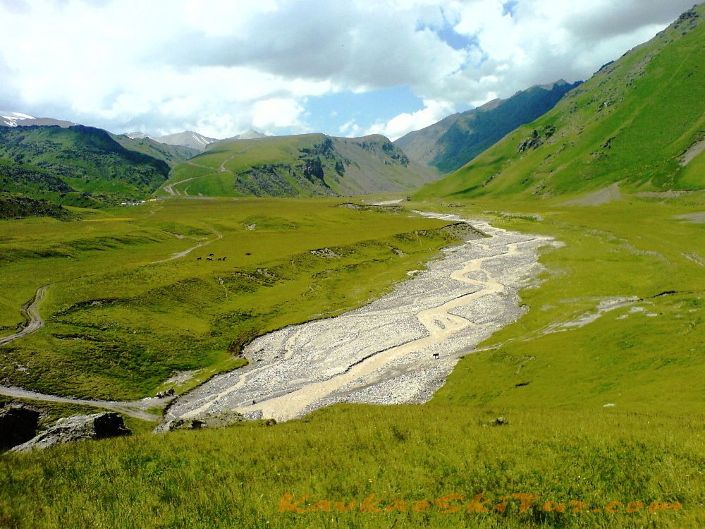
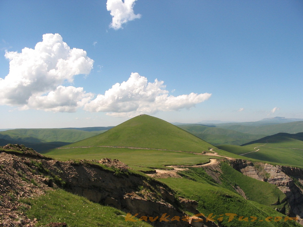
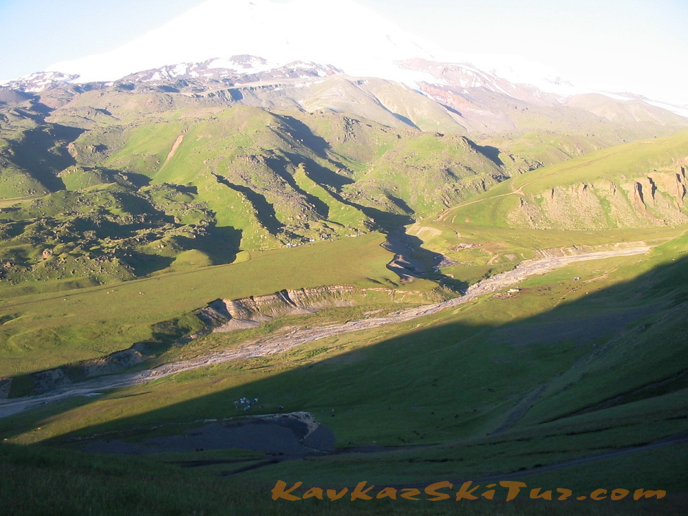
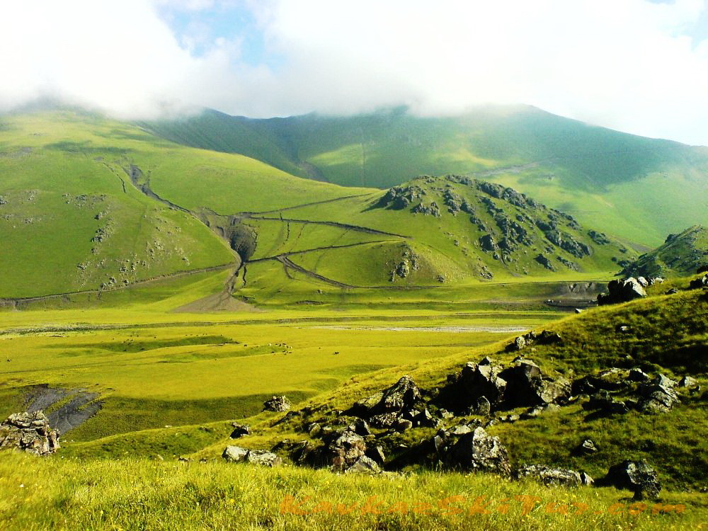
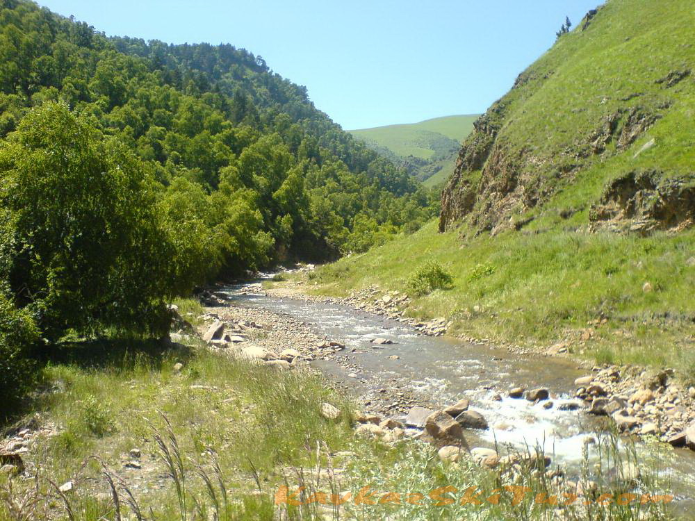
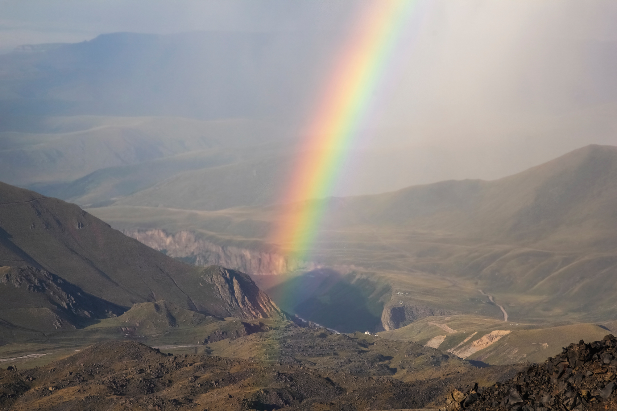
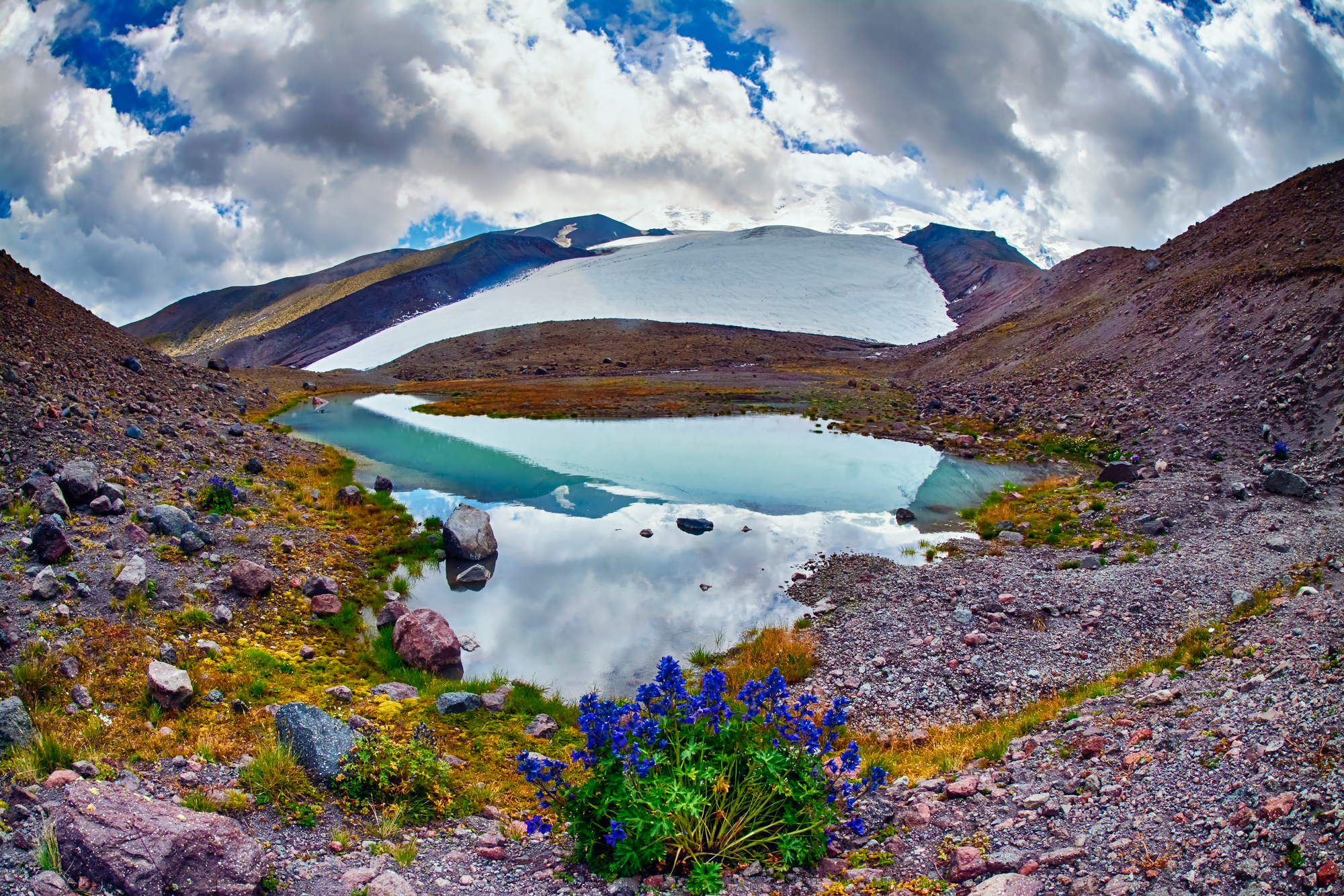
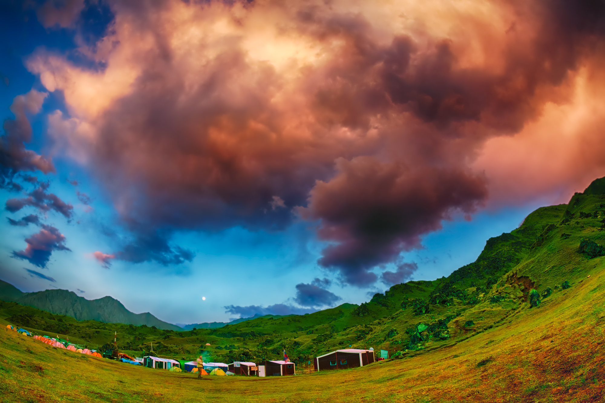
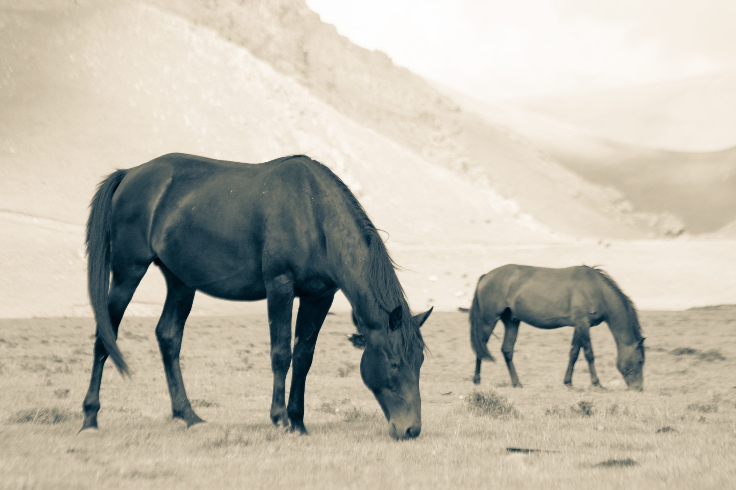
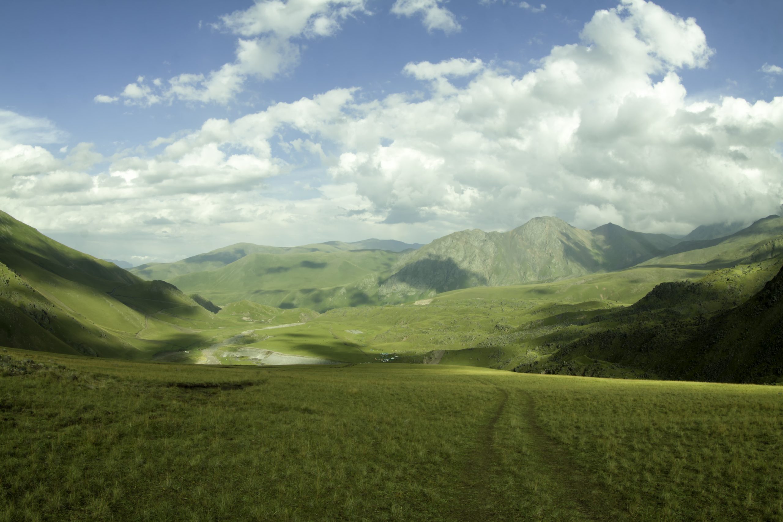
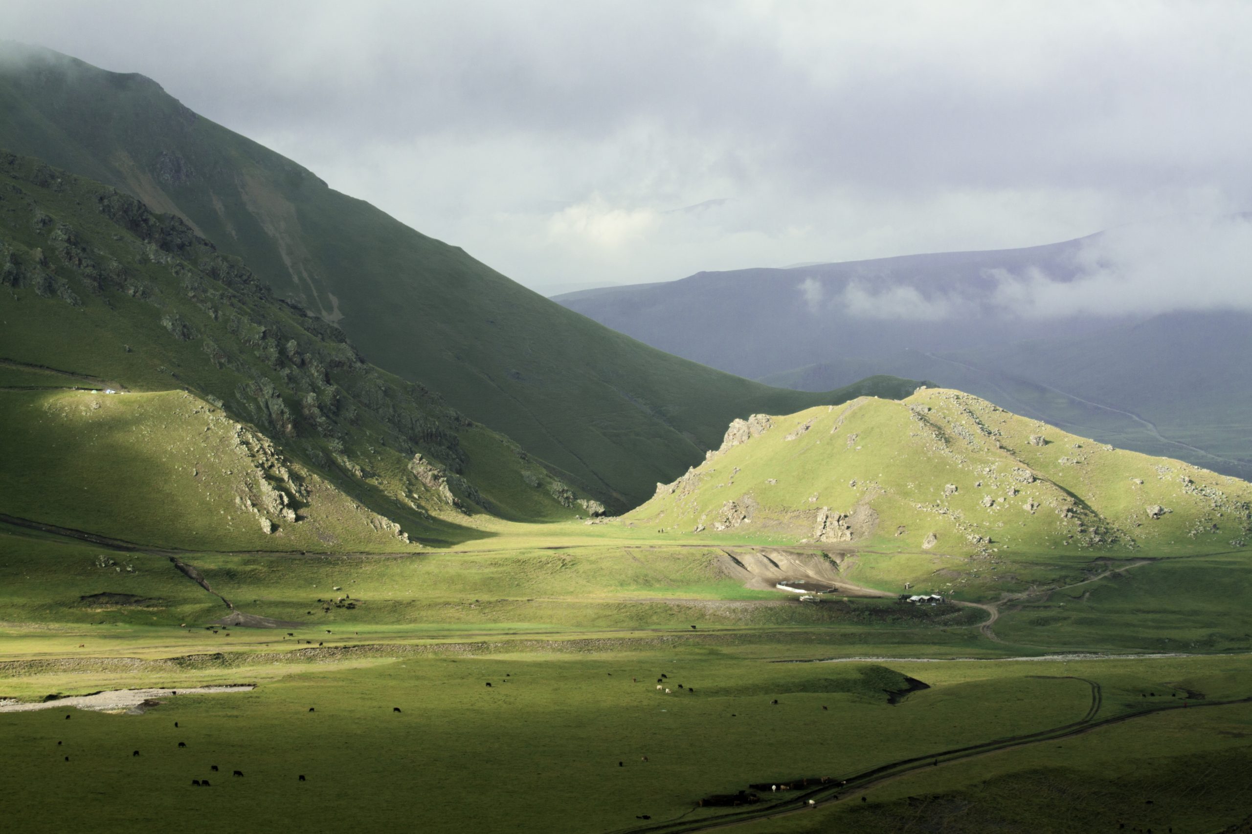
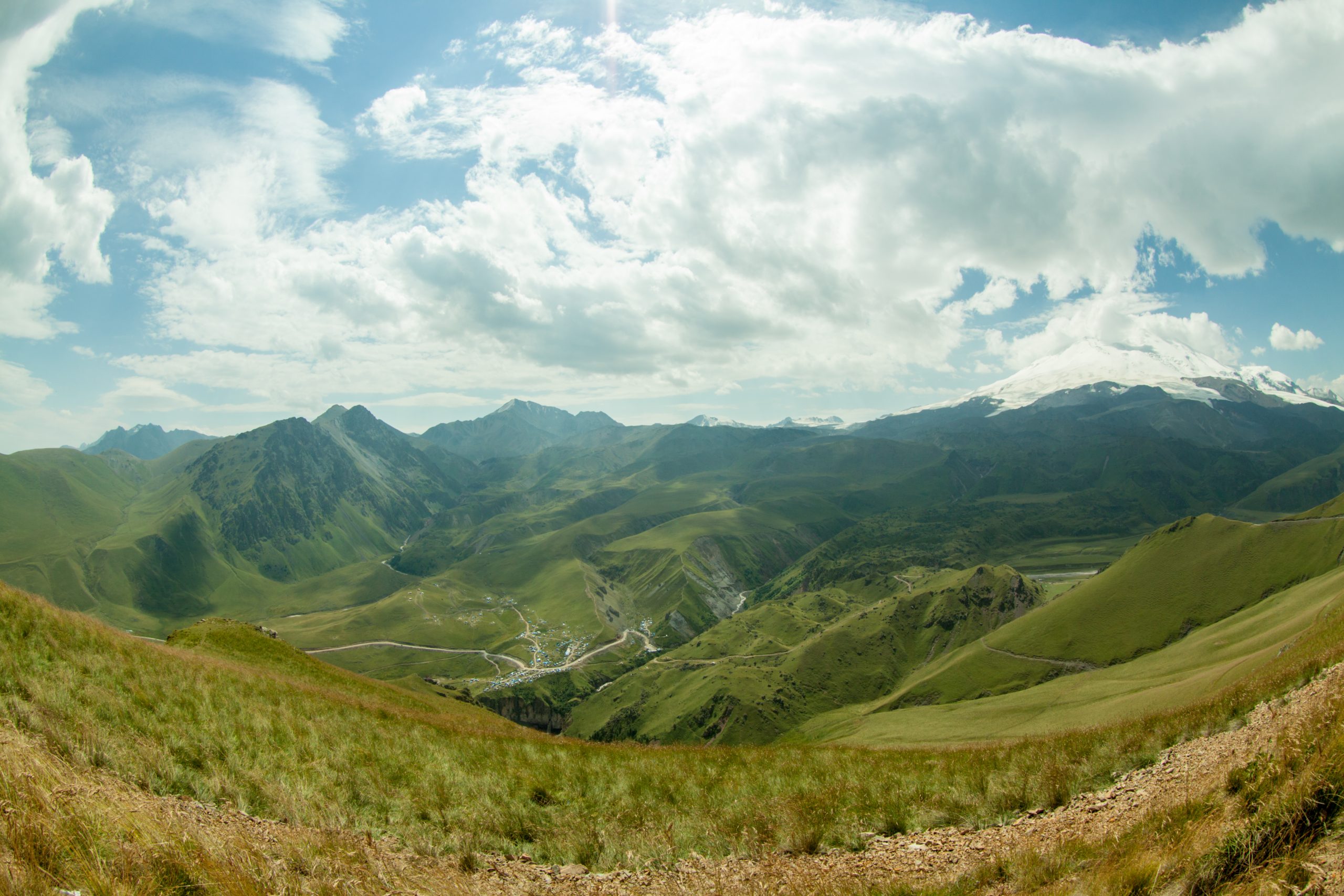
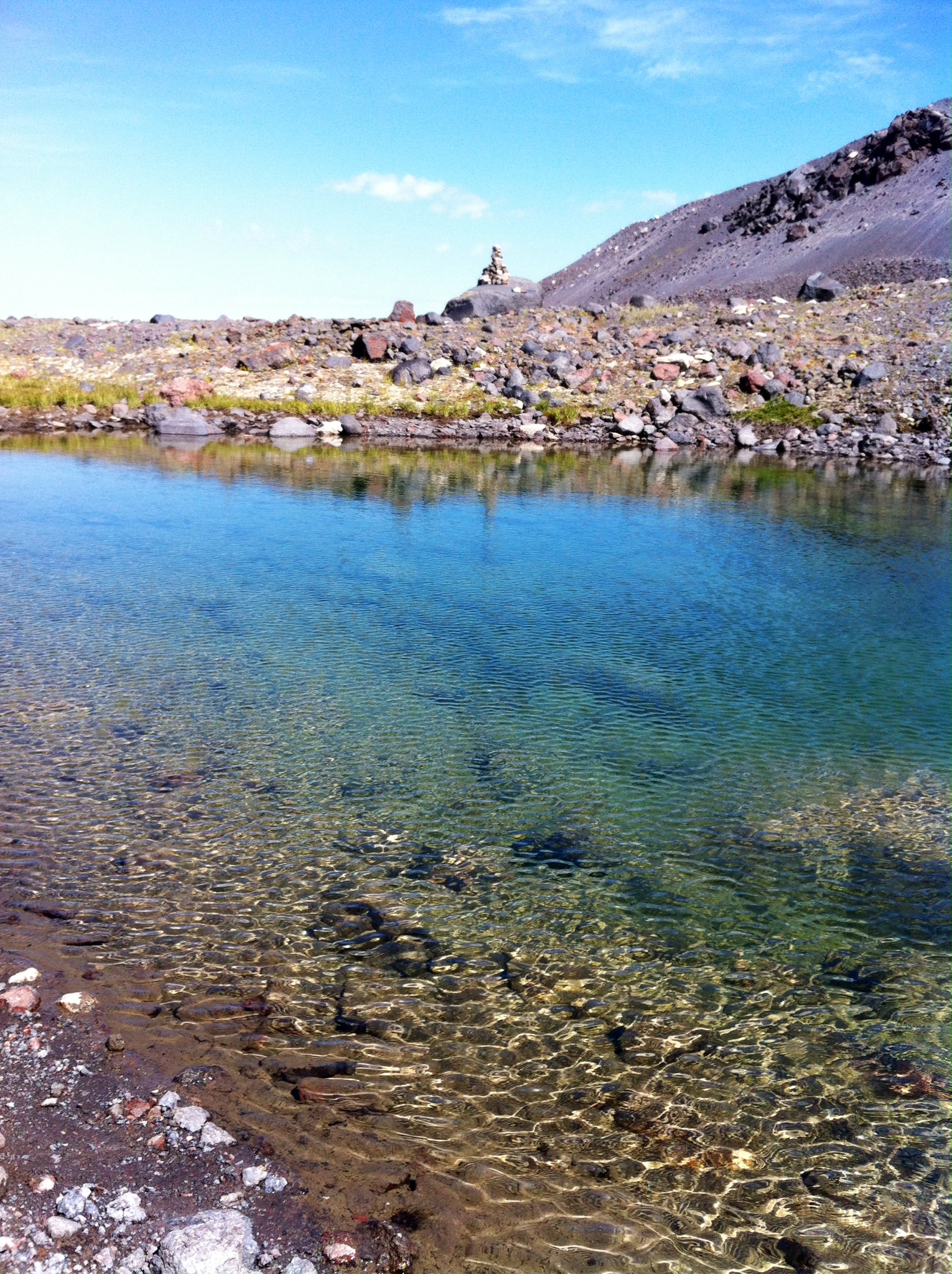
The trip allows to get acquainted with many attractions of the landscape and nature of northern Elbrus. All the routes are going through the natural beauty and wild mountain regions, which are best of all reflects the soul of the North Caucasus. Large plateau with stunning views of Mount Elbrus, glacial and spring lakes, wild rivers, crystal clear streams with trout, birch alpine forests, alpine meadows, glaciers, waterfalls, mineral springs, ancient ruins of villages, menhirs, passes: that’s just a small part of what offered in program. All tracks are under the watchful eye of the main attraction of these places – His Majesty Elbrus. The base camp has all necessary conditions for quality rest and get ready for new adventures. There is something here that leaves inside the warm and calm feeling of home, where you leave a large part of your heart and soul. And all this will call you back. It is very beautiful in here. And its all real. The real nature. These mountains. Real people.


Briefly about the tour
Day one:
Transfer to hotel in city Nalchik.
Hotel accommodation 2-3* in Nalchik park area.
Day two:
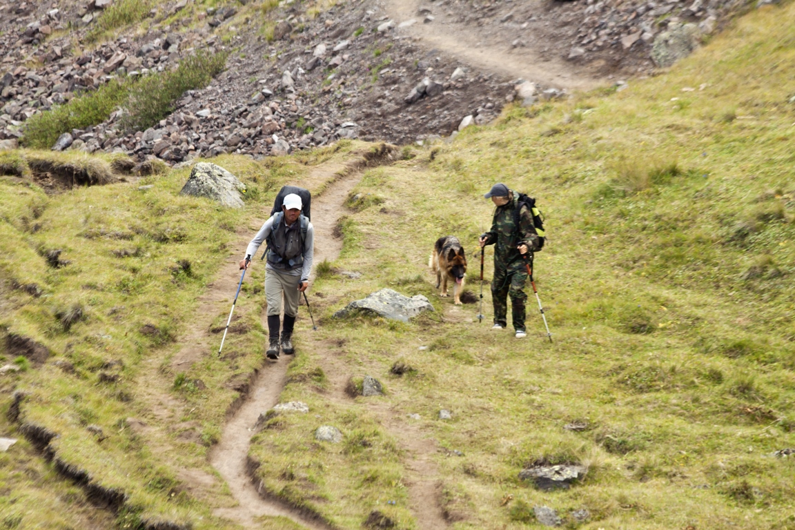
Trekking with small gain of altitude in the nearby surroundings.
Hiking time is 4-5 hours.
Absolute fluctuations in altitude: -300m, +300m.
Length — 12 km.
Day three:
Time — 9-10 hours.
Altitude: +1000 m, -1000 m.
Length — 20 km.
Day four:
Time 8-9 hours.
Height: + 1200 m, — 1200 m.
Length: 12 km.
Day five:
Time 5-6 hours.
Height: + 1200 m.
Length: 7 km.
Day six:
Time: 3-6 hours.
Height: +-700-800 m.
Length — 5 km.
Day seven:
Day eight:
Eastern peak of Elbrus 5621 m:
Time: 10 – 13 hours.
Height + — 1800 m
Length — 13 km.
Western peak of Elbrus 5642 m:
Time: 12 — 16 hours.
Height + — 1800 m
Length 17 km.
Day nine:
Day ten:

About camps
The climbing program relies on the existence of stationary camps and the availability of the necessary infrastructure in them, sufficient to ensure a completely comfortable stay in these not comfortable, in general, natural conditions, and balanced in such a way as not to harm nature.
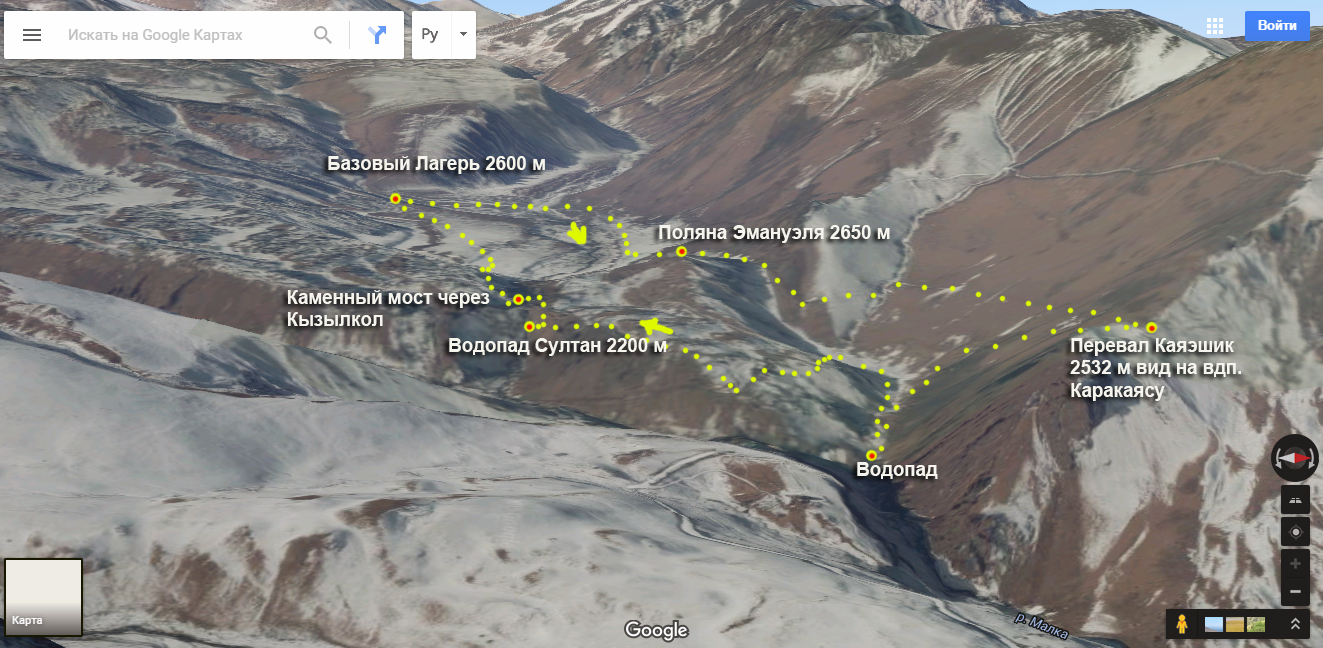
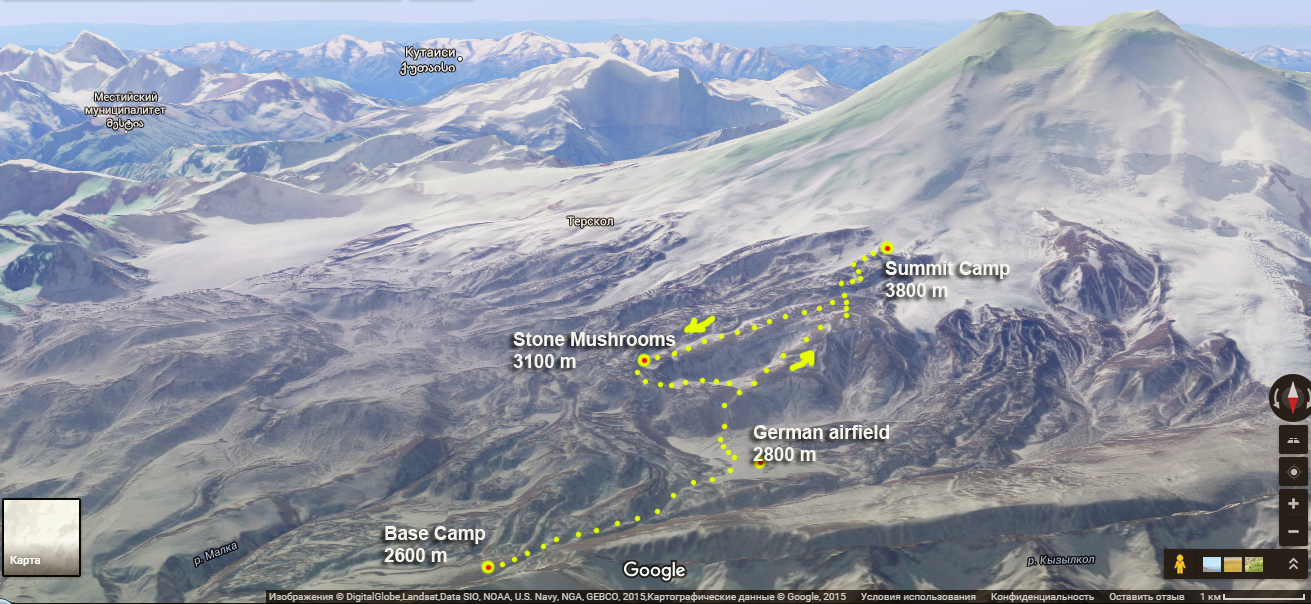
There are two camps :
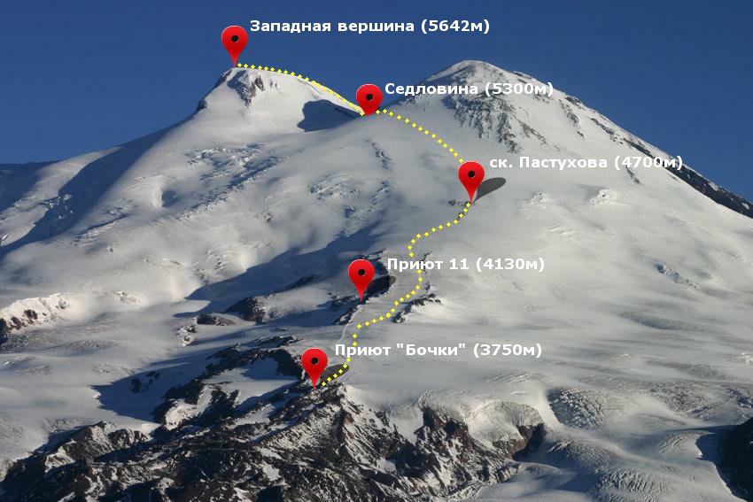
Base camp 2600 м.
Summit camp 3800 м.
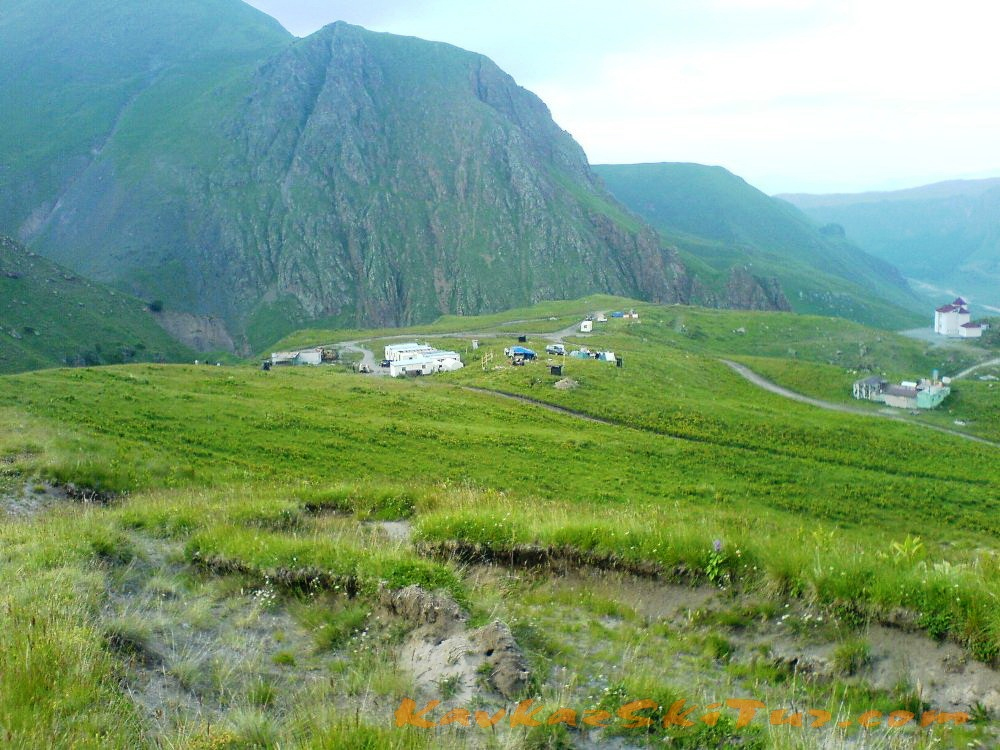
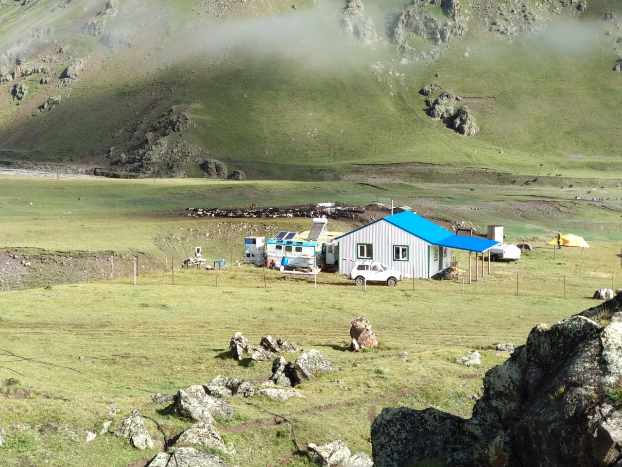
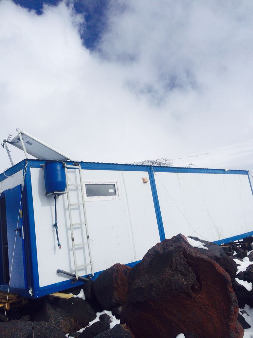
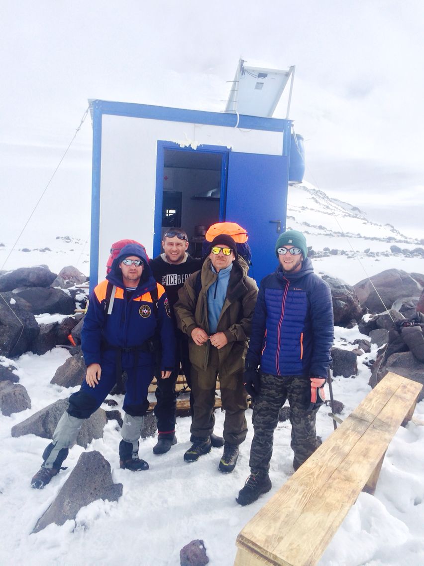
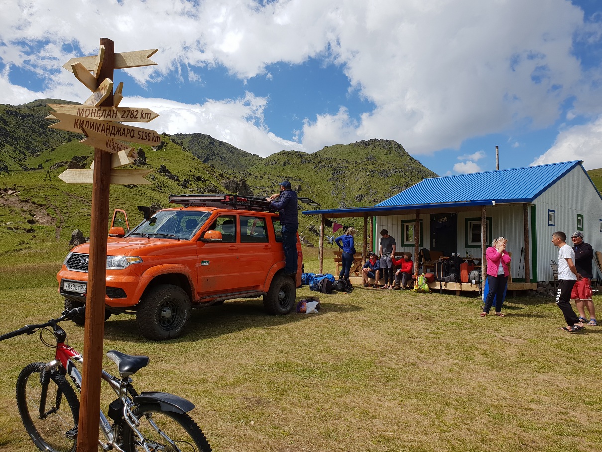
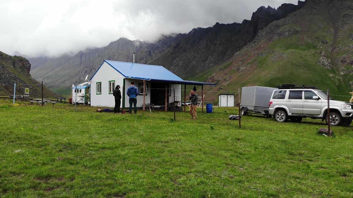
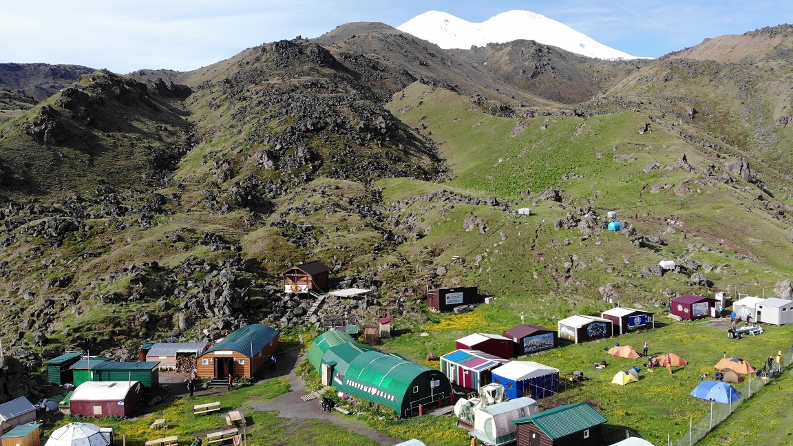
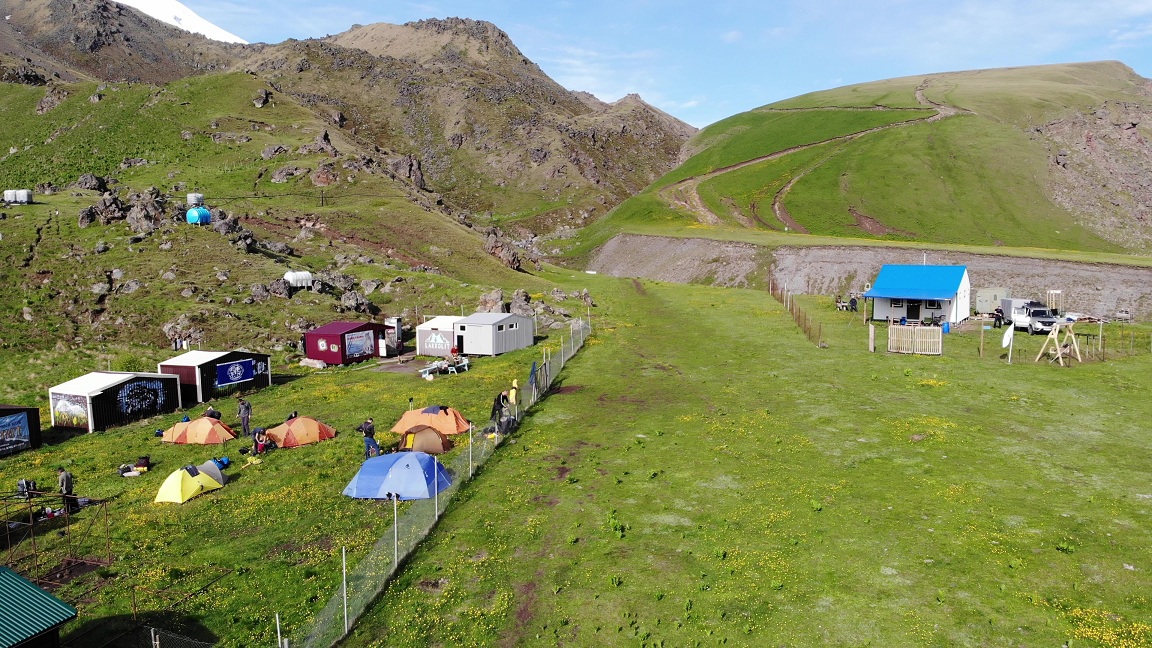
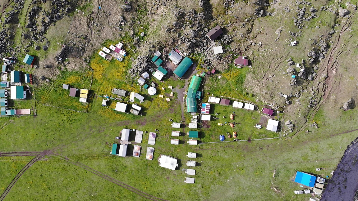
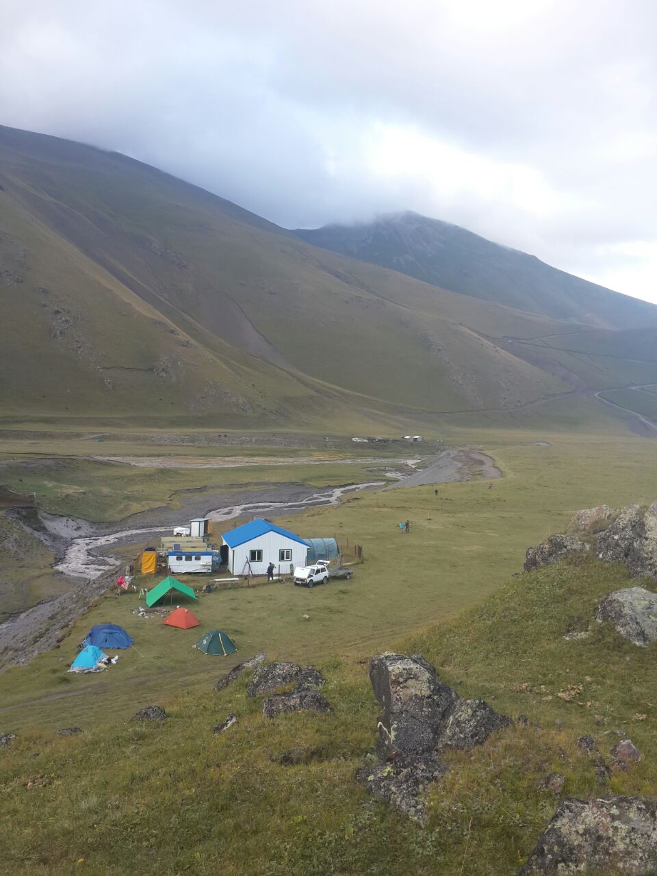
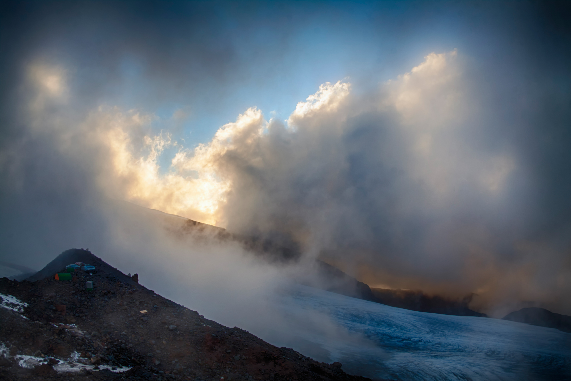
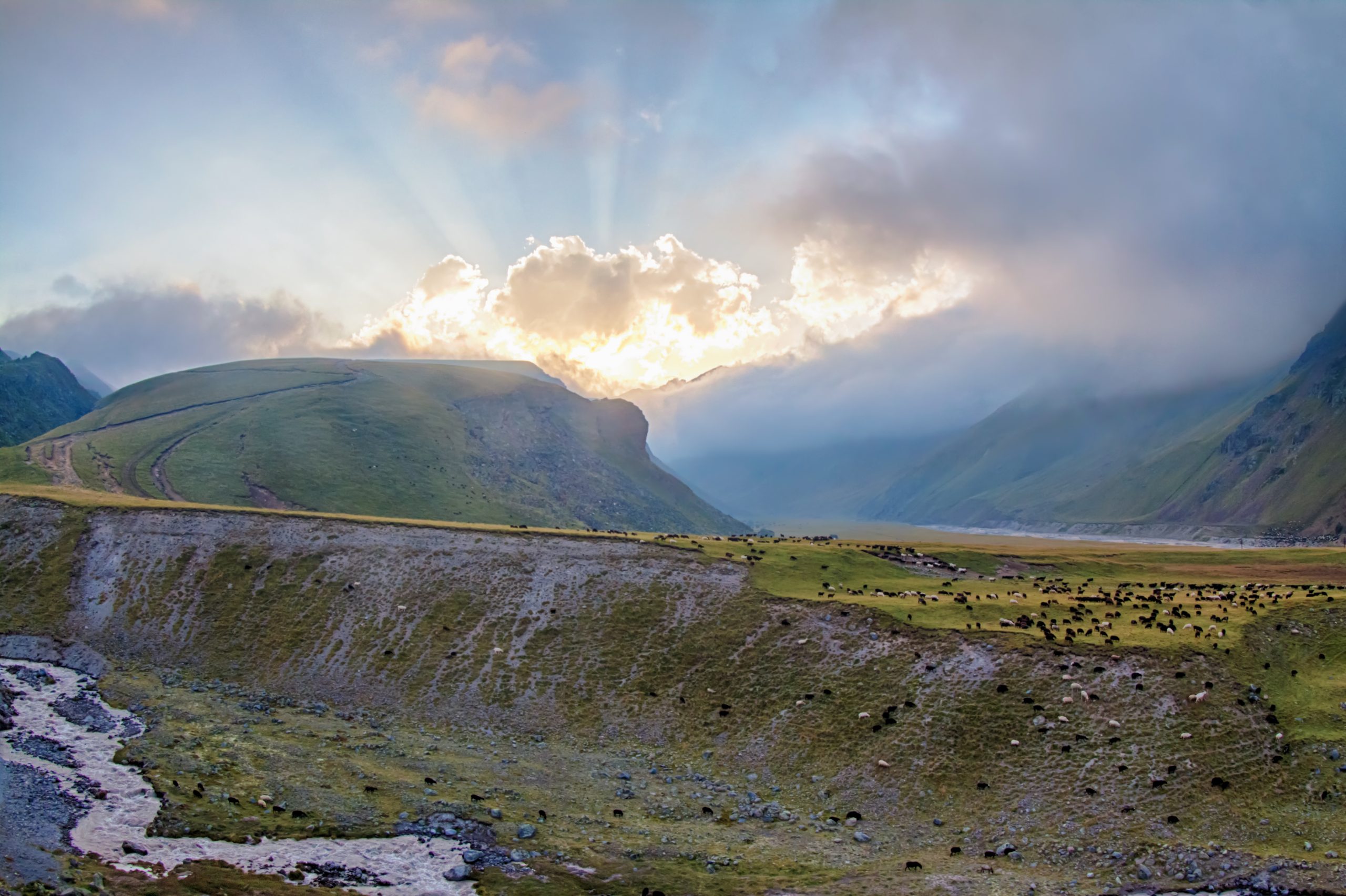
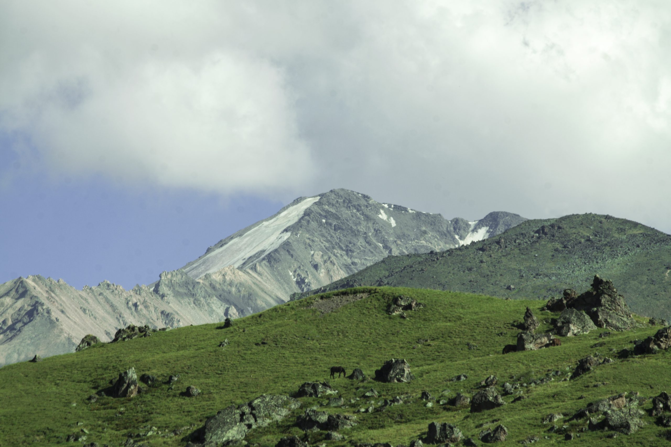
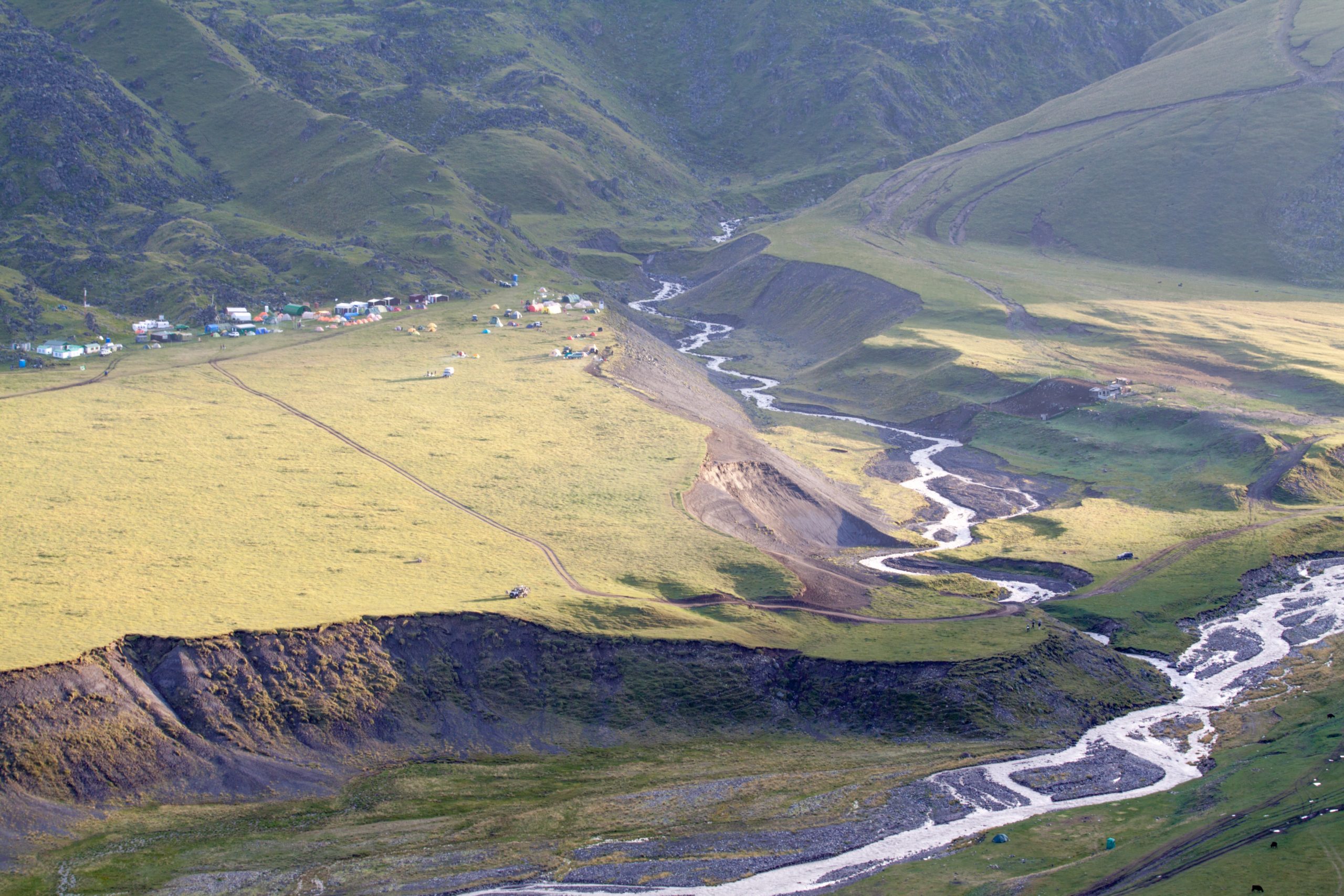
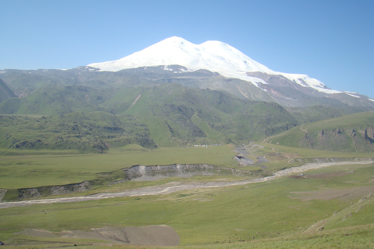
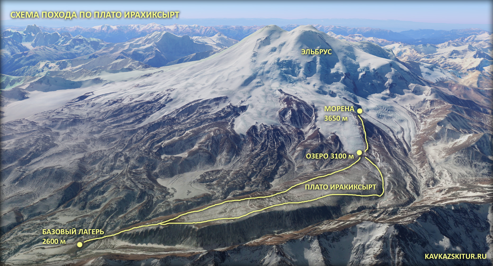
The base camp is located on the Irakhiktuz plateau, which since the time of Emanuel has also slowly begun to be called «Emanuel’s Glade». Being at an altitude of 2600 m, the base can rightfully be considered the highest mountaineering base camp in Europe.
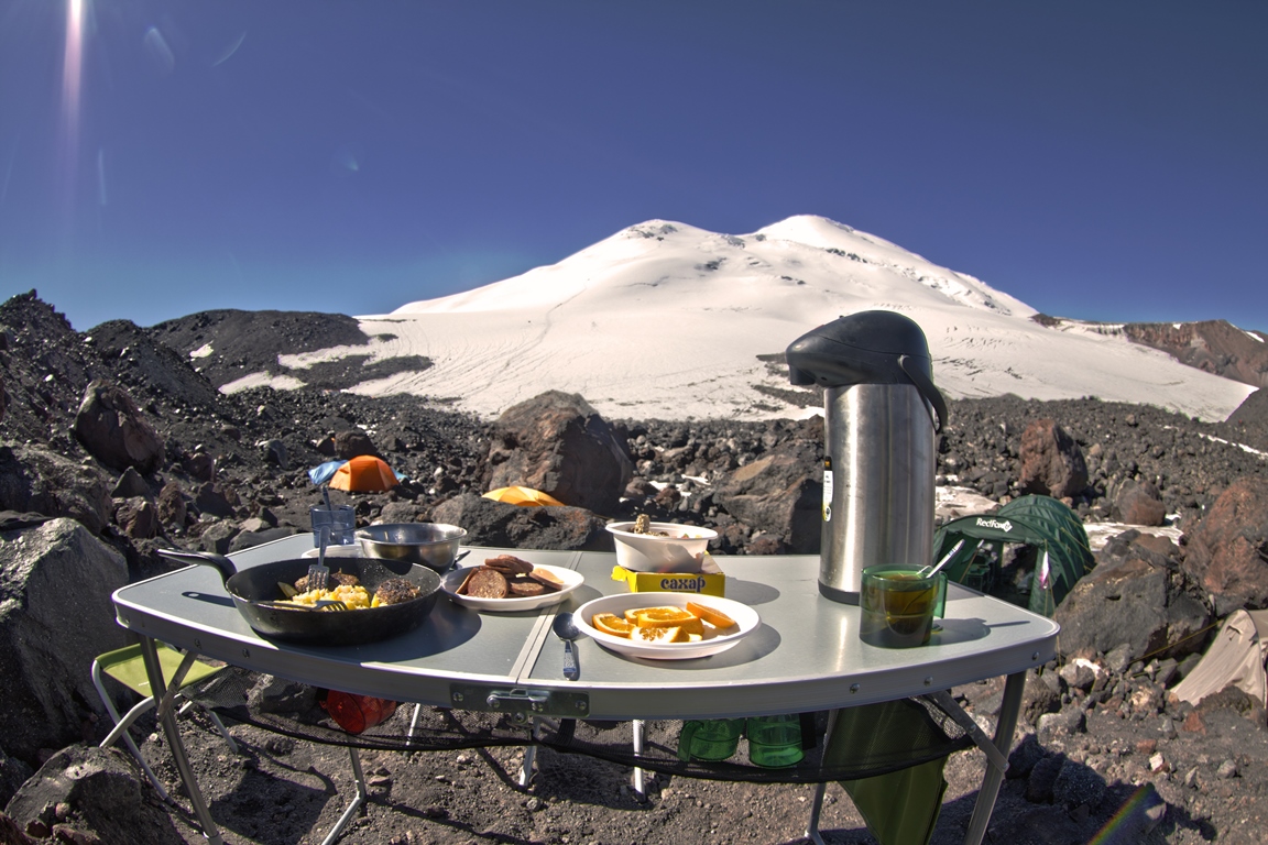
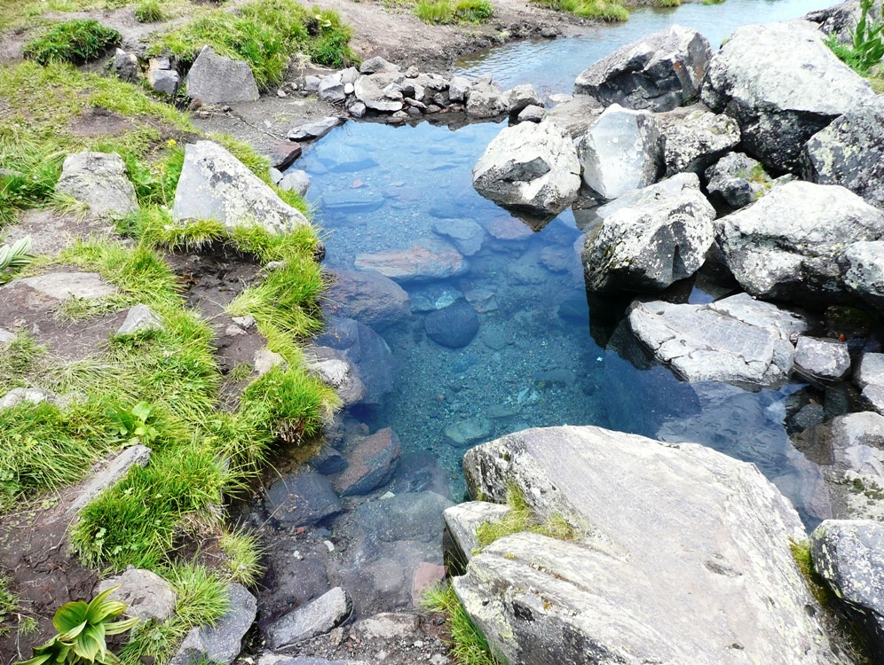
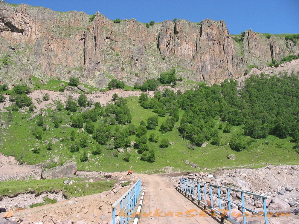
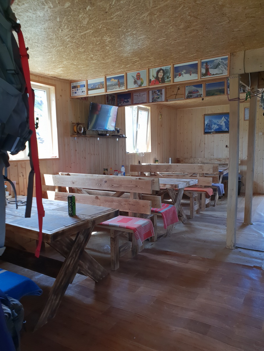
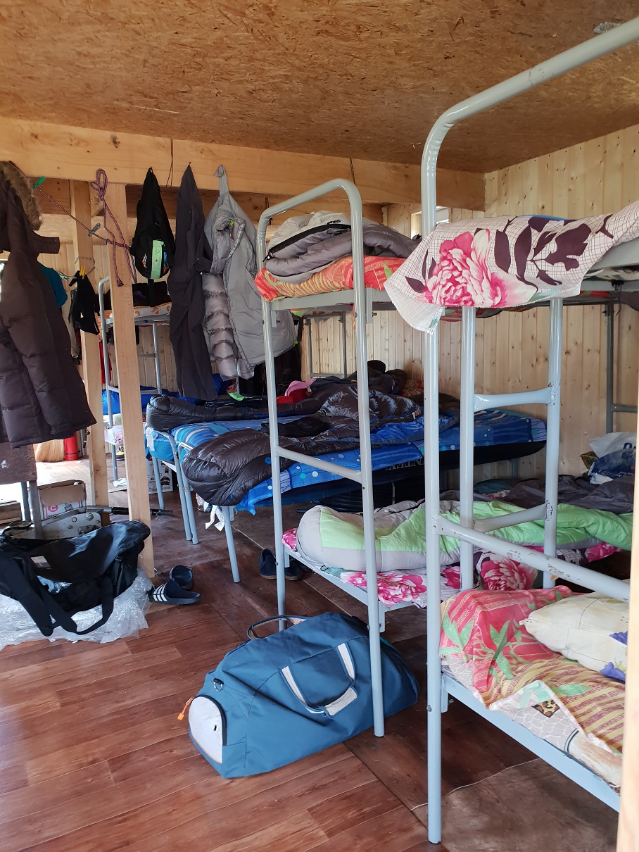
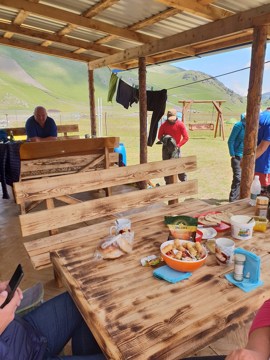
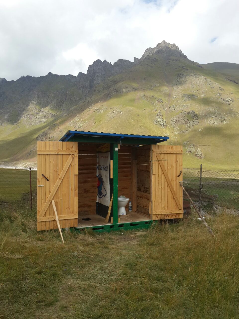
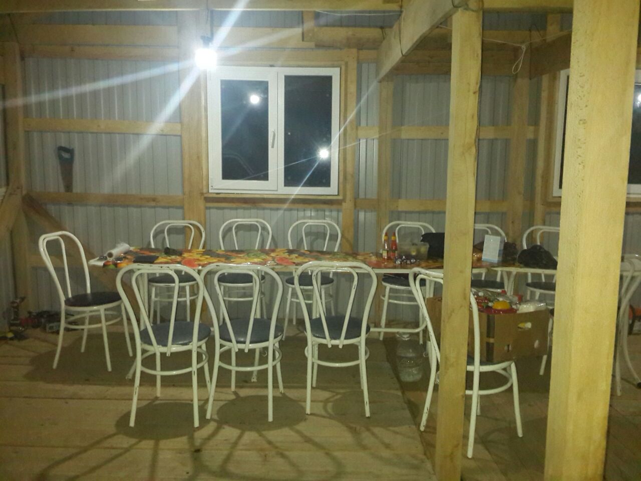
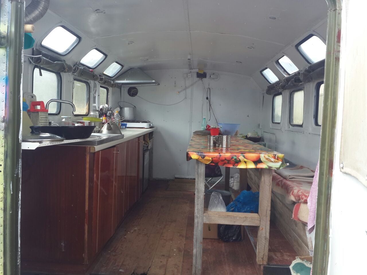
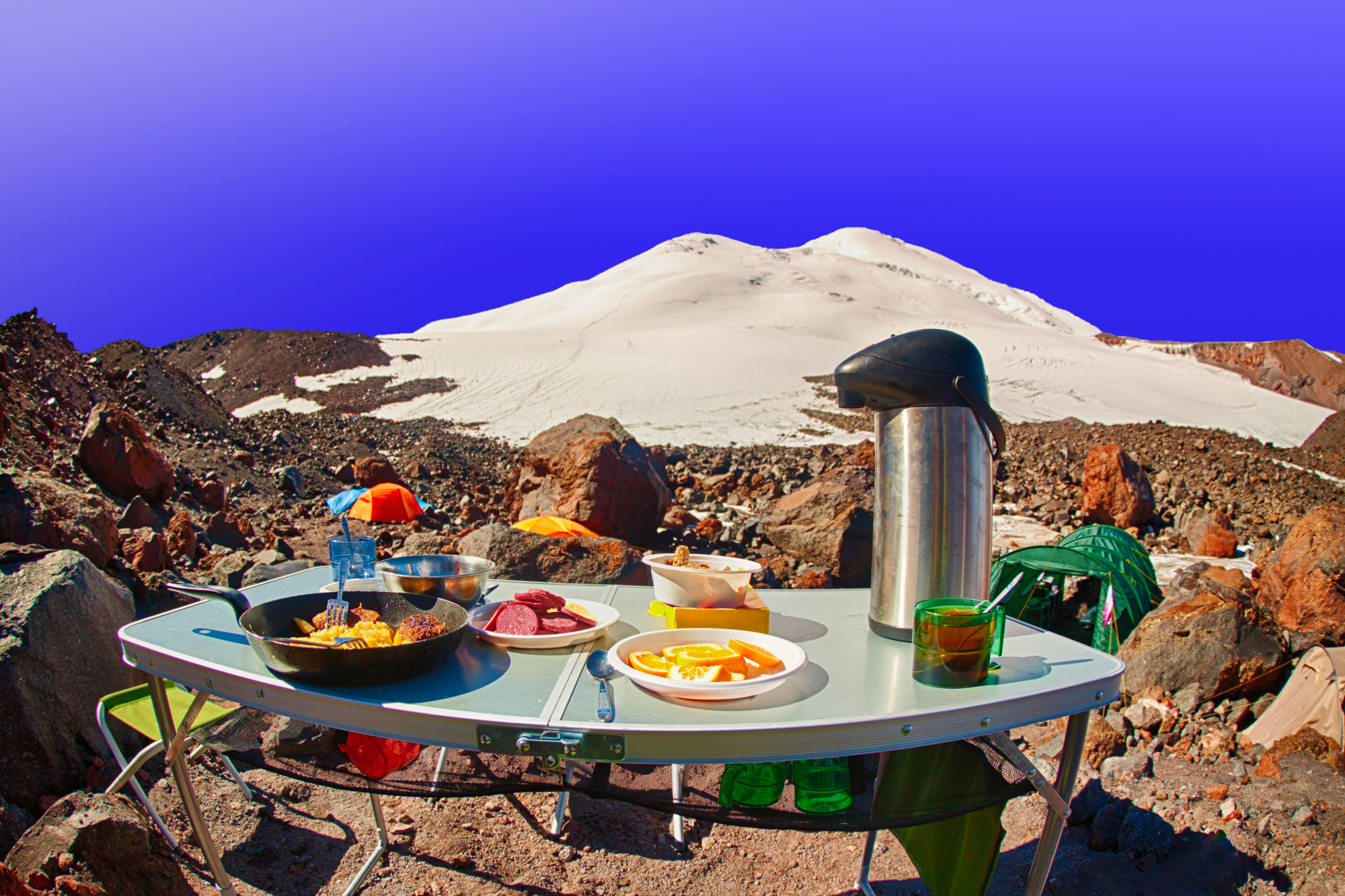
Huts with beds, hot shower, washbasin, toilet, kitchen, dining room, Wi-Fi, TV. On one side of the plateau there is a beautiful ridge — Kyzylkol with peaks up to 3600 m, on the other side — lava hills climbing to the border of eternal ice, covered with various vegetation: there are berries, useful herbs, rhododendrons. Four kilometers walk along the trek, three hundred meters lower of camp, there is the Dzhily-Su tract, in the vicinity of which there are many sources of mineral water narzan, hot springs, waterfalls, a cafe, a small shop.
A five minute walk from the camp there is sheep-yard, where you can taste the food of true mountaineers – cheese, ayran, bread of shepherds, buy lamb (on request it can be prepared and cooked as shashlik – grilled barbecue and shurpa – soup made from mutton).
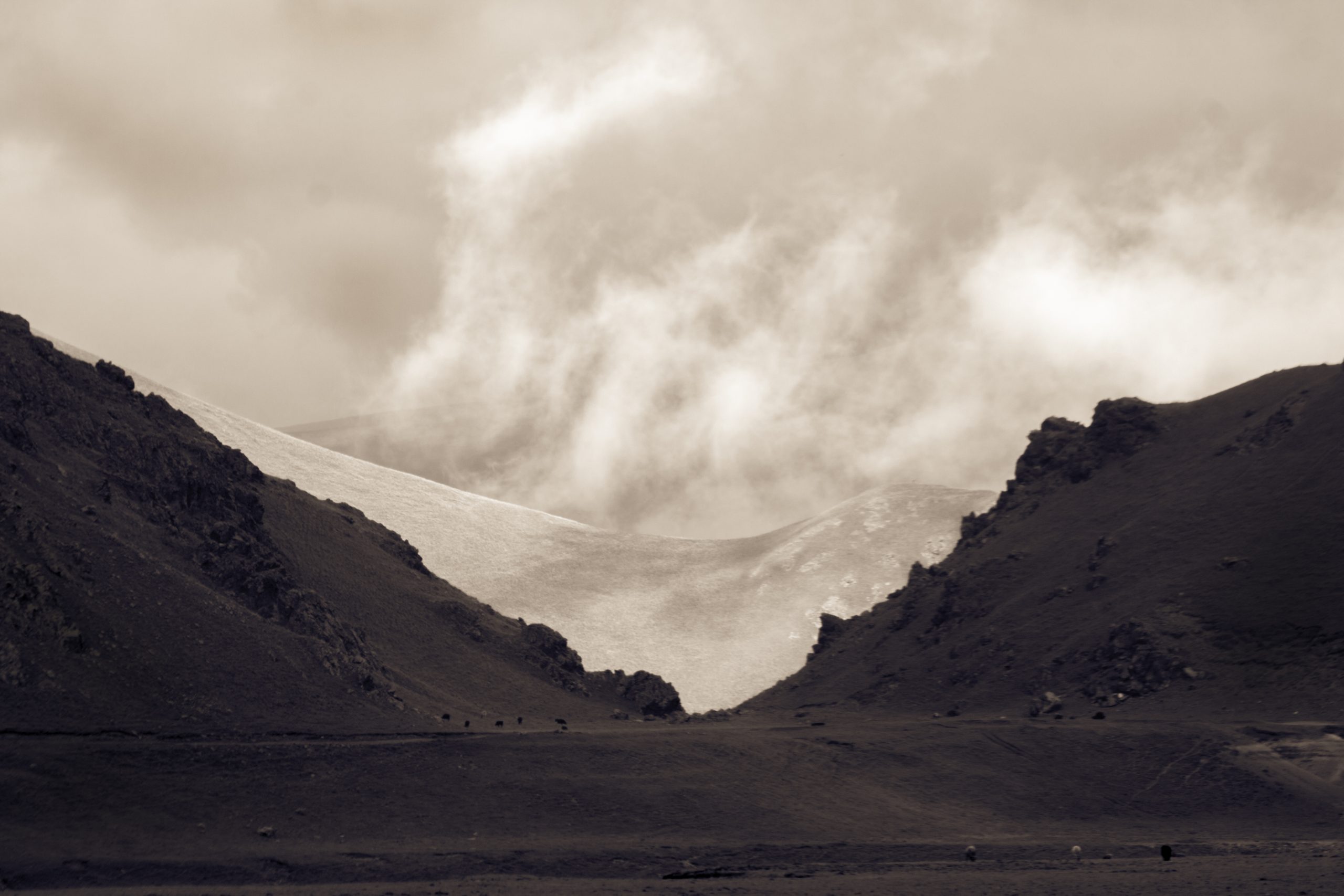
Weather and climate in base-camp. During the summer season on the glade of the base camp the weather is very comfortable, even at temperatures above 30 degrees in the sun it does not feel as “heat” because of dry air. At day time – it’s hot, at night – not cold. It is worth noting that the climate of these places is formed not only by the global atmospheric formations such as cyclones, but to a greater extent it is due to local processes, caused by the proximity of ridges, the presence of glaciers, changes in temperature of air, winds, caused by this, and of course the presence of huge volcanic monster nearby, on which we, in fact, going to climb.
In general, the climate even in this northern part of the Elbrus a little “softer” than the climate of the central parts of the Caucasus joined to the Main Caucasian ridge. But along with a few days of acclimatization in the “beach” style, sometimes can be all days raining and the wind blows. But, at this stage, we can assume that there can be any weather in this phase of our adventure. Because all of this can be overcome and not critical, even if the weather drops “very bad”.

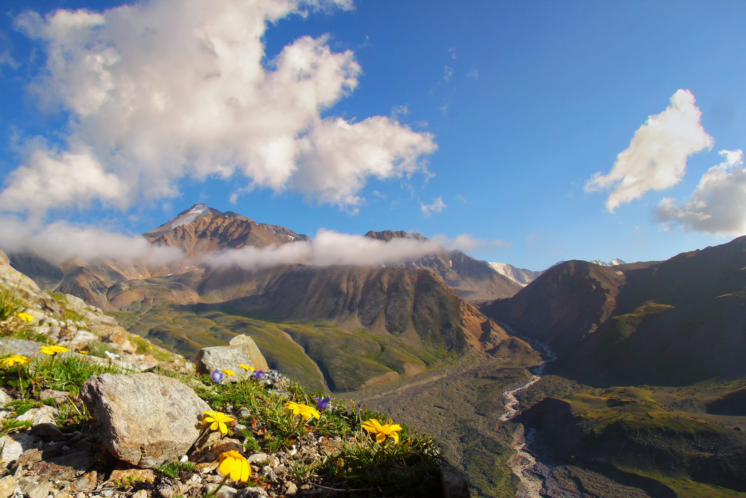
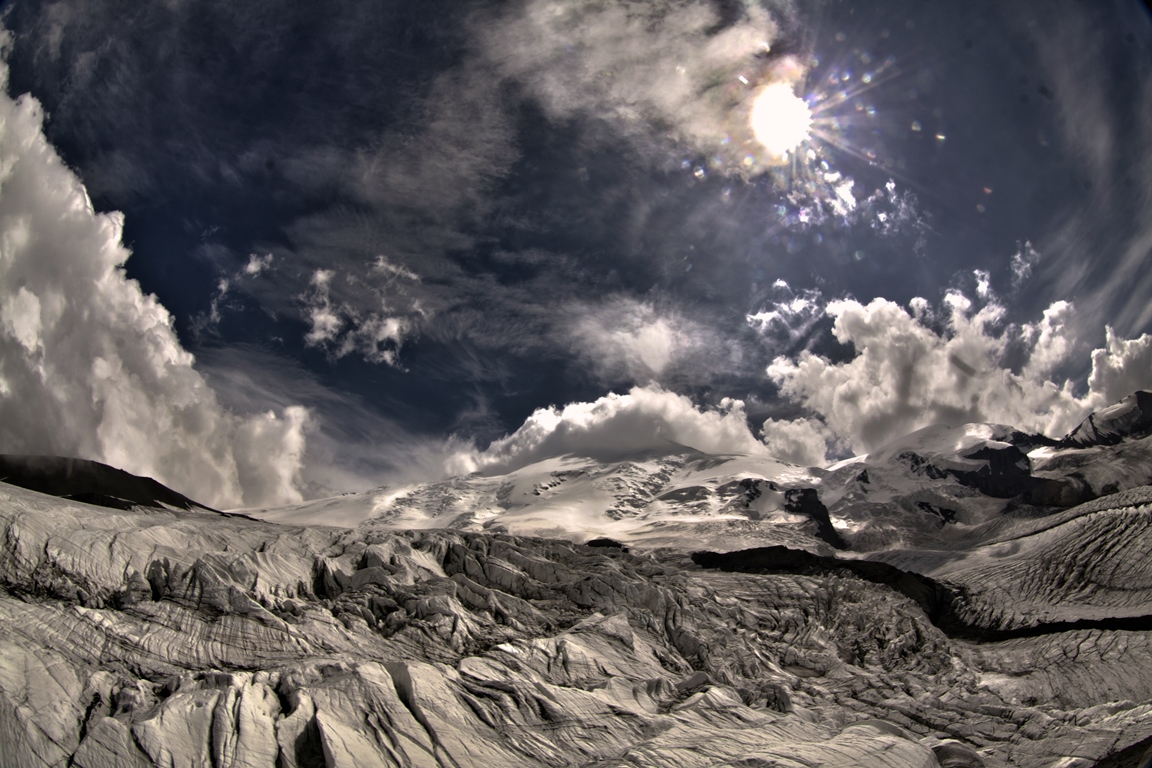
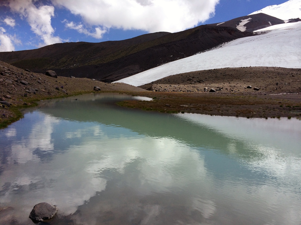
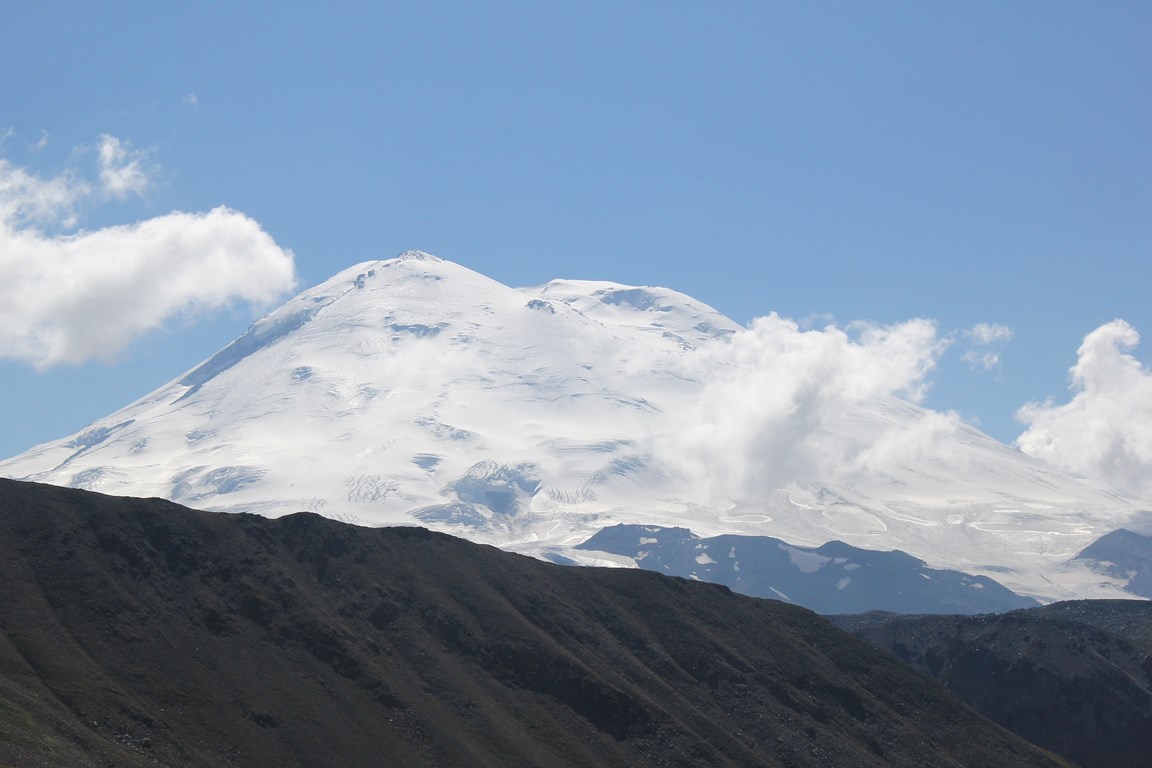
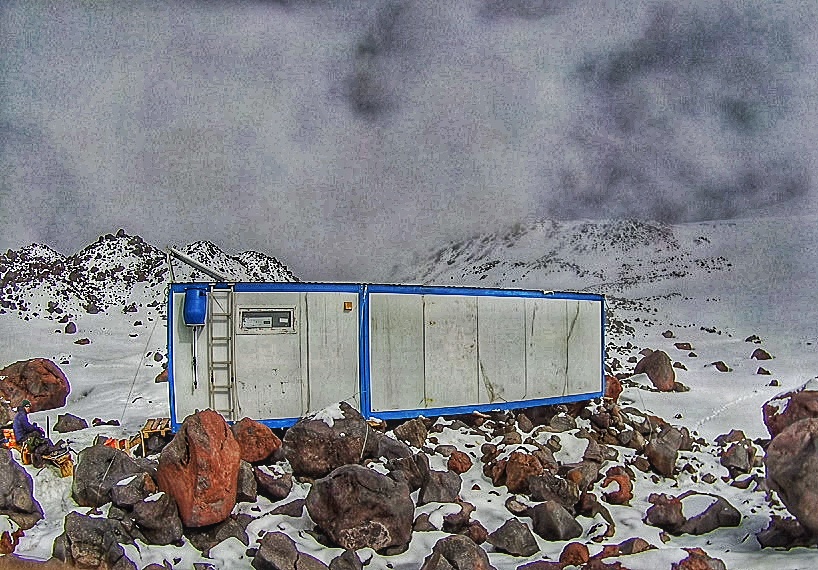
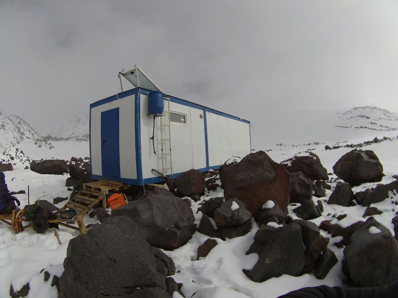
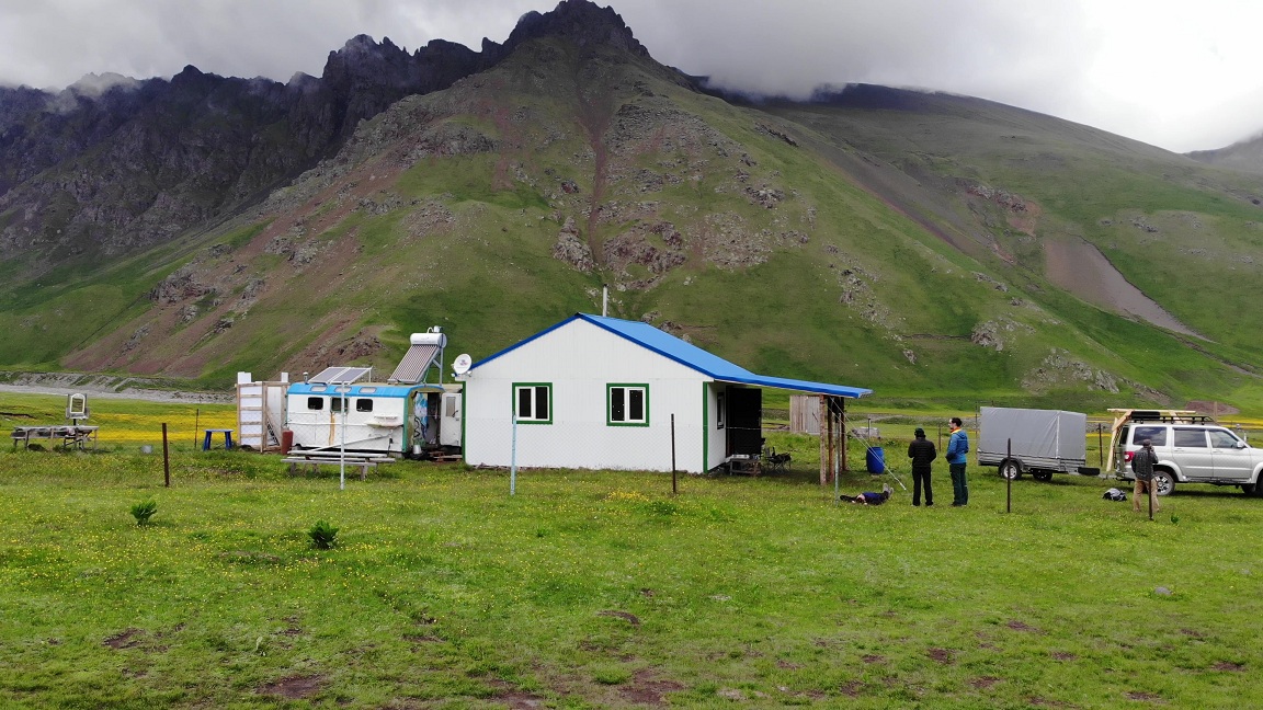
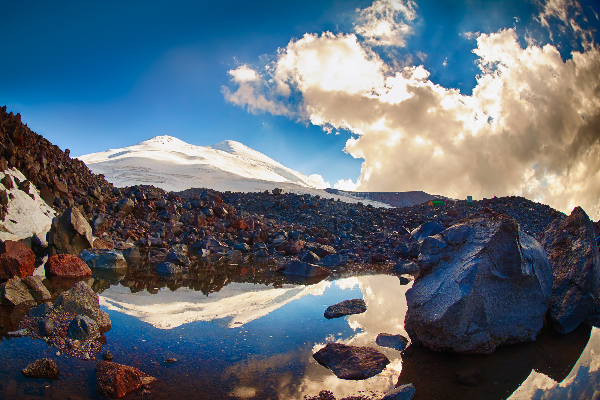
The summit Camp is located on a moraine of glaciers flowing down the northern slopes of Elbrus, at an altitude of 3800 m. If the Base Camp is located in the zone of alpine meadows, then summit camp — in the zone of eternal ice. And that changes everything, except that you still have a house. It happens that even in summer here the wind is fierce in earnest, blows tents and destroys poorly fixed buildings. But you will always have a roof over your head and walls that will protect you from the storms during the period of rest from hard training.
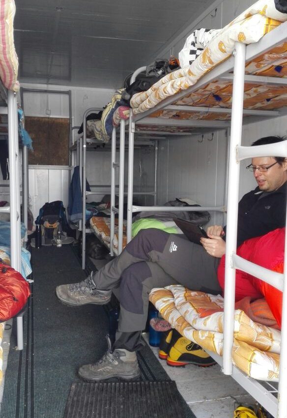
There are several stationary camps on the moraine, with sleeping places, a kitchen, and cooks. The dining areas here are a little smaller than downstairs, but there is plenty of room for everyone. There is no shower, you can take an invigorating bath in small lakes of moraine, in which the water has time to warm up a little by the sun, or wash yourself in a stream of melt water.
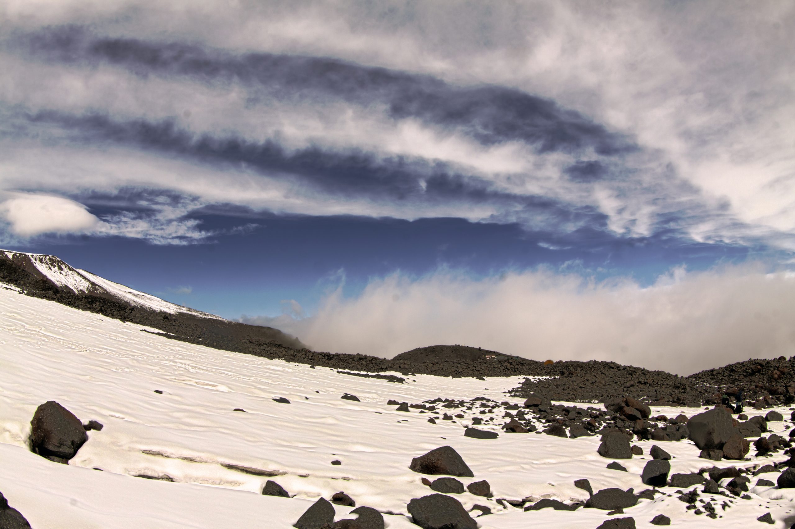
Weather (local climate) in summit camp. In sunny day here also can be very hot, so that you can walk in shorts and this despite the presence of huge masses of ice nearby. The cloudy weather can be cold and freezing. All this can also vary throughout the day. Evening (or night) frost is not felt sharply here and often does not feel as cold, although in the night the lakes that are on the moraine are covered with a centimeter layer of ice. The air is dry, so because of that the evening, too, can be quite comfortable even outside the walls of houses.
In the moments when in the lower camp its rain here its snow or hail. It happens that even in the summer time may fall snow almost to the knees in a single session.
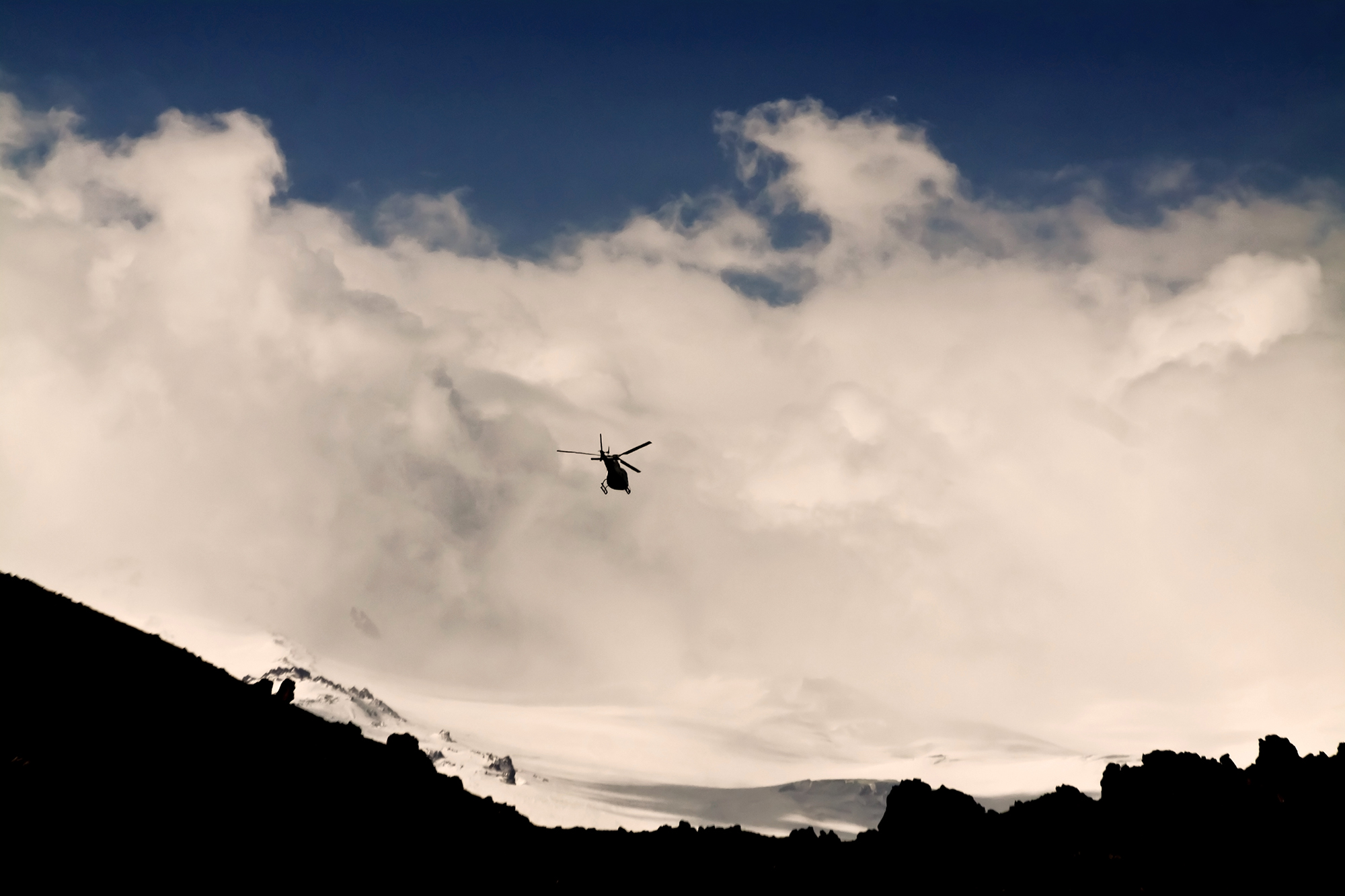
At night, the temperature drops below zero, however, due to the dryness of the mountain air, it feels mild. During the day, streams of melt water flow here, the sun shines brightly, clouds form in the evening, but on bad weather days it is quite harsh here: the wind can reach 60-70 kilometers per hour in gusts, it even happened that it carried away the houses fixed with cables; a lot of fresh snow may fall, and revenge for a couple of days, a thunderstorm with hail may come, and then the camp is located right in its epicenter. After sunset, the clouds descend below the level of the camp, and the lights of towns and cities are visible across the horizon, scattered across the vast expanses of this region. Close stars, the Milky Way, are lit in the sky, closer to the middle of the night, chains of climbers’ lanterns begin to appear on the slope.
Join our groups. We have :
- Guaranteed meetings and transfers from Mineralnye Vody or Nalchik any day and time.
- No additional fees for transfers.
- The most experienced and professional guides on Elbrus english speaking.
- We have been in the service since 2003 and therefore have a great experience of successful climbing trips and satisfied tourists.
- You can join the group later or leave early with the return of unused nights from the hotel.
- Convenient number of tourists in groups from 4 pax to 10 pax (not more).
- Support from our KavkazSkiTour office around the clock in the city of Nalchik, with a close location to Elbrus, which allows us quickly resolve any issues that arise during the trip.
- Safety support and quick contact with medical, emergency and insurance agencies.
Preliminary application
TOUR DESCRIPTION
Day 1: Arrival to Nalchik.
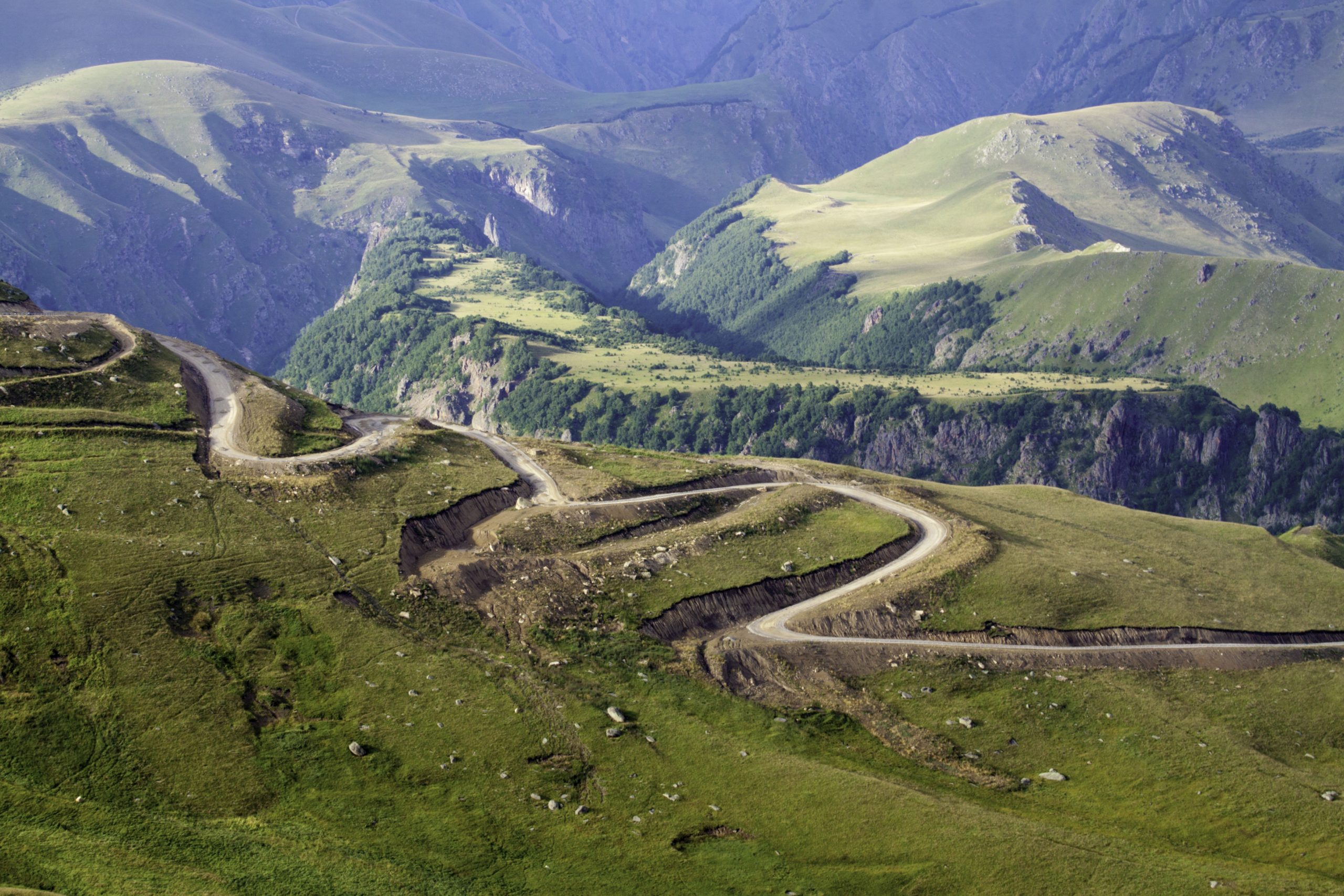
Meeting at the airport or railway station of Mineralnye Vody and/or Nalchik. Transfer to a hotel in the city of Nalchik. The road from Min Vody to Nalchik takes about two hours. Accommodation in a 2-3* hotel in Nalchik in the center and park area. Preparation of equipment, you can leave extra things that will not be needed on Elbrus in storage room of hotel or in our office. Evening city tour. You can have dinner in the park in one of the various cafes with national cuisine (for an additional price).
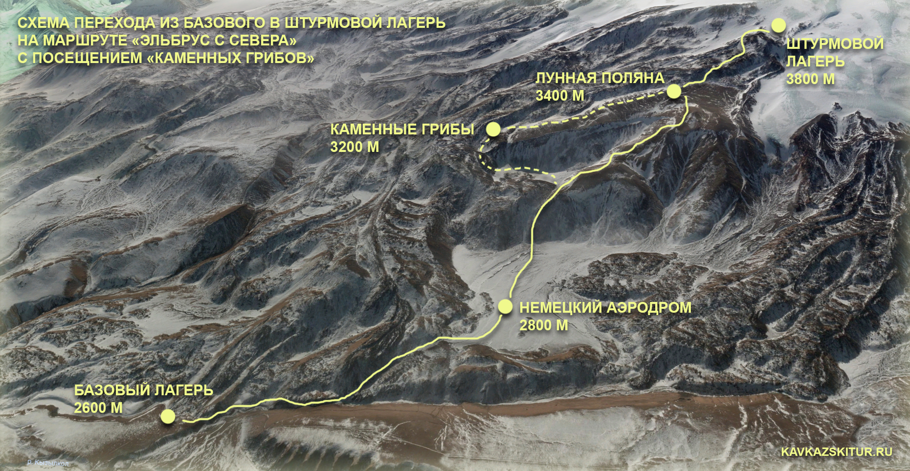
Day 2: Transfer from Nalchik to Northern Elbrus.
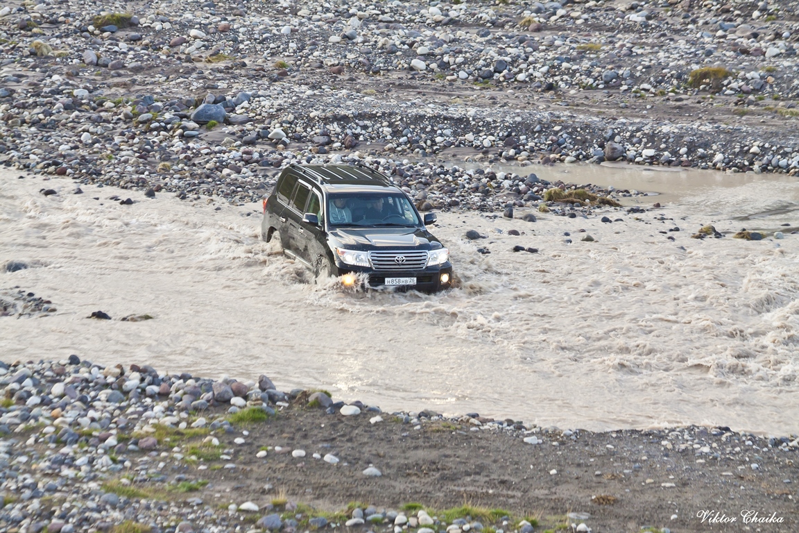
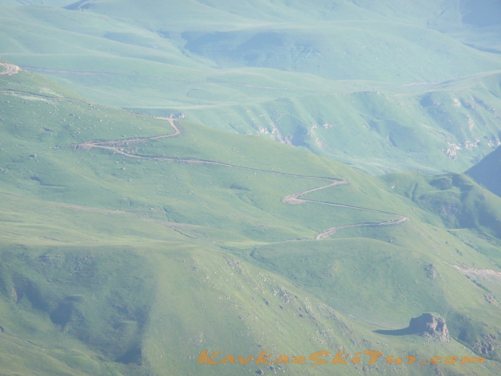
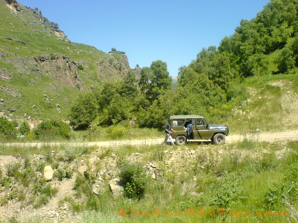
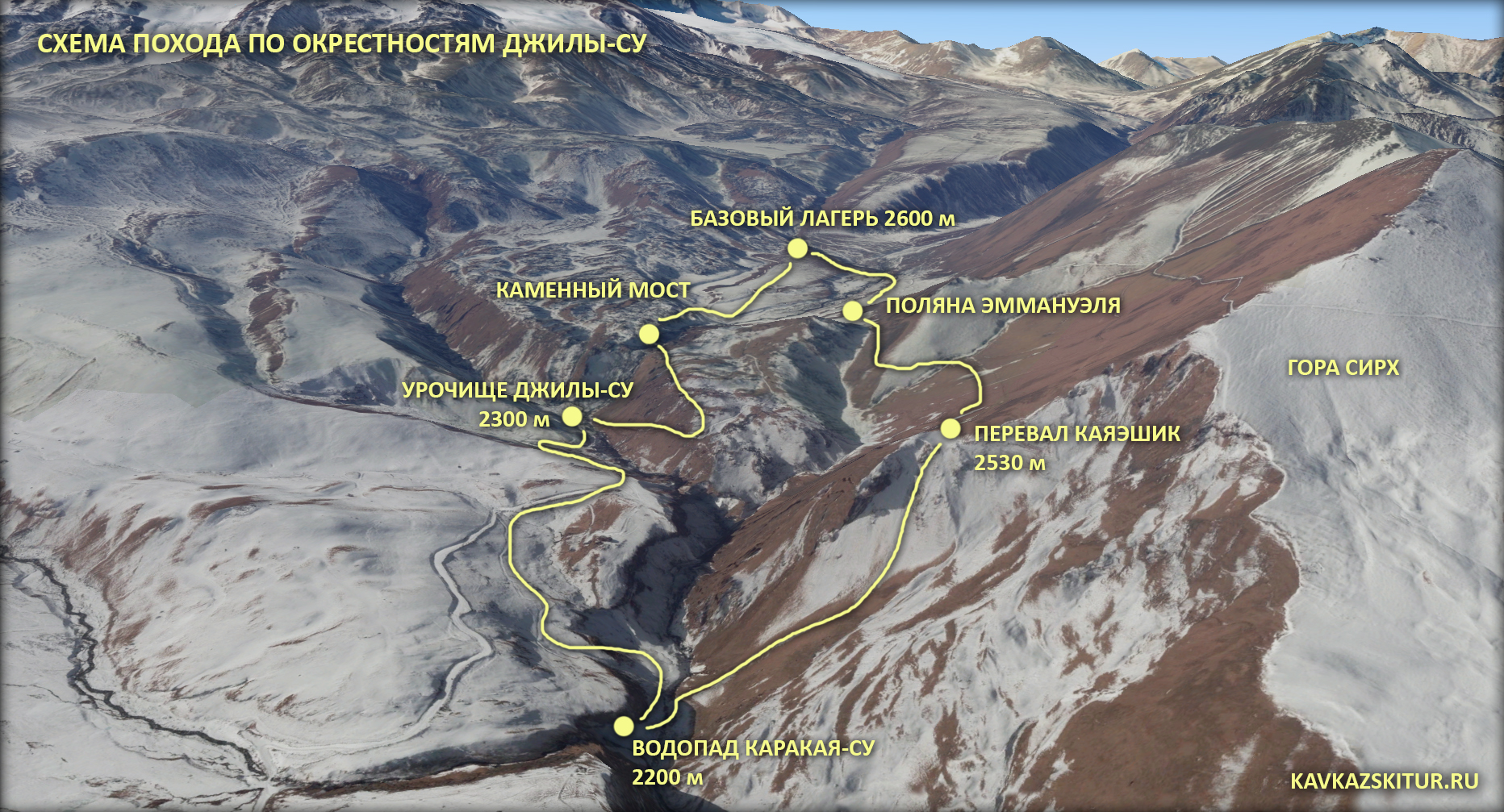
Early breakfast. At 7 a.m. transfer to North side of mount Elbrus through village Malka. Time of transfer by 4 wheel cars from Nalchik till Elbrus north takes about 4-5 hours depending from road condition and weather. Early arrival to the Base Camp at 2600 m on the Irahik-Tuz plateau (100 km from Nalchik) to the foot of Elbrus from the North side. Accommodation in houses.

After dinner hiking with small gain of altitude in the surrounding area.
The route of this day:
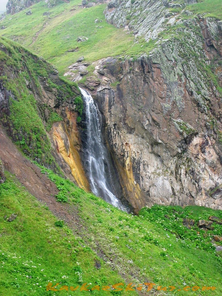
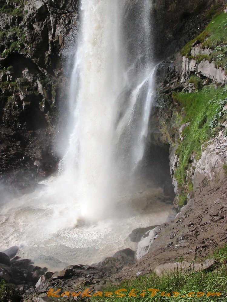
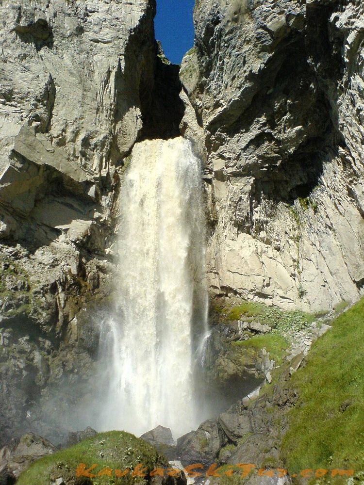
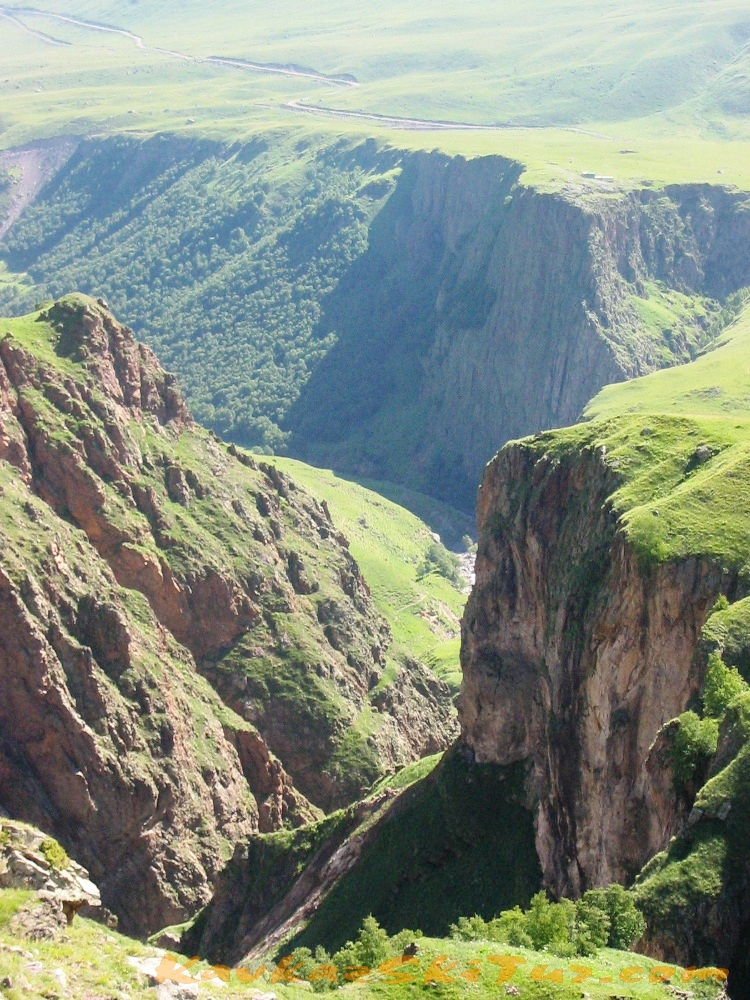
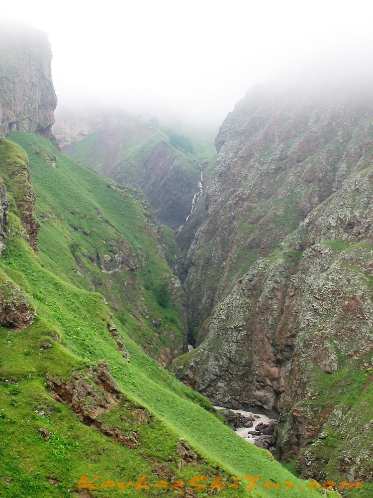
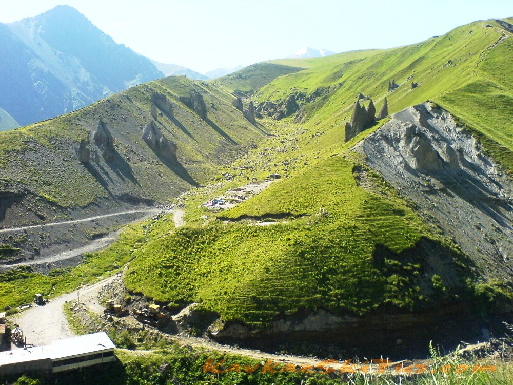
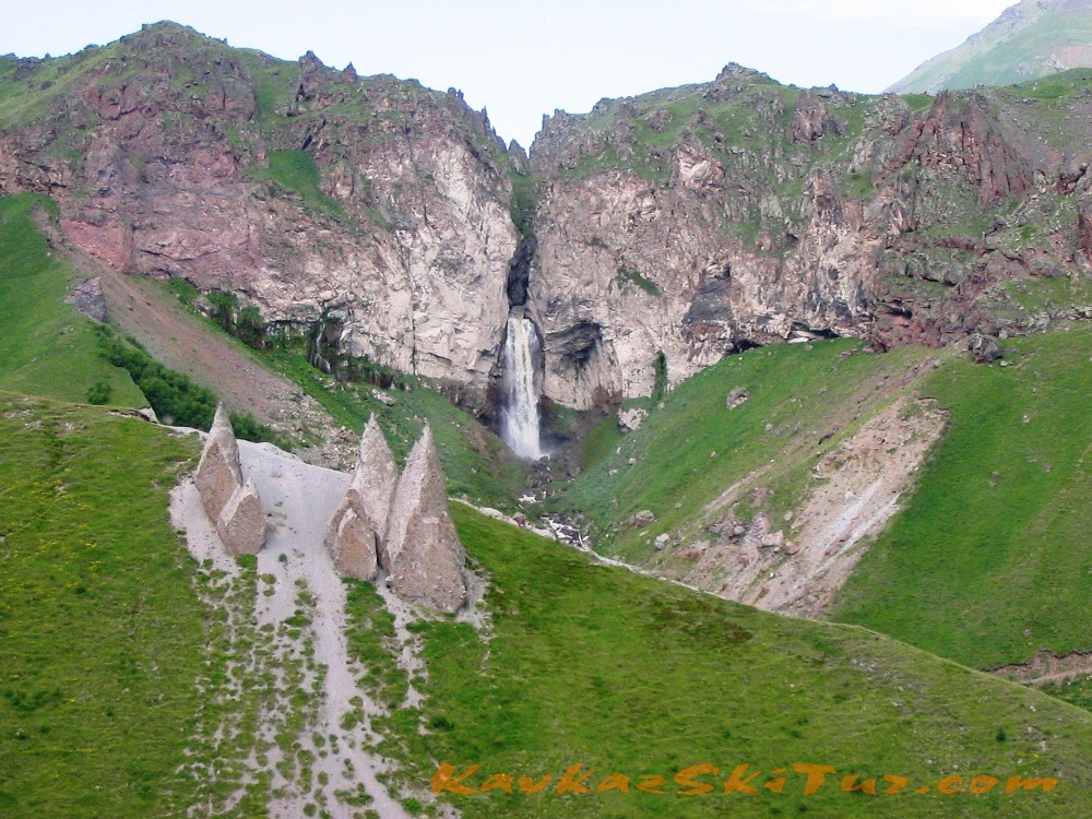
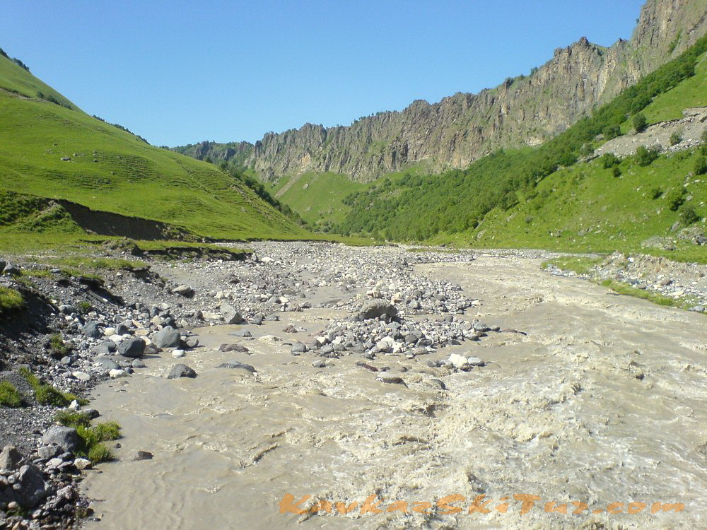
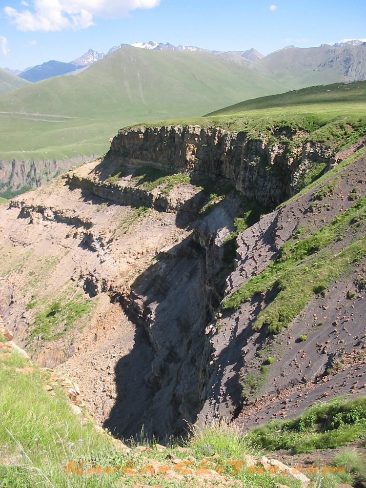
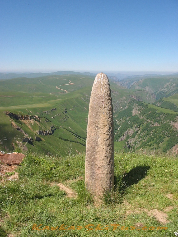
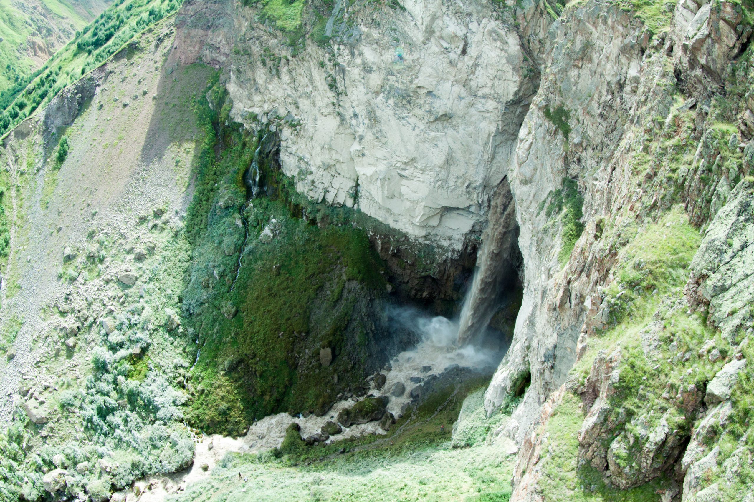
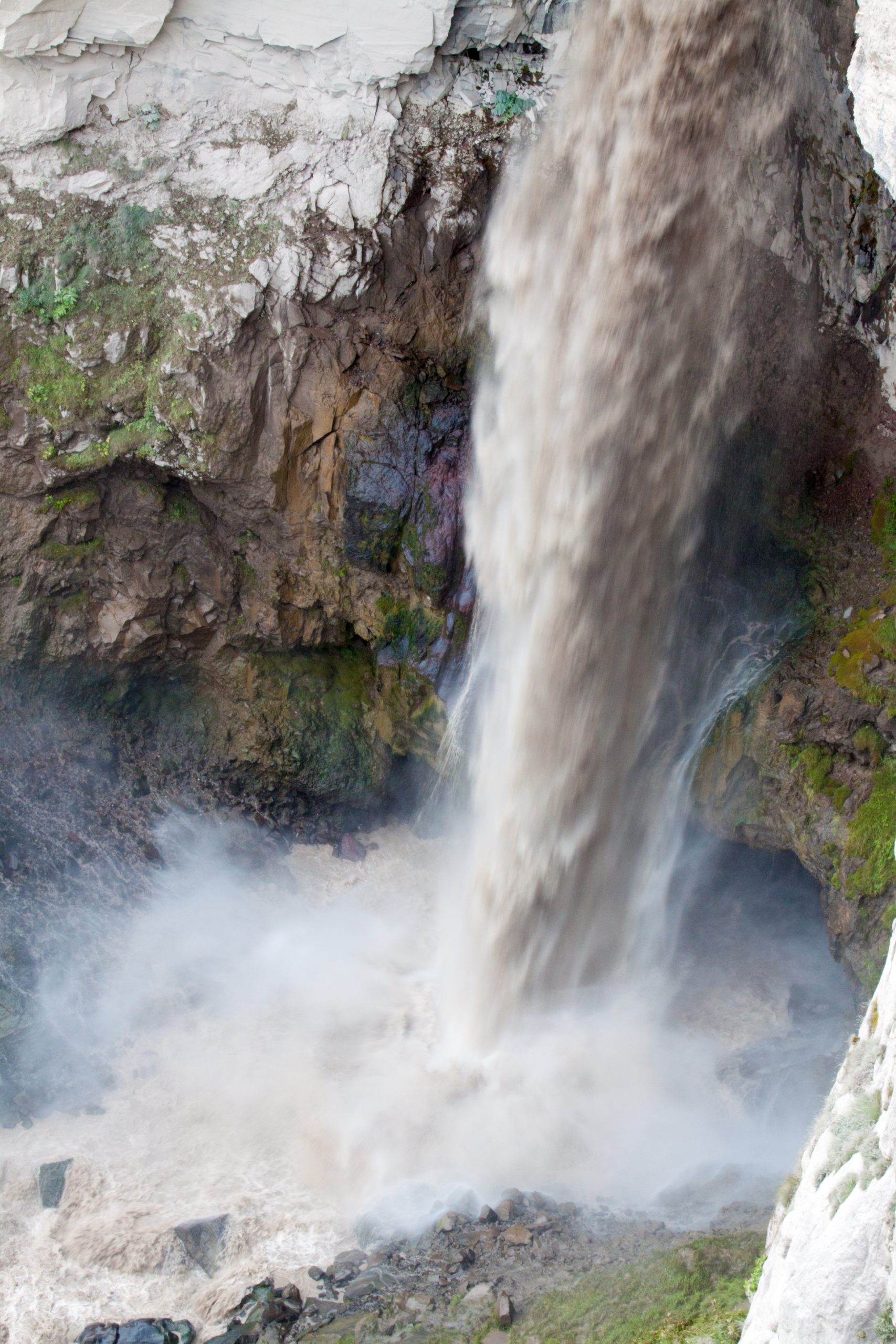
Glade Emanuel, a place where was the base camp of the first expedition to Mount Elbrus, stone Emanuel, Pass Kayaeshik, with views of the Malka canyon and waterfalls (the biggest in Kabardino-Balkaria) on the river Karakaya-su.
Two waterfalls on the river Kyzylkol.
Mineral springs Gil-Su.
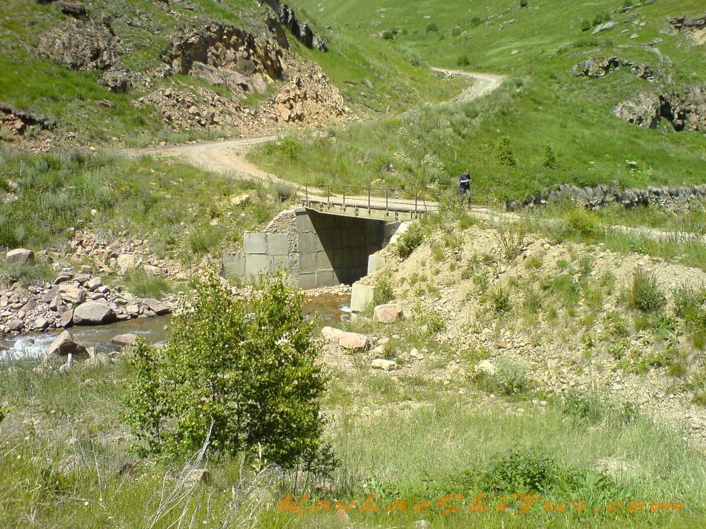
Stone Bridge (Kalinov Most) by the river Kyzylkol.
Return to Base Camp.
Time 3-4 hours.
Elevation: +-400m
Length – 12 km.
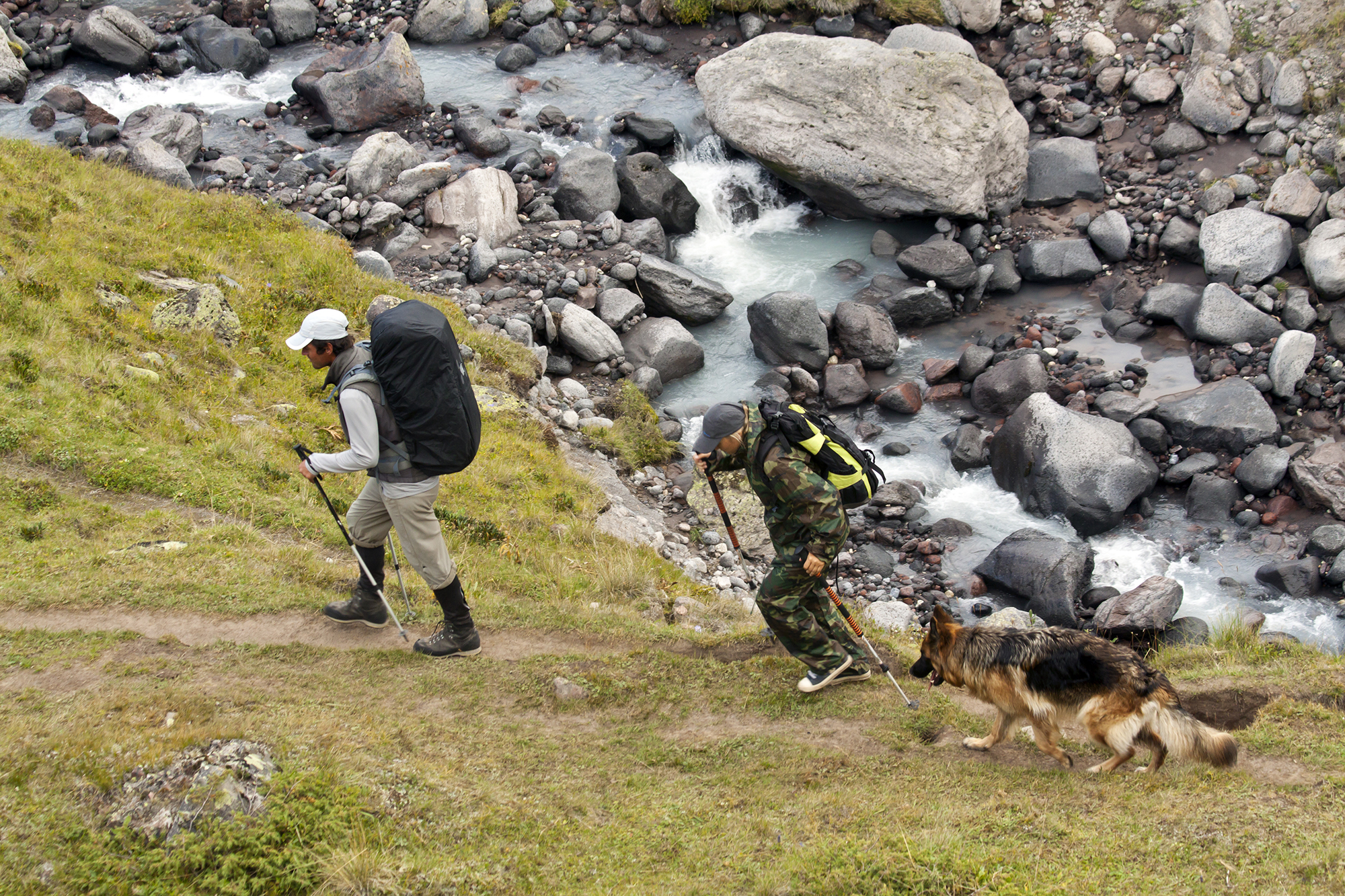
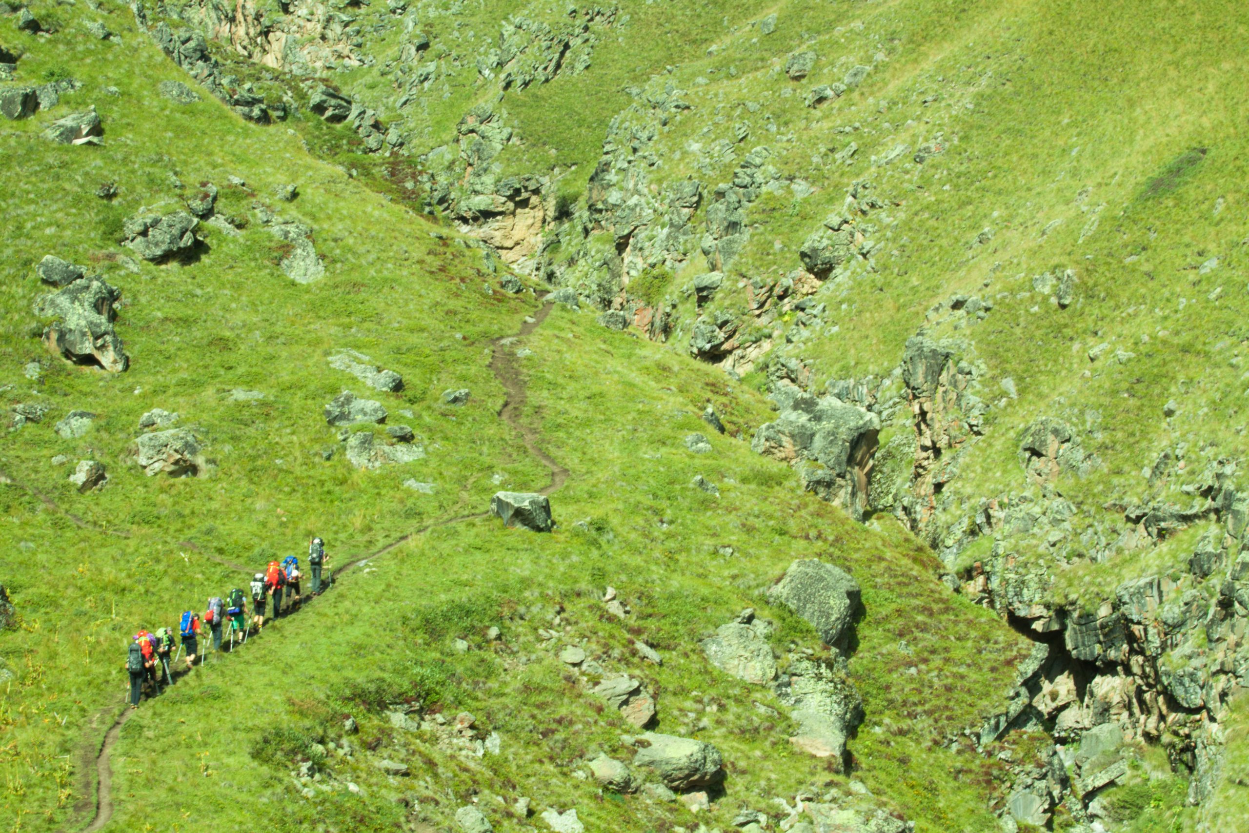
The hike begins with a walk to the Kayaeshik pass, from here a worthy view of the Malka canyon opens. On the way we pass through the Emmanuel glade, where in 1829 the camp of the first climbers to Elbrus stood. From the pass we descend to the waterfall on the Karakaya-Su River, this is the highest waterfall in Kabardino-Balkaria. Then we climb Djily-Su, passing marvelous sand castles guarding the entrance to numerous Narzan springs, which are everywhere here; listening to the music of another forty-meter waterfall. Then along the hills we get to the Stone Bridge on the Kyzylkol River. This is a natural bridge formed by a collapsed rock, a monumental place. We cross the bridge to the other side and return to the base camp along the hills, admiring the Kyzylkola canyon along the way. All the way passes along the paths of grassy slopes. The length of the route is about 6 kilometers, the drop and climb is 400 m. The approximate time for the route is 3-4 hours.

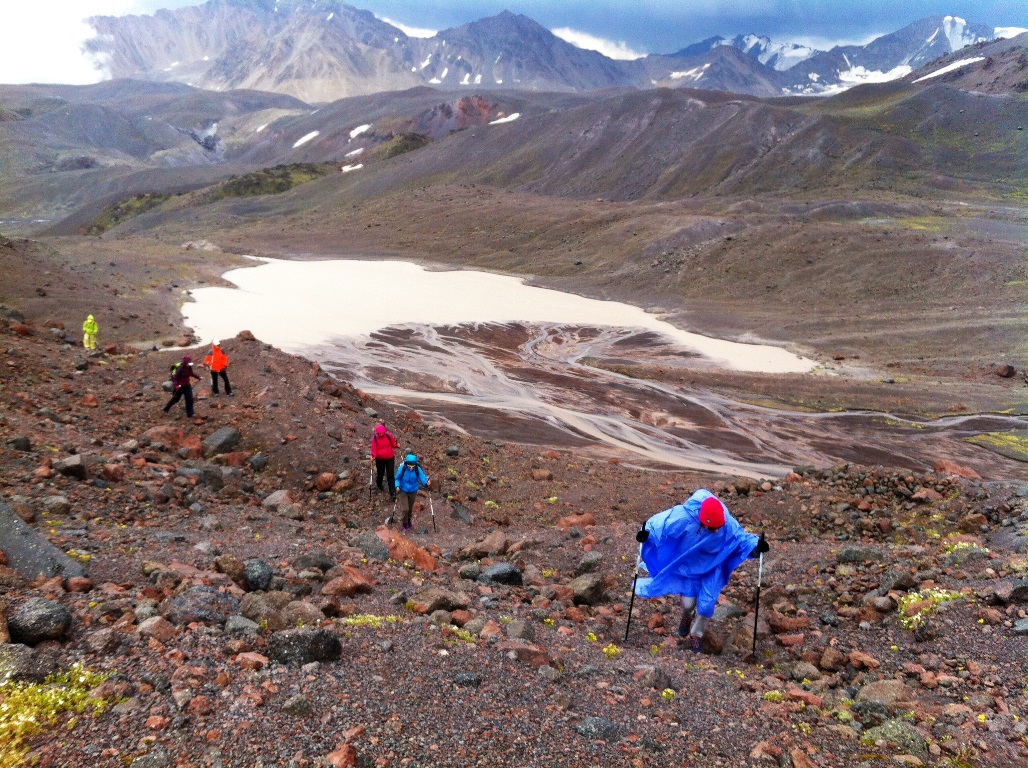
Day 3: Trek to the glacier.
Acclimatization hike on the plateau Irahiksyrt – till the moraine of Ulluchiran glacier 3650 m.
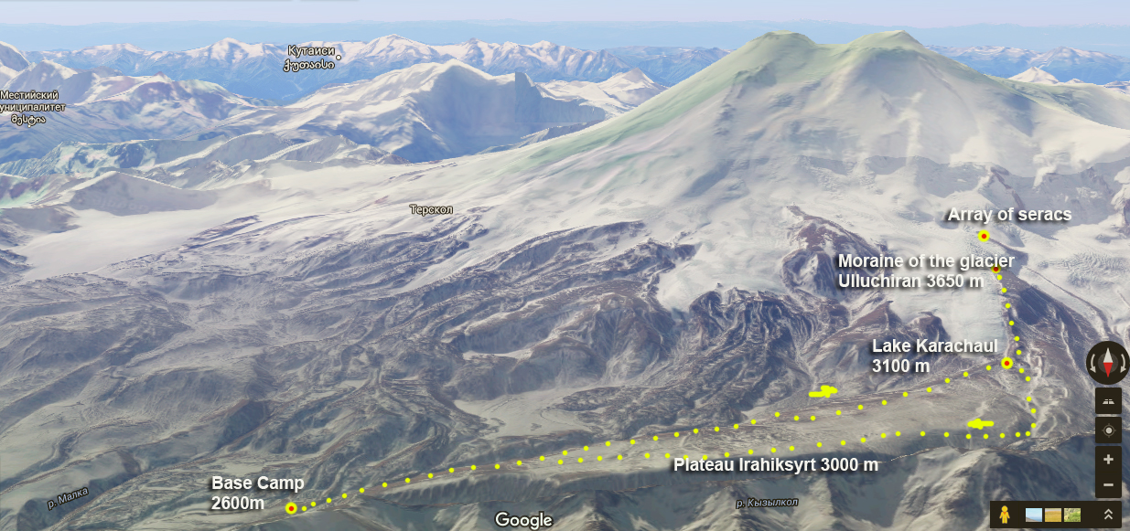
The route of this day:
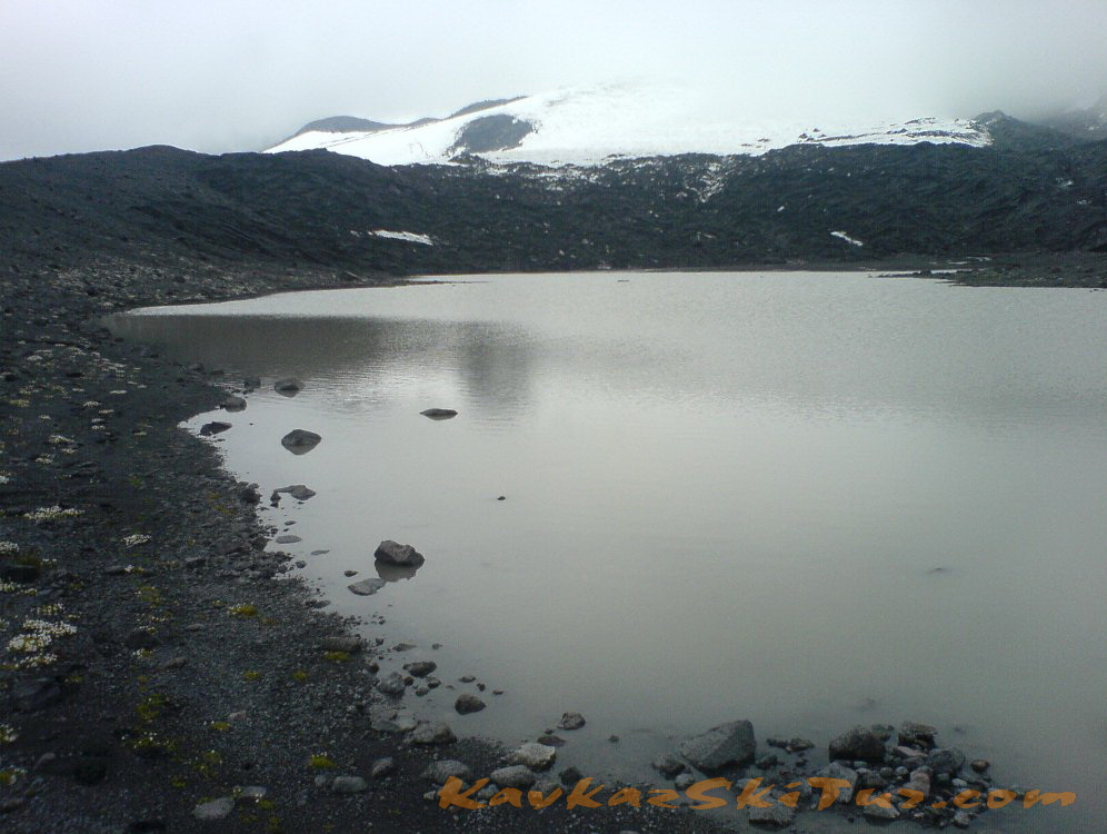
Trekking along the southern edge of the plateau to the lake Karachaul (2 hours, 3,000 m) at the foot of the glacier of the same name. The lake water temperature is higher than the glacial rivers and it can be swim.
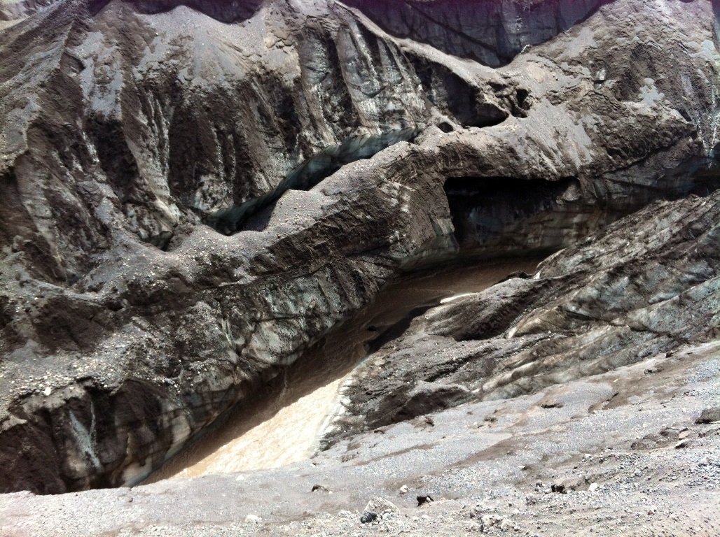
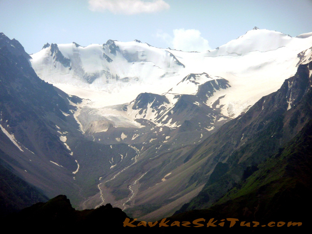
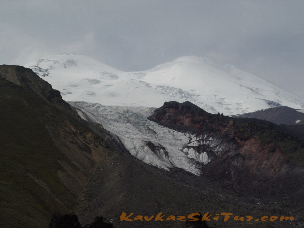
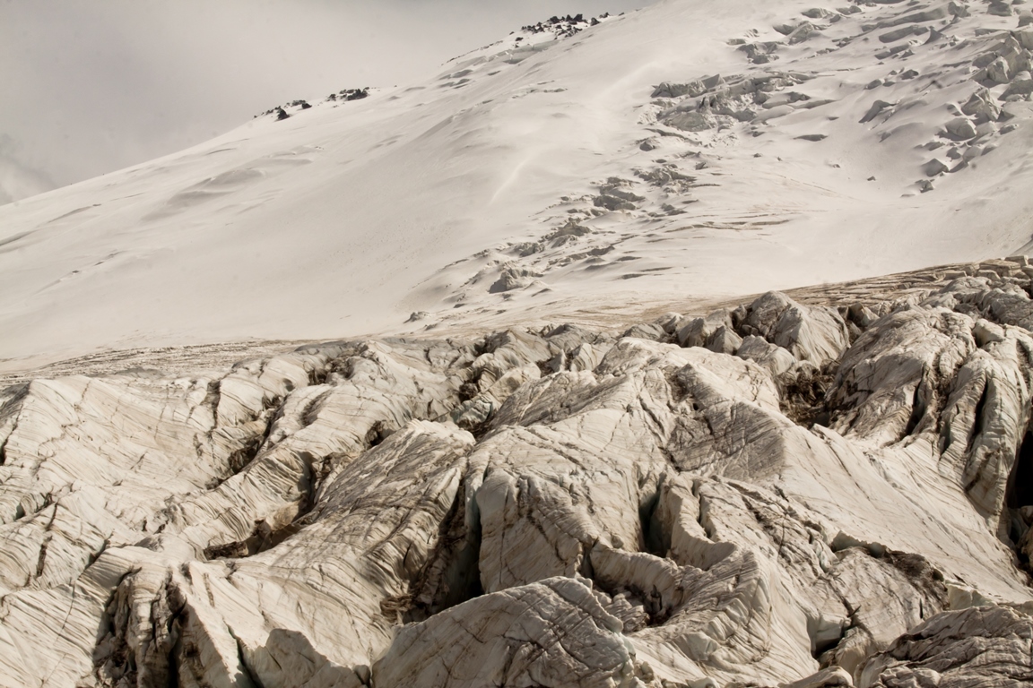
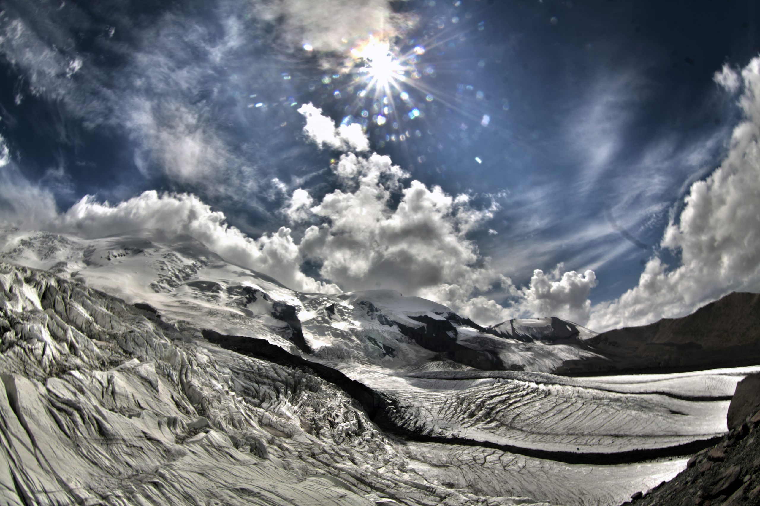
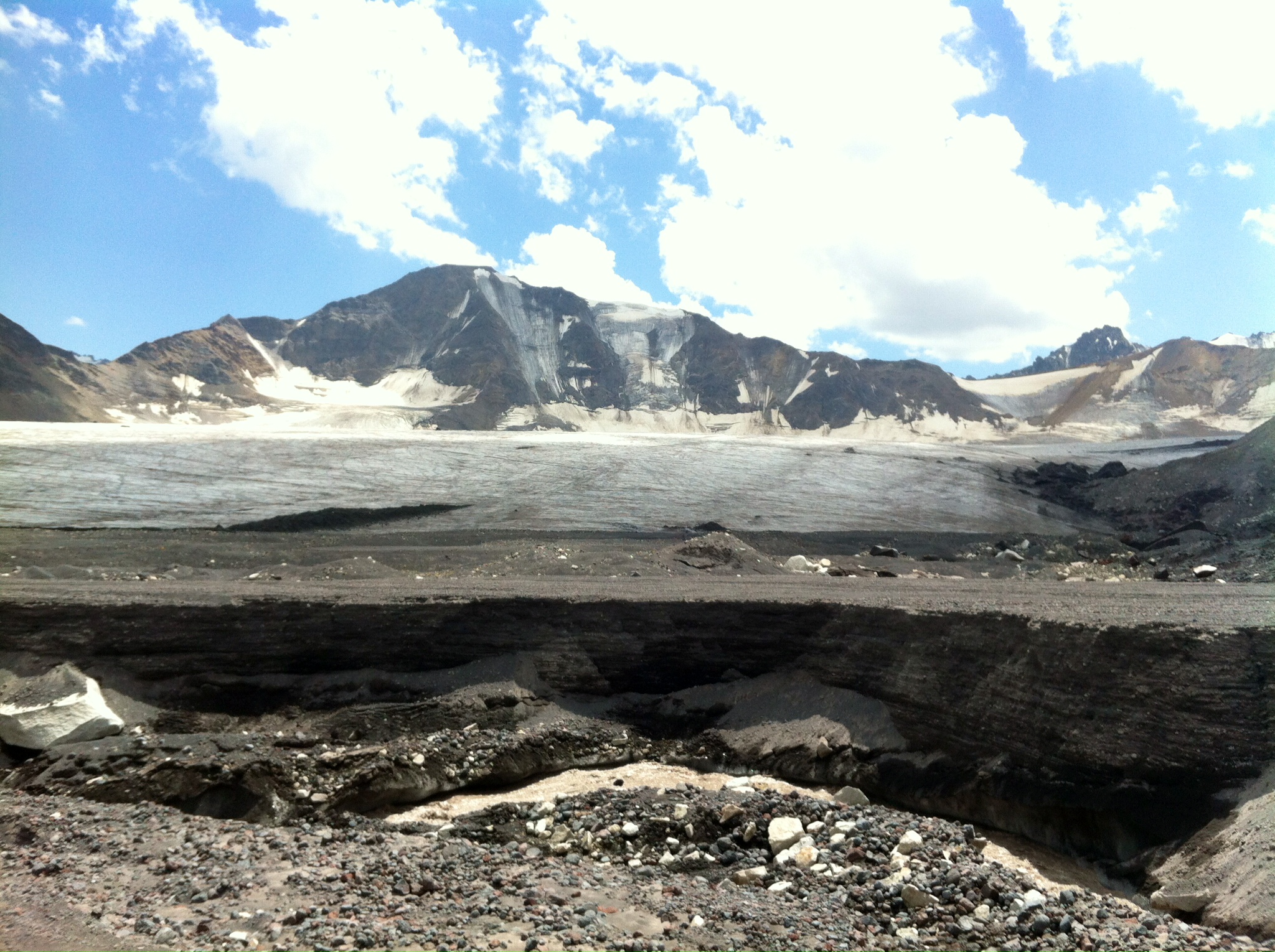
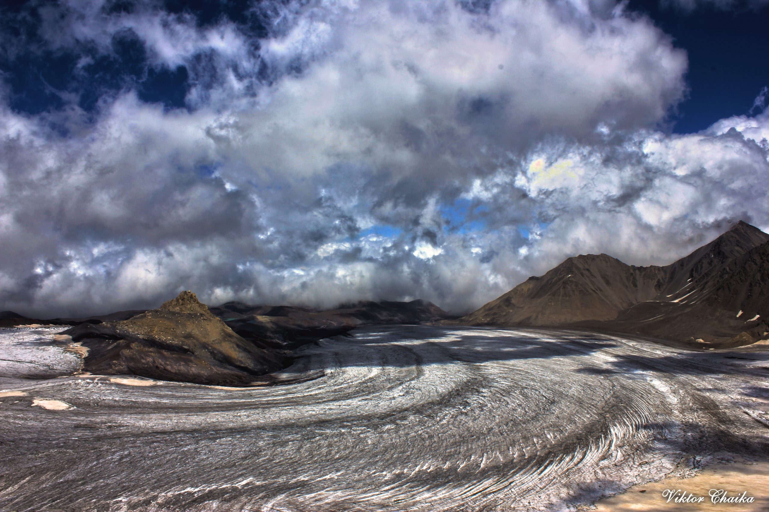
Climbing the moraine to the junction of glaciers Karachaul and Ulluchiran, to a height of 3650 m (another 2 hours). Views of glaciers and great faults with seracs.
Return along the northern edge of the plateau Irahiksyrt to Base Camp.
Time – 8-9 hours.
Elevation: +-1050 m.
The length – 17 km.
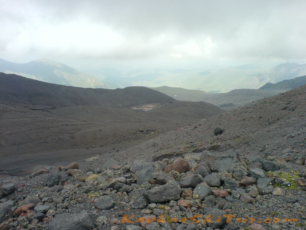
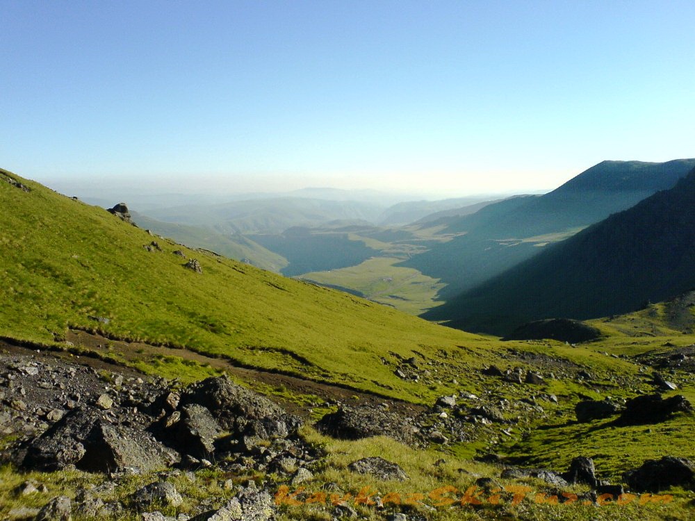
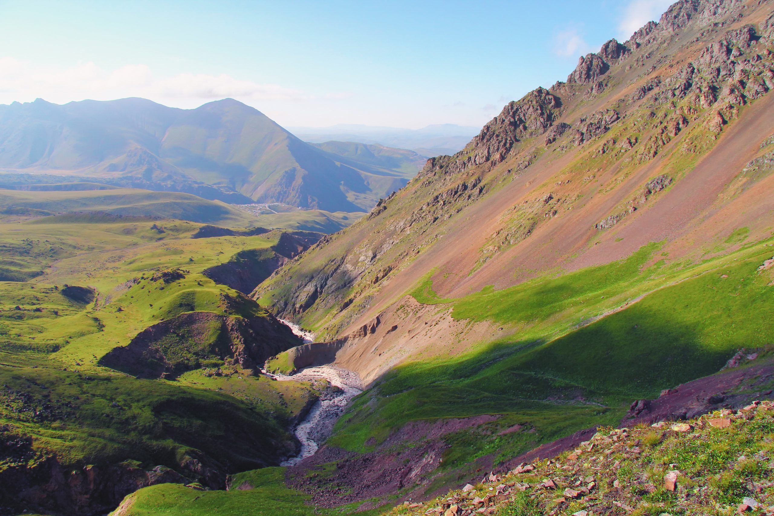
We take tea, lunch bags and the necessary minimum for an easy hike, we hit the road. The length of the route is about 17 kilometers, the drop and climb is 1050 m. The approximate time for the route is 8 hours. The first part of the route passes through the meadows of the Irahiksyrt high-mountain plateau, moving along it, we sort of bypass Elbrus, which is very close by. The view changes all the time: after the grassy hills, open up glaciers, moraines and streams, while the Mountain itself slowly unfolds its Northern slope, showing us the Western features. This part of the walk is quite easy, because the surface of the plateau has a very slight slope, and looks horizontal.
At the far edge of the plateau leads us to the Karachaul glacier, under which there is a small picturesque lake, if you wish, you can even swim in it.
A small halt, and after it a more severe part of the route — we will climb the moraine that separates the Karachaul and Ulluchiran glaciers, and go to its upper edge. There is no path here anymore — no one walks here, but the grandeur of the landscape deserves the presence of a person and his admiring eyes. Nature needs someone who can see and appreciate its beauty.
Altitude here 3650 m. We are standing right above the giant blocks of the icefall. In this place, both glaciers, in their slow downward flow, break, creating architectural works of genius in their chaos. The sun shines through the clouds, filling the picture with the movement of their shadows. A cold wind is blowing from the ice world, and we will not stay here too long, we will have a snack, drink tea and go down.
Day 4: Acclimatization to the summit camp at 3800 with some of equipment. Return to BC.
Ascent to the summit camp at 3800 with some of clothes to leave in huts. After lunch and rest we go back to the lower camp.
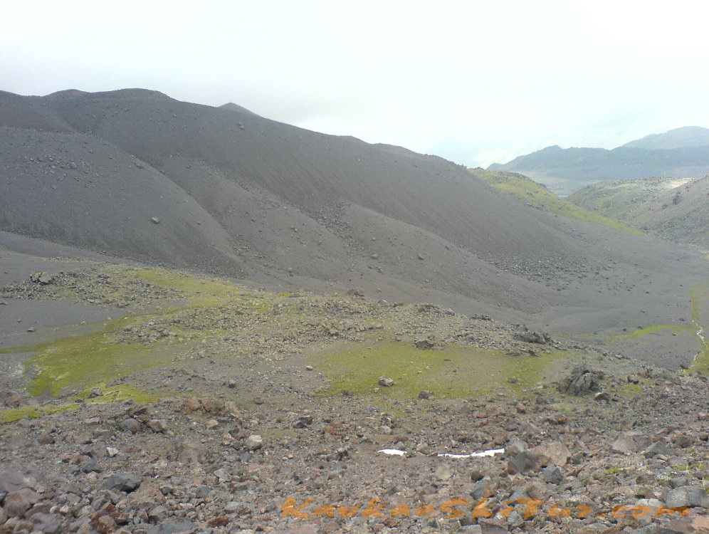
On the way we pass through a few notable places as “German airfield” (according to legend, Hitler sent here Tibetan lamas seeking exceptional opportunities of forces and allegedly landed the planes). Moon glade – a large field covered with volcanic rock obsidian. And in the end we remain in the zone of eternal ice on the moraine of 3800 in the upper camp.
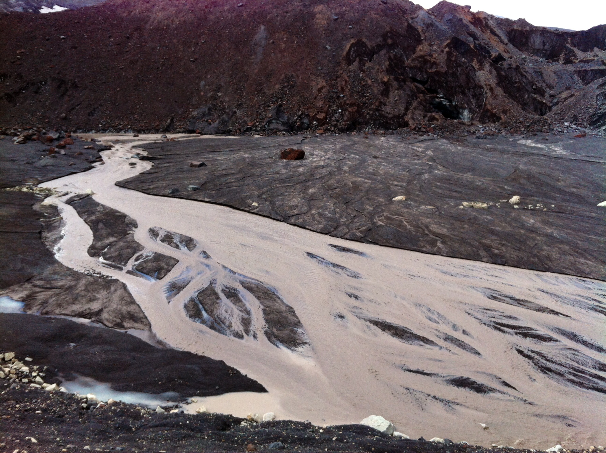
Breakfast at 7 am. Exit at 8 o’clock. We take lunch bags with us for lunch on the route and thermoses with tea. Almost the entire route is on the trail. Our path begins along the grassy slopes of a mountain river with a beautiful canyon. An hour later we come to a large flat plateau, which is known as the «German Airfield», according to legend, during the Second World War, the Germans landed planes here. Then the trail becomes steeper, the vegetation gradually disappears, because we are approaching the zone of eternal ice. At around 3400 m we cross Lunnaya Polyana (Moon Glade) — a rocky plateau of an alien looking. At this altitude, it happens that we go straight into the cloud. The glaciers are already very close. Here begins the final part of the ascent, the most wild. The trail sometimes disappears, a cold wind or even snow may appear, but the views from here are grandiose: the Kanzhol, Bermamyt plateau, the vast expanses of hills and valleys, the Tyshlysyrt ridge in the foreground. When we find ourselves on the moraine in the summit camp, we approach the glacier. At the height of the day, streams of melt water flow around, which freeze again at night. Here begins the climbing path to Elbrus, houses huddle between huge lava fragments, climbers are preparing for hard summit. Both peaks are visible, it seems that they are very close, but this is a misleading impression, the mountain is huge, everyone who decided to climb it felt it well. Chains of such daredevils, already descending from the mountain at this time, are clearly visible from the camp. We drink tea, have a snack, leave some of the equipment in camp and decent down.
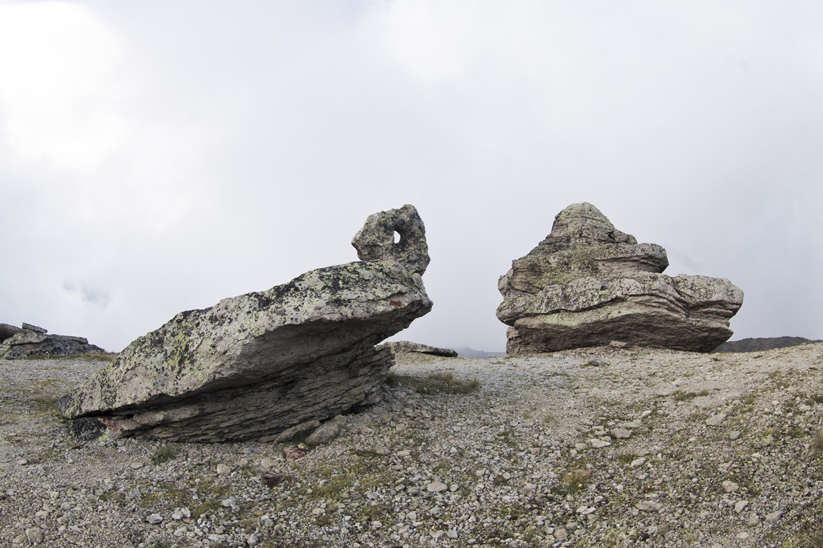
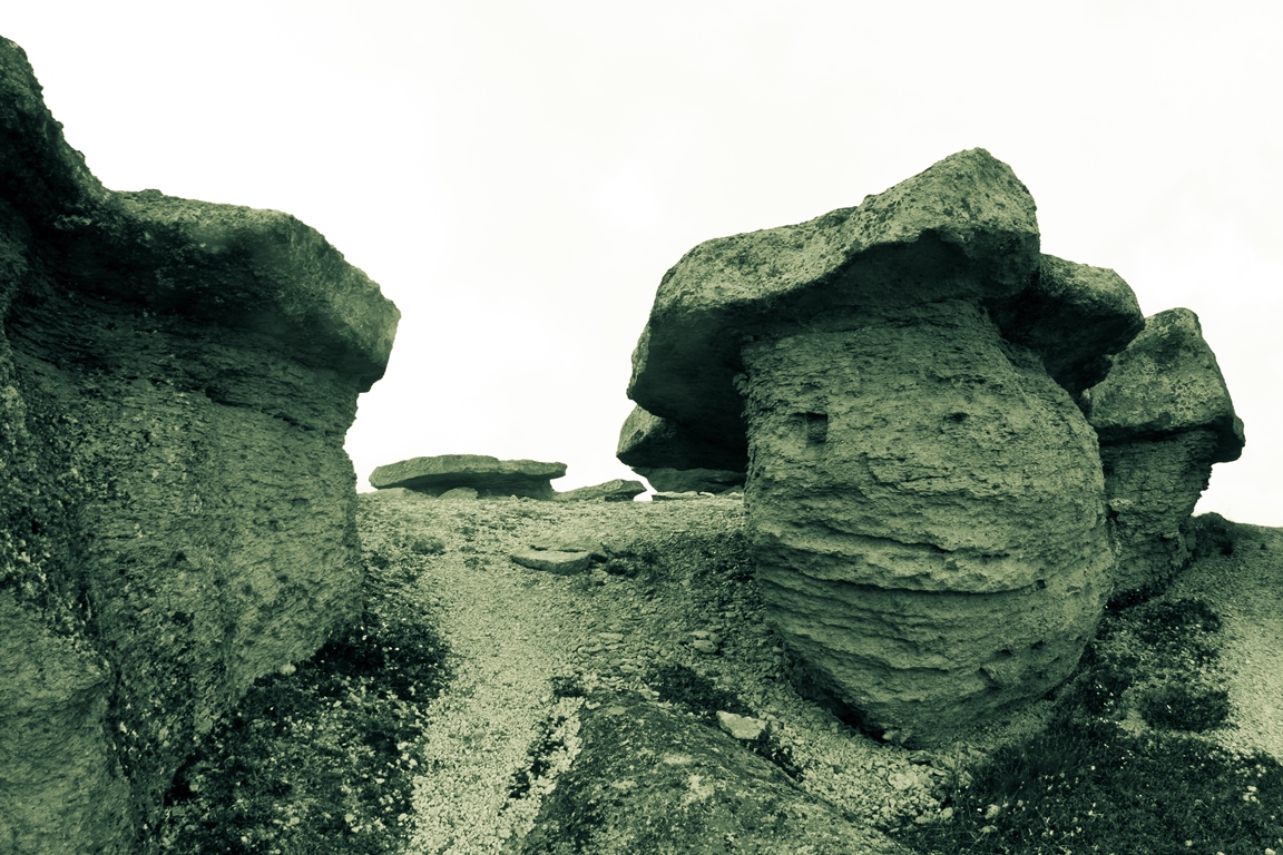
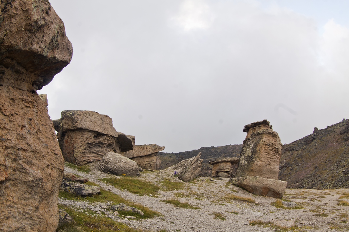
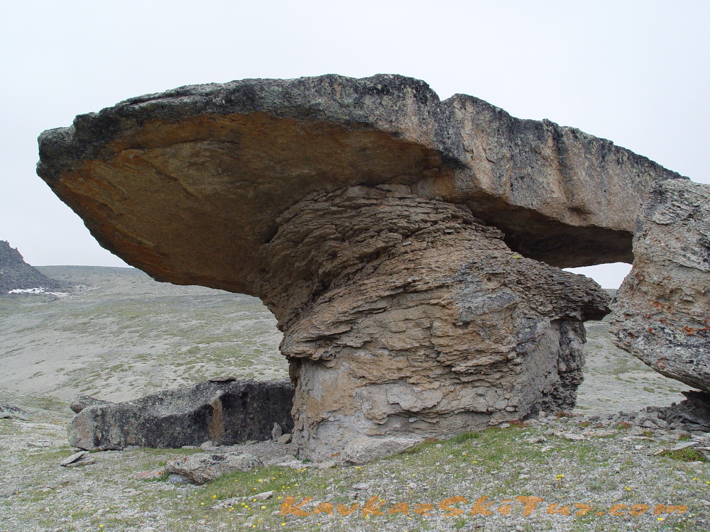
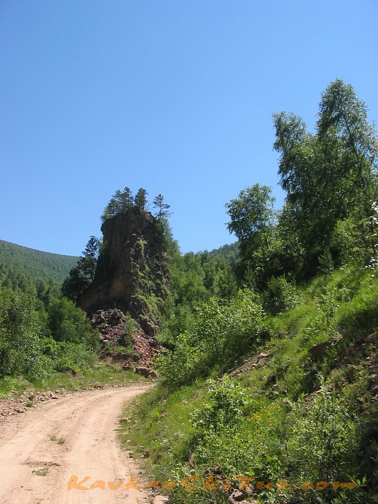
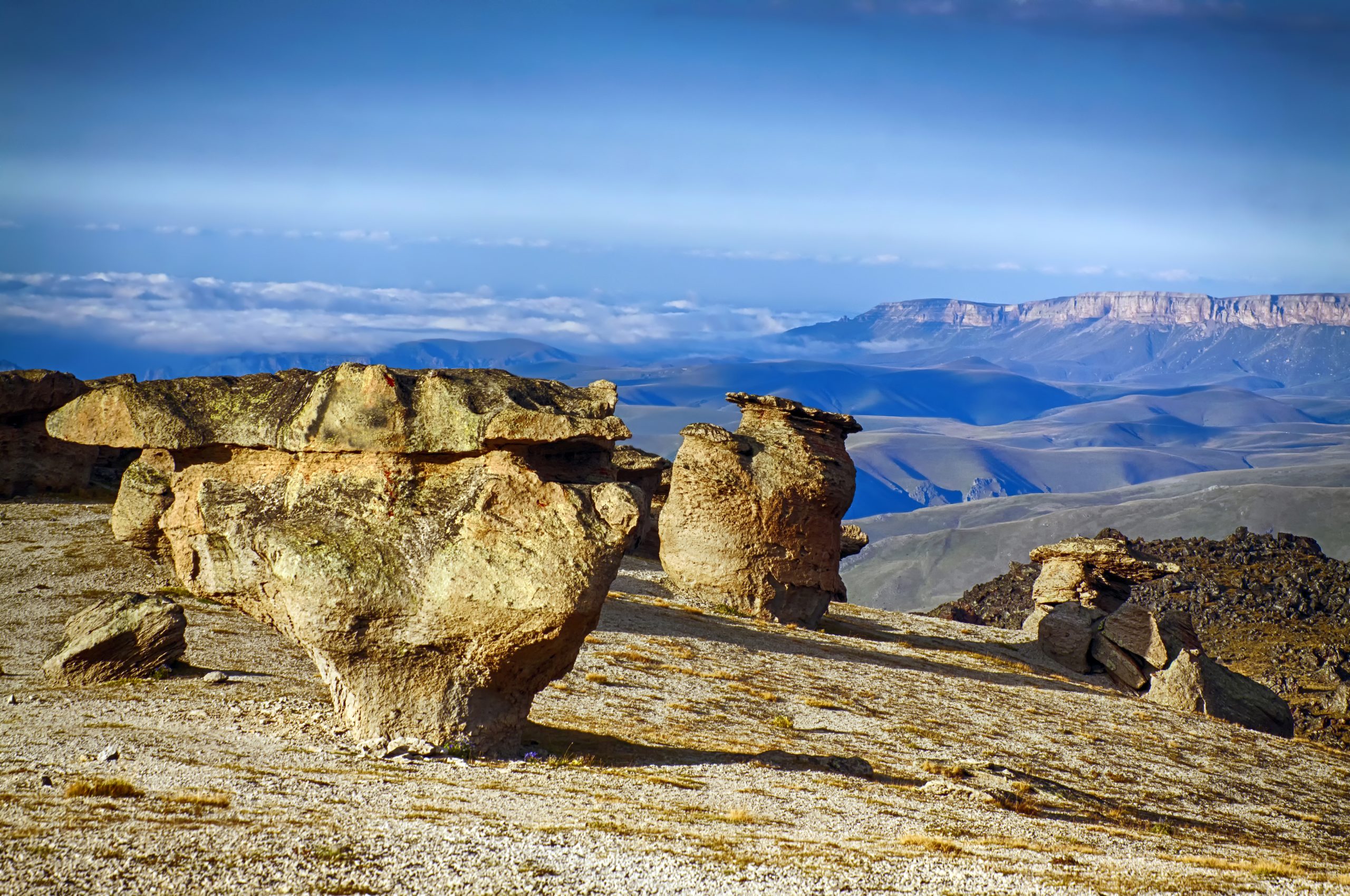
On the way back on Moon glade, we change route, we go through it all and get to Stone Mushrooms, a place known for its uniqueness. These formations are the result of the joint work of geological processes and wind.
From here we descend to another grassy plateau lying at the foot of the Moon glade. Then we return to the base camp through the airfield. Dinner. Overnight stay in huts.
Travel Time 8-9 hours.
Climb and drop : + 1200 m, — 1200 m.
Route Length: 13 km.


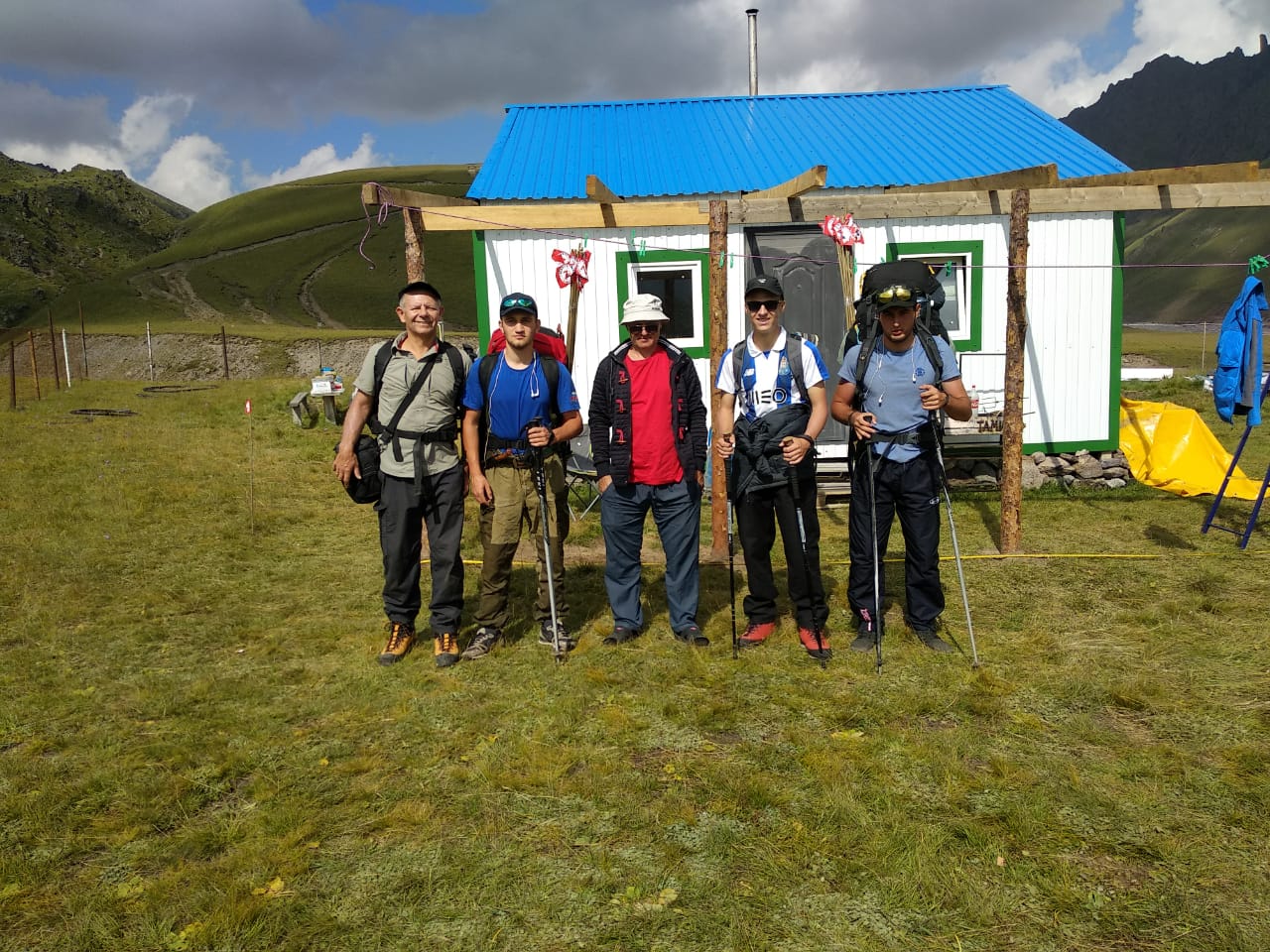
Day 5: Ascent to the summit camp (3800 m) – accommodation in hut.
The ascent to the summit camp at 3800 with all the necessary equipment for further acclimatization and climbing. We come back to the lower camp after the summit.
The entire route coincides with the only classical route of ascent to high camps on this side of Mount Elbrus.
Time 5-6 hours.
Elevation + 1200m
Length: 7 km.

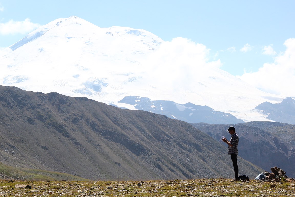
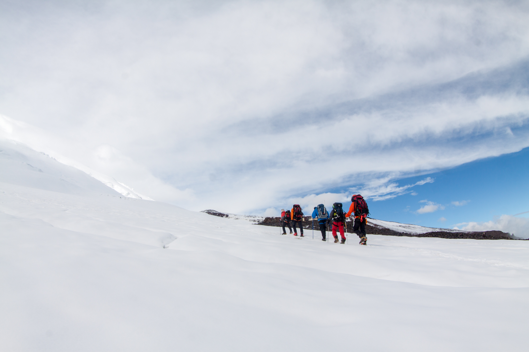
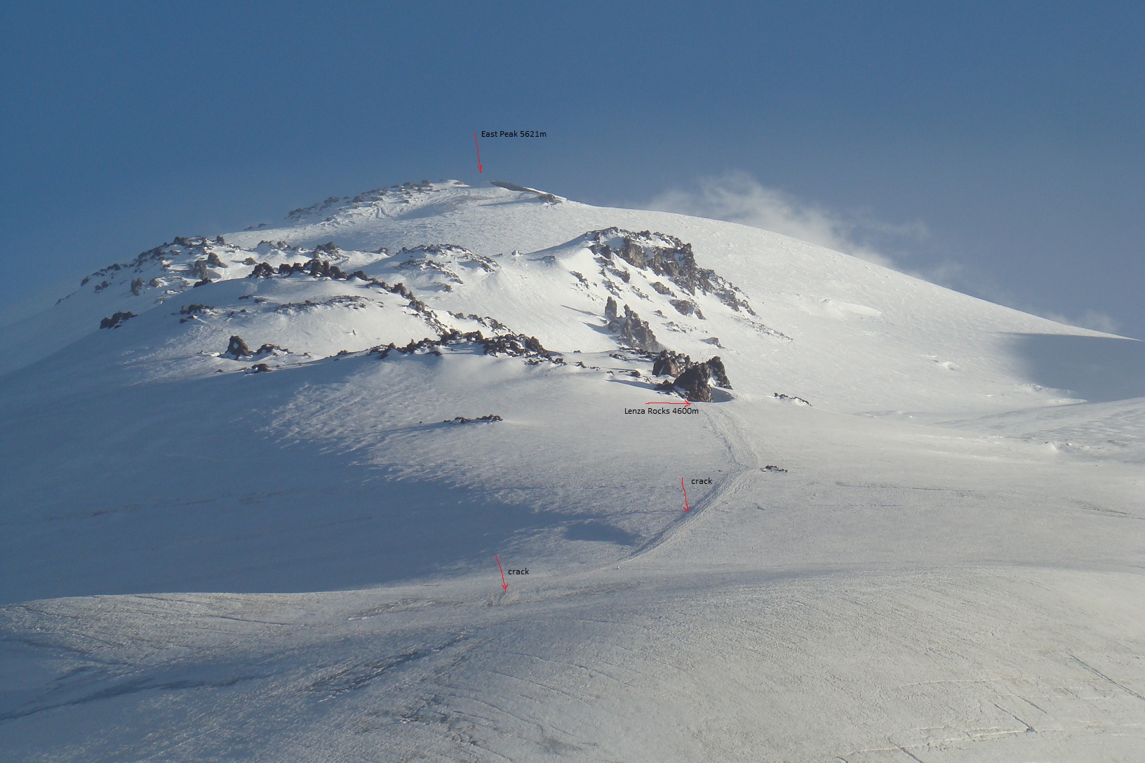
Day 6: Acclimatization on the rocks of Lenz 4600 m.
Acclimatization-training ascent to the lower boundary of the Lenz rocks to the height of 4500-4600 m. (Scheme coincides with the line of the route of ascent).
The start of ascent is optimal at around eight o’clock in the morning in order to use the best, the first half of the day because of the weather. Depending on the condition and training of the climbers this already “fighting” ascent, can take “from the camp to the camp” from three to six hours.


Clothing. Today all the same clothes as for climbing day. In general, the ascent is going in the whole complete set of clothes and equipment as for the summit, in which you will go directly to the top. The difference of today from climbing day – we leave at eight o’clock in the morning – not as cold as the night when there is a climbing to the mountain. Because of that some warm clothes may not be necessary, but worth to take it anyway, in case of worsens of the weather. Again, depending on the individual thermo regulation, someone may not need a “full” set of recommended clothing and hike of this day makes it also possible to “adjust” your own set of clothes before summit.
Equipment – climbing boots, crampons, harness, poles, headlamp flashlight, and sunglasses.
Food: Hiking will not be so very long to become very hungry, but a thermos of tea and some sweets you can take, again, the question of how the body requires or not the feeding during physical activity.
Time: 3-6 hours
Elevation + -700-800 m.
Length – 5 km
Day 7: Rest day.
Day of rest and sleep. On this day, we have a rest, a little walk on the moraine, there are several small lakes, and one rather big. Dinner at about 18:00 and after it – just sleep because the rise occurs in half past one at night, so that at two o’clock in the morning to be on the route.


The route to the lakes offers a good side view of the North-Eastern slope of Elbrus, the Lenz rocks are visible in profile and in good weather you can even see the shine of the houses of the summit camp.
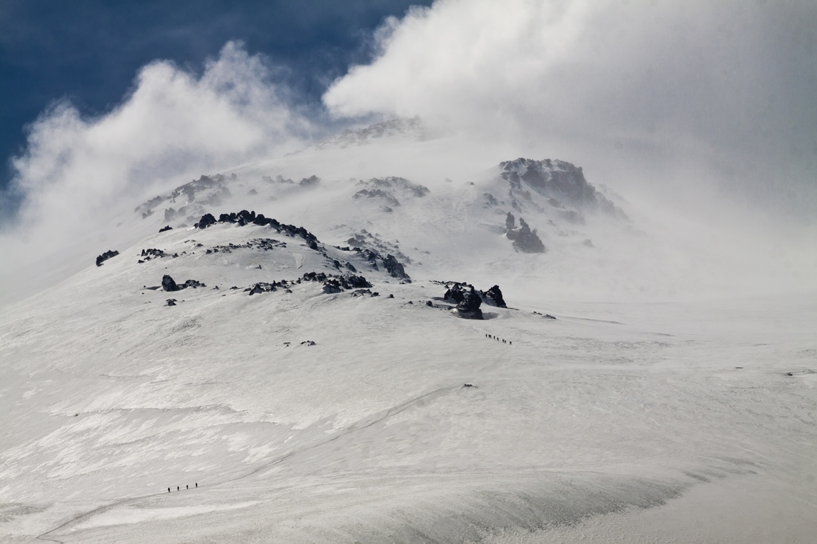
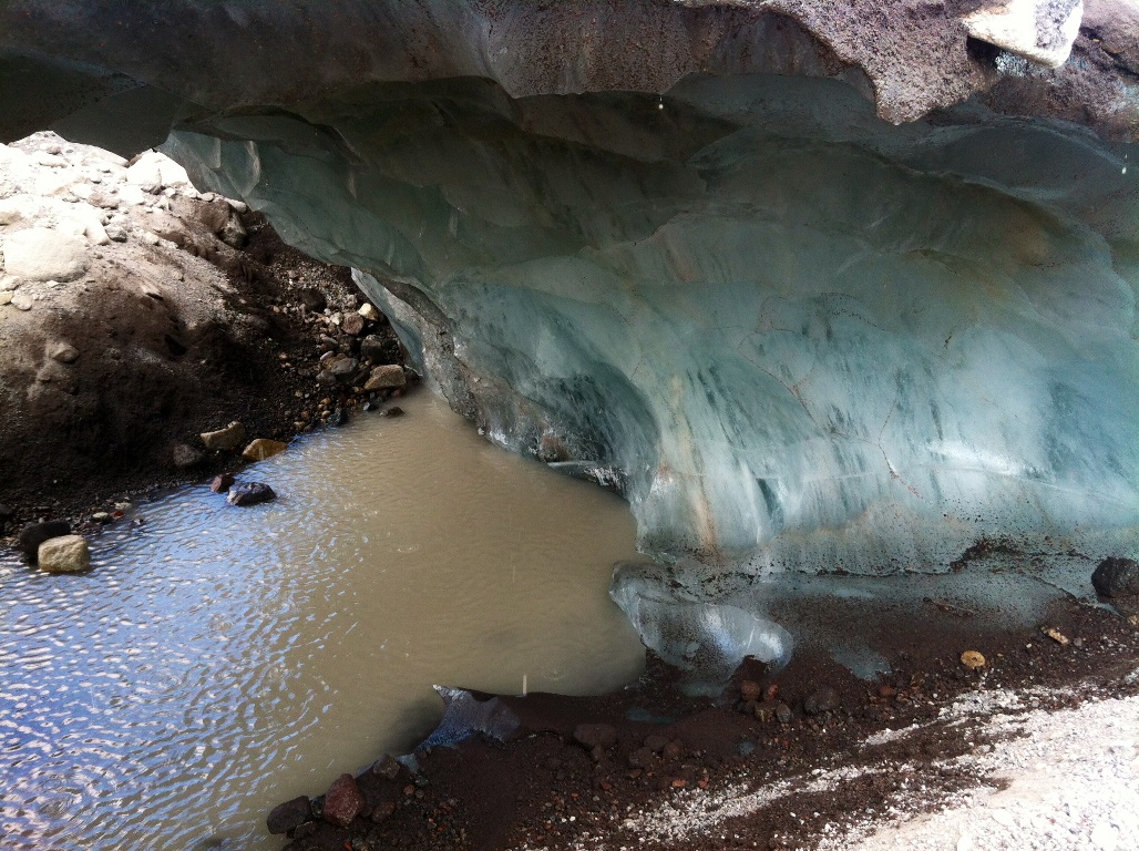
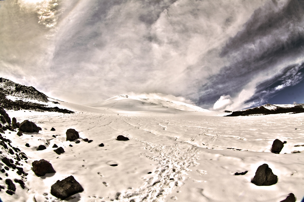
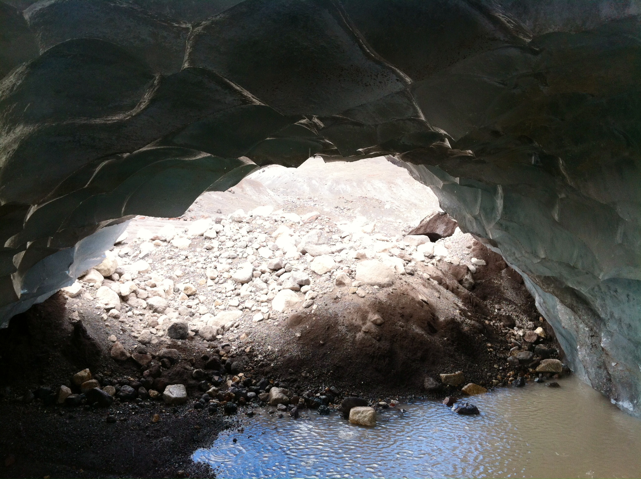
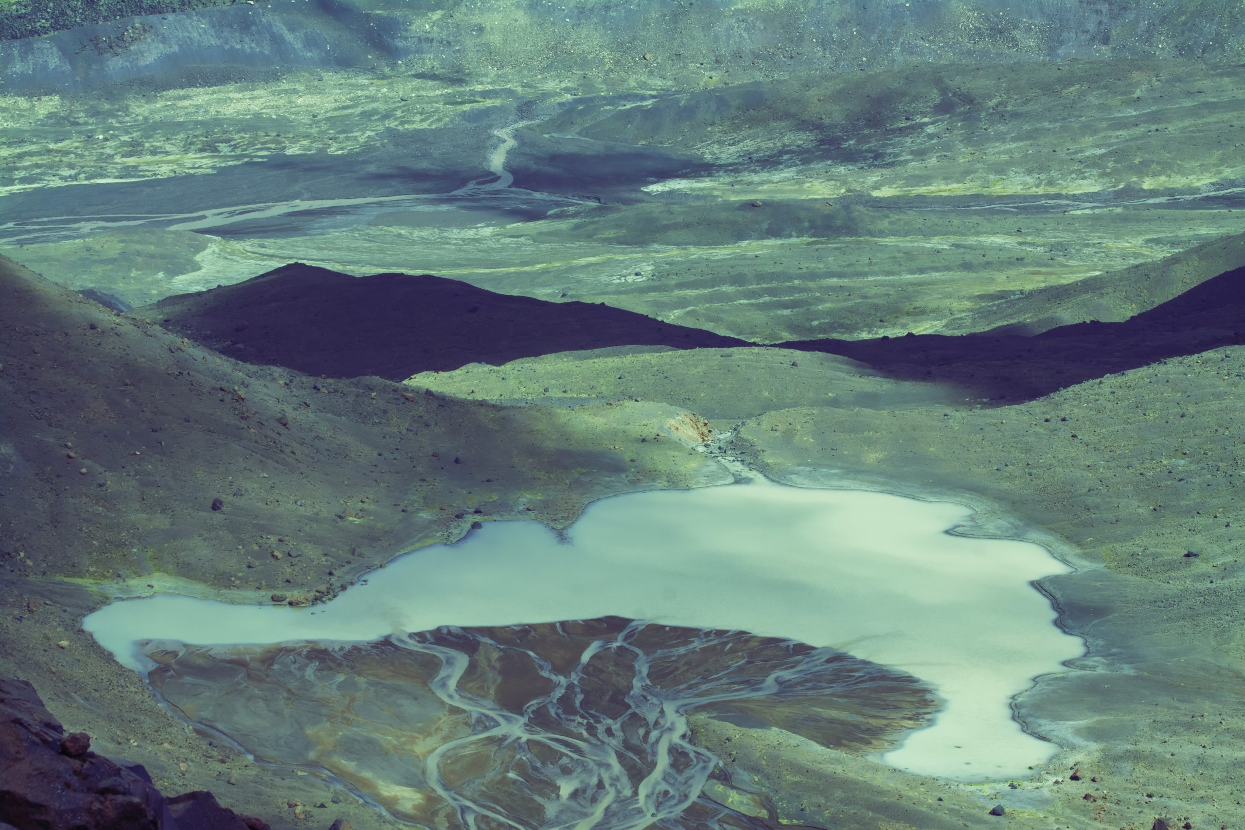
After 7 kilometers of the start of the route, we come to the huge Jikaugenkez ice plateau. A monumental spectacle — a horizontal frozen space, surrounded by dashing mountain ranges, and, in an incomprehensible way, a peak appeared here in the very center. How close you can get to it depends on the current state of the glacier on which we will move. In this place, it forms a moraine covered with lava chips and stones. Seasonal melting of ice forms amazing shapes and grottoes.
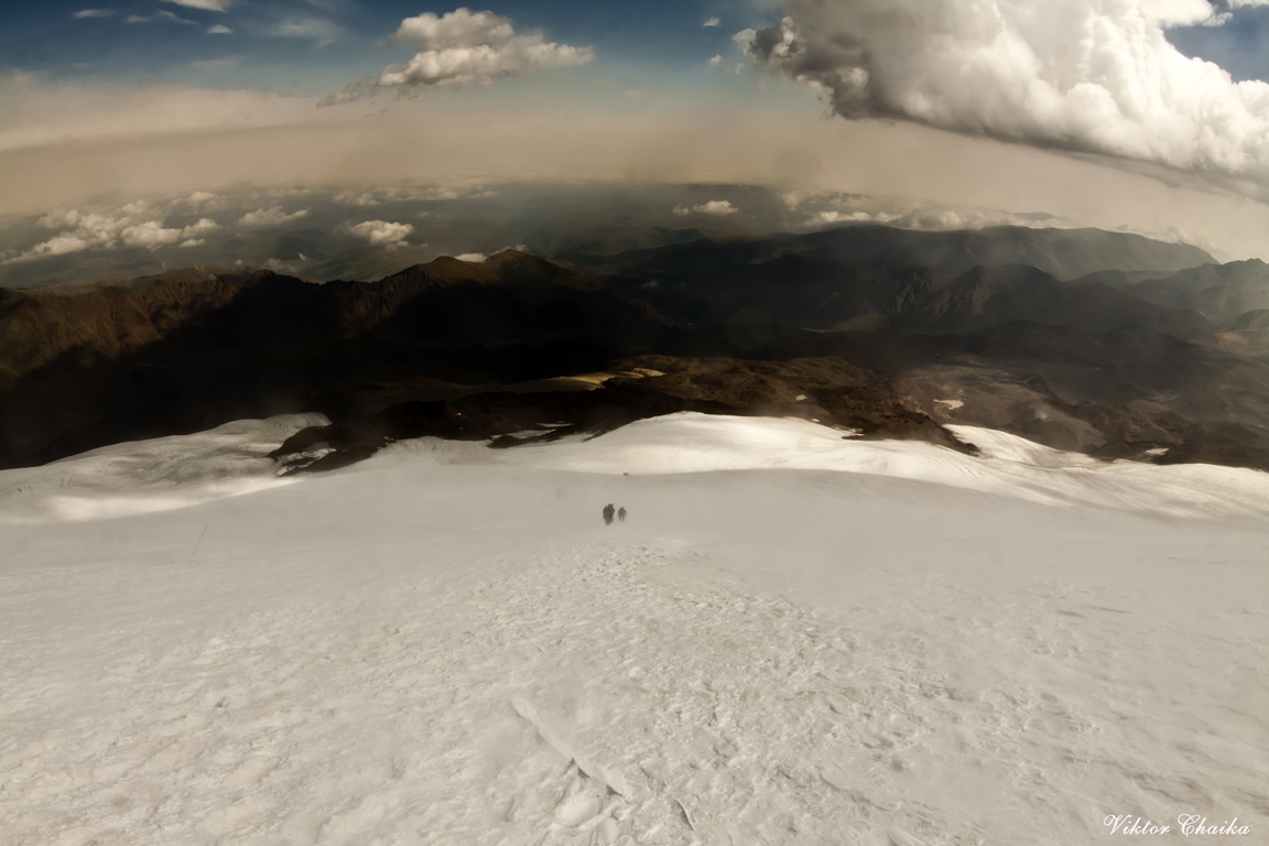
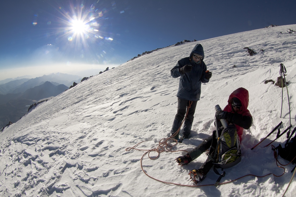
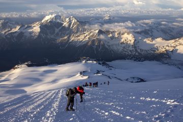
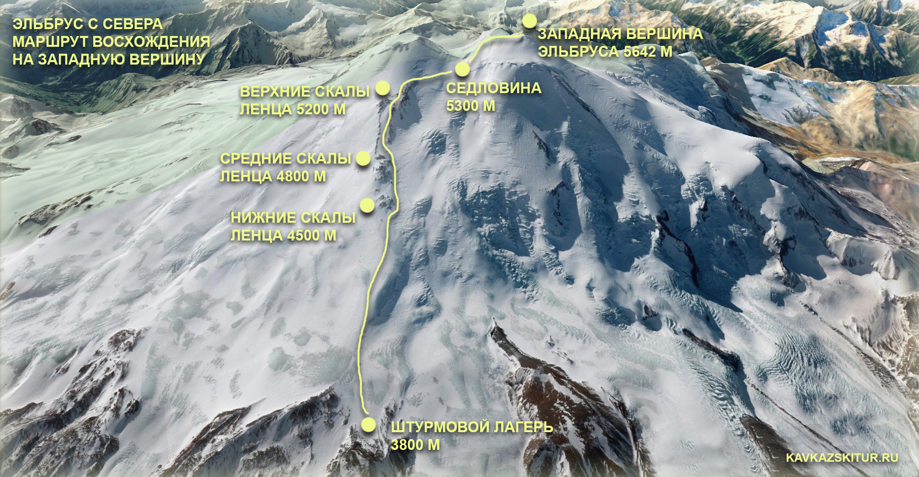
Day 8: Summit day.

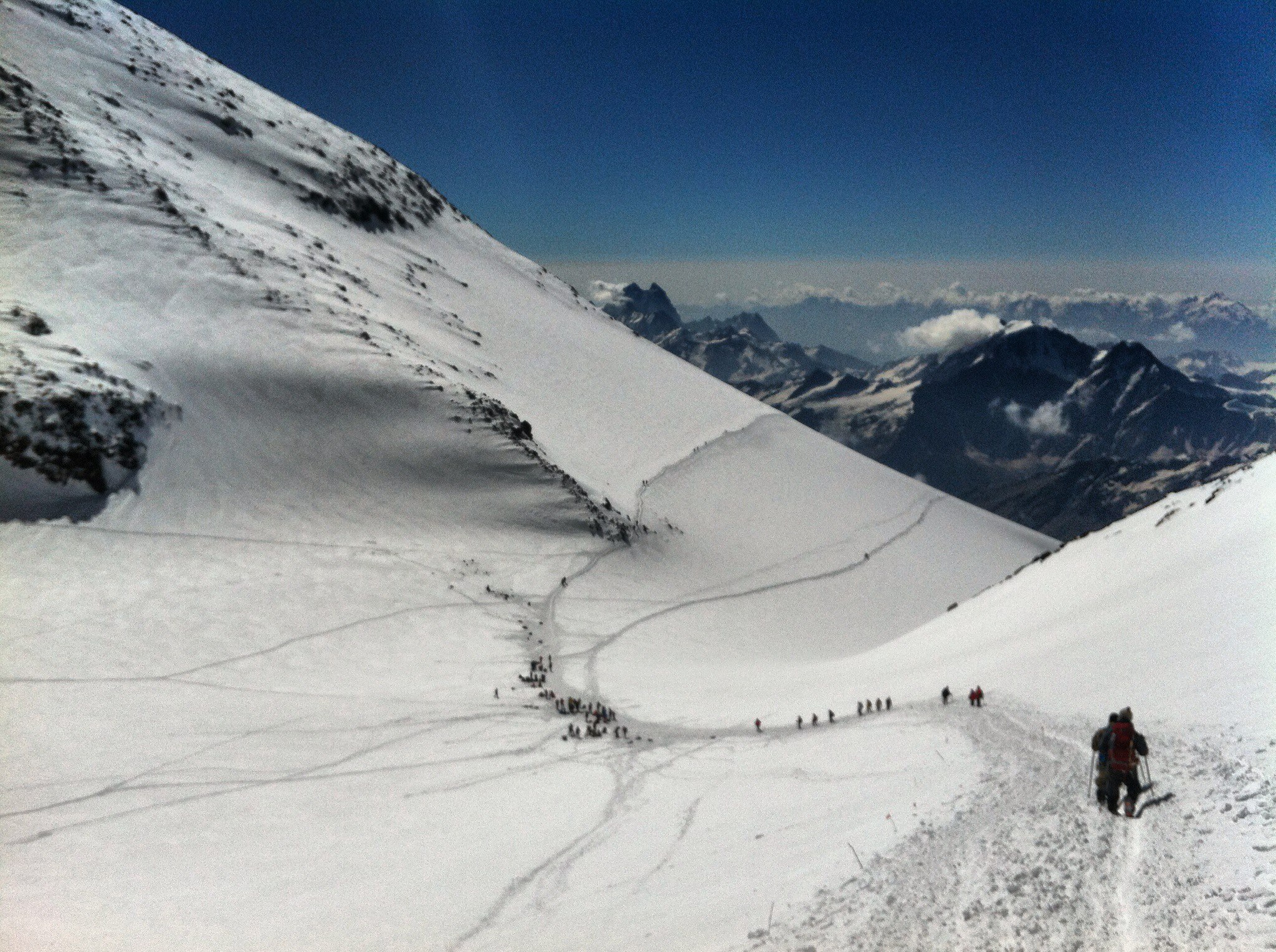
Early rise at twelve o’clock at night. Breakfast. Cooks prepare boiling water for thermoses. Filling thermoses. Take lunch bags. Departure at 2 am. 8-10 hours for ascent, 3-4 hours for descent — these figures can be considered a good average for most groups to the East Summit in good weather. Well-trained people can manage the Western peak during this time. On the day of the ascent, you need to gain and then drop more than 1800 meters, having traveled more than 15 kilometers (12 km to East summit). And although the slope is not technically difficult and steep, it is a very big job. The human body cannot work endlessly with a constant intensity, it works most optimally for the first eight hours, then its productivity begins to decline sharply, to which is added the influence of some oxygen starvation associated with altitude, sun, wind, dehydration, lack of sleep (or even a night without sleep before climbing), fatigue accumulated over the previous days. The peak also makes its own adjustments: the turn back time fluctuates around 13 pm, very often after this time the mountain can experience problems above five thousand meters, and you should try not to take part in them. People who go to Elbrus from the South, reaching as high as possible using technology (lifts, snowcats), can afford to walk, gaining 100 m of height in an hour. There it can be done, and a less prepared person can succeed more there than a more prepared one from the North side. But the mountains are not for competition. From the North, the optimal pace can be considered an average of 250 — 300 meters of altitude per hour. At any level of acclimatization and preparation, a comfortable pace will decrease with altitude. In a more prepared person — to a lesser extent. Therefore, the first half of the route can be at a pace of 300 meters per hour, and 400 meters per hour and even 500 in specially prepared cases. Above five thousand, the pace can drop to 200 and even up to 100 meters per hour in height. One of the tasks of the guide is precisely to study the physical form of the team in practice during the days of preparation, and on the ascent, as correctly as possible, choose the pace that suits both the team and the Mount. It is important to understand the point well: The mountain is very closely involved in what should be the pace, sleep, food, drink and other aspects of life and activity here. For example, if a person is going to start walking, gaining 100 meters per hour, he needs to prepare better, either choose another mountain at the moment, or, if he really wants to climb Elbrus, go from the South, simplifying his work as much as possible.
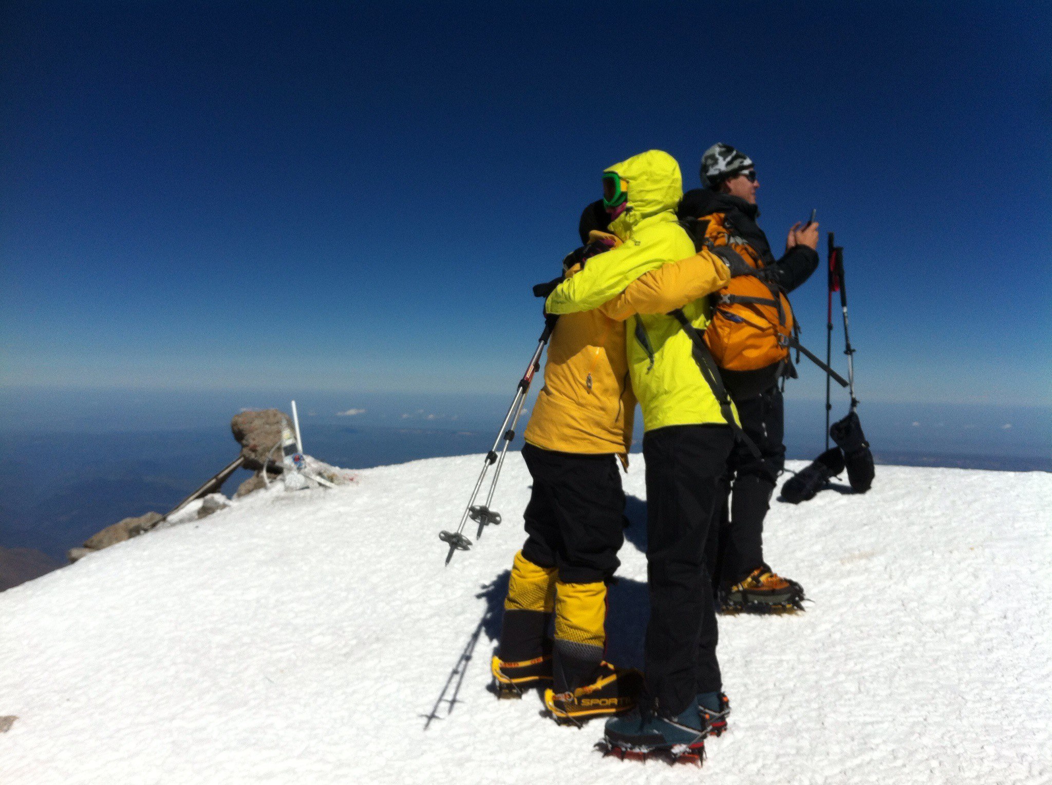
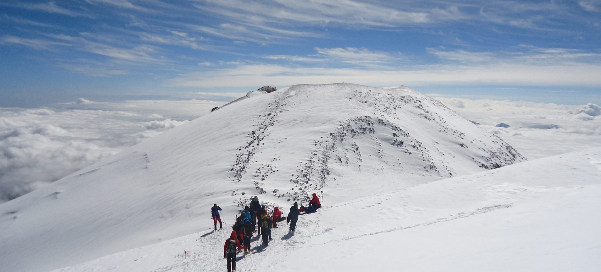
East summit.
From the top of Lenz rocks through not very steep snow slope, about 30 degrees, we rise to the top plateau, we cross it and reach the top. After a short stay begins the descent. Normally, the descent takes one-third of the ascent time. On average, leaving at two in the morning the group comes back at around four o’clock in the afternoon. But it is also good and implementable 8 hours to the top and about three hours for the descent. That is, with respect to an adequate level of training of the group all the climbing with a return to high camp can take up to 12 hours. It is on the eastern peak.
West summit.
It is located further, and climbing can last longer (relatively the ascent to the east) for 3-4 hours or more. Climbers with a good level of preparation can reach the western summit starting from 3800 for 8-9 hours. If it is decided to go west top, the turn to it occurs on the upper rocks of Lenz. After it about an hour traverse of the dome to the saddle 5300, then rise to the dome of western summit, crossing the summit plateau and reaching the summit. Descend along the ascent.
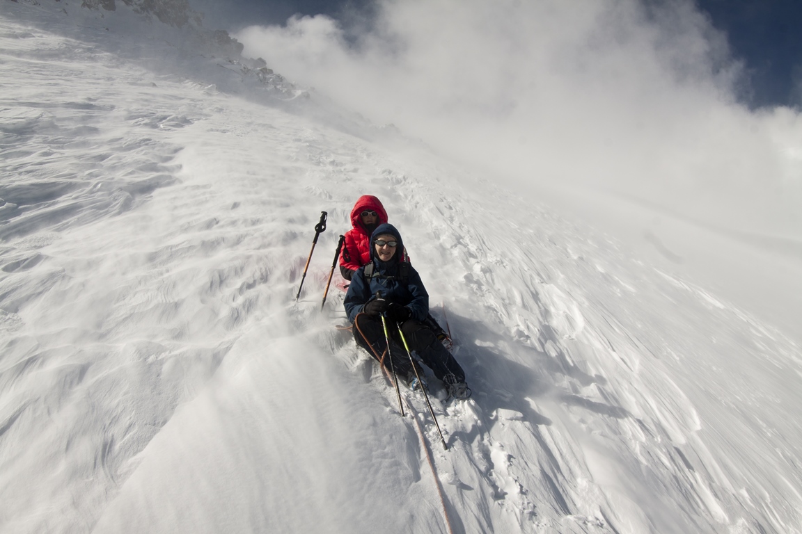
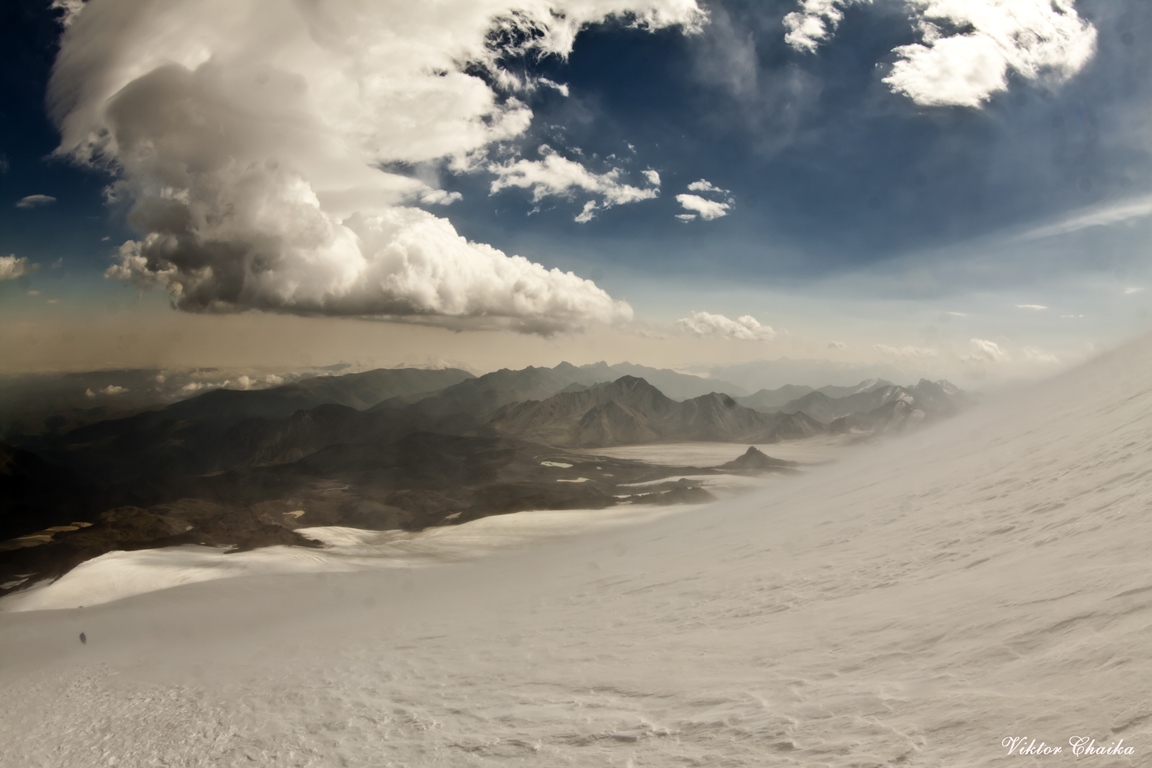
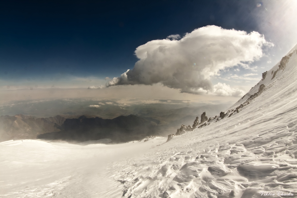
Weather. On the slopes of the north side it can be quite severe and even so it is considered acceptable. For example: a wind of 20 m/s – it is a normal working weather, those who doesn’t know that its permanent here can turn back thinking that he was blown off. Over the slope the situation with the wind may be different. It happens that before the lower Lenz rocks it is relatively calm, and from the border of rocks abruptly begins to blow. Sometimes vice versa – in the camp the strongest wind and slightly higher on the slope it becomes calmer. The air temperature in the upper part of the route can drop to -20 degrees, and in the sun can also be same number but in different direction. When the sun does not shine and comes the wind and clouds you are as if in the freezer. When the sun fries – as if in a stove. So you need to be prepared for such features.
Liquid. Loss of moisture – this is an important moment. In addition to the moisture, which vaporizes the skin during physical activity, the greater amount of it is evaporated through lungs when breathing, especially in a dry air. A trained body is able more efficiently use internal reserves of liquid (and nutrients), but even it cannot adapt to dehydration. Dehydration greatly affects on workability – can begin sick, headache, “heavy” muscles. The presence of these signs has already said that the drink is too late, it is better not to bring it up to it, and occasionally drink liquid on the route.
East summit:
Time: 11-14 hours
Elevation + – 1800 m
Length – 13 km
West summit:
Time: 12 – 16 hours
Elevation + – 1800 m
Length – 17 km.
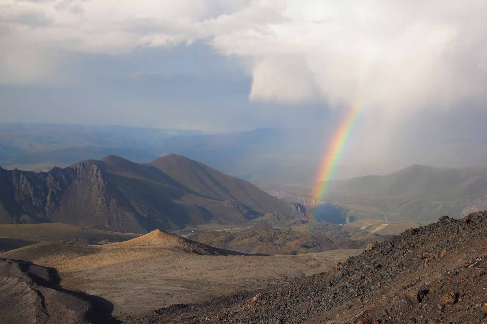
The beginning of descent in direction to the saddle of Elbrus and then to Pastukhov Rocks (4,800 m). Descent down to a camp “Gara Bashi”. Here we can stay for the night or depending from the time and if the lifts are working descent down to hotel in Terskol.

Day 9: Reserve.
Reserve day in case of bad weather.
Day 10: Departures.
Transfer to airport Min Vody or Nalchik. Departure to Moscow (Istanbul etc).
| SERVICES | STANDARD |
| All transfers: from Min Vody airport to hotel and back to airport; from hotel to north side of Elbrus and back to hotel. | |
| Accommodation in hotel in city Nalchik, according the program 2 days including breakfast. | |
| Campsite Huts on Emanuel glade 2600 m 3 days and on summit camp 3800 m according the program 4 days. | |
| All meals in camps: cooked meal everyday with packed lunches. | |
| Cook in base-camp and summit camp with all kitchen stuff. | |
| Qualified guide-instructor for acclimatization and climbing english speaking. | |
| Extra guides on summit day, 1 guide/3-4 climbers. | |
| Visa support, park fees, registrations. | |
| Rent of group equipment | |
| Rent of personal equipment. | |
| Dinners and lunches in the cities. | |
| Porters for personal equipment. | |
| Accident insurance. | |
| TOTAL PRICE | 95 000 rubles |
Preliminary application
| REQUIRED EQUIPMENT FOR THE EXPEDITION «CLIMBING ELBRUS FROM THE NORTH FACE»: | GROUP EQUIPMENT: |
|
|