+7 928 691 44 05
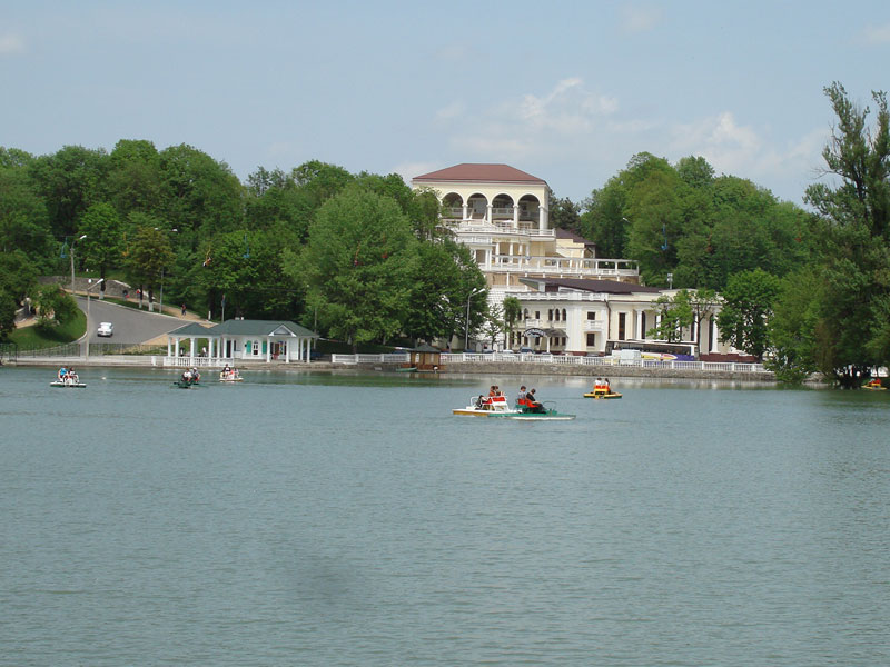
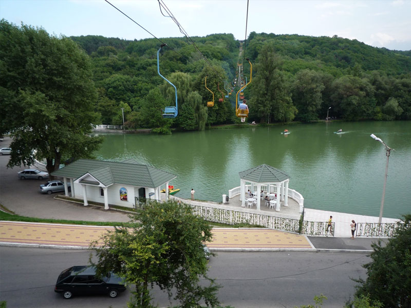
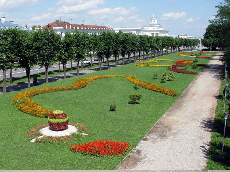
 Russia, KBR, city Nalchik


Schedule of climbing Elbrus
|
|
|
The northern slope of Elbrus has been always attracting the attention of scientists, mountaineers, climbers and resort visitors. Just there the first conquerors of Elbrus, the participants of the famous Emmanuel expedition, made their attempt to conquer Caucasian giant.
The given short program is for tourists physically prepared and experienced in high mountaineering.
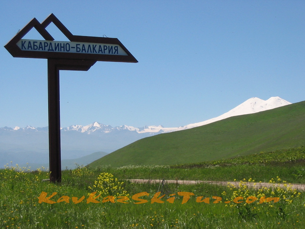
The tour allows to see the most beautiful place of Kabardino-Balkaria – north side of Elbrus with springs Gili-su.
This tour is designed for tourists who want to wander through the wild mountains to feel the real mountain tourism and mountaineering.

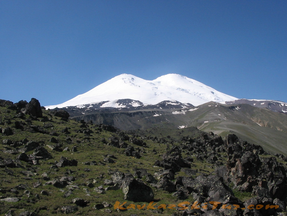
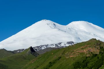
The program provides an opportunity to climb Elbrus by the first ascent route. However, later, it was considered as classic climb from the south side route. According to statistics, successful ascents from the South – 80%, from North – about 30%. These numbers show best of all and lead to the conclusion that, the ascent of the North route much more difficult than the ascent from the South. Today, the north side of Elbrus can be considered wild and untouched: hence the ascent can be considered more “honest”. There are no snow cats and cable cars, you need to go here all by yourself. The infrastructure of South allows to reach “in the easy way” to an altitude of 5100m (cable car to an altitude of 3800m, and then – snowcat to a height of 5100).
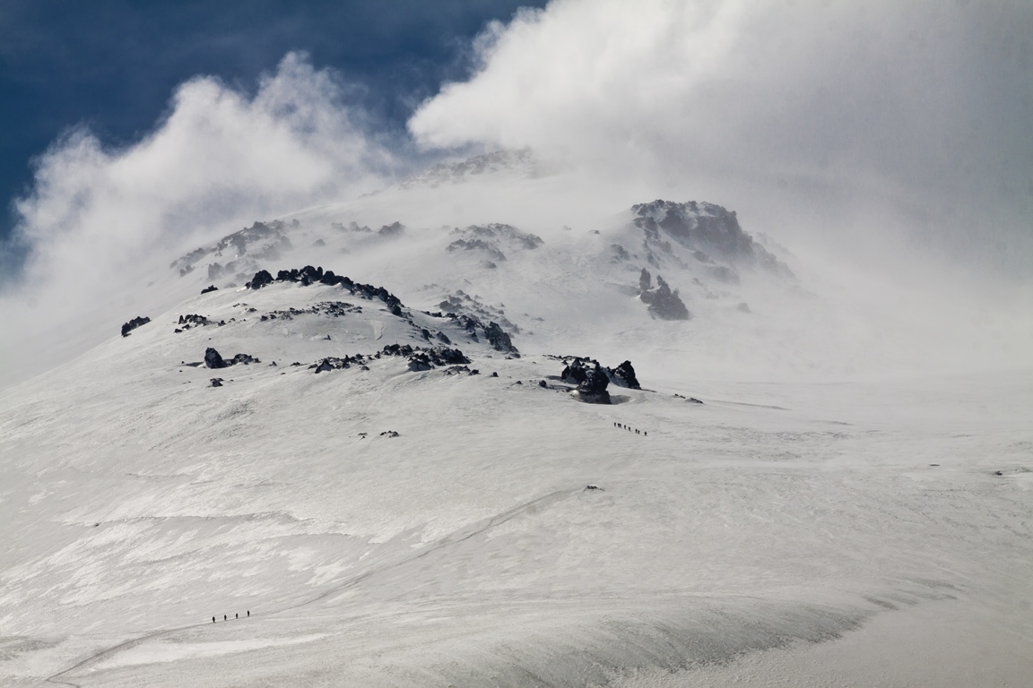
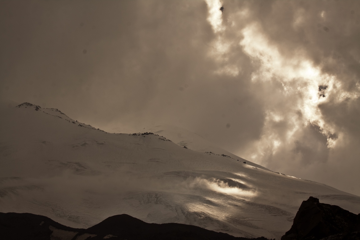
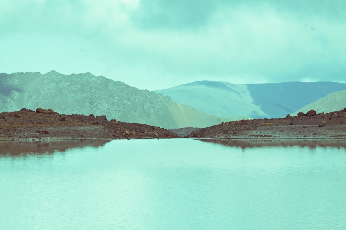
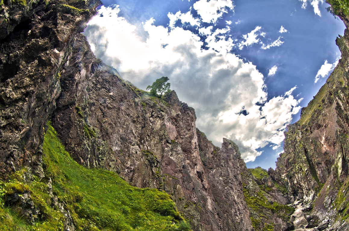
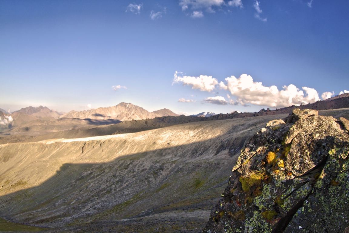
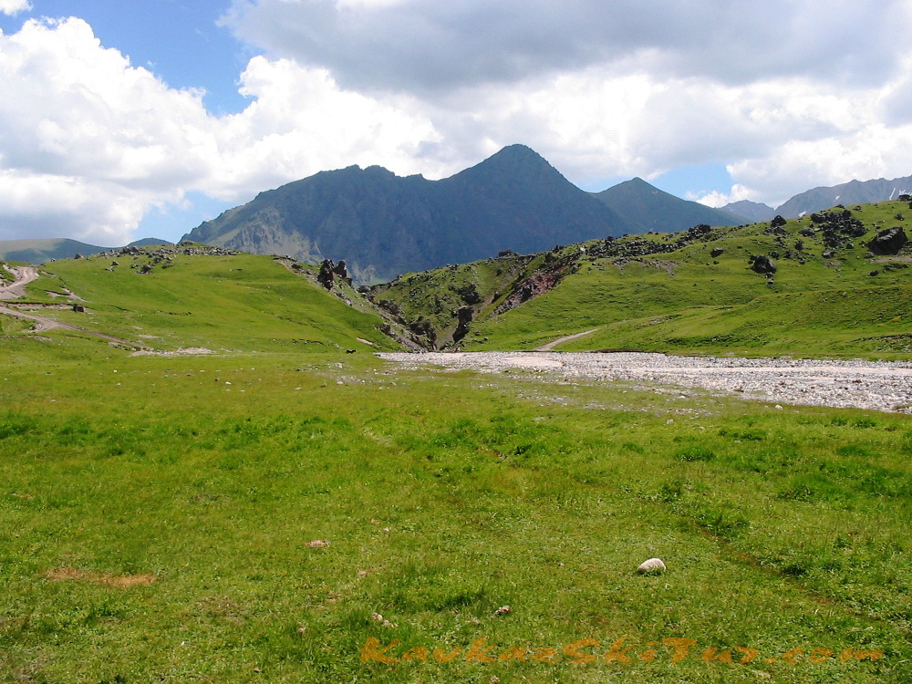
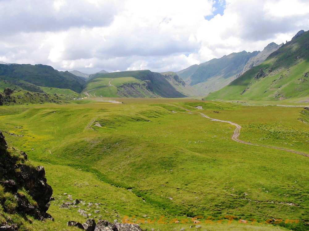
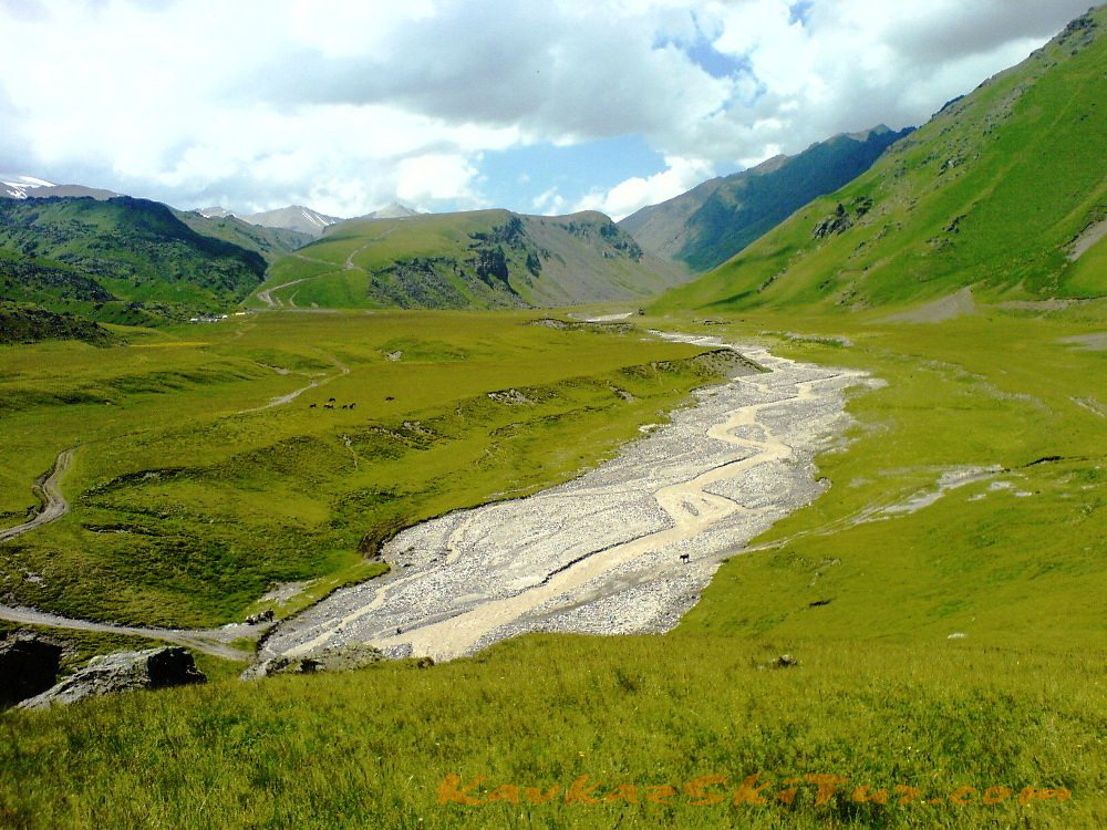
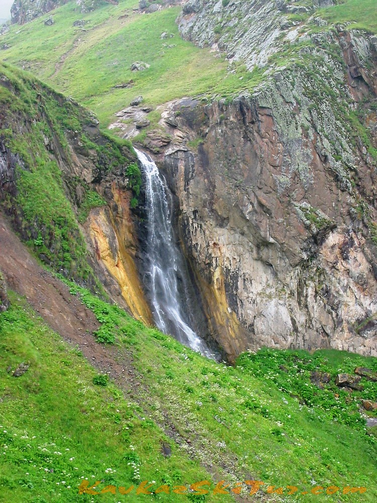
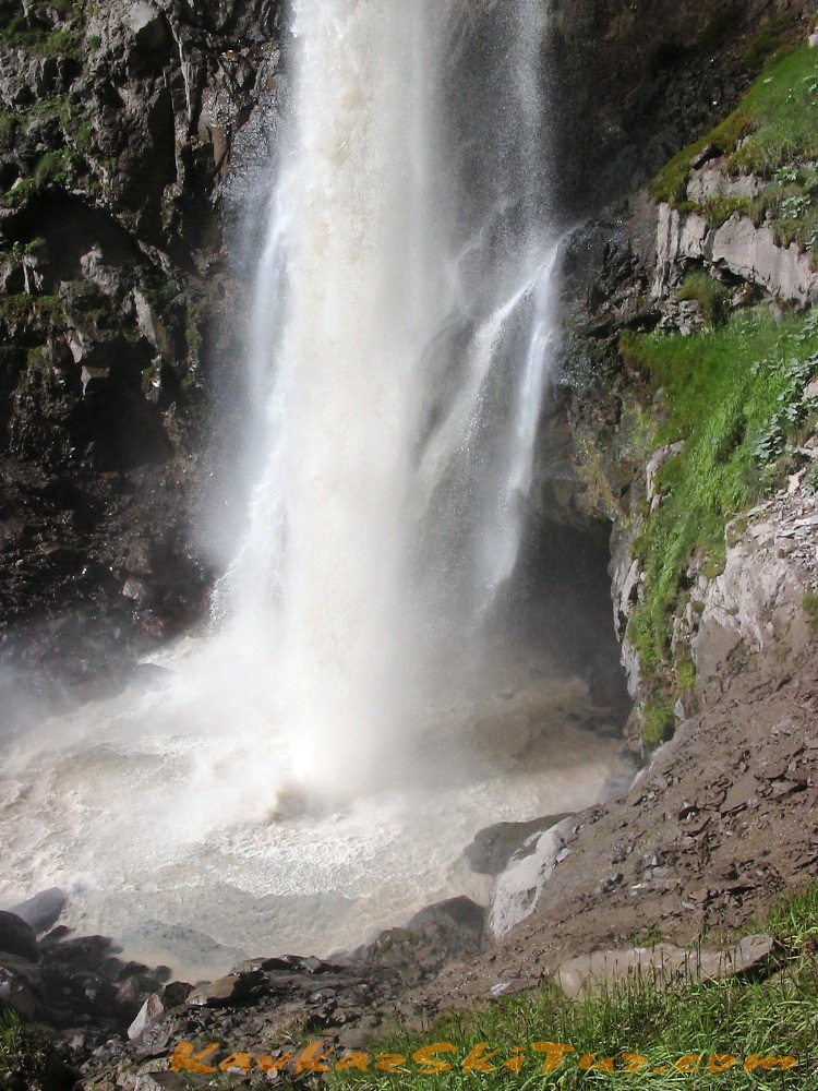
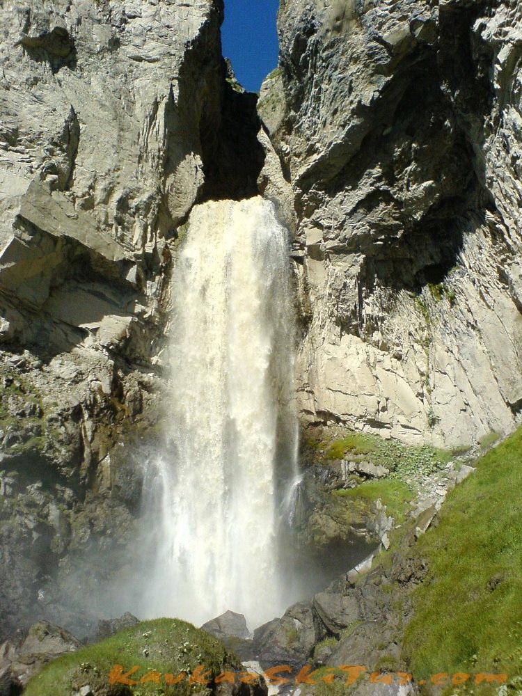
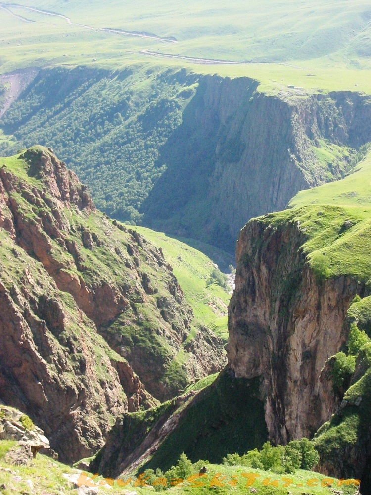
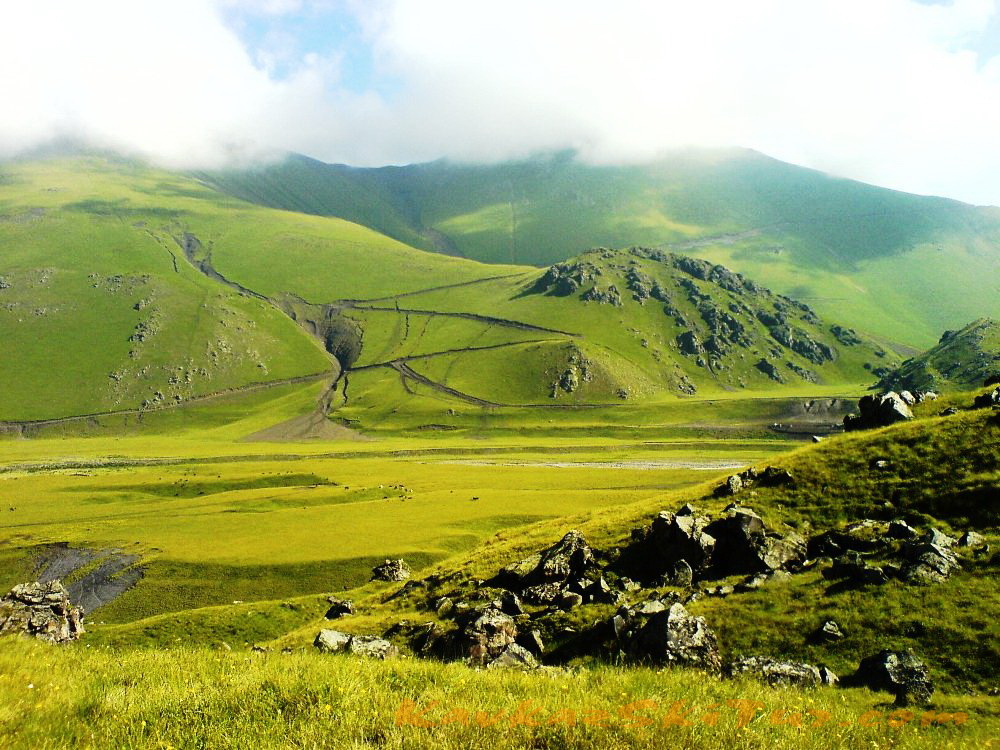
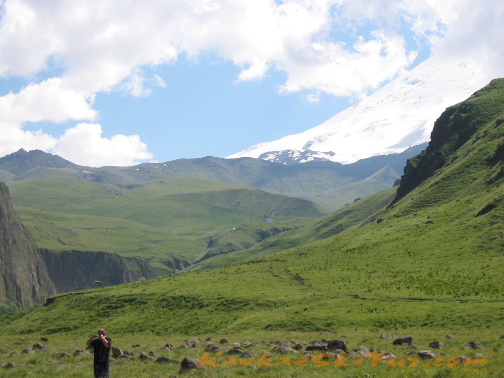
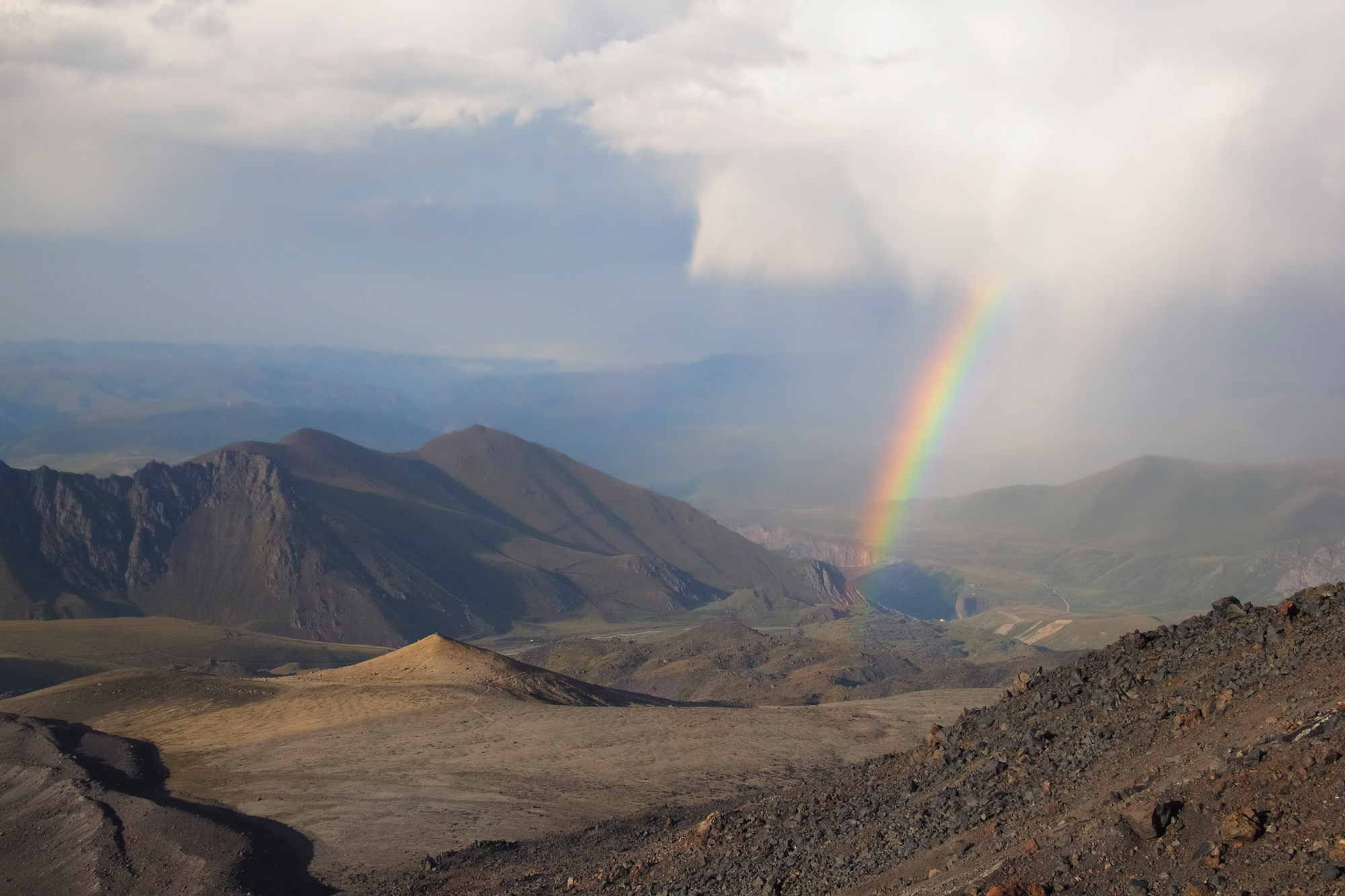
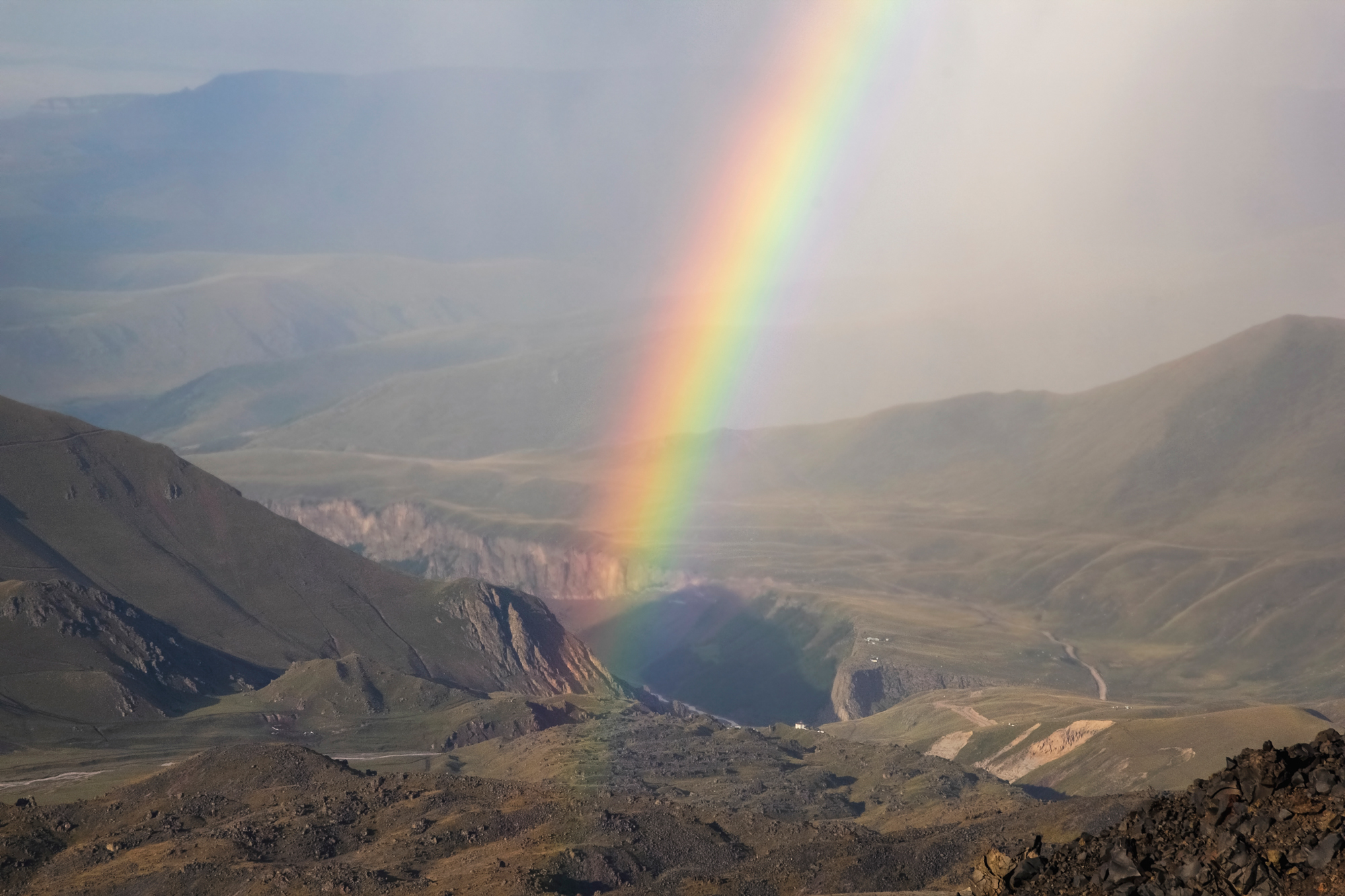
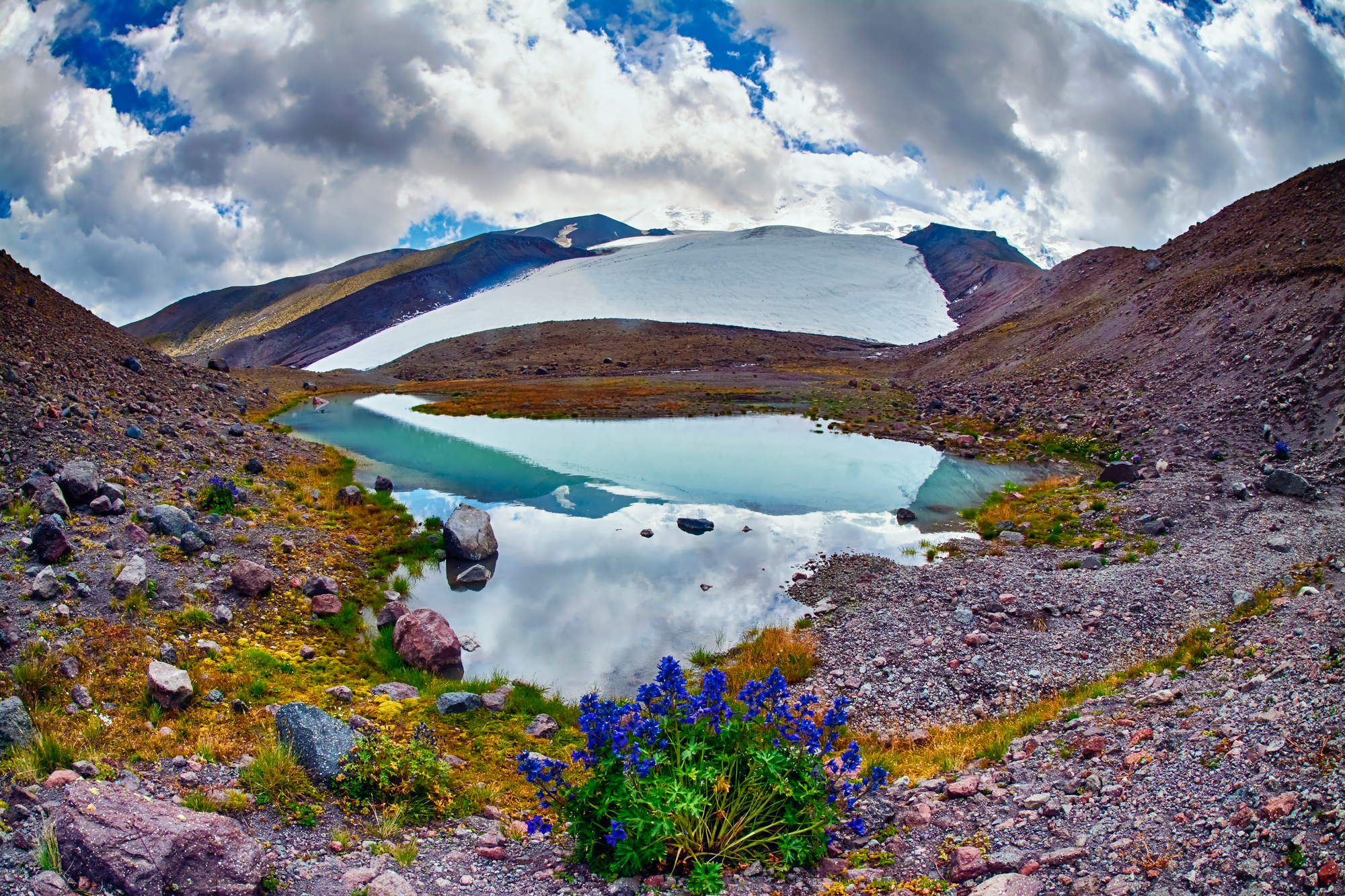
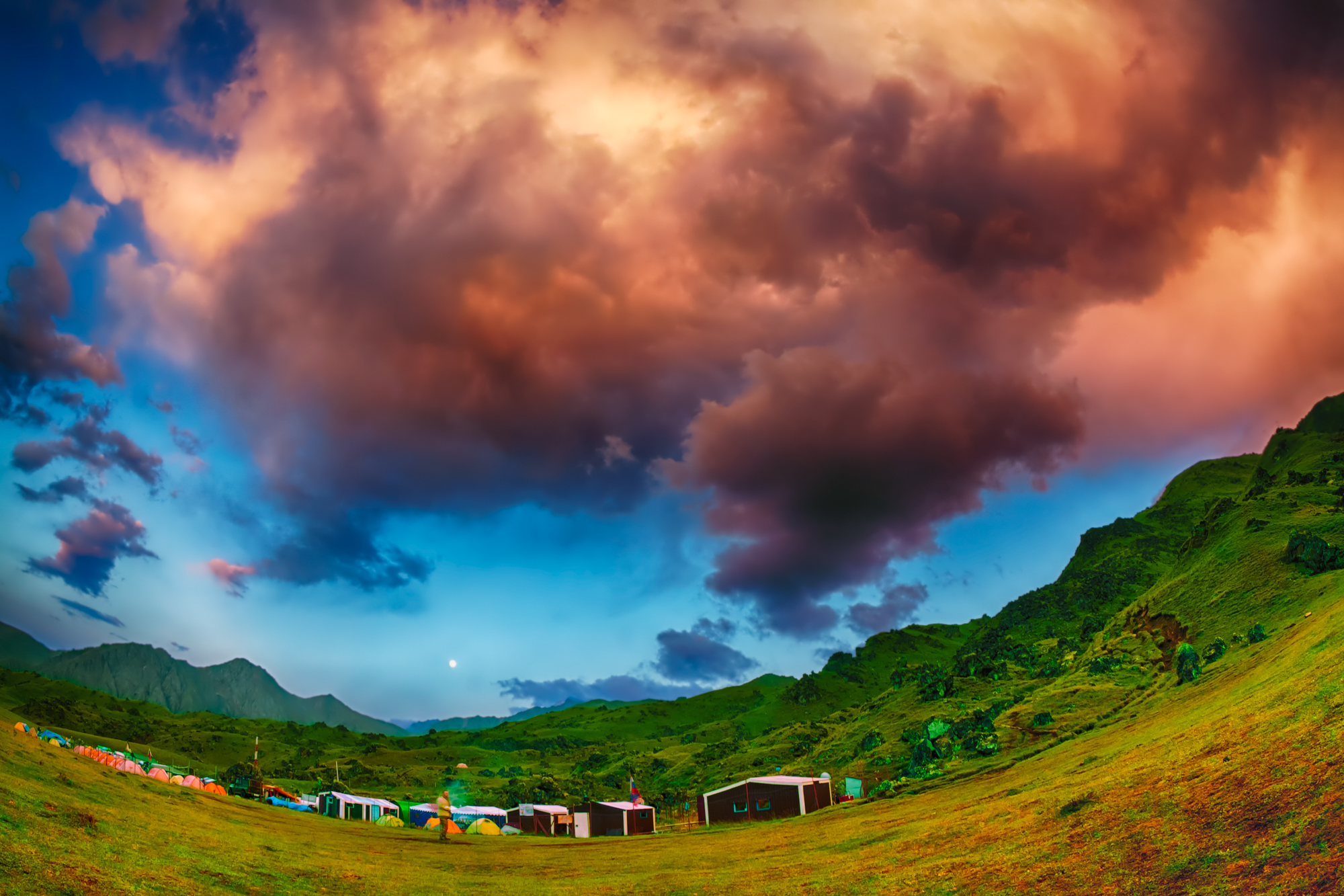
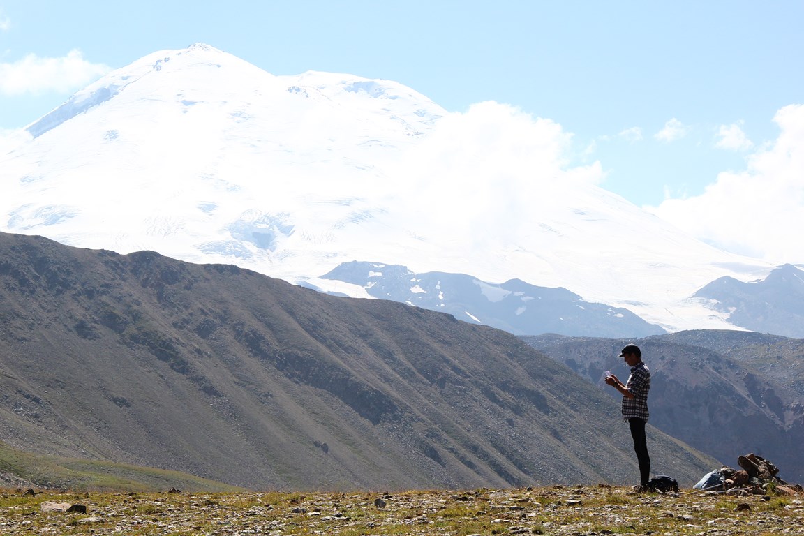
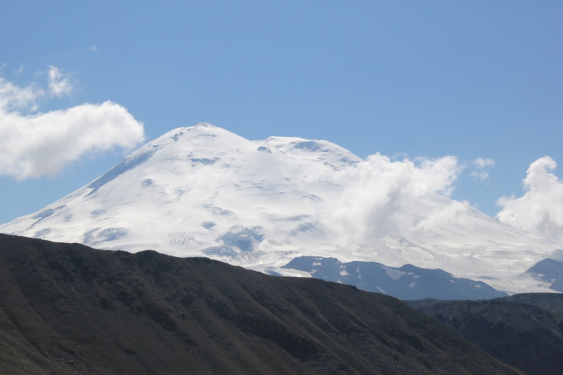
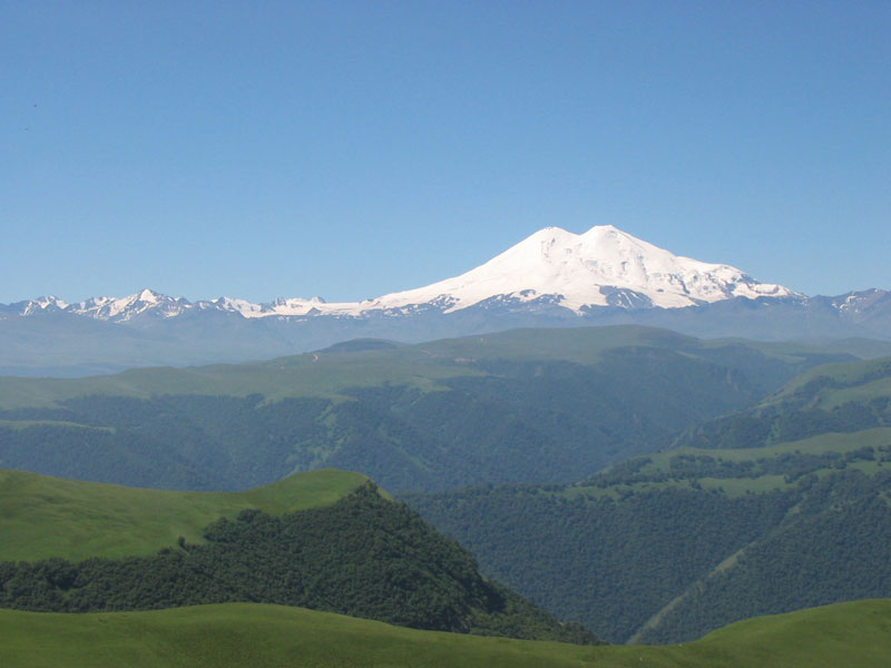
The northern side of Elbrus is a great place to dive into the wild nature of the Caucasian mountains, and test yourself in climbing one of its hardest snowy peaks. The place has sufficient infrastructure of the base camp, harmoniously blending into the greenery of the hills and meadows. There are no large concentrations of people and equipment here, as from the classical, southern side. Spacious glades, plateaus and meadows, turbulent rivers, natural springs of narzan, hot springs, waterfalls, vultures soaring in the sky, the measured life of mountain shepherds and the dazzling head of Elbrus towering above all this — you will like it here.
Climbing Elbrus along the Northern slope is a rather difficult test even for an experienced climber. Although the route is not technically difficult and does not require special skills, it often requires all possible forces and resources of the body, due to its length and large height difference on the day of the summit. Also the decisive factor, can be the weather on the Mount: winds sometimes reach sixty kilometers per hour, and the temperature on a summer night can drop to minus thirty degrees. The sun also requires special respect to it — the layer of the atmosphere here is two times thinner than at sea level, and it shines and warms twice as much. Thanks to the optimal acclimatization program, the route is feasible for a physically healthy person, even if this is the first big mountain in your life, however, you will have to work hard. There are many factors influencing success, a team of professionals working with you always tries to take into account the maximum number of them in order to increase the chances of success. There are many people who were able to pass this route. There are those for whom it was the first mountain. There are also experienced ones who did not succeed the first time. And there are many for whom the day of ascent became the last day of life. For optimism in the mood, you can keep in mind the case of the very first ascent of Elbrus: it was in 1829, along this very route to the Eastern Summit. In those days, there was no such clothes as today, no equipment, no experience of walking on such high and fierce mountains. And they were able to do it.
Briefly
Day 1 — meeting in airport Mineralnye Vody, transfer to city Nalchik, overnight at the hotel.
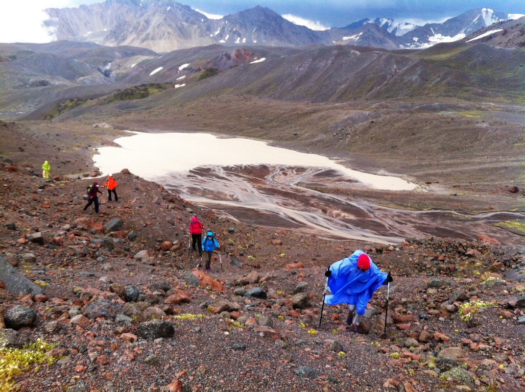
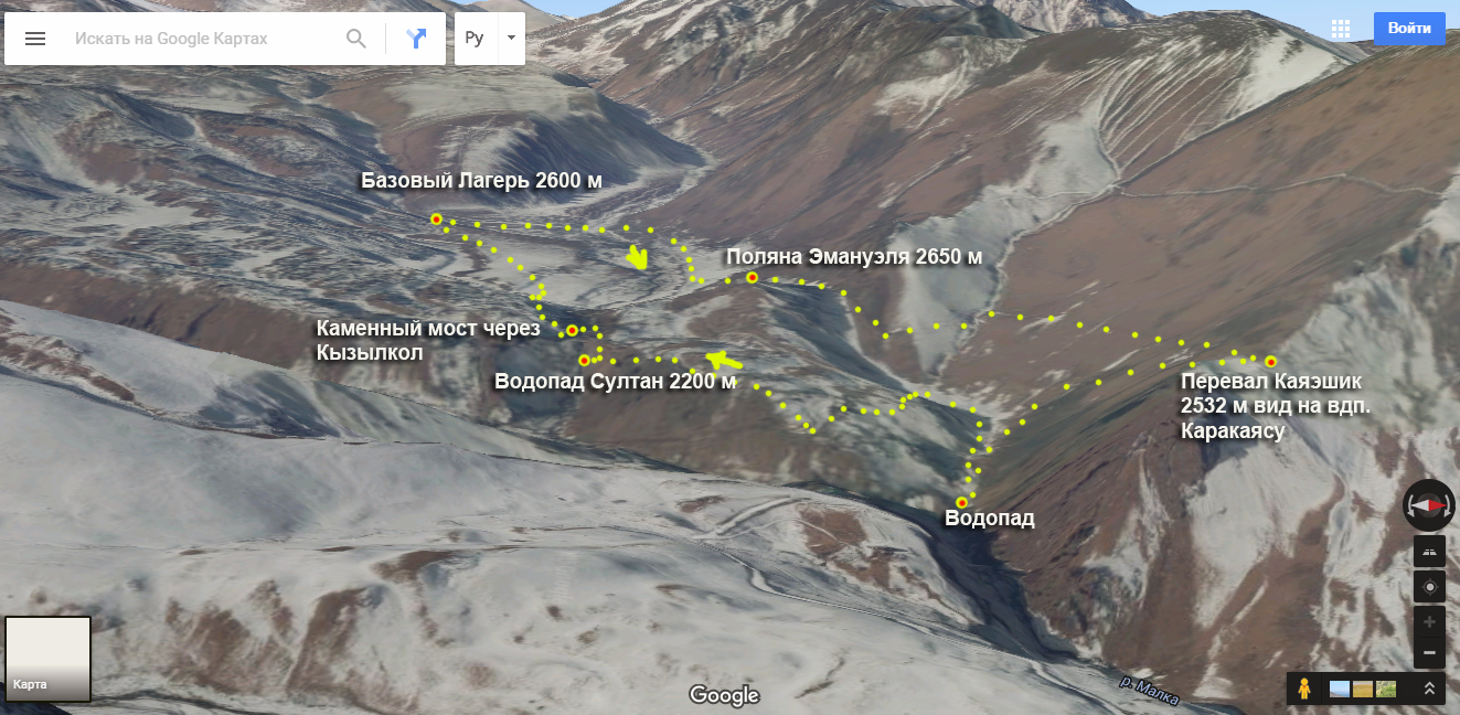
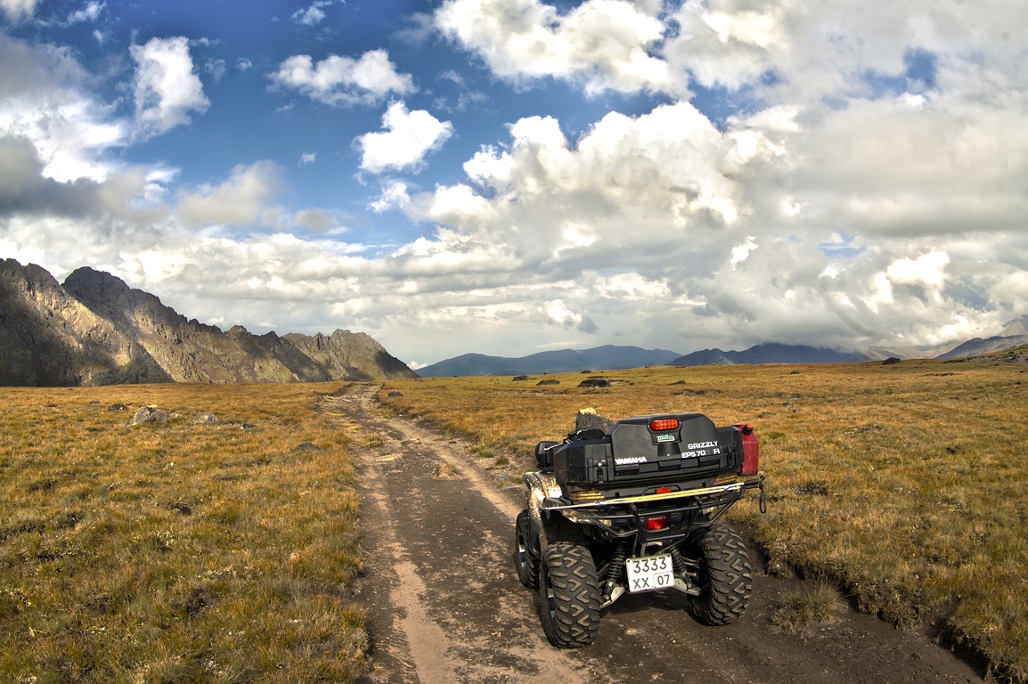
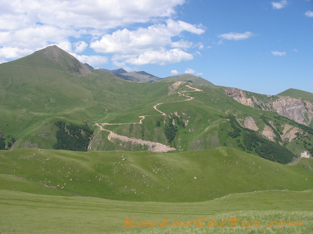
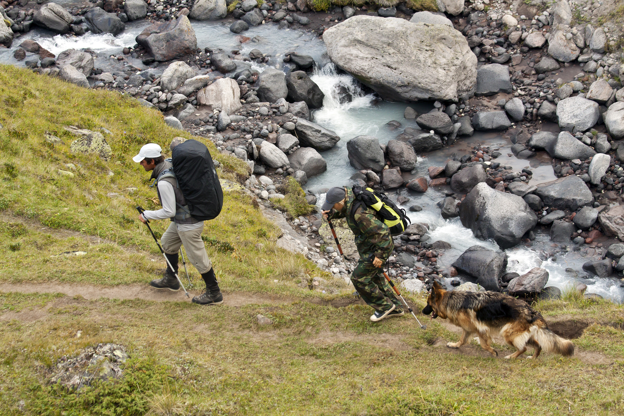
Day 2 — transfer from Nalchik to the North Elbrus, arrival at the Base Camp 2600 m on the Irakhiktuz plateau, near the Emmanuel glade and the hot springs of Dzhily-Su. Accommodation in BC. Acclimatization walk around the area, with a visit of the highest waterfall in Kabardino-Balkaria on the Karakaya-su River and Narzan springs. The length is about 6 km, drop / climb — +400 m. 3 hours.
Day 3 — transition to the summit camp at a height of 3800 m, with the transfer of all the necessary things, from now on life is in this camp. Length 6 km, +1200 m, 3-4 hours.
Day 4 — acclimatization hike to the Lenz Rocks up to a height of 4600 m, descent to the summit camp. Length about 5 km, +-800 m
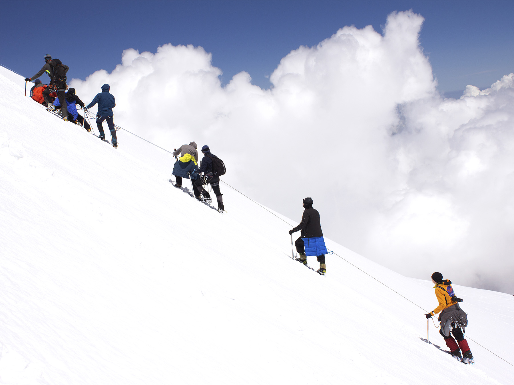
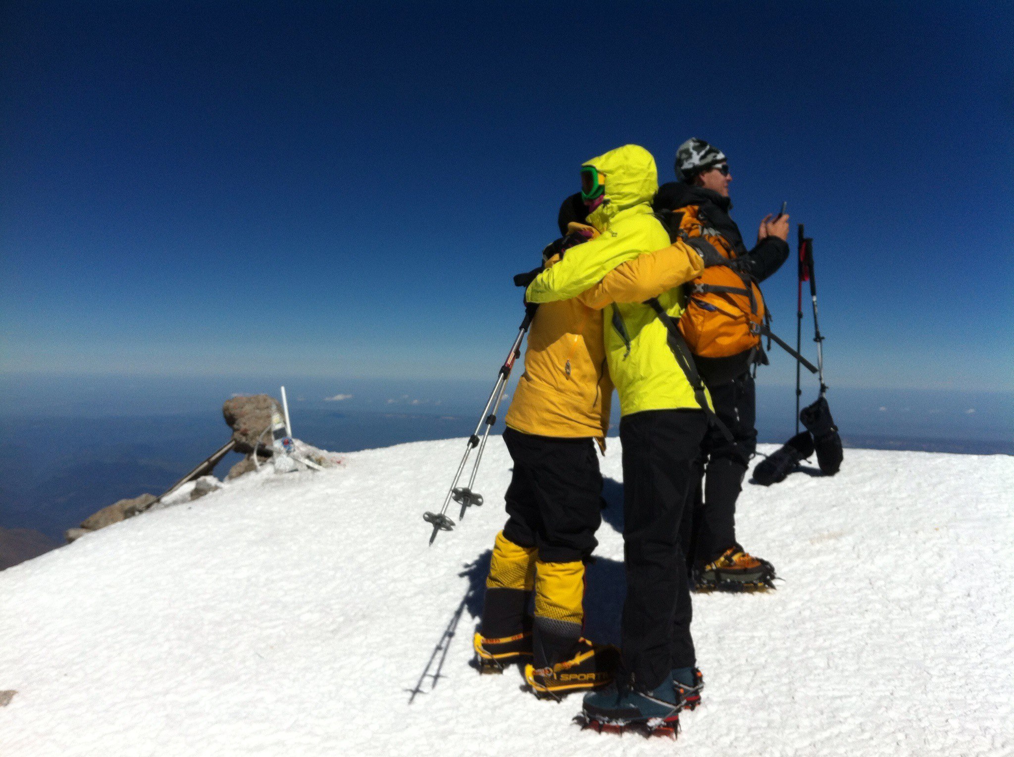
Day 5 – summit day on western or eastern top of Elbrus – depending on group and weather condition. The length is about 12 km, the height is + -1800 m. The average travel time is 12 hours.
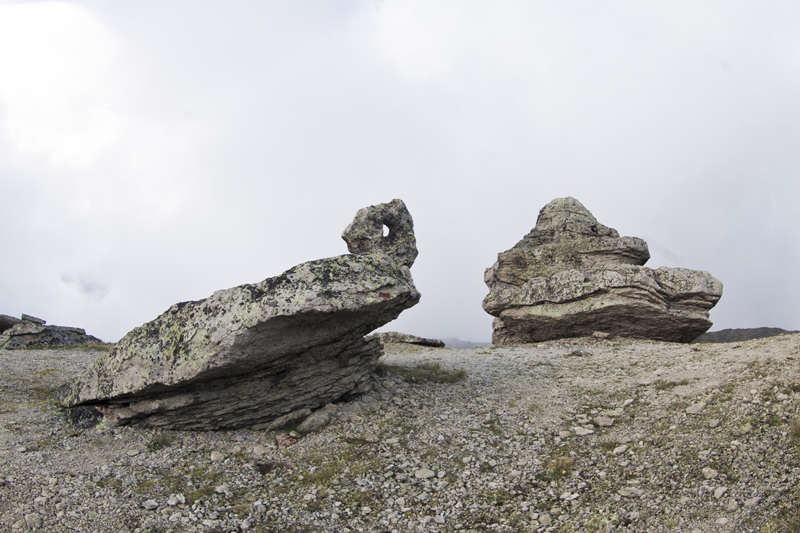
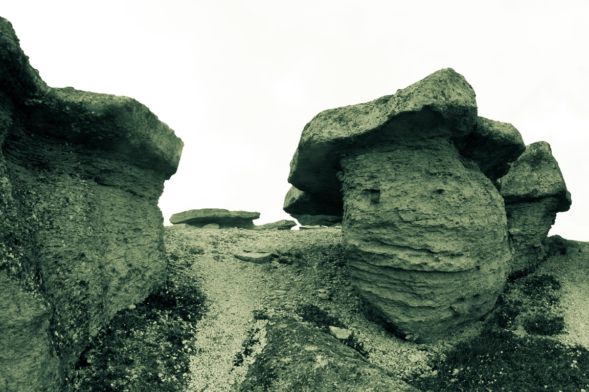
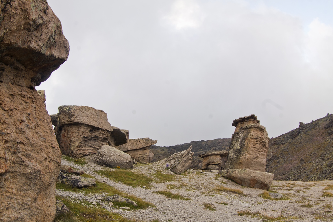
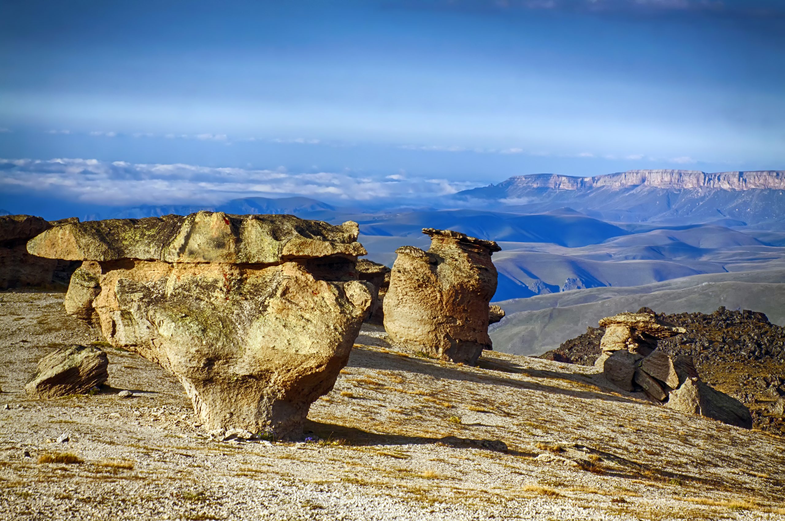
Day 6 – reserve day in case of bad weather and descent down to base camp 2600 m. Depending on the situation — a visit to the «Stone Mushrooms», an amazing place.
Day 7 — transfer to city Nalchik, overnight at the hotel.
Day 8 — transfer to airport Minvody or Nalchik, departure flights.
Our program includes everything you need, with the exception of personal equipment. Transfer from/to the airport, accommodation, meals, guides. Personal special equipment, as well as specialized clothing, can be rented from us.
More details about the program and life in camps/huts.
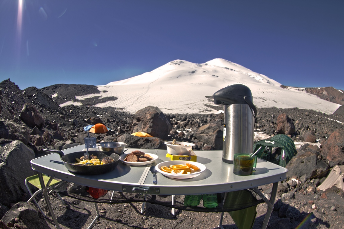
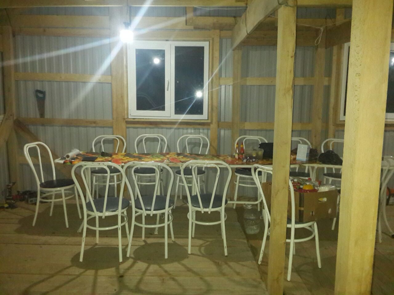
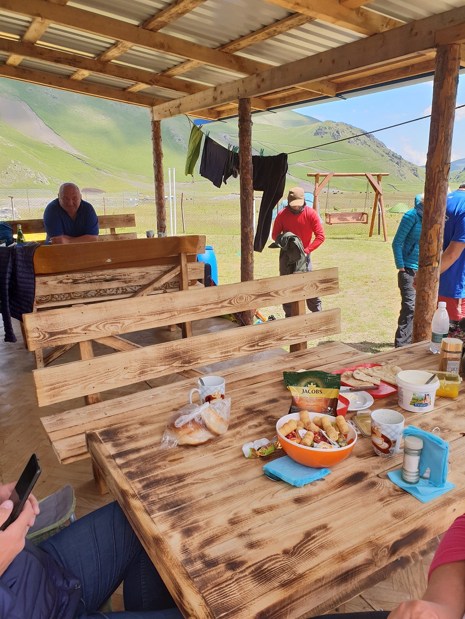
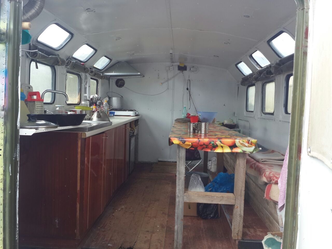
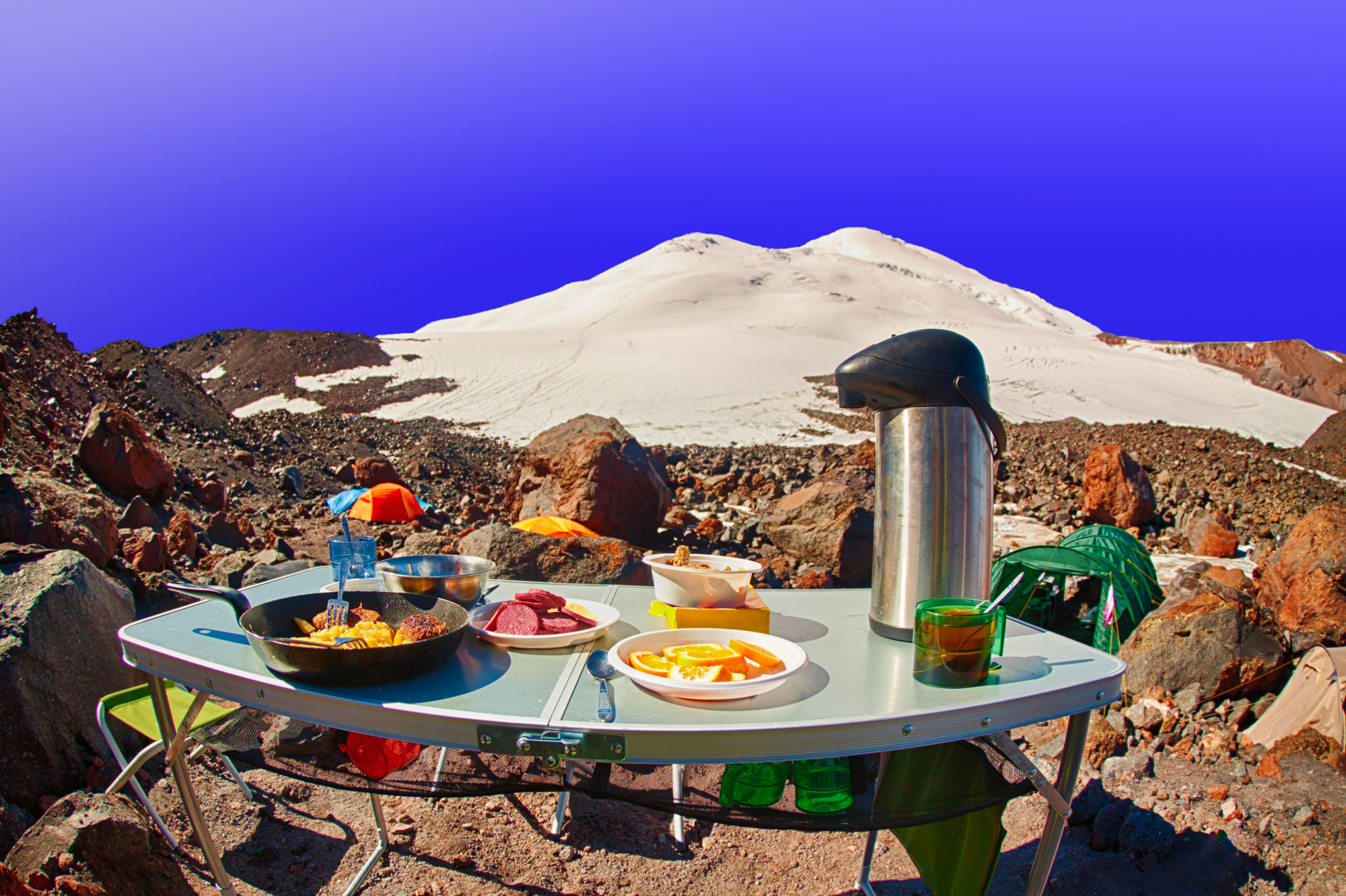
Food. The base camp and the summit camp have a full kitchen with a cook and a dining room where you can comfortably sit down for a meal or drink tea. All food is prepared from natural products and is adequate to the «mountain» lifestyle. A thermos with hot water for making tea or coffee is always available. Meals — three meals a day, a lunch package is issued on the day of the ascent.
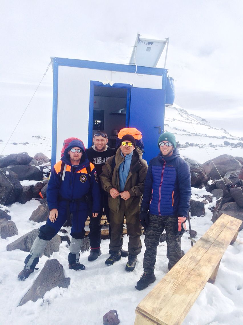
Guides. Each of our guides is well acquainted with this Mountain, with the physiological features of the work of the human body in these conditions, as well as with many pitfalls of the human psyche, due to the combination of environmental factors and the work that a person finds himself in here. The number of guides varies depending on the size of the group. On average, there is one guide for every 3-4 climbers. Also, the number of guides is equal to how many times the group can split up during the ascent, to descend the «tired» to the camp.
Rescue team. Each group is registered with the rescuers who are on duty on the route in the base and summit camps.
Porters. These are mountain carriers. The base camp has its own porters for the needs of the camps, the delivery of food and materials to the summit camp, and the descent of garbage. Anyone can use their services for an additional fee, for full or partial delivery of their equipment and things to the summit camp, or descend to the base camp.
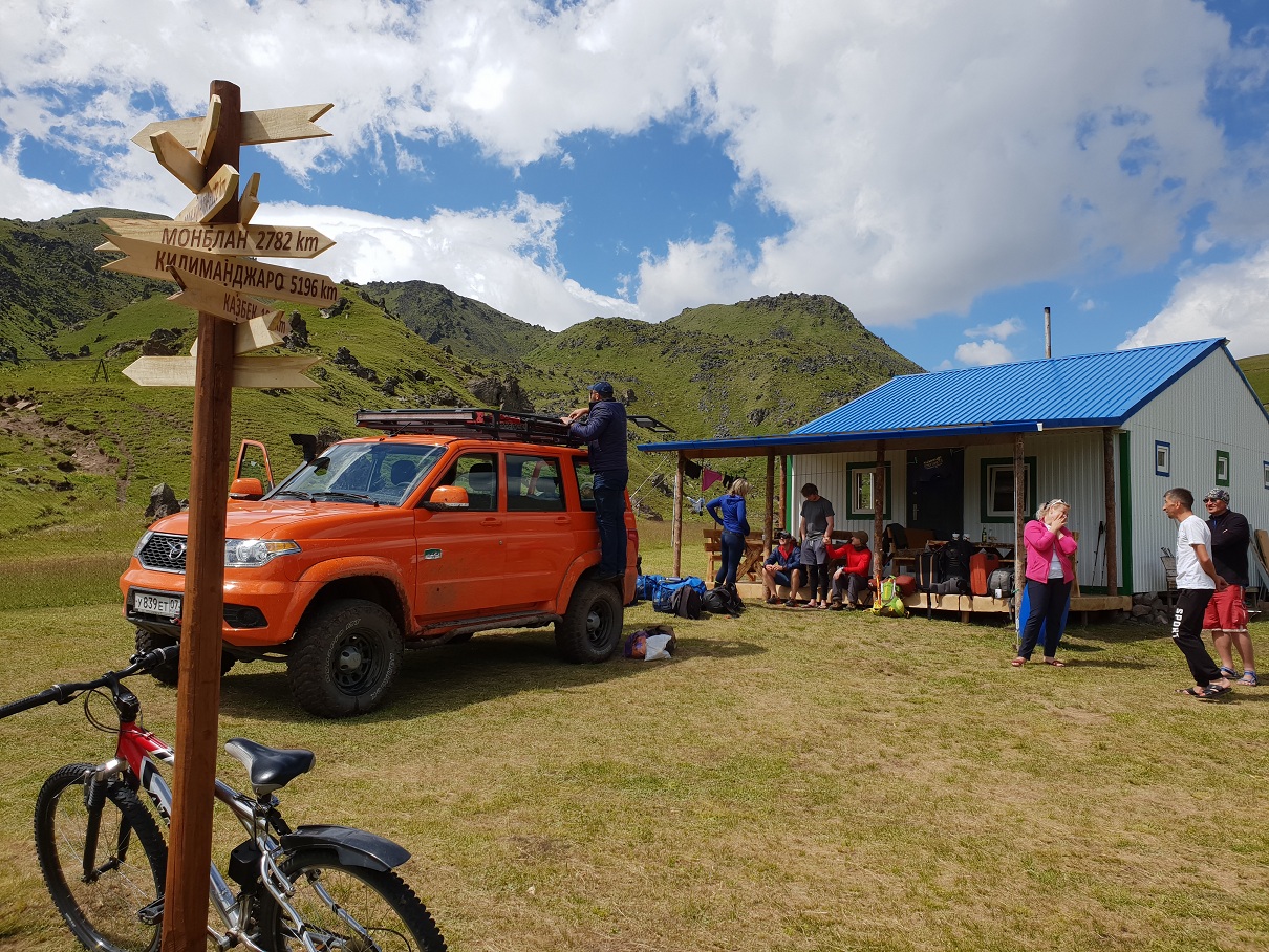
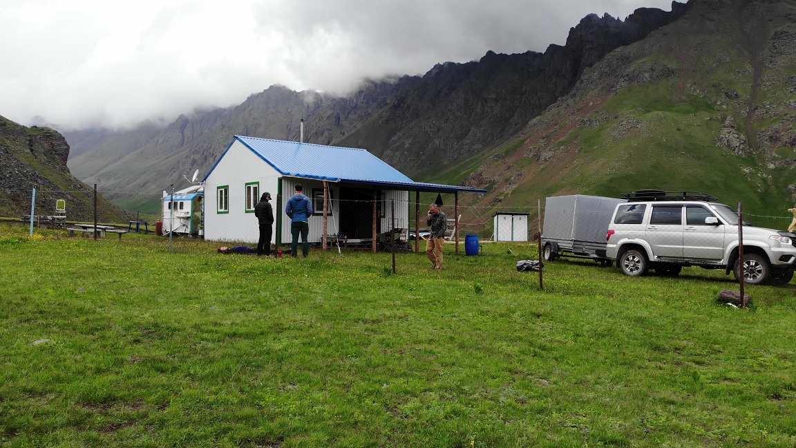
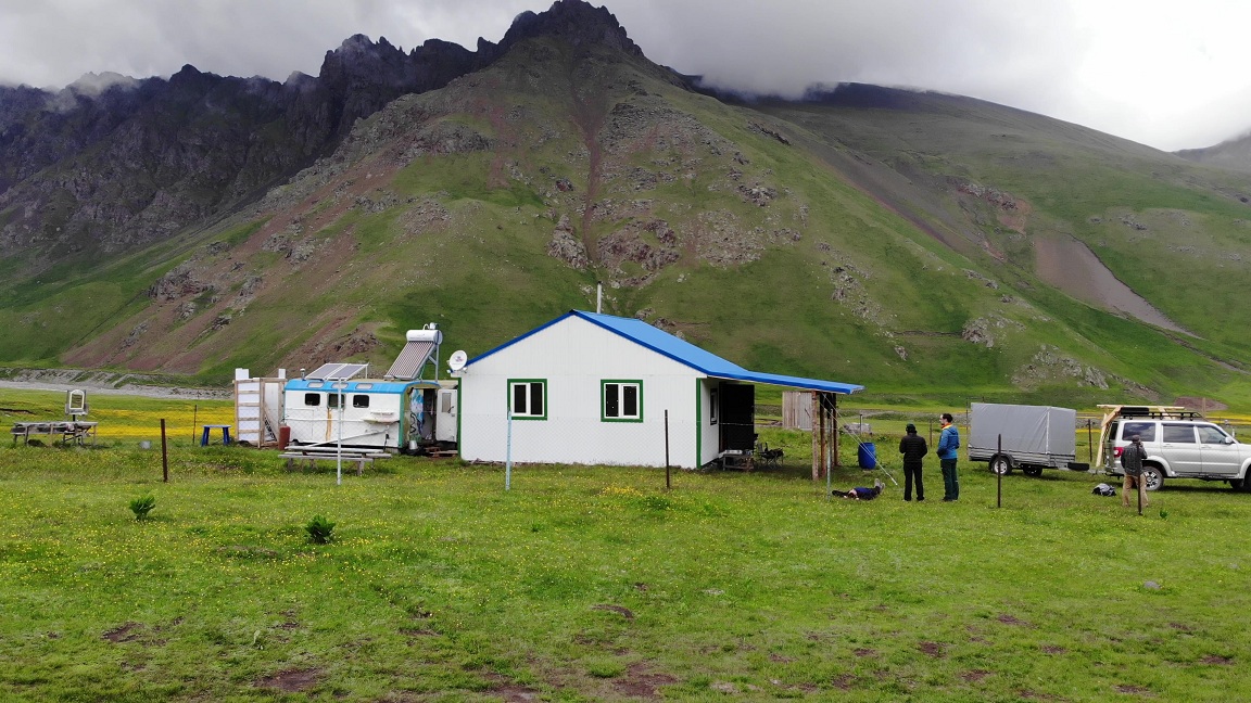
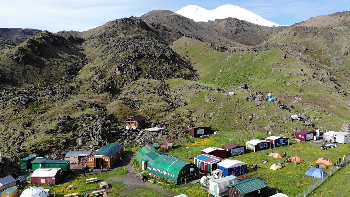
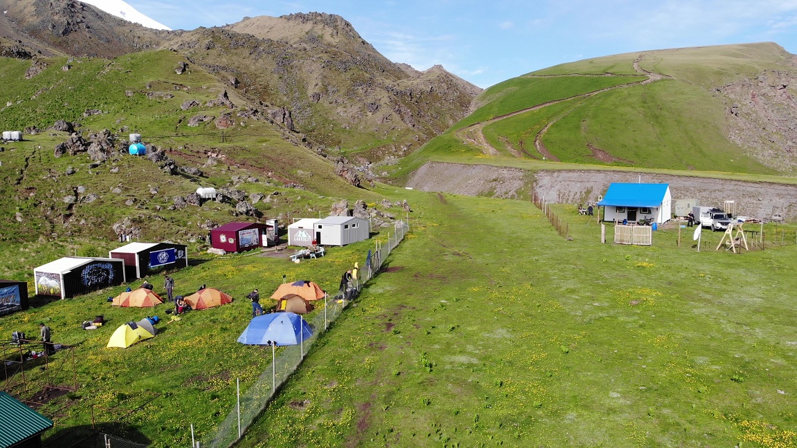
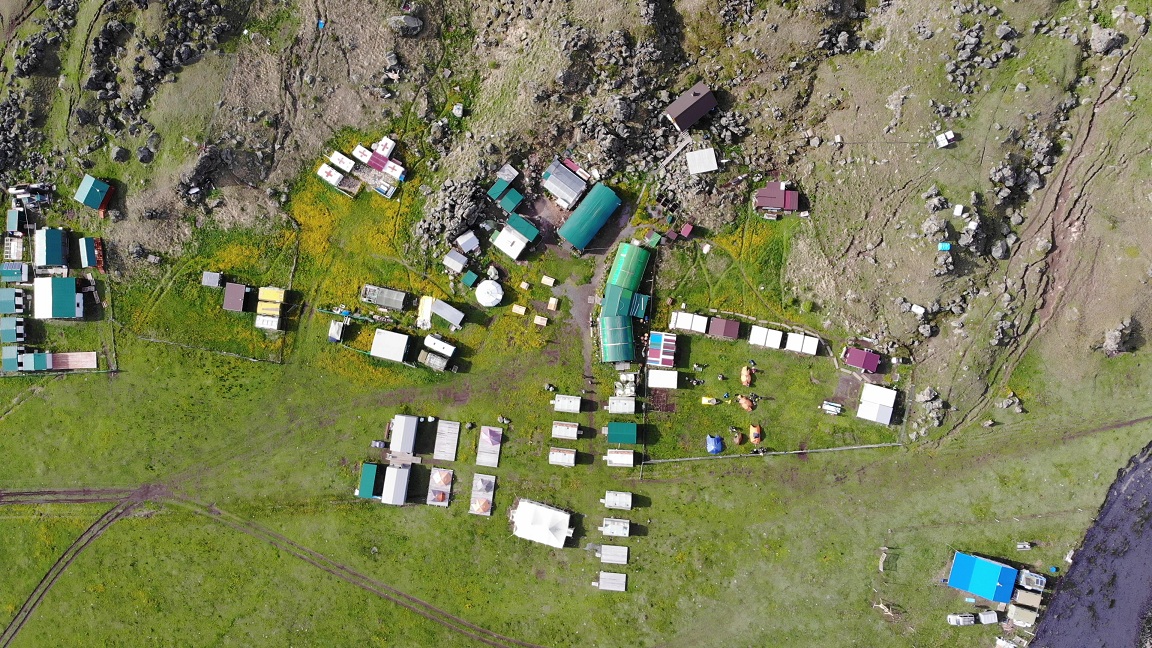
Base camp 2600 м.
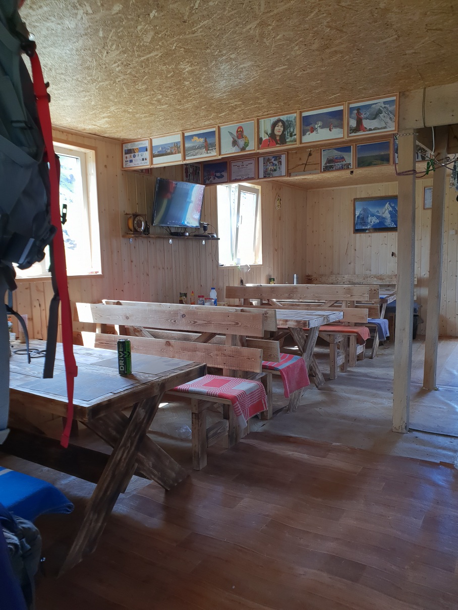
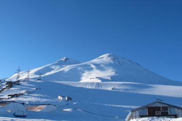
Base camp. It is located at an altitude of about 2600 m, on the large green plateau of Irakhiktyuz near the confluence of the Kyzylkol and Karachaul streams, from which the Malka River is born a little lower.
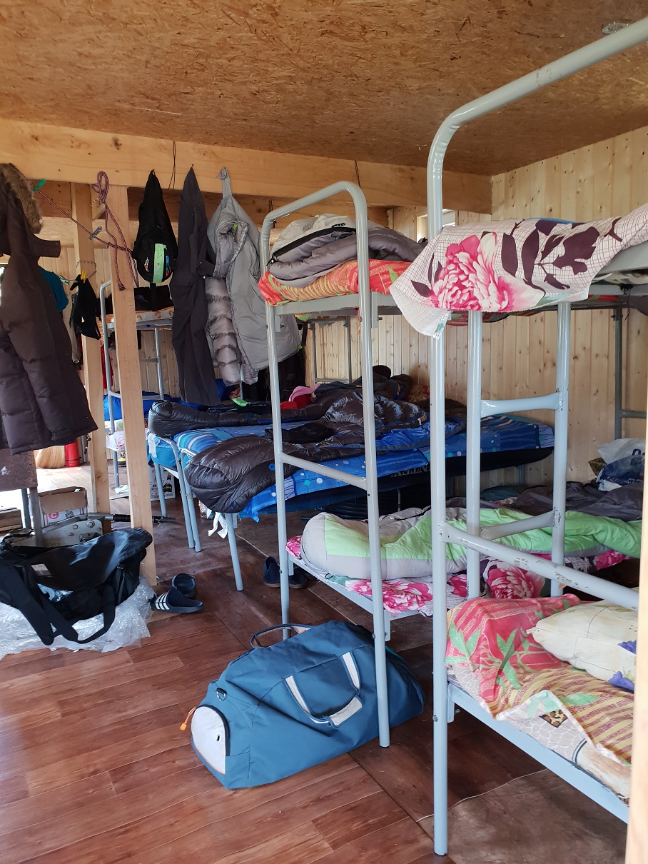
- Accommodation — in houses.
- Three meals a day, plus snacks.
- GSM mobile communications
- Internet
- Electricity (generator)
- Hot shower
- Water — spring
- There is a narzan mineral spring nearby.
- Incredibly starry sky)) Which allows the base to be considered a «thousand-star hotel»))
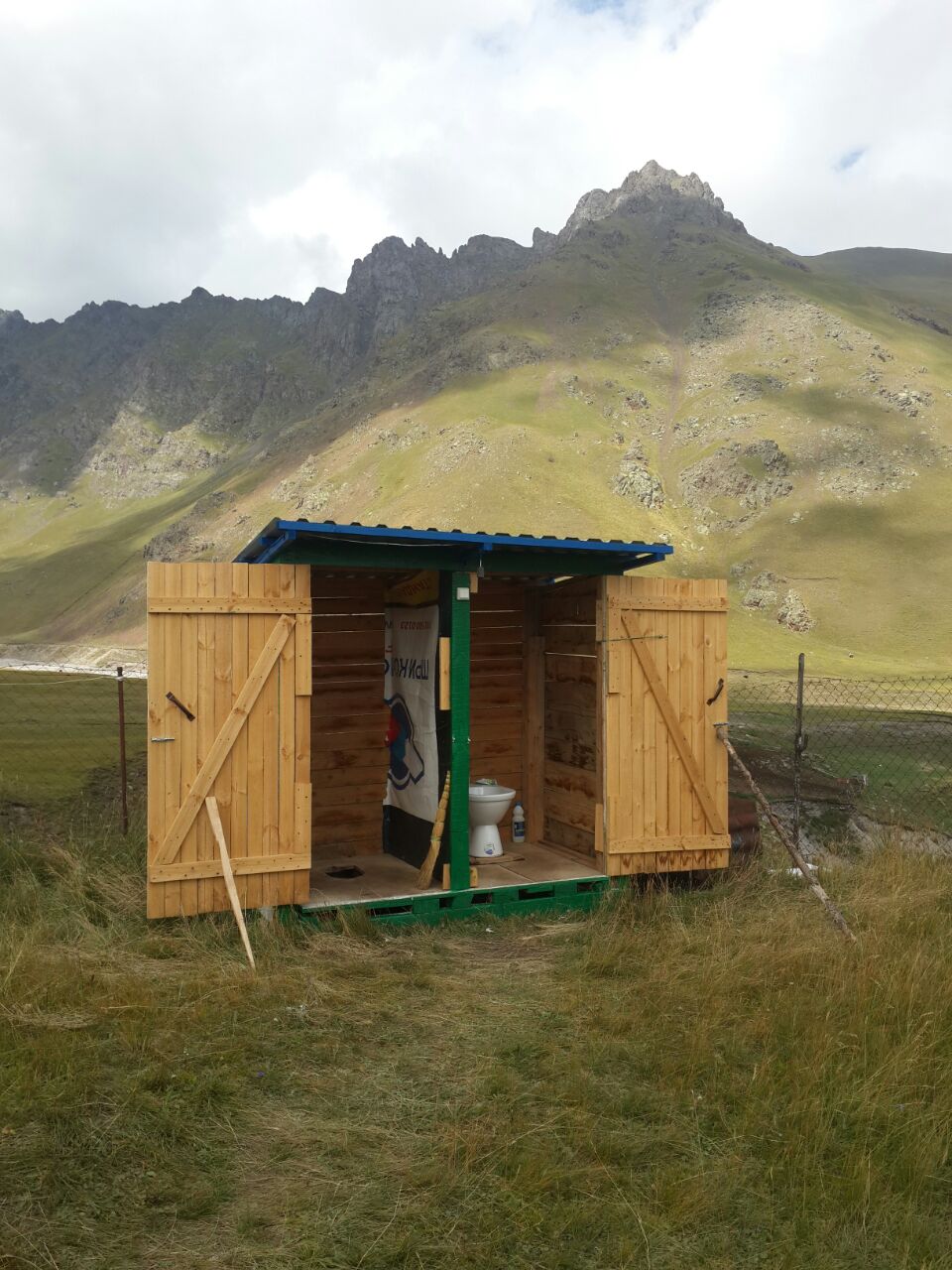
Huts with beds, hot shower, washbasin, toilet, kitchen, dining room, Wi-Fi, TV. On one side of the plateau there is a beautiful ridge — Kyzylkol with peaks up to 3600 m, on the other side — lava hills climbing to the border of eternal ice, covered with various vegetation: there are berries, useful herbs, rhododendrons. The glade offers an excellent view of the Karakay and Balyksu peaks, as well as the legendary Kanjol plateau, which lies twenty kilometers to the northeast. A five-minute walk from the camp there is a source of narzan. In August, the Silver Spring begins its life — a crystal clear cold stream coming from the mountain, according to local legends, strengthening health. On the bank of the Kyzylkol River, next to the glade, there are several pastoral summer yards where you can buy local homemade bread, cheese, ayran, milk, lamb. Four kilometers walk along the trek, three hundred meters lower of camp, there is the Dzhily-Su tract, in the vicinity of which there are many sources of mineral water narzan, hot springs, waterfalls, a cafe, a small shop.
Summit camp 3800 м.
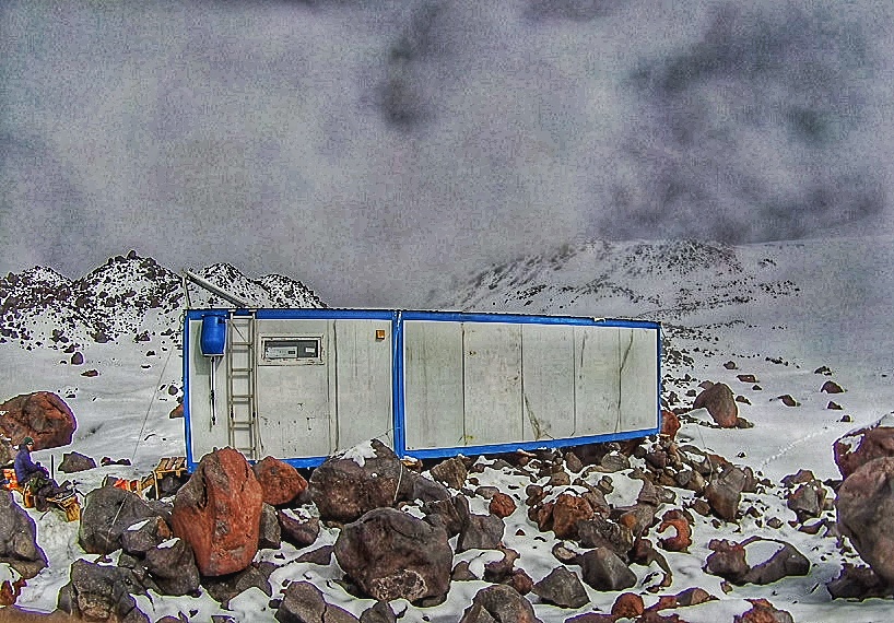
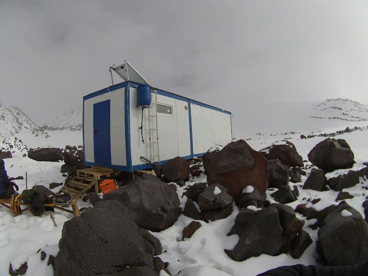
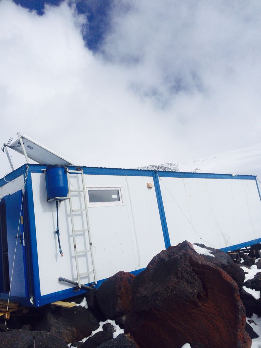
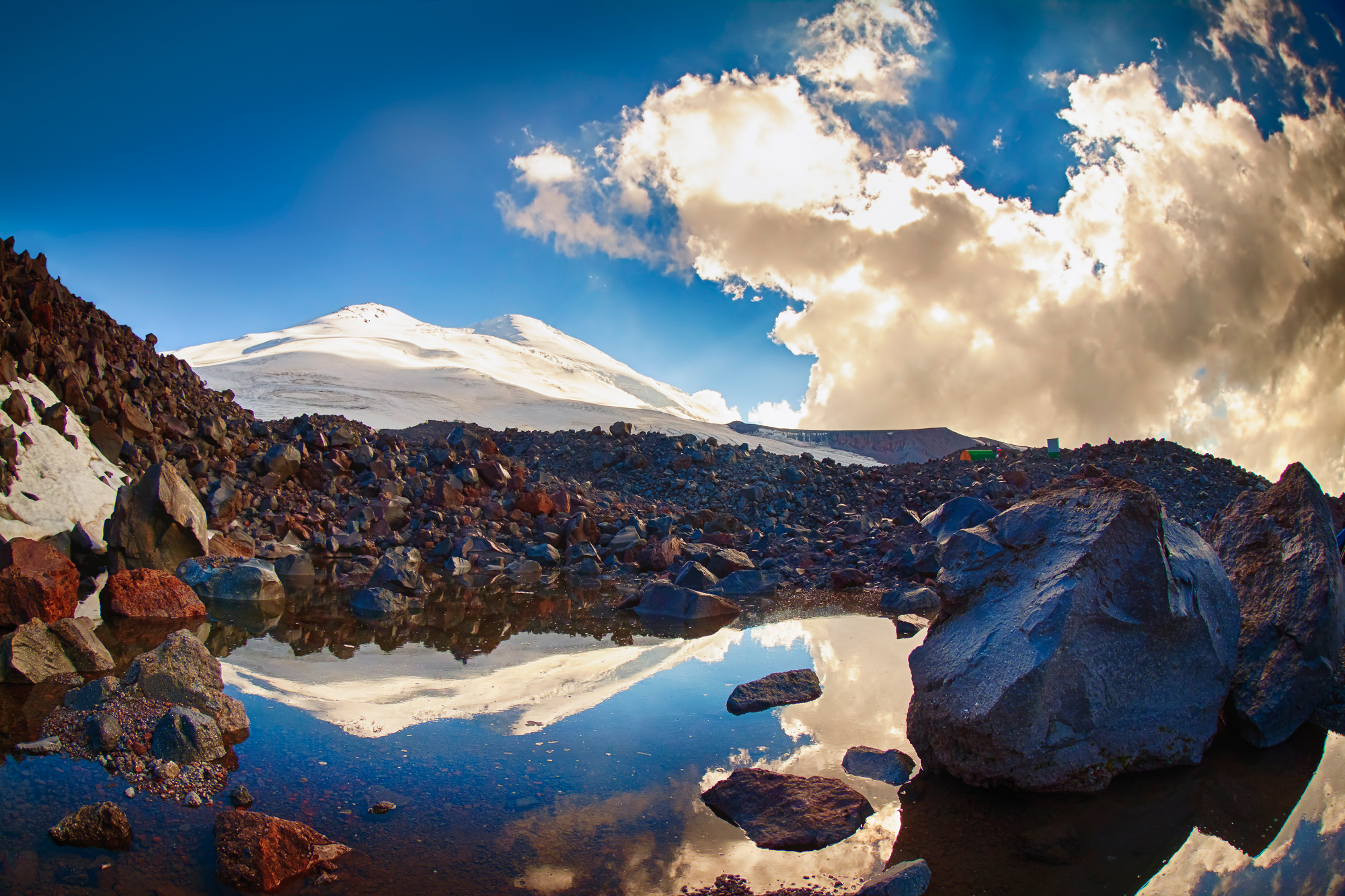
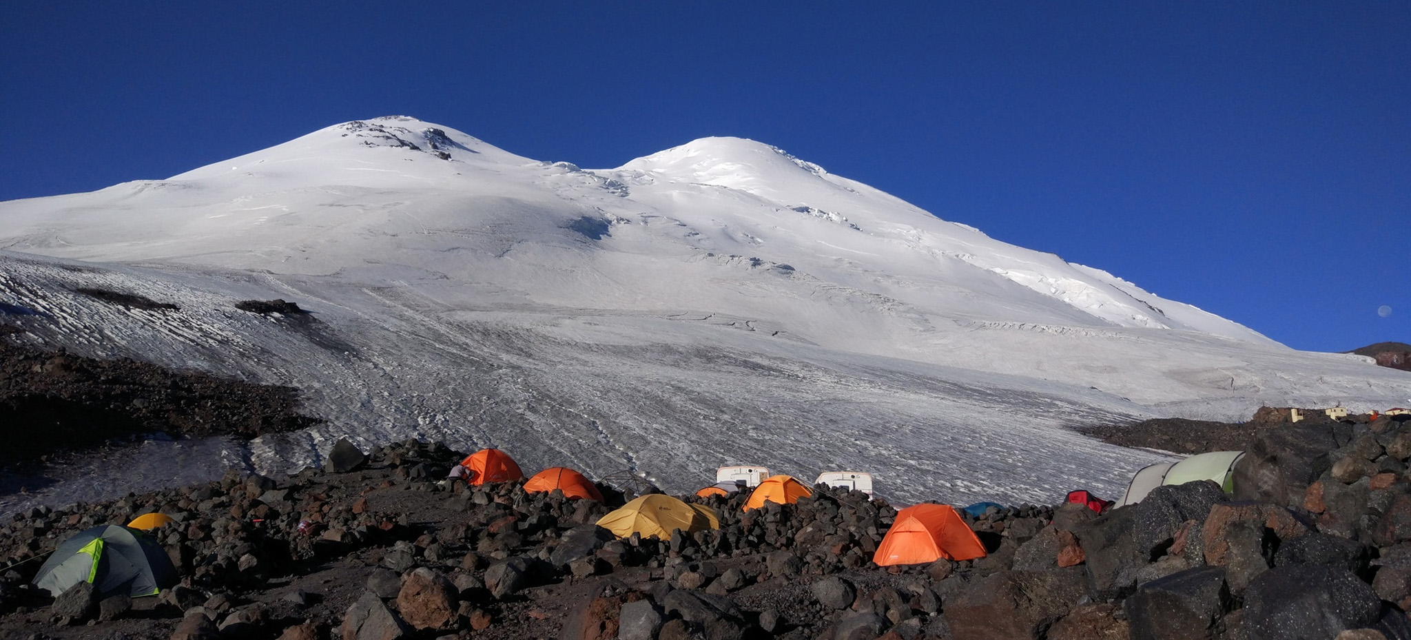
Summit camp.Located at an altitude of 3800 m, on the moraine of the glacier.
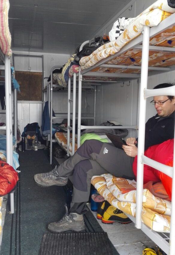
- Accommodation — in wagon house.
- Electricity (generator).
- Meals — three meals a day, plus snacks. Lunch bags and hot water for acclimatization and climbing.
- Water — glacial, melted, clean.
- Communication — depending on the mobile operator, it can be a little better or worse, it does not work everywhere, but on most of the moraine it is anyway.
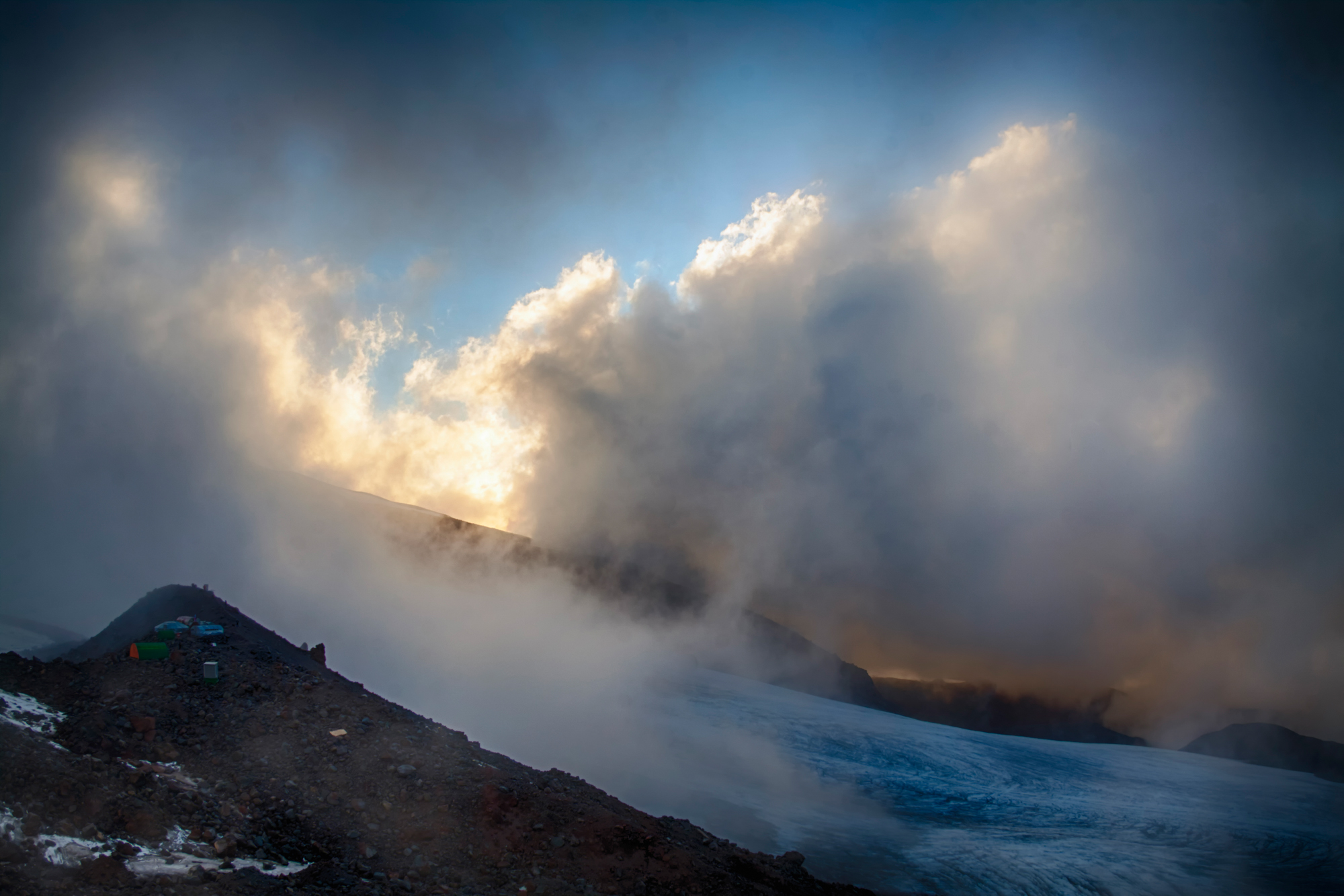
At night, the temperature drops below zero, however, due to the dryness of the mountain air, it feels mild. During the day, streams of melt water flow here, the sun shines brightly, clouds form in the evening, but on bad weather days it is quite harsh here: the wind can reach 60-70 kilometers per hour in gusts, it even happened that it carried away the houses fixed with cables; a lot of fresh snow may fall, and revenge for a couple of days, a thunderstorm with hail may come, and then the camp is located right in its epicenter. After sunset, the clouds descend below the level of the camp, and the lights of towns and cities are visible across the horizon, scattered across the vast expanses of this region. Close stars, the Milky Way, are lit in the sky, closer to the middle of the night, chains of climbers’ lanterns begin to appear on the slope.
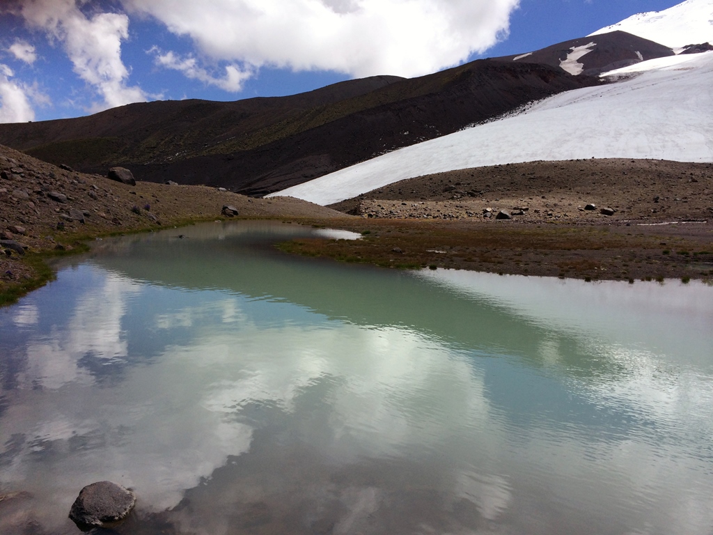
There are several stationary camps on the moraine, with sleeping places, a kitchen, and cooks. The dining areas here are a little smaller than downstairs, but there is plenty of room for everyone. There is no shower, you can take an invigorating bath in small lakes of moraine, in which the water has time to warm up a little by the sun, or wash yourself in a stream of melt water.
Connection. Mobile coverage is available at both camps and, depending on the weather and mobile device, it works on the climbing route all the way to the summit.
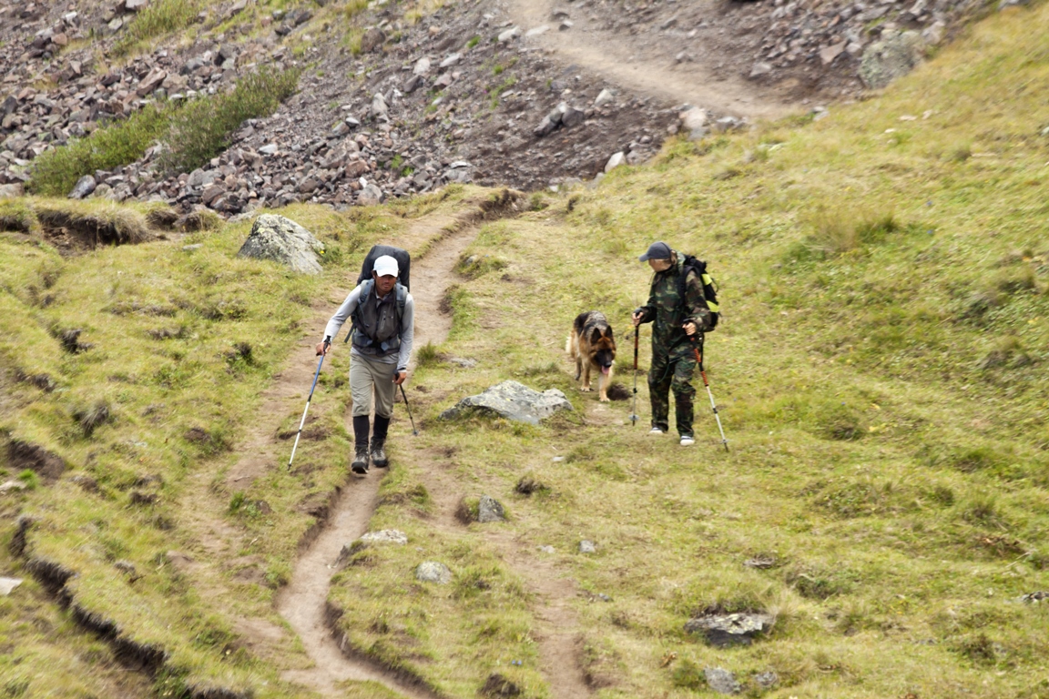
Acclimatization days and walks. During all hikes there are intermediate pauses for rest. During these treks, the team adapts to the conditions, to each other, a feeling of a comfortable pace, a possible pace, and the team’s capabilities are developed. Climbing Elbrus is a big task, and a worthy test, and for all the days of preparation and adventure, the team must unite, become, in fact, a team, friends, in order to have the greatest human, physical and psychological potential in any situation. For a person, there is no support stronger than another person. And all this is not happening on purpose, just the main thing to remember is that the most important thing in the mountains is people.
These hikes can take place in good weather conditions, with the sun, blue skies and light clouds. And they can pass through very difficult ones — rain, wind, hail, dampness, cold. On acclimatization days, hikes take place in any weather (the exception is a strong thunderstorm, but usually it does not last long and is simply waited out). In general, the morning and the first half of the day have the best weather conditions, in the evening the weather can become more daring, so the main part of the work takes place in the first half of the day.
Acclimatization access to snow and ice coincides with the ascent route, and, in addition to adaptive goals, also pursues the goal of mastering or updating the skills of walking on snow and ice in crampons, walking in a bundle, optimizing other processes associated with work during ascent.
All these walks and transitions are quite long and energy intensive, so you need to try to have a good rest in between, in order to try to approach the moment of ascent in optimal shape, acclimatized, but not too tired.
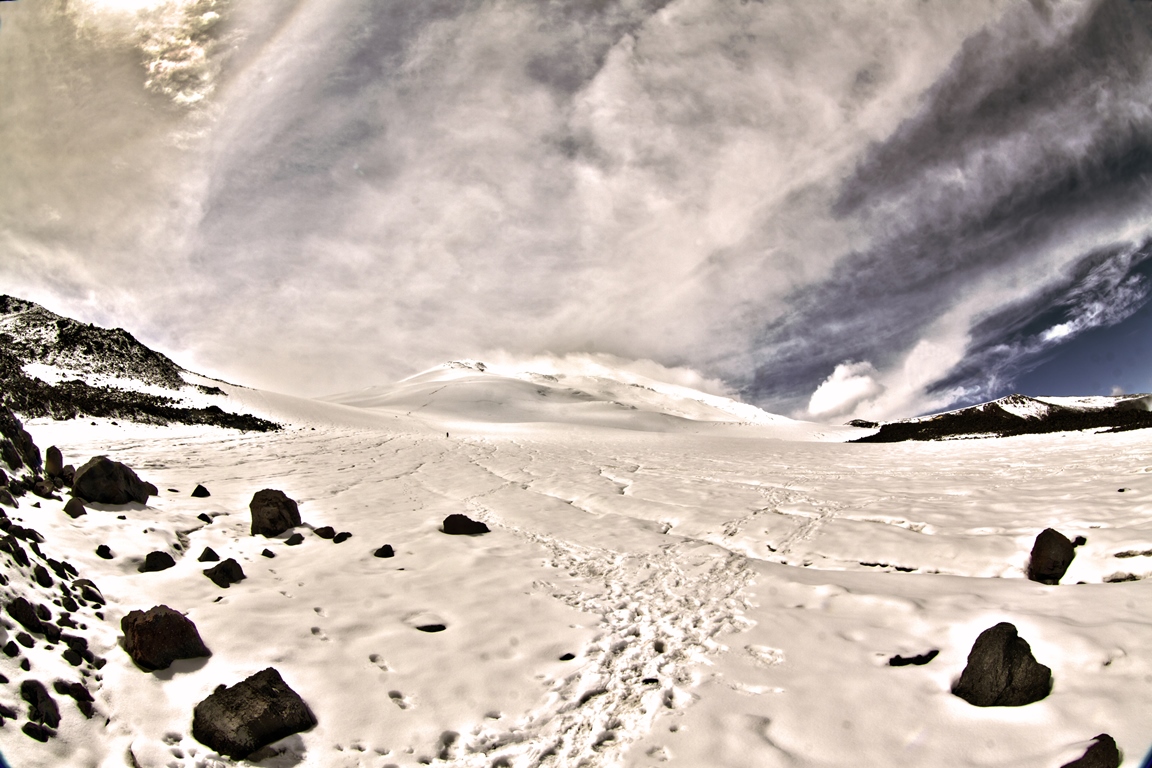
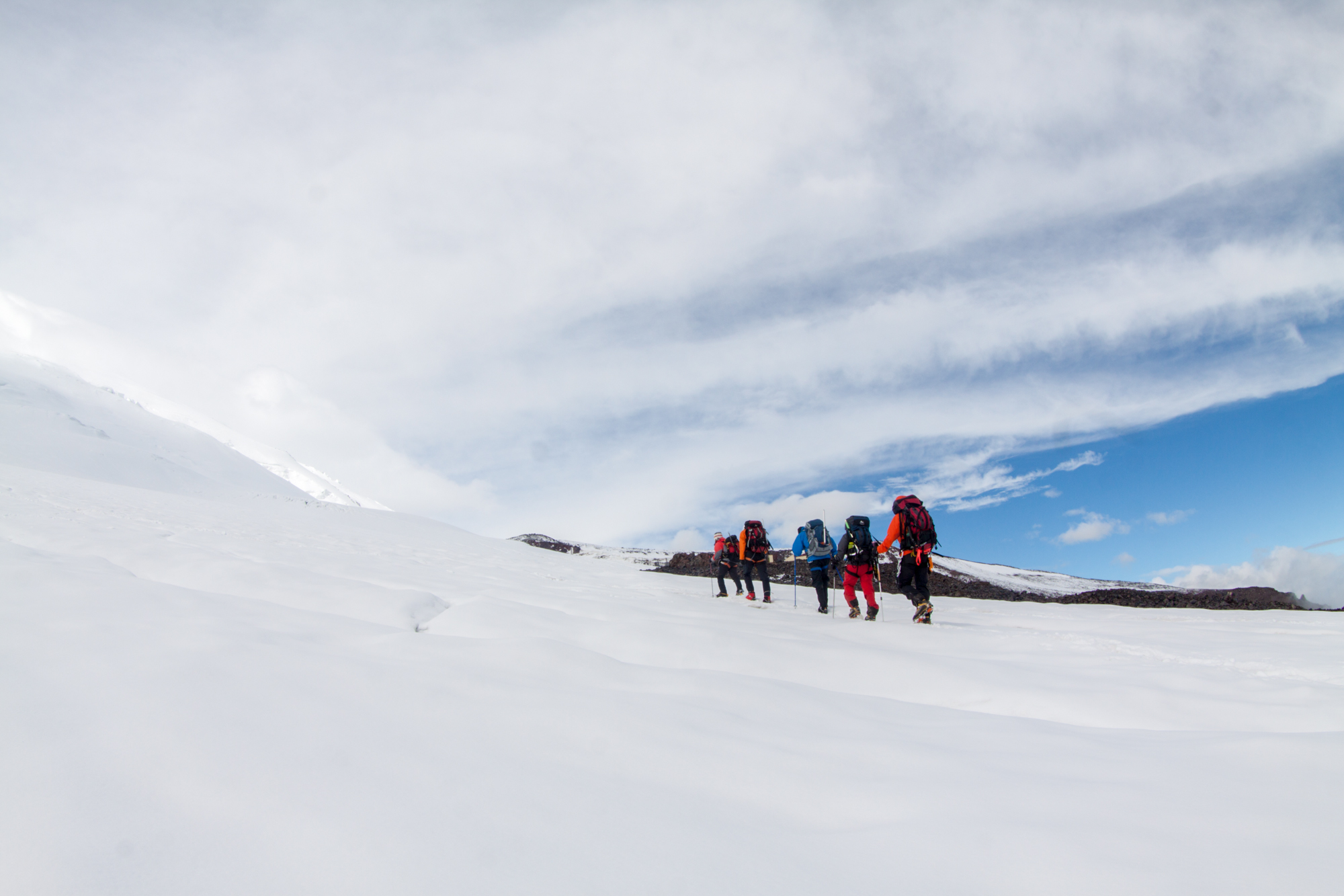
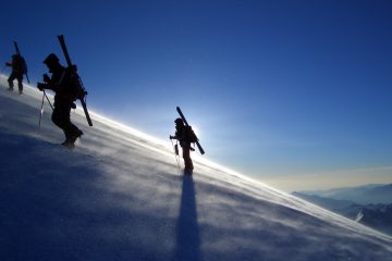
Summit day. Early rise at twelve o’clock at night. Breakfast. Cooks prepare boiling water for thermoses. Filling thermoses. Take lunch bags. Departure at 2 am. 8-10 hours for ascent, 3-4 hours for descent — these figures can be considered a good average for most groups to the East Summit in good weather. Well-trained people can manage the Western peak during this time. On the day of the ascent, you need to gain and then drop more than 1800 meters, having traveled more than 15 kilometers (12 km to East summit). And although the slope is not technically difficult and steep, it is a very big job. The human body cannot work endlessly with a constant intensity, it works most optimally for the first eight hours, then its productivity begins to decline sharply, to which is added the influence of some oxygen starvation associated with altitude, sun, wind, dehydration, lack of sleep (or even a night without sleep before climbing), fatigue accumulated over the previous days. The peak also makes its own adjustments: the turn back time fluctuates around 13 pm, very often after this time the mountain can experience problems above five thousand meters, and you should try not to take part in them. People who go to Elbrus from the South, reaching as high as possible using technology (lifts, snowcats), can afford to walk, gaining 100 m of height in an hour. There it can be done, and a less prepared person can succeed more there than a more prepared one from the North side. But the mountains are not for competition. From the North, the optimal pace can be considered an average of 250 — 300 meters of altitude per hour. At any level of acclimatization and preparation, a comfortable pace will decrease with altitude. In a more prepared person — to a lesser extent. Therefore, the first half of the route can be at a pace of 300 meters per hour, and 400 meters per hour and even 500 in specially prepared cases. Above five thousand, the pace can drop to 200 and even up to 100 meters per hour in height. One of the tasks of the guide is precisely to study the physical form of the team in practice during the days of preparation, and on the ascent, as correctly as possible, choose the pace that suits both the team and the Mount. It is important to understand the point well: The mountain is very closely involved in what should be the pace, sleep, food, drink and other aspects of life and activity here. For example, if a person is going to start walking, gaining 100 meters per hour, he needs to prepare better, either choose another mountain at the moment, or, if he really wants to climb Elbrus, go from the South, simplifying his work as much as possible.
Up to the Upper Lenz Rocks at 5200 m, the route is the same as the route to the Eastern Summit, and the trail can be very comfortable. Further, to the West summit till the saddle, if fresh snow or wind, it may be necessary to trail. From the saddle to the West Summit, the route is the same as the classic route from the South, and the trail is usually not bad, however, and there can be enough people on it.
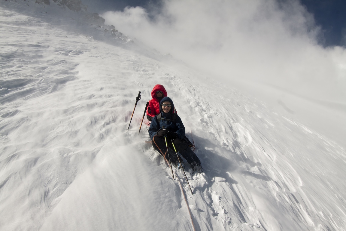
The main part of the route is with trekking poles. On the route there is a zone of cracks, periodically representing a potential danger. Such places are walked in a bundle.
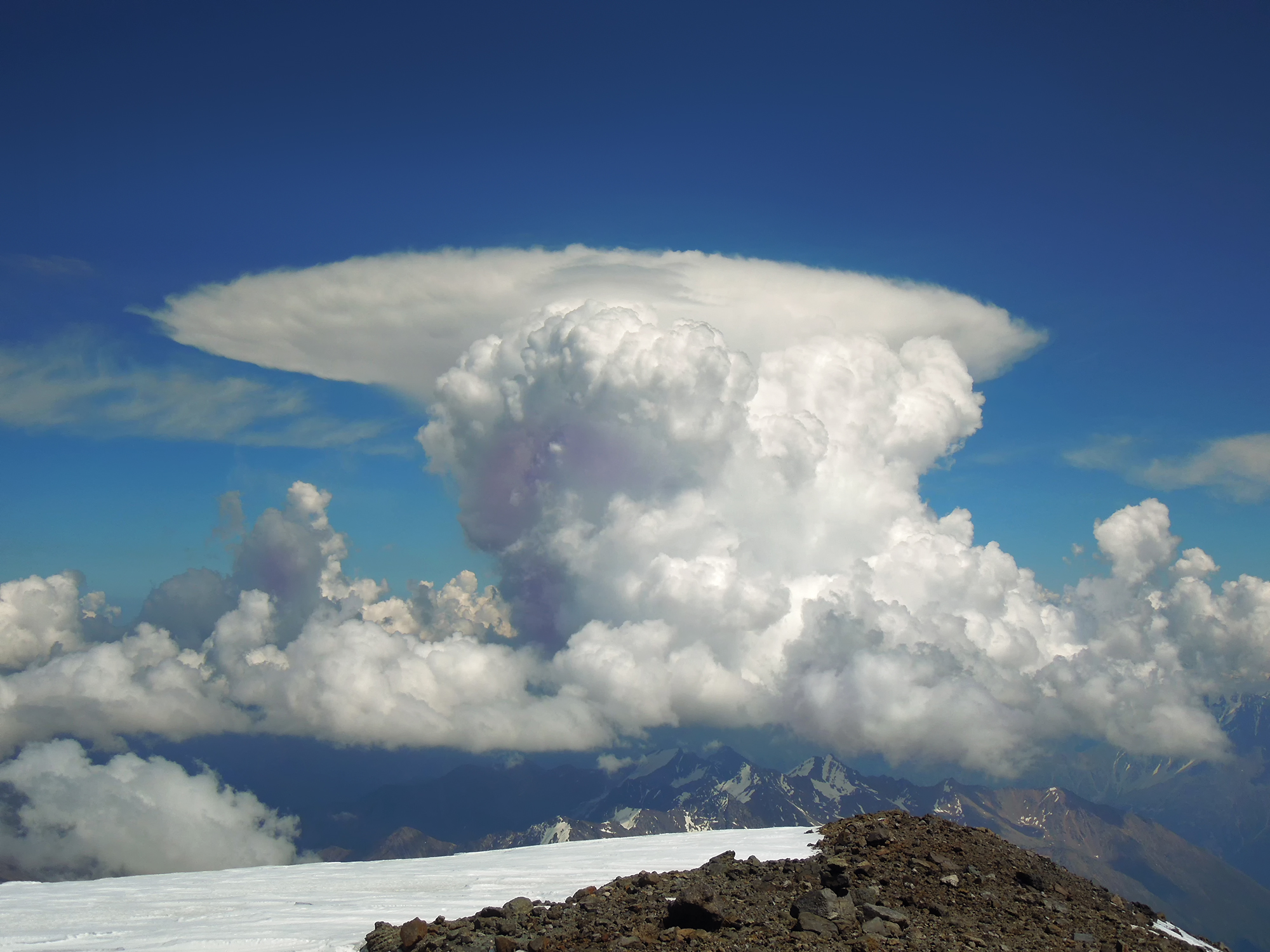
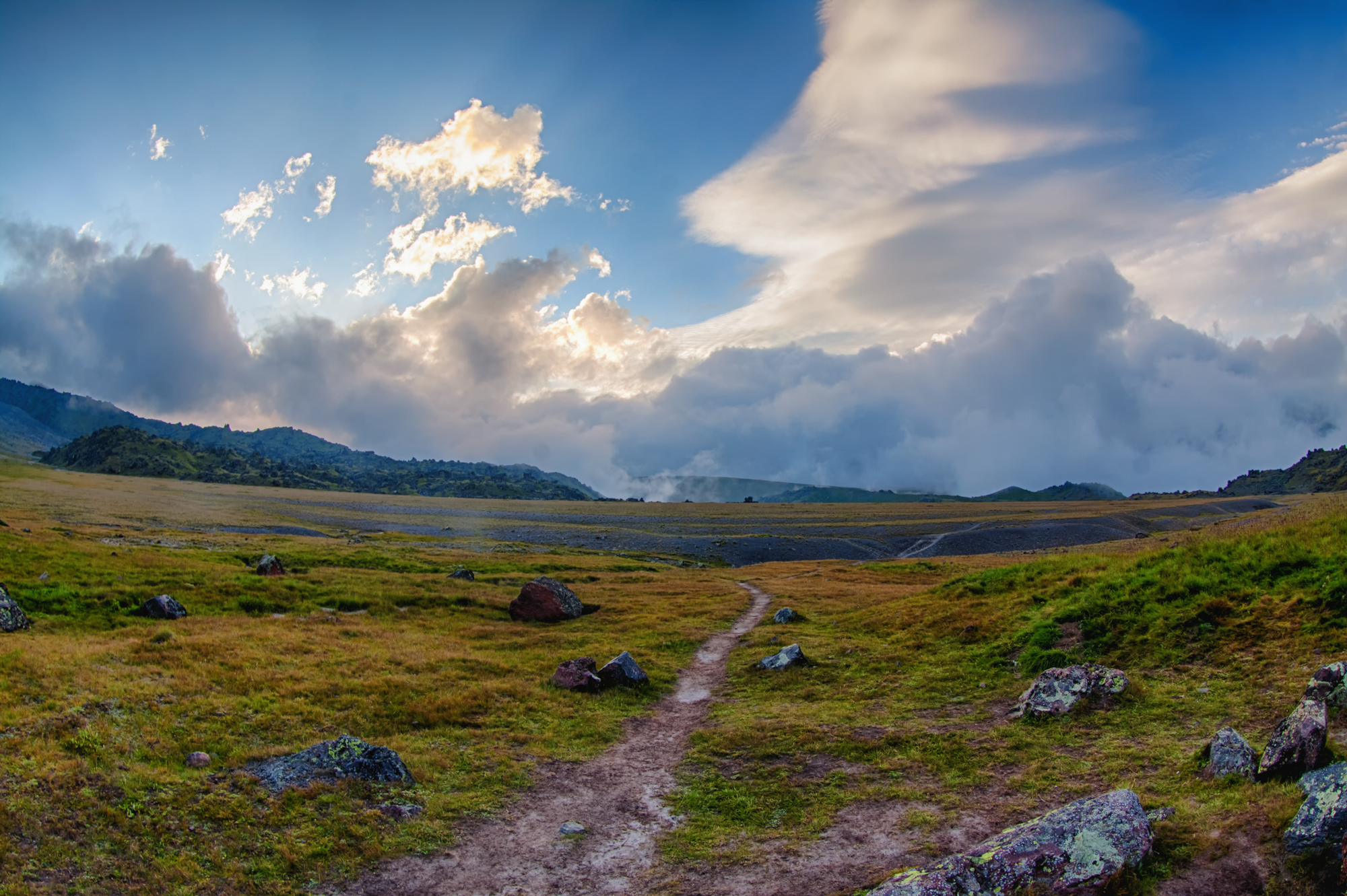
Season. In general, the vast majority of ascents occur from July to October. The best time for climbing can be considered July and August, this is the peak season. By this time, all winter snow had already melted, it is warm, and there is a sufficient duration of daylight hours. In June and September, the ascent can also be quite successful. In June there may be more snow than in the middle of summer, but at this altitude it is spring here all around, and everything is in bloom, numerous mountain meadow flowers and rhododendrons. In September, the situation with snow and ice can be even more stable than during the peak season, but the daylight hours become shorter and the average daily temperature drops, often even at the base camp can drop to zero at night.
Regardless of the time of the season, weather and other things, this adventure is worthy of a Human. If you feel worthy of it, we are waiting for you in our area, we will try to do everything possible so that everything works out for you. Welcome and see you on the Mount!
Join our groups. We have :
- Guaranteed meetings and transfers from Mineralnye Vody or Nalchik any day and time.
- No additional fees for transfers.
- The most experienced and professional guides on Elbrus english speaking.
- We have been in the service since 2003 and therefore have a great experience of successful climbing trips and satisfied tourists.
- You can join the group later or leave early with the return of unused nights from the hotel.
- Convenient number of tourists in groups from 4 pax to 10 pax (not more).
- Support from our KavkazSkiTour office around the clock in the city of Nalchik, with a close location to Elbrus, which allows us quickly resolve any issues that arise during the trip.
- Safety support and quick contact with medical, emergency and insurance agencies.
Preliminary application
TOUR DESCRIPTION
Day 1: Arrival to Nalchik.
Meeting at the airport or railway station of Mineralnye Vody and/or Nalchik. Transfer to a hotel in the city of Nalchik. The road from Min Vody to Nalchik takes about two hours. Accommodation in a 2-3* hotel in Nalchik in the center and park area. Preparation of equipment, you can leave extra things that will not be needed on Elbrus in storage room of hotel or in our office. Evening city tour. You can have dinner in the park in one of the various cafes with national cuisine (for an additional price).
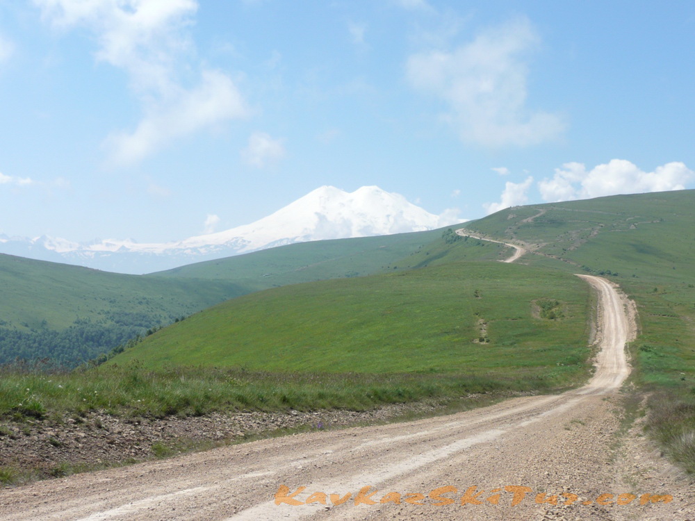
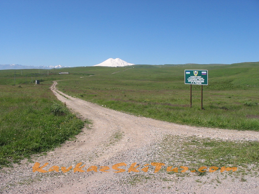
Day 2: Transfer from Nalchik to the North Elbrus.
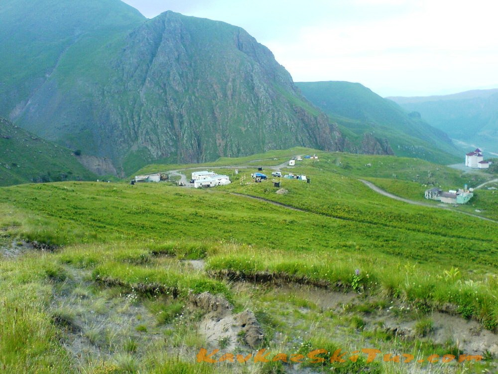
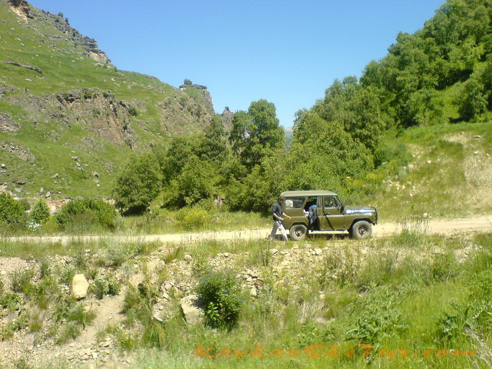
Early breakfast. At 8-30 a.m. transfer to North side of mount Elbrus through village Malka. Time of transfer by 4 wheel cars from Nalchik till Elbrus north takes about 4-5 hours depending from road condition and weather. Arrival to the Base Camp at 2600 m on the plateau Irahiktyuz, accommodation, dinner.
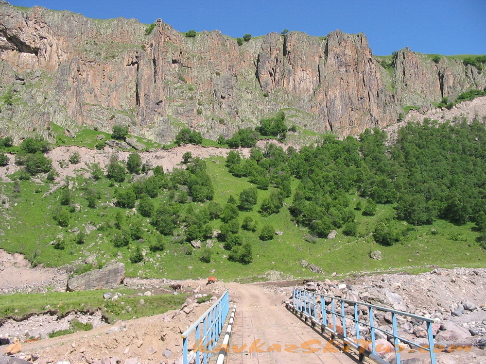
The road to Elbrus North is one of the most difficult and exhausting. To be more exact there was no road at all up to 1980-s. Now there are two roads leading there from two different sides of Malka canyon but they still remain tiresome.
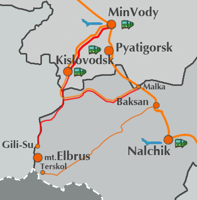 After about 40 km of federal road from Nalchik in the direction to Min Vody we turn from the main road in village Malka to canyon Malka. The comfortable road goes again about 40 km up till village Kichmalka in a good condition. From here starts the difficult path till north base camp of Elbrus.
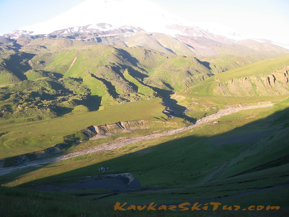
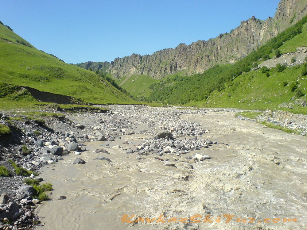
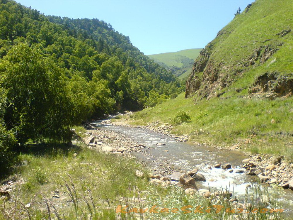
Following the stream of the river Khabaz, we reach the river Khasaut and the tourist hotel “Valley of Narzan” reminding of an old castle by its form. There are 14 natural mineral springs here: each has its own specific qualities which are superb. From here we drive 10 km more till the base camp.
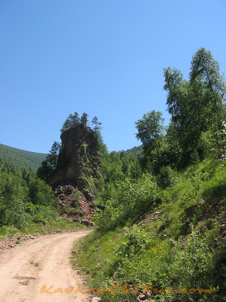
On the way after the Valley of Narzan there is the place we can see one more wonder of Elbrus Country – megaliths. There are several megaliths. Most of them are about three meters high. Its upper part is made like the warrior’s head in helmet. Megaliths is one of the most puzzling mysteries here.
You can get a lot of very interesting information about European megaliths in the WEB but not about Caucasian ones. Judging by the peculiarities of graving we can detect here the traditions of fore-Asiatic and Cimmerian art. This monument – if to judge by the features – may be referred to Scythians. As for the helmet it is the so called Assyrian type. It means that the monument goes back to the beginning of the 7th century BC.
There are megaliths in other parts of Kabardino-Balkaria, too. For example, one megalith of improbable size was found in the canyon Tuuz-Sirt, to the south-east from village Nizny Chegem. Another one is a graven image of some ancient deity or animal made from the whole block of granite.
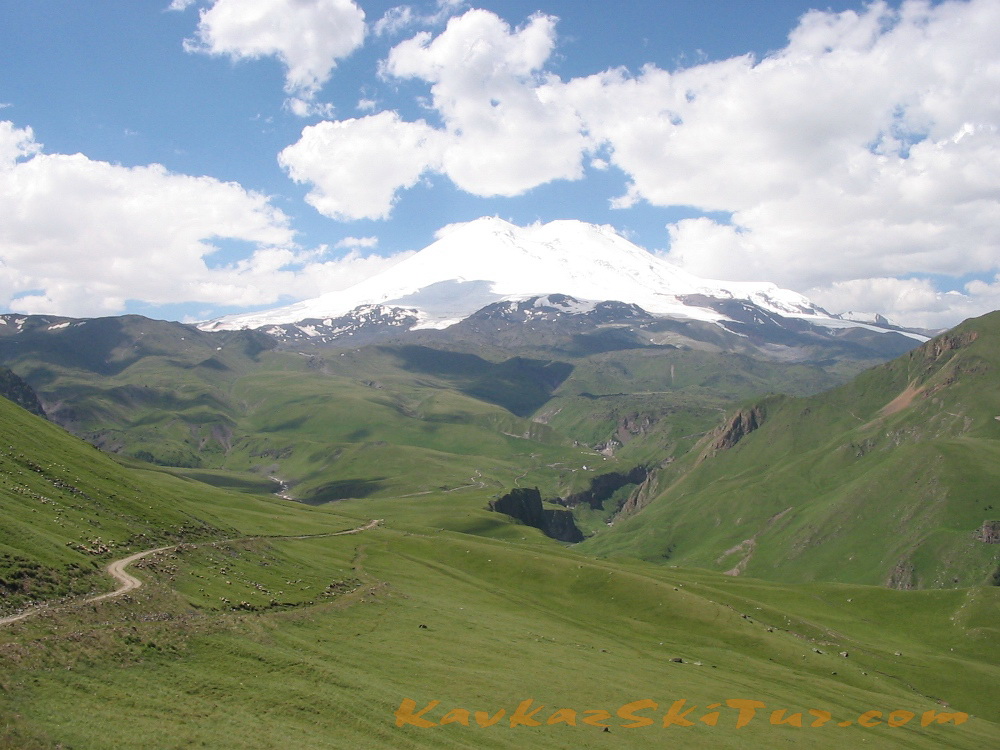
Approaching Gili-Su (2380 m) through the plateau with the watershed of the rivers Ingushly and Malka – you’ll get a marvelous view: Rocky Range with two beautiful summits of Western and Eastern Kandjol.
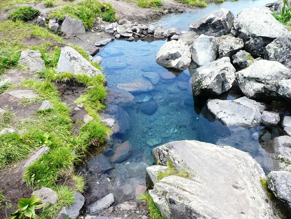
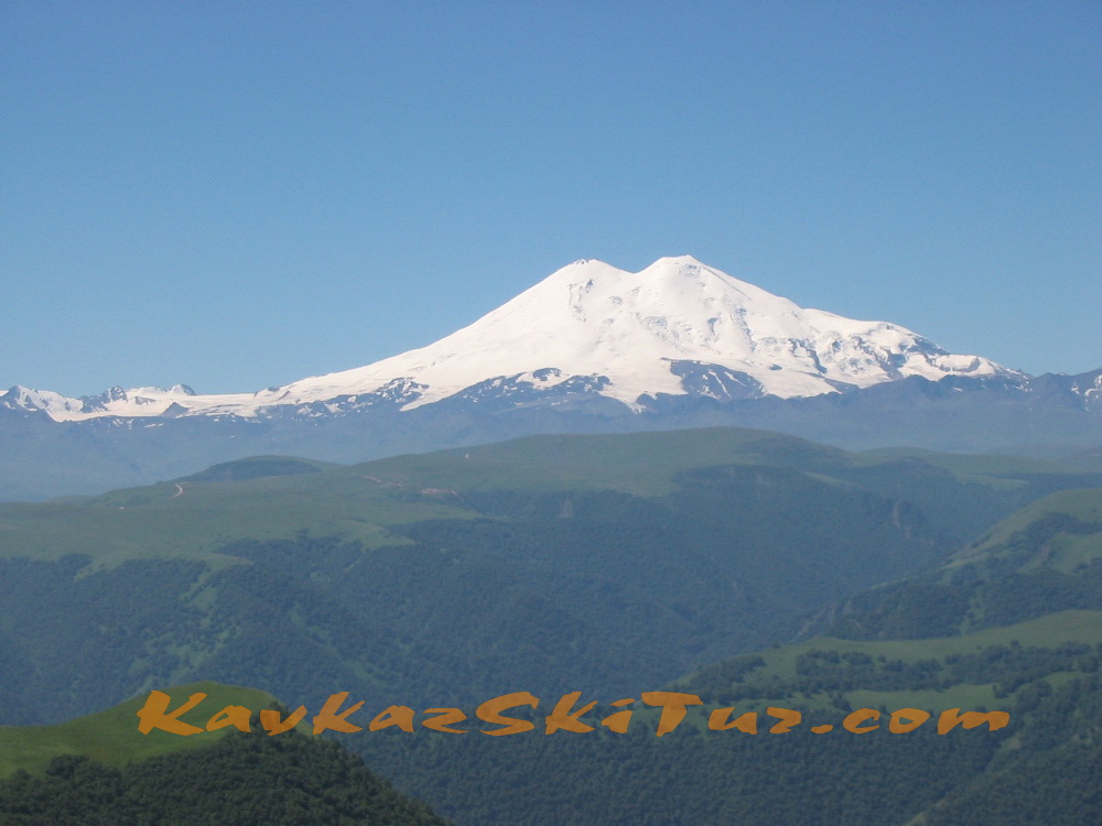
Nowadays it is generally accepted that the formation of Elbrus volcano and its activity began about 4 million years ago and was over about 4,5 -5 thousand years ago. Elbrus is an inactive volcano but some volcanic processes are still going on that can be detected by the temperature of water from the mineral springs (up to 24 grades C). Gili-Su springs are among them.
Gili-Su is a combination of numerous wonderful phenomena among which mineral springs giving power, energy, health; surprising ancient burials; mysterious megaliths; lakes on the mountain slopes; grand waterfalls; amazing views and a lot of other things. There is even something dealing with the riddles of the recent history: top secret aerodrome of the 2-nd World War.
We may say that Gili-Su is first of all is the creation of Elbrus as it is situated on its northern slope and is inspired by its might.
Only three mineral springs were known up to 1909. Afterwards a powerful landslide closed their outlets. One of the springs disappeared at all as Malka made there its bed. Nowadays we know about several mineral springs in different parts of Gili-Su. One of them is warm (22,4°C). It makes a reservoir with a brook going out of it. Two springs – 120 meters below Gili-Su – are on the banks of Sultan-Gara-Su river. They are often called Misost-narzan after the name of the man who showed the springs to the researchers. The last one – 3,5 km further from the main spring – somewhere below the mouth of Kara-Kaya-Su river.
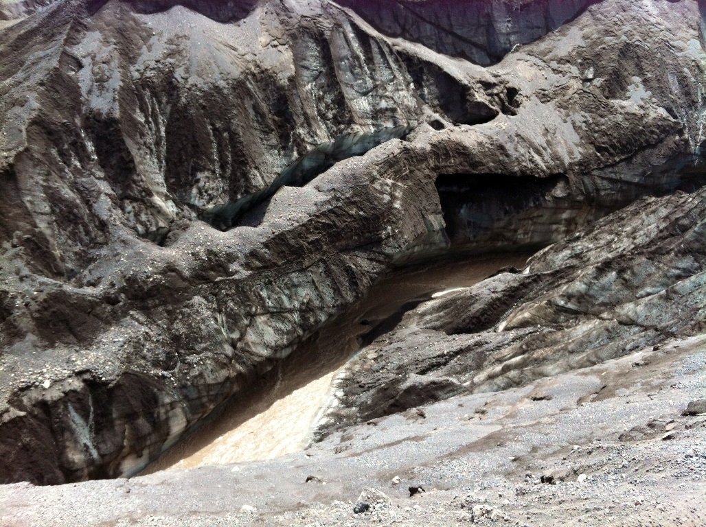
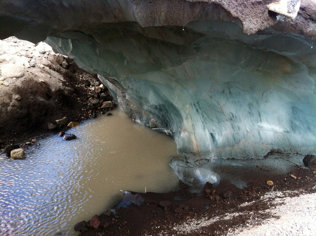
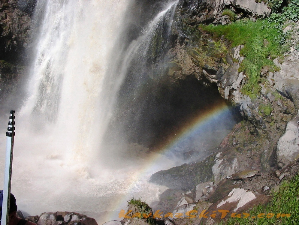
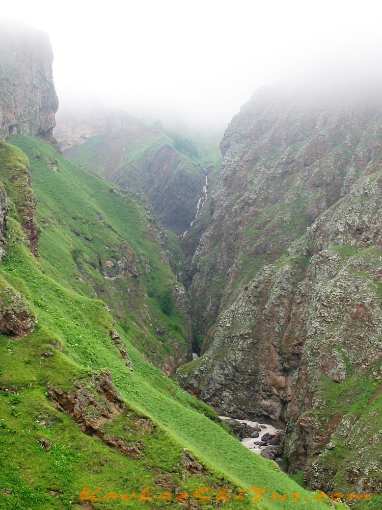
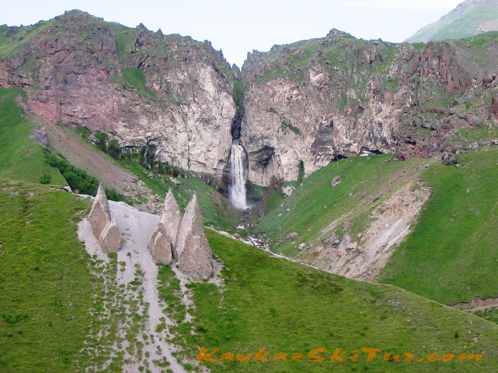
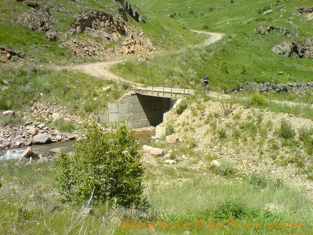
Just near the springs there is a grand waterfall Sultan – an amazing natural monument (35-40 meters high). River Kizil-kol precipitates down from a great height joining the water of river Birghanli-Su at the outlet of the warm mineral springs. A bit further there is one more waterfall – impetuous current falling into the narrow canyon from the height of 27 meters.

One more surprising masterpiece of nature is just behind the waterfall Sultan. It is a stone bridge across the river. Standing on it you experience different – from awe to rapture – feelings caused by a ferocious, wild power of the stream below.
Here is an extract from the book of 1913 by a famous traveler S.Anisimov: “One of the biggest glaciers of Elbrus Ullu-Chiran has one of the most original bridges in the world: it is a huge fallen fragment of rock which narrowed the flow of river Malka turning it into a passage. Malka rages and roars under the bridge but all around there are plenty of blue, white, violet alpine flowers. The stream of Malka, tearing out from volcanic rocks at the height of 40 meters, falls down becoming a striking waterfall with clouds of rainbow-like splashes” (Anisimov A. Kabardino-Balkaria. M., 1937).

Above the springs, an amazingly beautiful view of the valley of the Malka River.
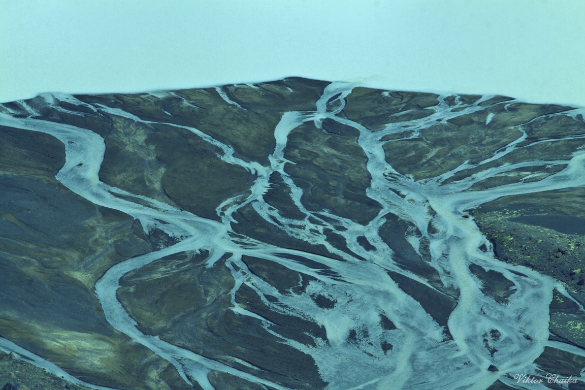
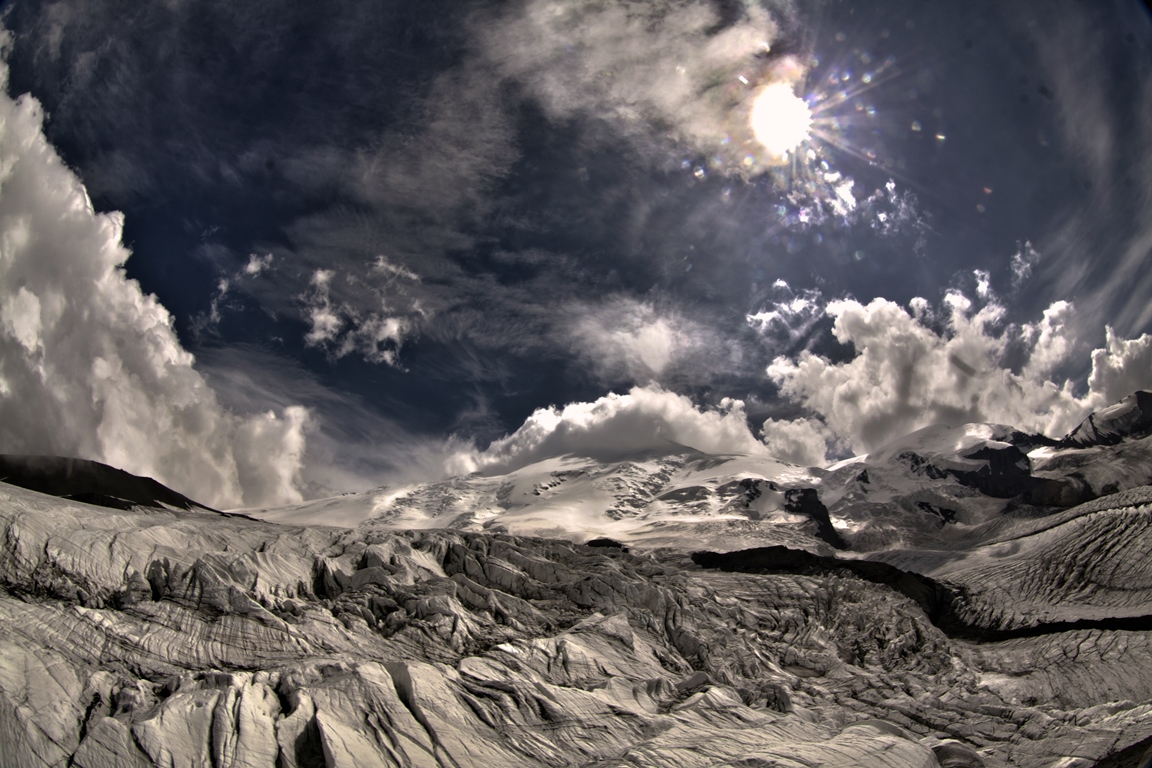
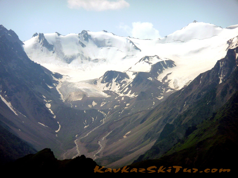
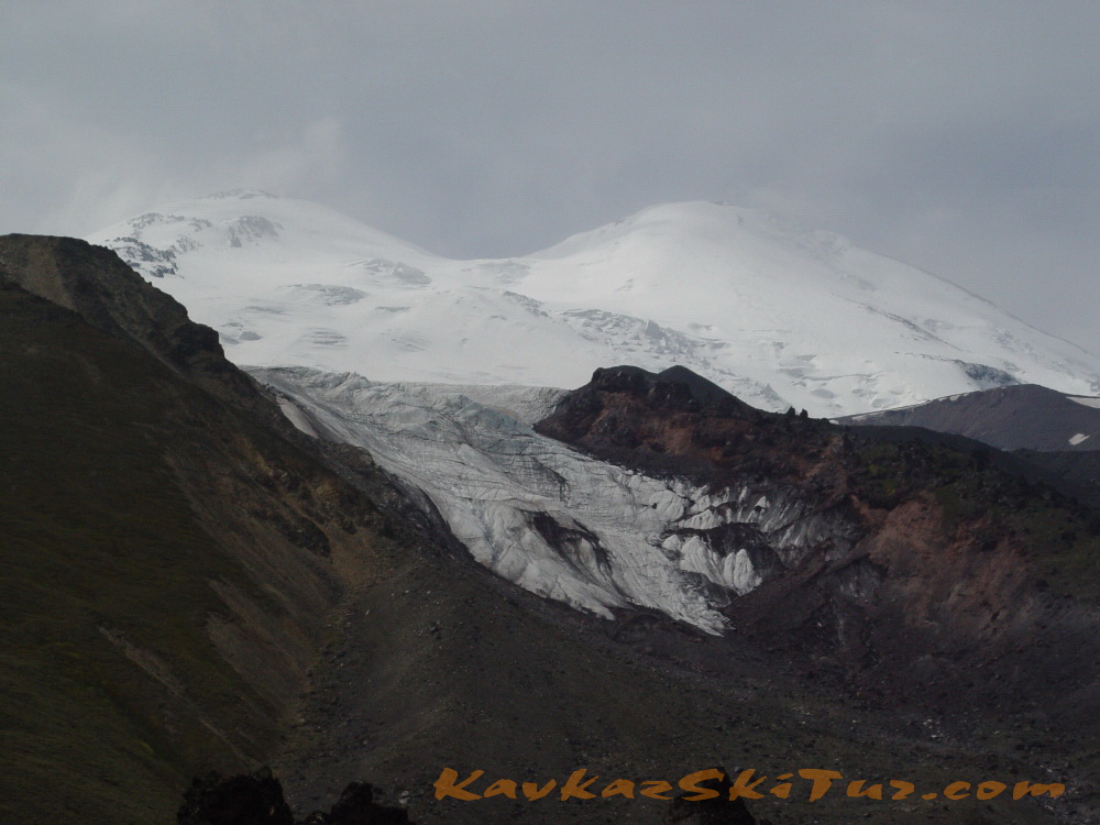
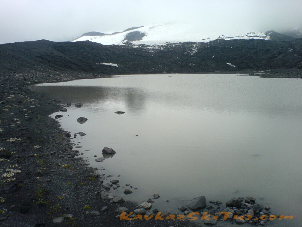
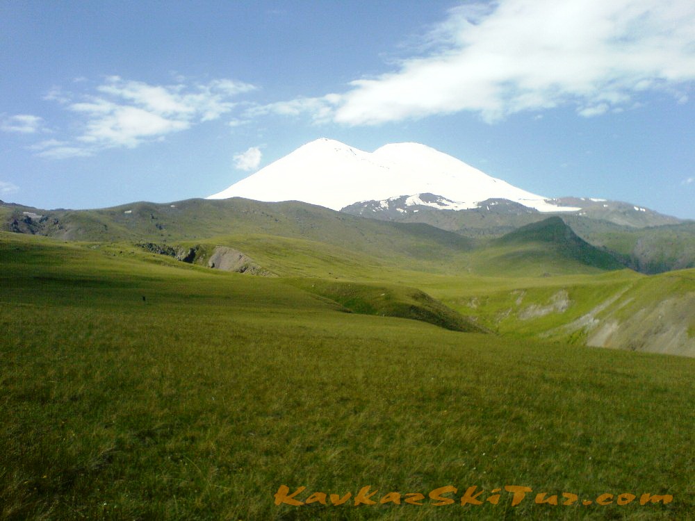
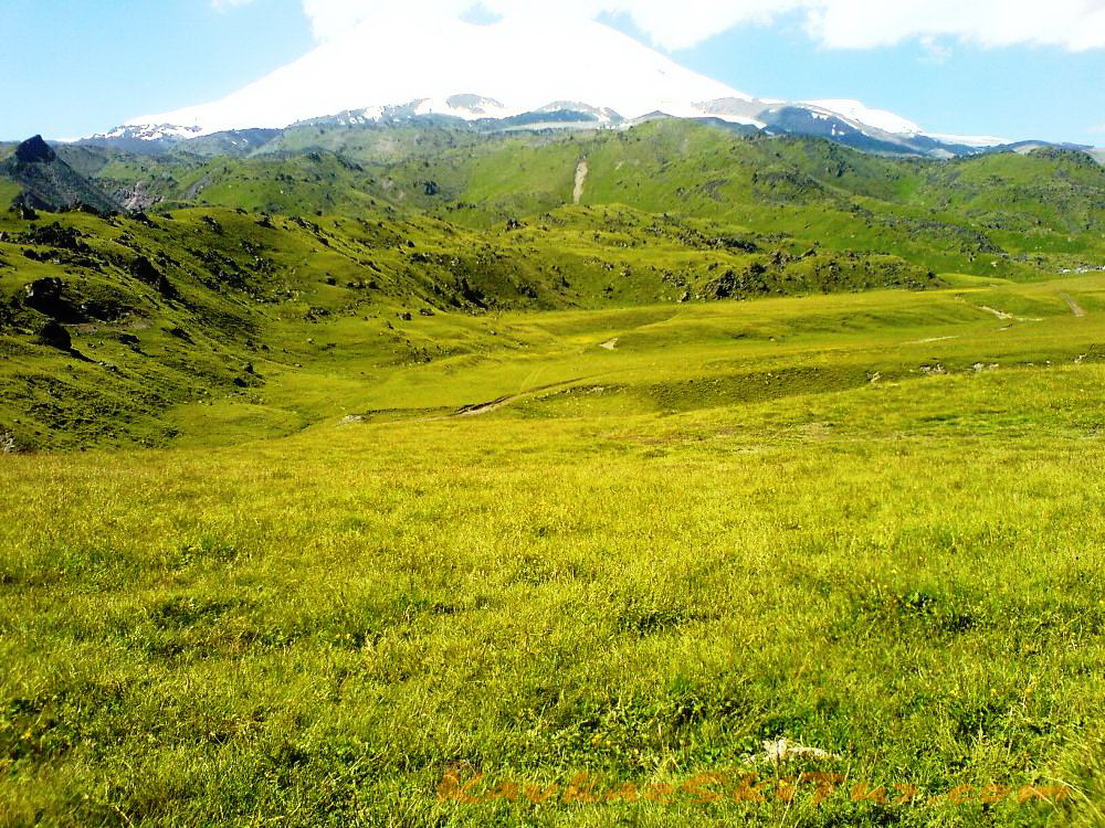
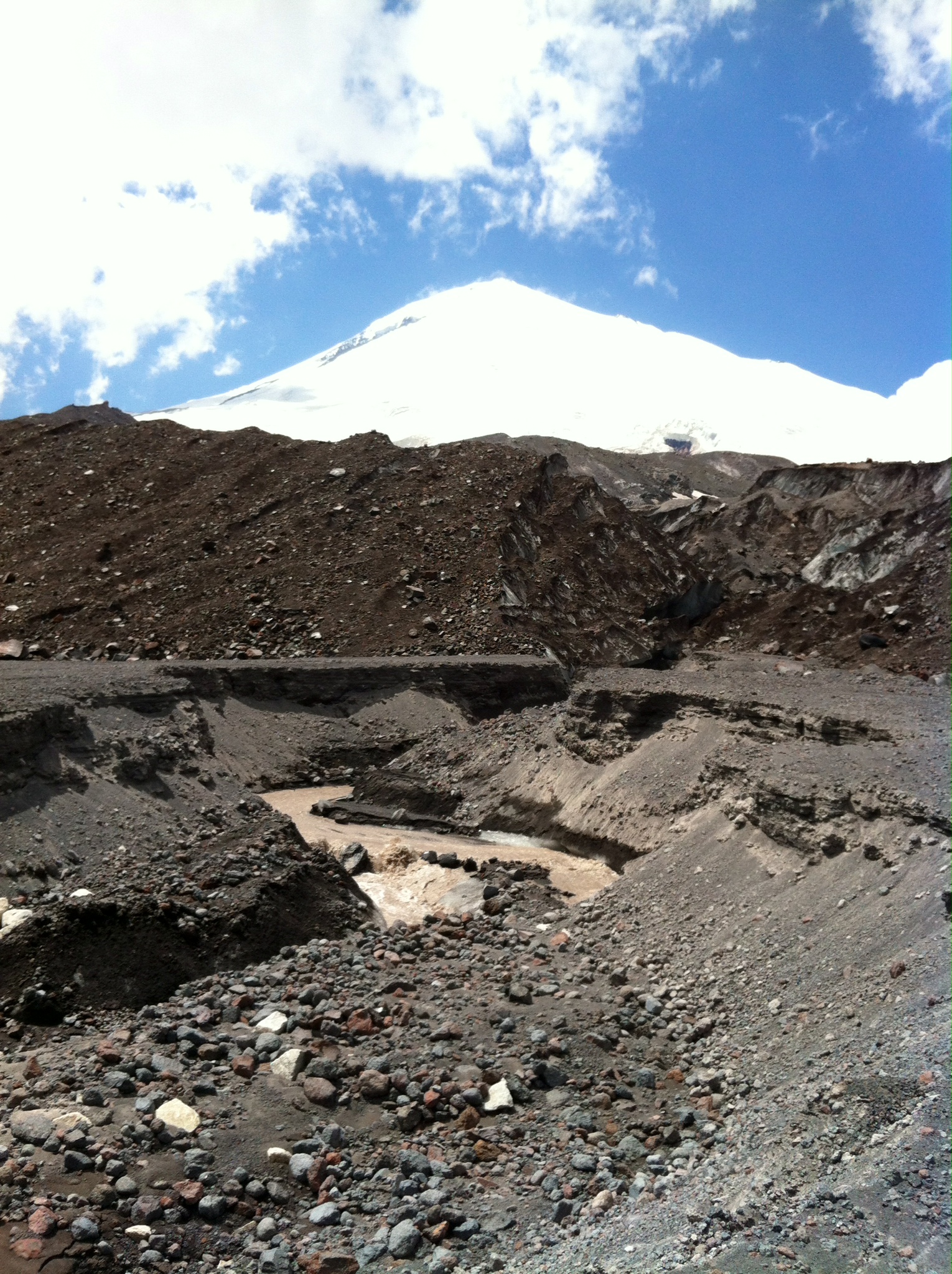
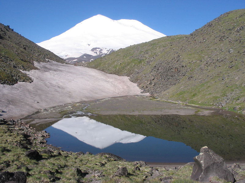
It’s nice to make a camping near the Dgilisu springs. Near the narzan bathes two rivers – Birdgalisu and Kyzyl-Su that are the sources of the river Malka flow together. We cross over the bridge to the left bank and go along the good path to the mouth step of the high-mountain valley of the Kyzyl-Su River (40 minutes). From here you can see the legendary Elbrus. The mountains around Elbrus seem the hills from here. The Elbrus Slopes are the sources of the rivers of the Malka basin. The square of the contemporary Elbrus glaciers is more than 135 square kilometers.
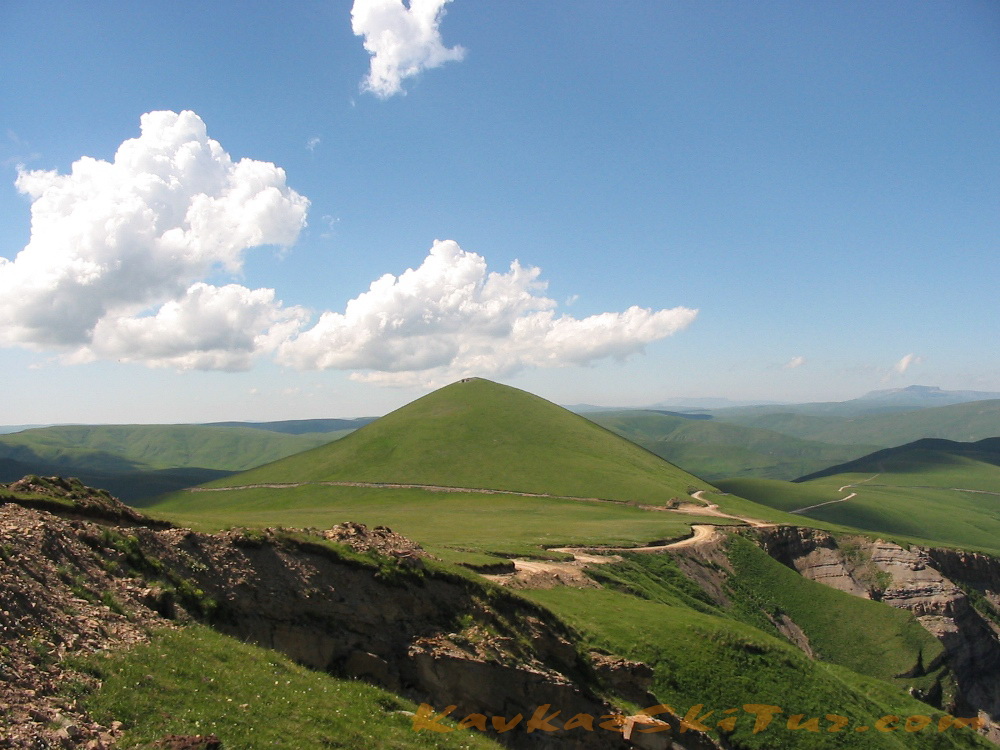
Further on there is the most highland (2600 m above sea) plateau Irakhin-sirt. It is the place where in 1829 the above mentioned expedition of Georgy Emmanuel (the hero general of the Patriotic War of 1812) pitched the camp. The purpose of the expedition was to “obtain a true information about this country: its mountains, valleys, canyons, woods, pastures, mineral springs and other phenomena of nature…”
The personnel of the expedition was 350 Cossacks, 650 soldiers, 2 cannons, 6 camels with Kalmuck drivers and two native guides – Islam Krimshaukhal and Mirza-kul Urusby. The general Emmanuel invited some scientists from The Russian Imperial Academy, the architect Bernardacci and Hungarian traveler Besh (Bess’e) to take part in the researches.
As Yanosh Besh put it down, “the expedition is a symbol of unity of the aim notwithstanding the variety of people and sciences. 9 nations from Europe and Asia take part in this undertaking. We are the first to look at Elbrus”.
The path leads to the summer farmyard situated near the Emmanuel’s Rock, on which you can see the inscription in the memory of the first Elbrus ascent: “From 8 to 11 of July in 1829 the general of cavalry Emanuel had been camping here”. This inscription was discovered by chance in 103 years after by the expedition as the layer of lichens covered it.
Here we accommodate in huts.
Day 3: Ascent to the summit camp (3800 m) – accommodation in hut.
The ascent to the summit camp at 3800 with all the necessary equipment for further acclimatization and climbing. We come back to the lower camp after the summit.
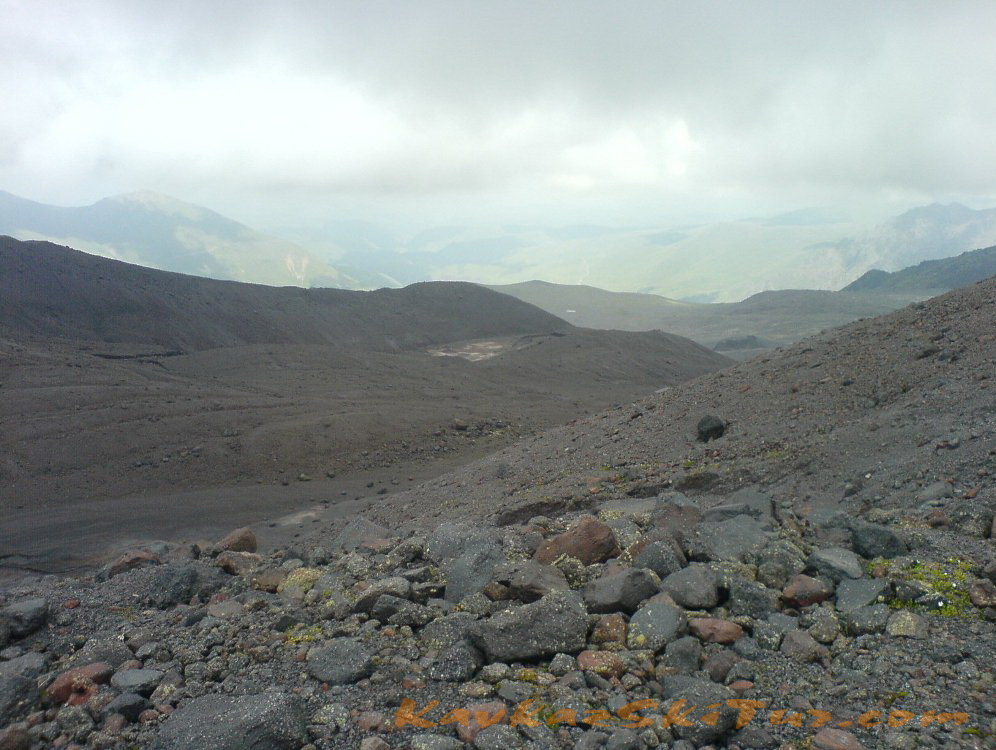
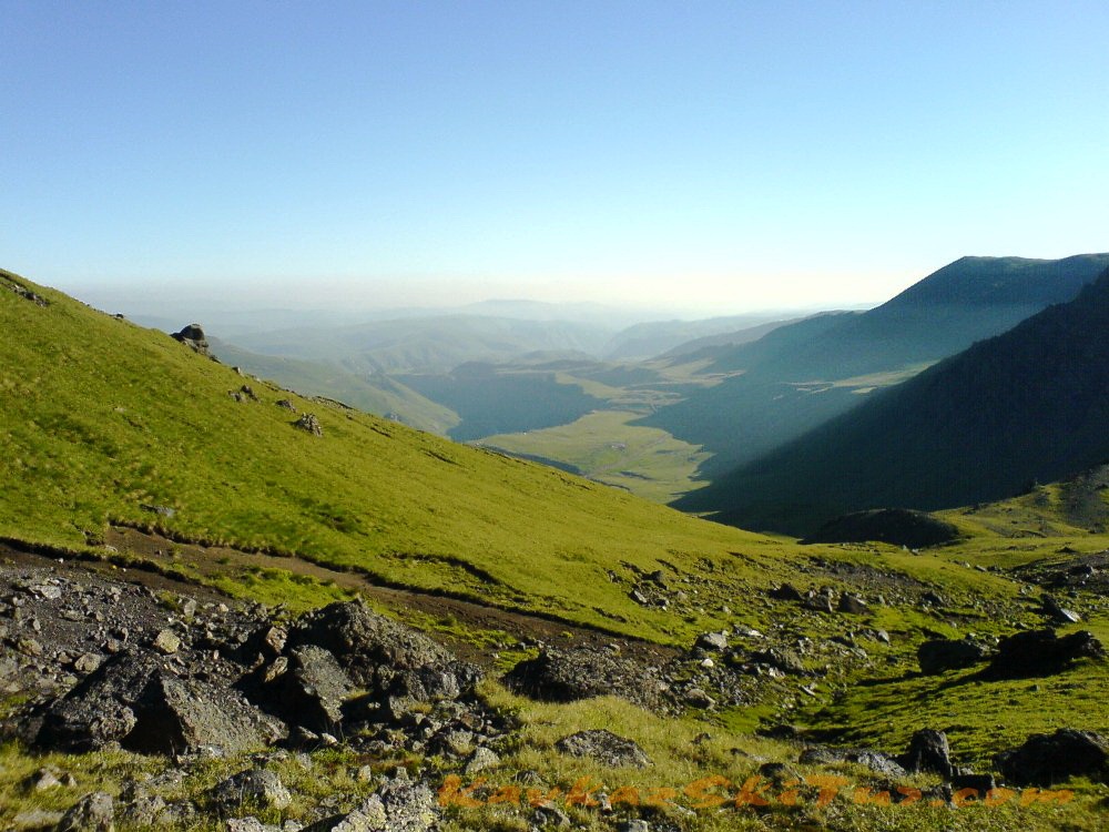
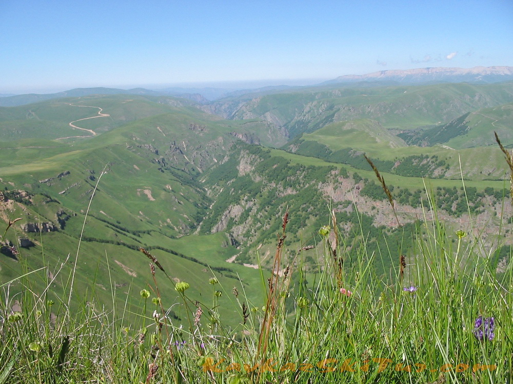
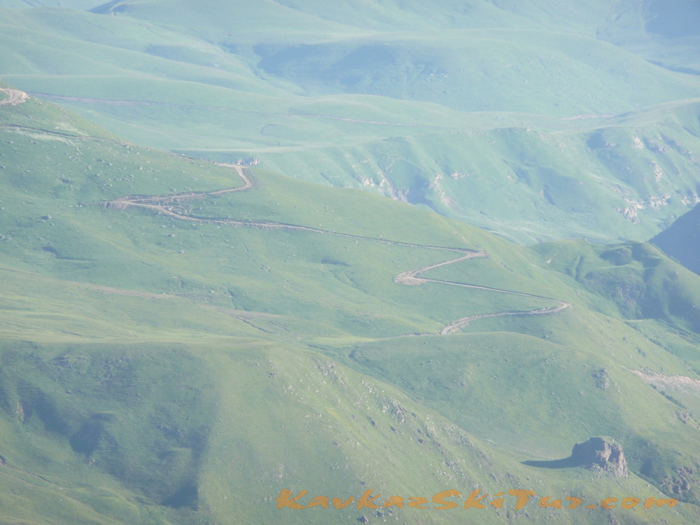
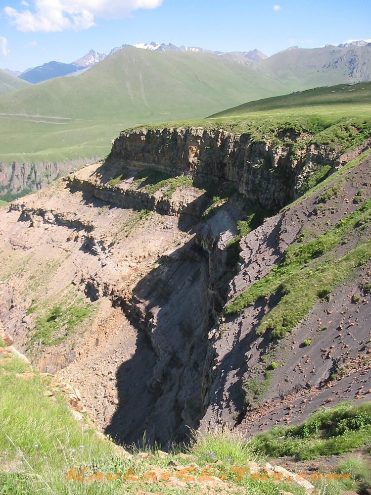
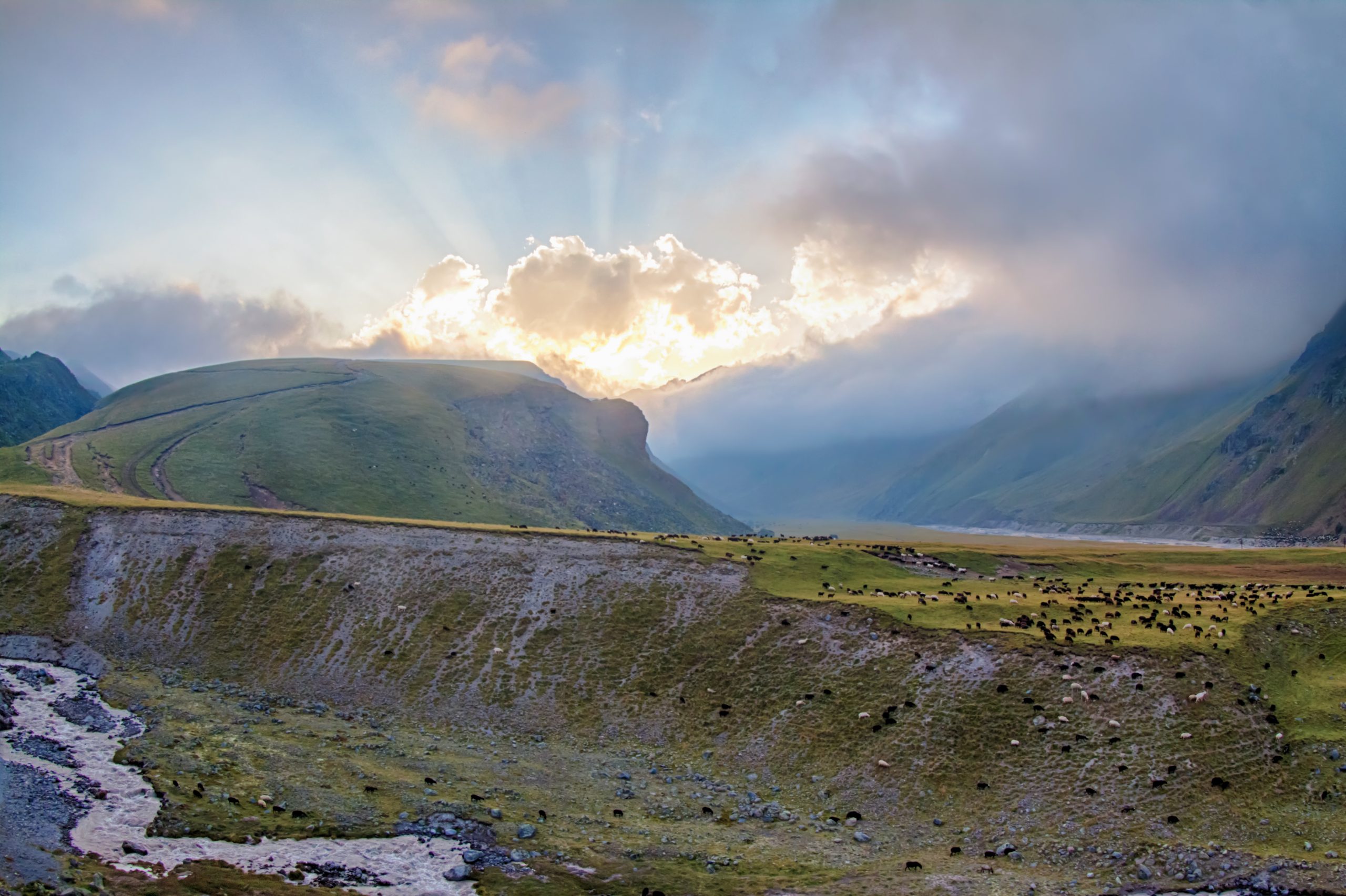
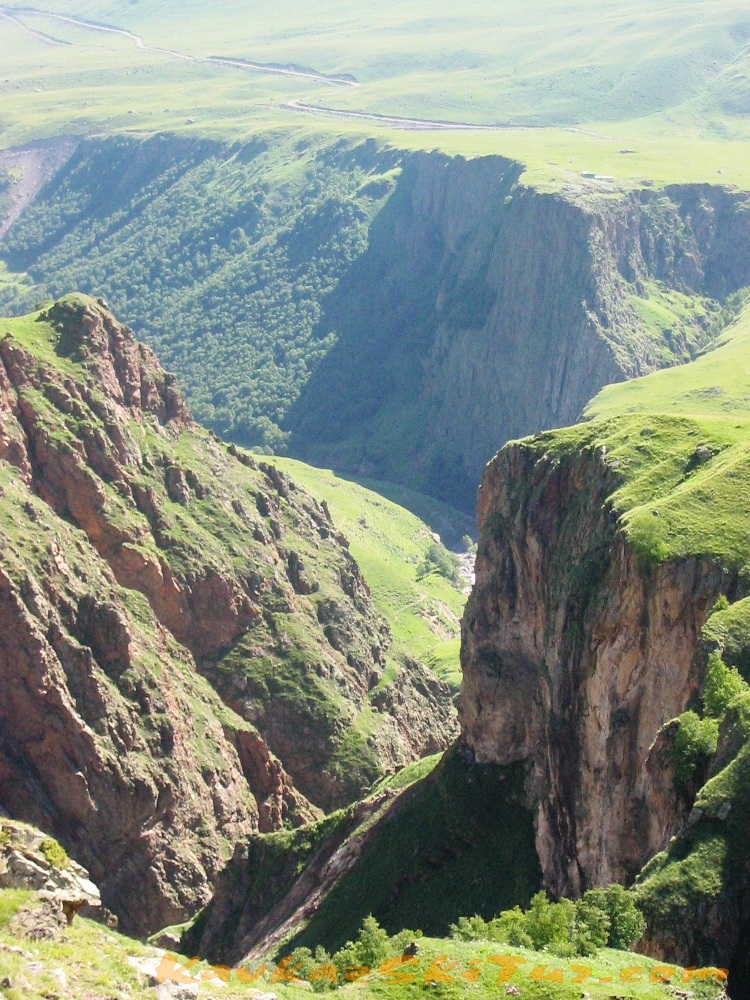
After the small ascent the path crosses the plateau from east to west. This alpine grassland is a good pasture. From here you can see the northern Elbrus glaciers: Ullu-Malgan-Chyran, Ullu-Kol, Kara-Chaul. At the right there is (in front of Elbrus) the meridian range – Tashly-Syrt.
After 2 hours walking you can see all the northern spurs of Elbrus coming to the Tashly-Syrt Range. In its upper part above the Ullu-Chiran Glacier, which is the source of Kyzyl-Su River, is located the Balk -Bashi Pass. In this spur but more lower directly from the motion direction is located the simple Buran-Tash Pass (3086 meters). Across this pass the way leads to the Hydes valley. The river Hydes is the right tributary of the Cuban River. This ancient path leading to the aul Hurzuk has the name Sut-Dgol, which means “the milk road”.
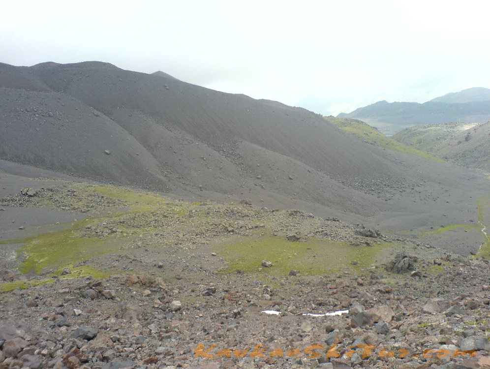
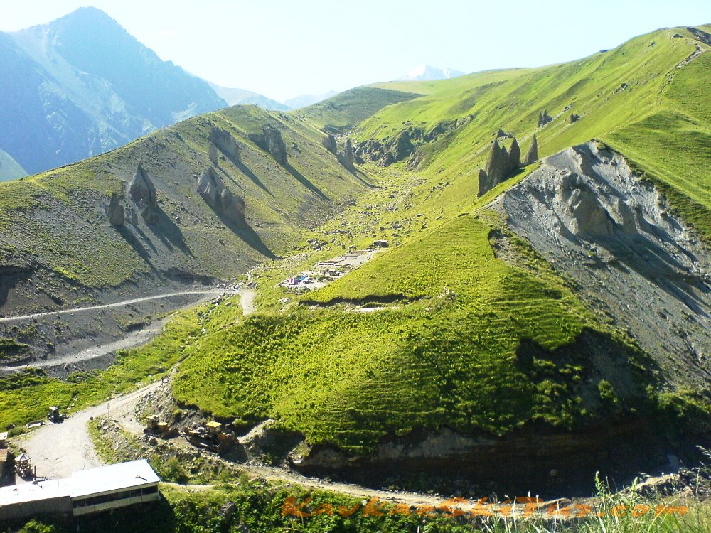
The next interesting object is a top secret airfield, which local shepherds call «German» (2900 m). This is an absolutely flat land, as if made by nature for some mysterious projects. It is 300 or 400 meters wide and over 1 kilometer long. Being there, at the foot of Elbrus, you are as if rooted to the spot being struck by the grandeur of the place: the peaks of Elbrus are incredibly close; a fantastic store of lava in front of them, as if the bizarre workmanship of some Hercules; the endless field extends up to the steep ridge with the «Mushroom Field».
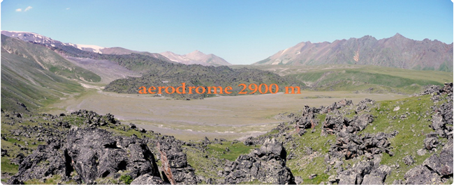
Numerous stories about German aerodrome, about enigmatic passengers brought to the foot of Elbrus, of their meditation, prophecy and following death are often among the natives, tourists and mountain climbers. Is it really an aerodrome is an arguable question. But sometimes imagination and rumors are better arguments. More than that. There is a lot of “data” about UFO watched over this place. You can get the information about it in the WEB. But according to the natives there are still plenty of places in Gili-Su inaccessible to man. And they still keep their secrets.
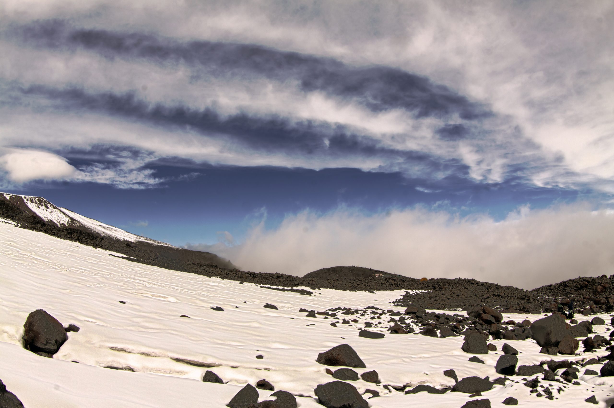
Day 4: Acclimatization on the rocks of Lenz 4600 m.
Acclimatization-training ascent to the lower boundary of the Lenz rocks to the height of 4500-4600 m. (Scheme coincides with the line of the route of ascent).
The start of ascent is optimal at around eight o’clock in the morning in order to use the best, the first half of the day because of the weather. Depending on the condition and training of the climbers this already “fighting” ascent, can take “from the camp to the camp” from three to six hours.
Goals of this ascent are several, and they are all important:
1. To practice walking on ice-snow slopes in crampons in the group.
2. Gain of height to acclimatize (improving the quality of blood in terms of oxygen transfer).
3. Assessment of the situation about the East or West summit by the guide and the climbers themselves.
Clothing. Today all the same clothes as for climbing day. In general, the ascent is going in the whole complete set of clothes and equipment as for the summit, in which you will go directly to the top. The difference of today from climbing day – we leave at eight o’clock in the morning – not as cold as the night when there is a climbing to the mountain. Because of that some warm clothes may not be necessary, but worth to take it anyway, in case of worsens of the weather. Again, depending on the individual thermo regulation, someone may not need a “full” set of recommended clothing and hike of this day makes it also possible to “adjust” your own set of clothes before summit.
Equipment – climbing boots, crampons, harness, poles, headlamp flashlight, and sunglasses.
Food: Hiking will not be so very long to become very hungry, but a thermos of tea and some sweets you can take, again, the question of how the body requires or not the feeding during physical activity.
Time: 3-6 hours
Elevation + -700-800 m.
Length – 5 km
Day 5: Summit day.
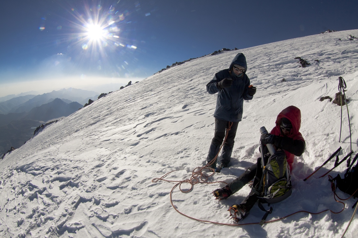
At night half past one is wake up. Breakfast, preparation, 2:00 – leaving. Earlier in the evening we leave thermoses and hydropacks (if required) to the cook, he will prepare and pour boiling water in thermoses and water in packs. Also, the cook prepares all lunchpacks, which may include for example: candy, chocolate, nuts, dried fruit, apple, juice, a sandwich. Although, it should be noted that the best “power” on the route is the hot sweet tea. Due to the active work of the diaphragm during breathing at this altitude in active working the presence of any (or arrival) of food in the stomach gives the body more disadvantages than benefits, and can often result as spontaneous get rid of it in the form of vomiting. The body is working at full capacity, it uses all the blood for the muscles and it does not have extra reserves to digest food, and even slight increase of the stomach volume begins to interfere to the operation of the diaphragm, causing a gag reflex. A good idea to carry a strong medicine for headache, because it can become a problem interfering to the normal work on the route.
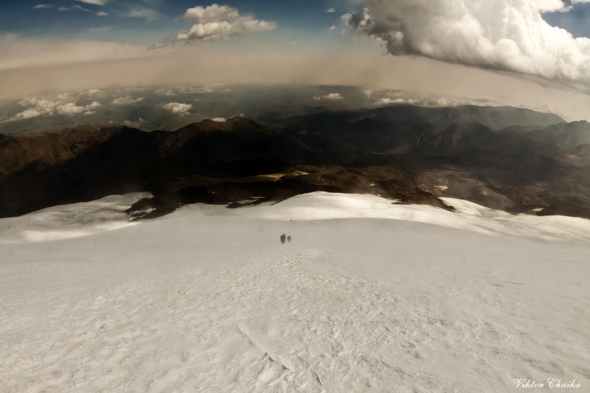
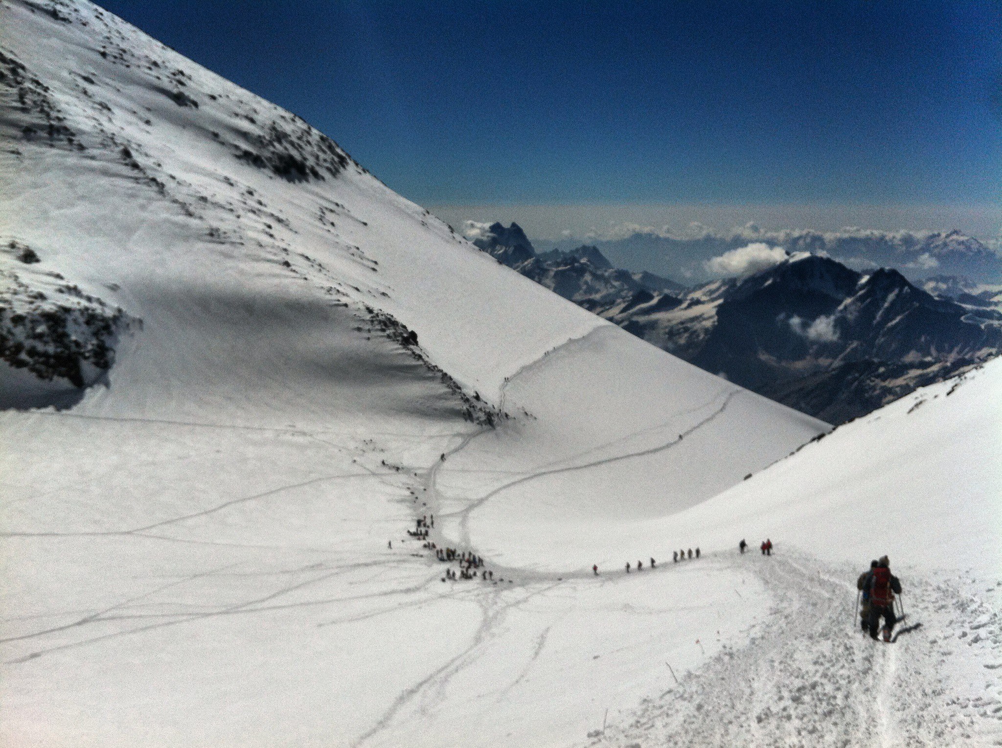
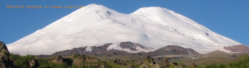
We go in the dark with headlamps the first part of the route. Sun rise approximately at the level of the lower Lenz rocks. In the trough at the lower boundary of the rocks – a little rest, tea, snacks. Then continue to move till a small plateau in the middle rocks of Lenz at an altitude of 4800 m. From here the slope becomes steeper, and it is at this part which can be decisive in the choice of the summit. Often many of those who wanted to go to the west, on the passing of this segment to the upper rocks of Lenz, understand all tallness of the mountain, and make sound decisions to go to the East top. On takeoff with a slope of 45 degrees, we reach the upper border of the rocks Lenz. It is 5200m. If initially it was decided to go to the East, then continue moving to the dome to which will take a 400-meter climb, if there is a chance and reserves of strength, then we can turn to the West Summit here.
East summit.
From the top of Lenz rocks through not very steep snow slope, about 30 degrees, we rise to the top plateau, we cross it and reach the top. After a short stay begins the descent. Normally, the descent takes one-third of the ascent time. On average, leaving at two in the morning the group comes back at around four o’clock in the afternoon. But it is also good and implementable 8 hours to the top and about three hours for the descent. That is, with respect to an adequate level of training of the group all the climbing with a return to high camp can take up to 12 hours. It is on the eastern peak.
West summit.
It is located further, and climbing can last longer (relatively the ascent to the east) for 3-4 hours or more. Climbers with a good level of preparation can reach the western summit starting from 3800 for 8-9 hours. If it is decided to go west top, the turn to it occurs on the upper rocks of Lenz. After it about an hour traverse of the dome to the saddle 5300, then rise to the dome of western summit, crossing the summit plateau and reaching the summit. Descend along the ascent.
It is important to understand one thing: a guide makes decisions on the basis of objective possibilities of the group, which he understood in most cases more than the climbers themselves. The successful ascent to the planned summit – it is always a personal victory for any guide. But for a good guide the main victory – when all came back alive and healthy. A good guide will never go on customer’s unreasonable demands, although it happens that the customer can even offer some extra money on a mountain only to have him climbed at the top by any means, despite the fact that the guide recommends him to go down. The main task of the guide here on the mountain: well know and feel the mountain and take a clear look at the situation, trying to make the most objective, correct and optimal solution, even if for the climbers it does not seem most joyful at first sight. The most important thing – the safety of people and correct assessment of the situation.
Weather. On the slopes of the north side it can be quite severe and even so it is considered acceptable. For example: a wind of 20 m/s – it is a normal working weather, those who doesn’t know that its permanent here can turn back thinking that he was blown off. Over the slope the situation with the wind may be different. It happens that before the lower Lenz rocks it is relatively calm, and from the border of rocks abruptly begins to blow. Sometimes vice versa – in the camp the strongest wind and slightly higher on the slope it becomes calmer. The air temperature in the upper part of the route can drop to -20 degrees, and in the sun can also be same number but in different direction. When the sun does not shine and comes the wind and clouds you are as if in the freezer. When the sun fries – as if in a stove. So you need to be prepared for such features.
Liquid. Loss of moisture – this is an important moment. In addition to the moisture, which vaporizes the skin during physical activity, the greater amount of it is evaporated through lungs when breathing, especially in a dry air. A trained body is able more efficiently use internal reserves of liquid (and nutrients), but even it cannot adapt to dehydration. Dehydration greatly affects on workability – can begin sick, headache, “heavy” muscles. The presence of these signs has already said that the drink is too late, it is better not to bring it up to it, and occasionally drink liquid on the route.
East summit:
Time: 11-14 hours
Elevation + – 1800 m
Length – 13 km
West summit:
Time: 12 – 16 hours
Elevation + – 1800 m
Length – 17 km.
Day 6: Reserve.
Reserve day for climbing. Descent down to base camp.
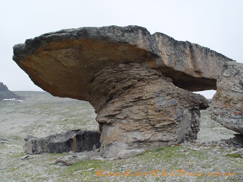
At 9-00 a.m. descend to base camp in a glade Emanuel, on the way back visiting of “stone mushrooms”. Among wonders of the northern slope of Elbrus there is the so called “glade of mushrooms”. But these are the mushrooms of stone. They look as if someone mighty, idling the time away, put a kind of caps accurately on the stone stems. Such stone mushrooms can be also seen on the right bank of Gara-Auzu-Su river. They are sometimes 5 meters high.
After lunch, walk to Dzhilysu thermal sources.
The Dgilisu valley (“Warm Waters”) is known as a public balneological health resort. Long since the mountaineers knew about the medicinal properties of these mineral springs and used them. Now the Dgilisu springs are two thick springs with pools for the bathing with the constant temperature of water 22.4 degrees above zero. In spite of ways difficulties, high altitude (2,380 meters) nearness of Elbrus glaciers and the primitive state of life and treatment the resort visitors always get easing here.
A healing, curative power of Gili-Su springs seems unbelievable: their water cleanses the organism from slags; induce inner energy; rise life tone; improve general state; make your sight sharper. Gili-Su is not only mineral healing springs but a wonderful microclimate as well. It is a kind of natural inhaler. Air there is absolutely pure. You can’t but enjoy it.
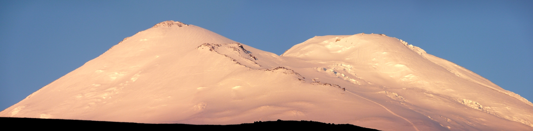
But the main wonder of this place is, of course, Elbrus. It is beyond comparisons, above understanding. Matchless. Elbrus is tender pink at dawn, dazzling white – at noon, bluish black – at midnight. Ancient and newly-born, constant and changing, calm and challenging…
One of its “minor” wonders is Gili-Su – a masterpiece of nature. We can’t help admiring it. We can not even enumerate all its peculiarities. Here are only some of them: lava dike in the valley of river Karakaya-Su; the moraine glacier deposits; 20 meters high ice wall on the tongue of the glacier Ullumalienderku; ice plateau with the peak of Kalitsky; the glacier Mikelchiran going down right into the lake…
We can only mention here some ancient inscriptions on the rocks of the northern slopes of Elbrus accessed to the people of those days; of the caves containing family burials; of some burials where remarkable skulls – “unusually long, with big foreheads” – were found. By the way, there are only three places in the world with the finds alike: they are in Peru, Egypt and Siberia.
Gili-Su may be really called a splendid mystery itself.
Day 7: Transfer from camp.
Transfer to Nalchik. Hotel accommodation. On this day we can visit hot springs near Nalchik or further to canyon till “Blue Lakes”.
Day 8: Departures.
Transfer to airport Min Vody or Nalchik. Departure to Moscow (Istanbul etc).
| SERVICES | STANDARD |
| All transfers: from Min Vody airport to hotel and back to airport; from hotel to north side of Elbrus and back to hotel. | |
| Accommodation in hotel in city Nalchik, according the program 2 days including breakfast. | |
| Campsite Huts on Emanuel glade 2600 m 3 days and on summit camp 3800 m according the program 4 days. | |
| All meals in camps: cooked meal everyday with packed lunches. | |
| Cook in base-camp and summit camp with all kitchen stuff. | |
| Qualified guide-instructor for acclimatization and climbing english speaking. | |
| Extra guides on summit day, 1 guide/3-4 climbers. | |
| Visa support, park fees, registrations. | |
| Rent of group equipment | |
| Rent of personal equipment. | |
| Dinners and lunches in the cities. | |
| Porters for personal equipment. | |
| Accident insurance. | |
| TOTAL PRICE | 85 000 rubles |
PRELIMINARY APPLICATION
| REQUIRED EQUIPMENT FOR THE EXPEDITION «CLIMBING ELBRUS FROM THE NORTH FACE»: | GROUP EQUIPMENT: |
|
|