+7 928 691 44 05
  Russia, KBR, city Nalchik


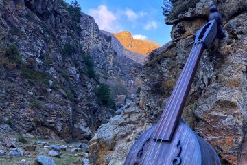
«KavkazSkiTur» offers an amazing, beautiful and romantic trekking route that starts at Syltran-Kol Lake and ends with climbing one of the nearby peaks.
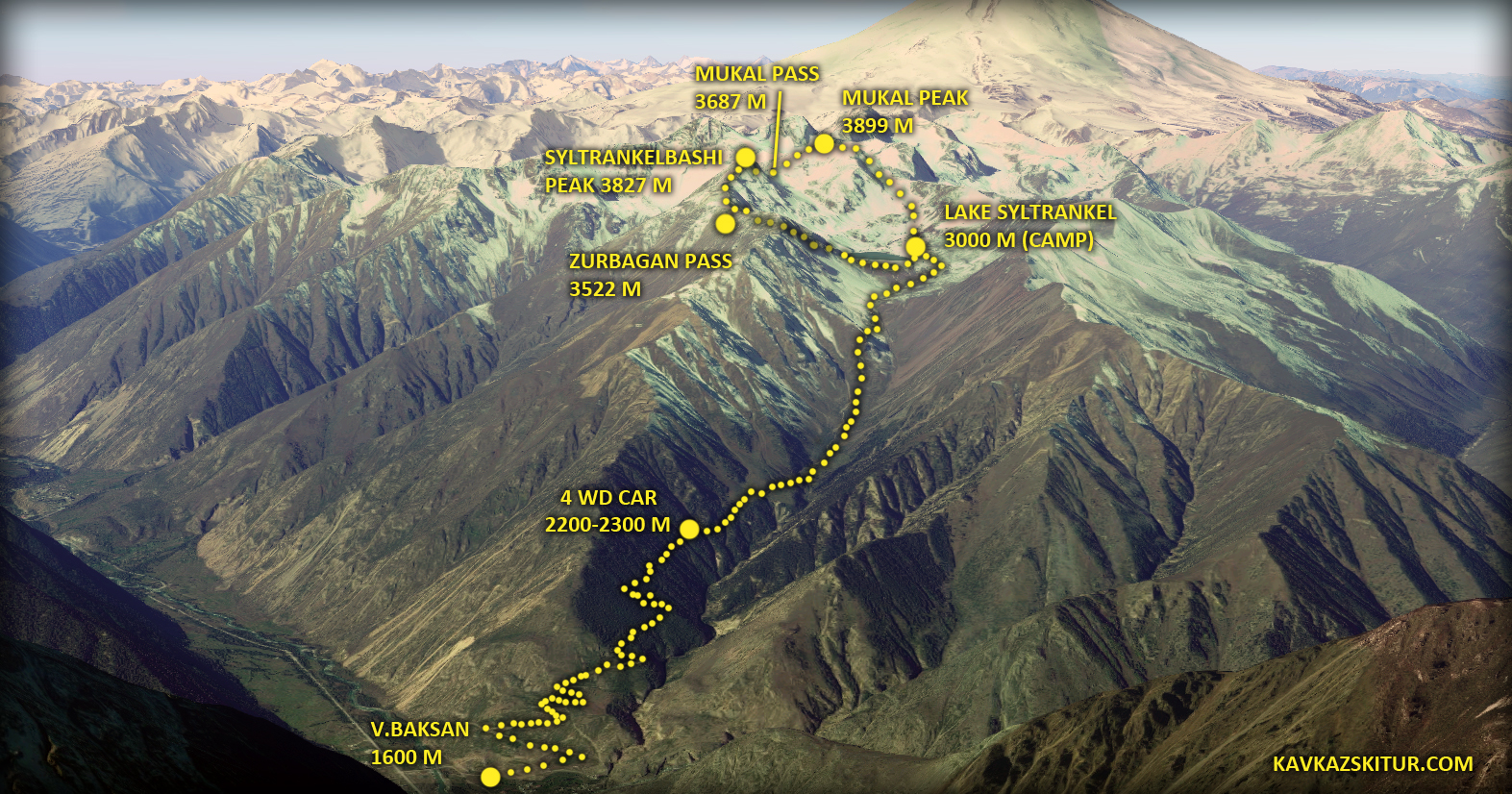
Trekking route: Village Verkhny Baksan 1600 m – drive by 4wheel car till 2300 m (or, alternatively, on foot from the beginning of the forest, about 1900 m) – crossing to Syltrankel Lake 3000 m – overnight in tents – ascent to one of the peaks – descent to the lake — overnight in tents — gathering camp – return to the forest zone (the car is waiting at 2300 m) – further descent according to plan.
This program, in case of its fullest implementation, allows you to make an excellent trek to the Syltran Gorge, passing from a height of 1600 (or 2300) to Lake Syltrankel 3000 m, spend the night there and the next day traverse the peaks of Syltrankelbashi 3827 m or Mukal 3899 m, located in the ridge next to the lake. This trip can serve as a good acclimatization link in the Elbrus climbing program.
The hike is not technically difficult (however, it will physically allow you to work a lot), does not require special climbing equipment (except for crampons (in May-June) and mountain boots, ascent to any of the passes of the target ridge in the morning — along the firn, due to the northern exposure of the slopes. All that you will need on a hike (and what you will need to take care of yourself) is a sleeping bag, mat, clothes (see article about clothing for trekking and climbing), personal hygiene items (sunscreen, lipstick), sunglasses, headlamp, personal first aid kit, trekking poles, mug-bowl-spoon-knife. The total weight of the backpack will be no more than 10 kg. Camping equipment, its delivery, kitchen, groceries, food preparation are provided by the KavkazSkiTur team. Crampons, mountain boots, sleeping bag, mat — if you don’t have something, you can rent it from us.
The «KavkazSkiTur» team meets each member of the group at the airport or railway station, then we head to the Elbrus region.
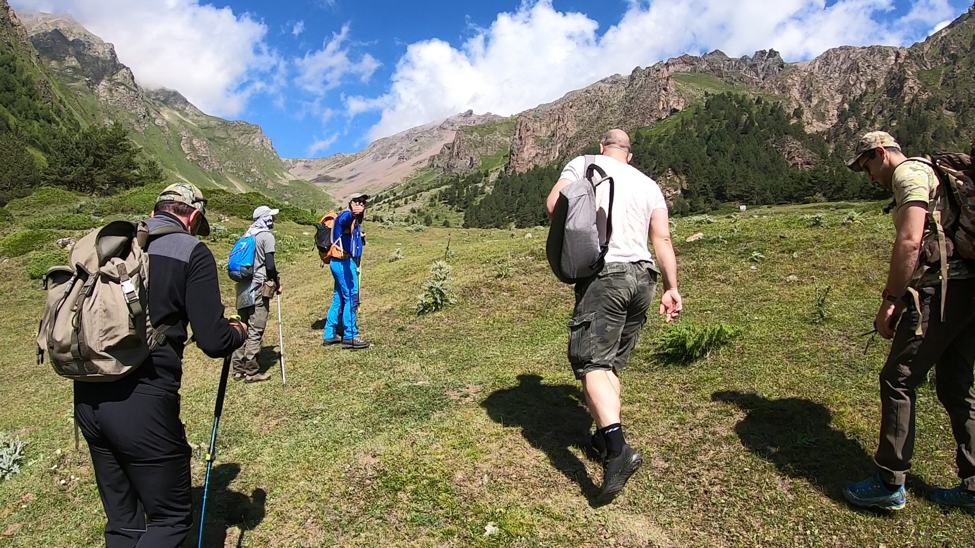
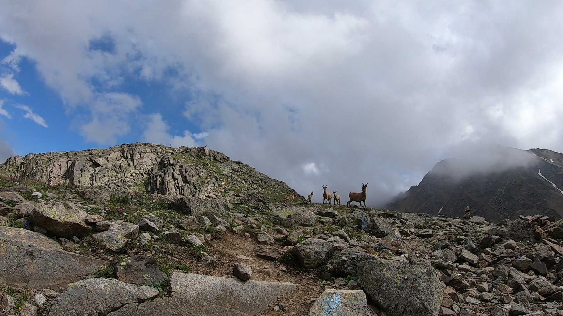
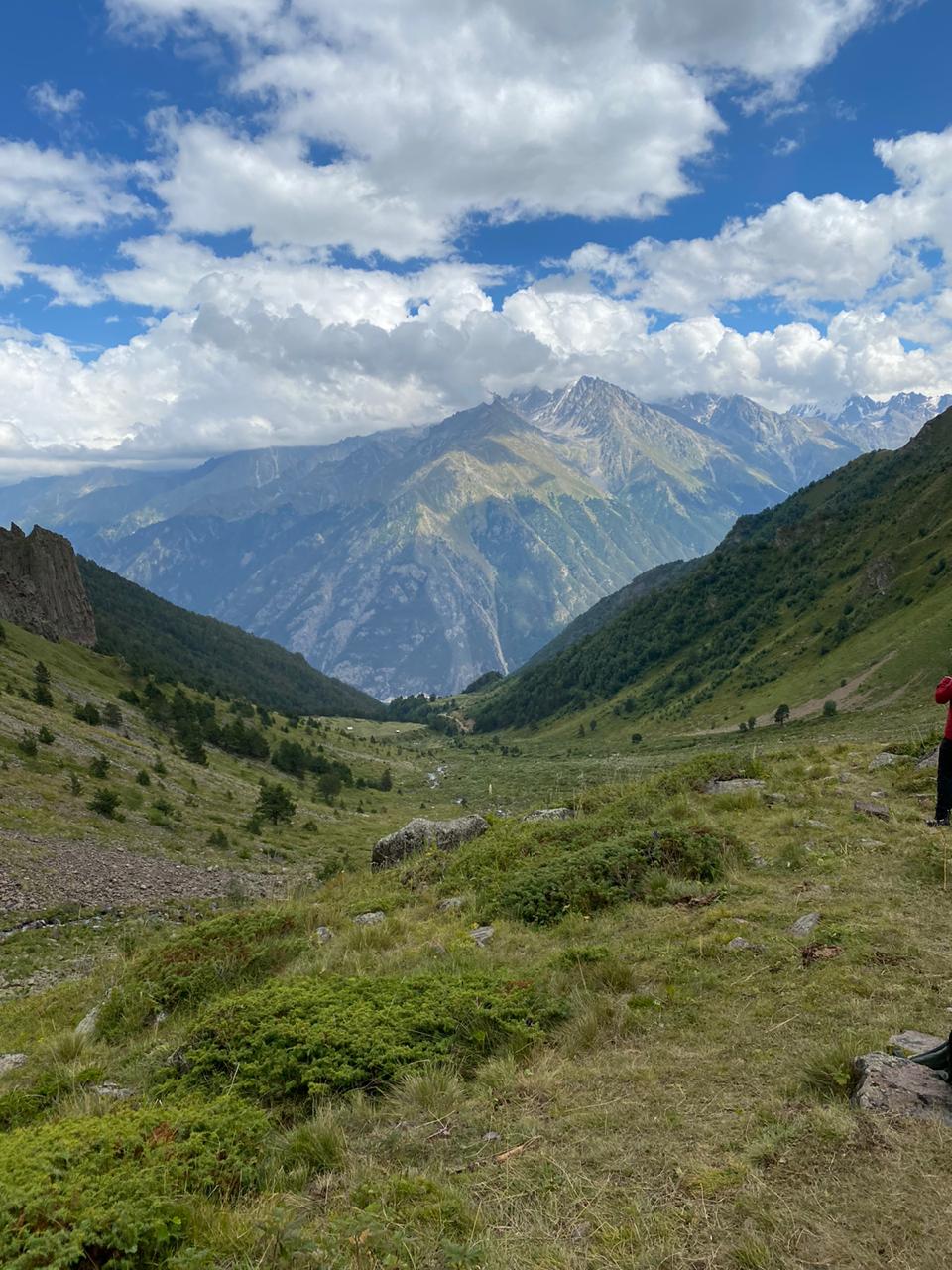
On the first day, arrival in Upper Baksan, transfer by car until 2300, although there is an excellent option to still walk through the forest on foot with small backpacks (the car will take you to the lower border of the forest, or even its possible from the village). It’s beautiful there, and the air is good, you still have time to ride in cars on the plain in the cities, in a huge gap between the mountains. As well as living in strong four walls on a couple of tens of square meters of space. If you came to the Mountains, then here they are — MOUNTAINS. If you want adventure, then this is adventure for you. This is the Caucasus, everything is more severe here, there are no ladders to the mountains, there are no houses, here and there. There are base and summit camps, in places where they really needed. And there you will still have a great opportunity to sit in cars, the all-encompassing nature of the Caucasus gives you a great opportunity to air yourself to the fullest, as well as the brain, as well as the spirit.
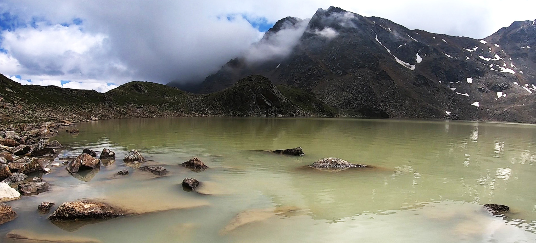
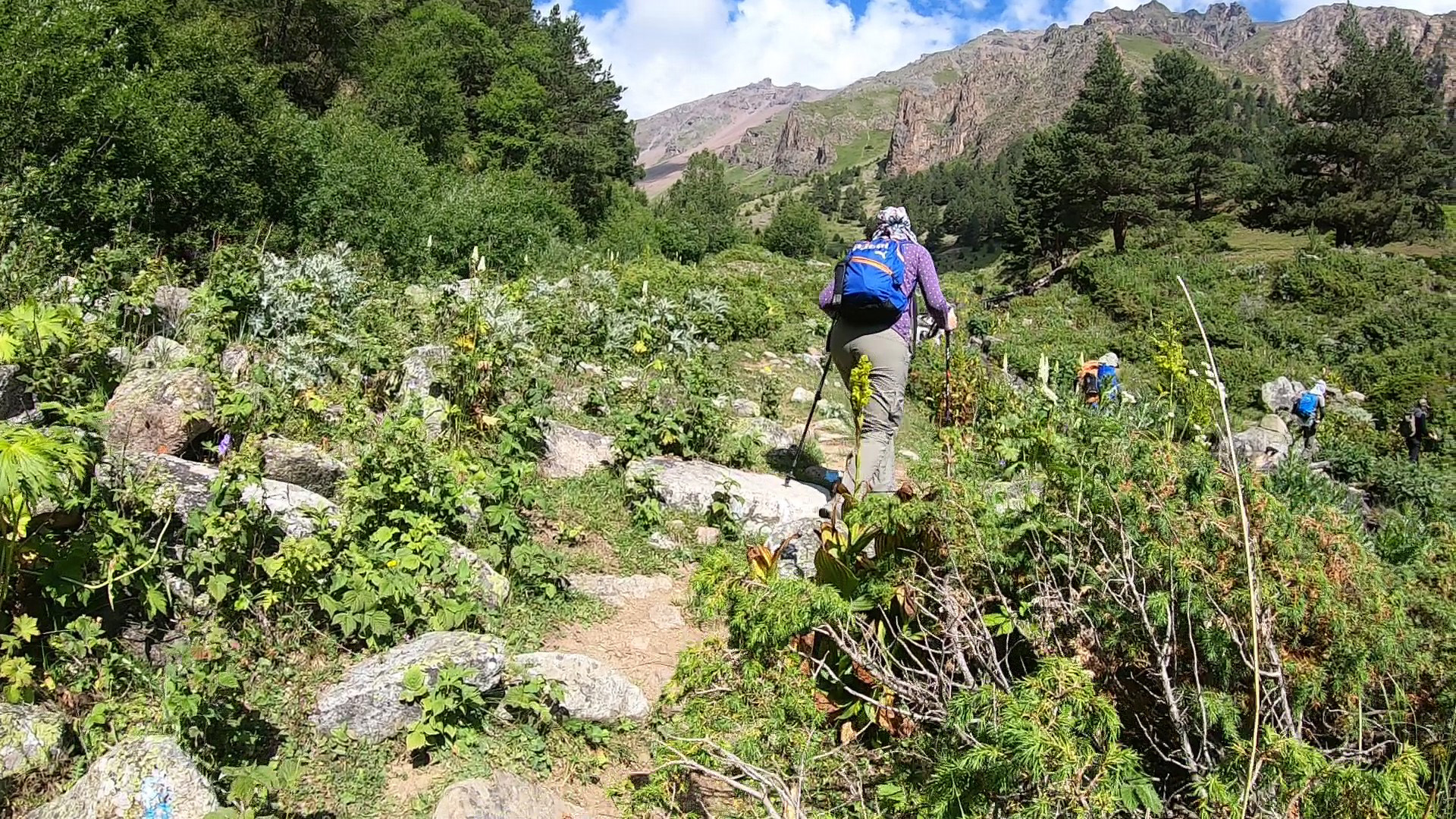
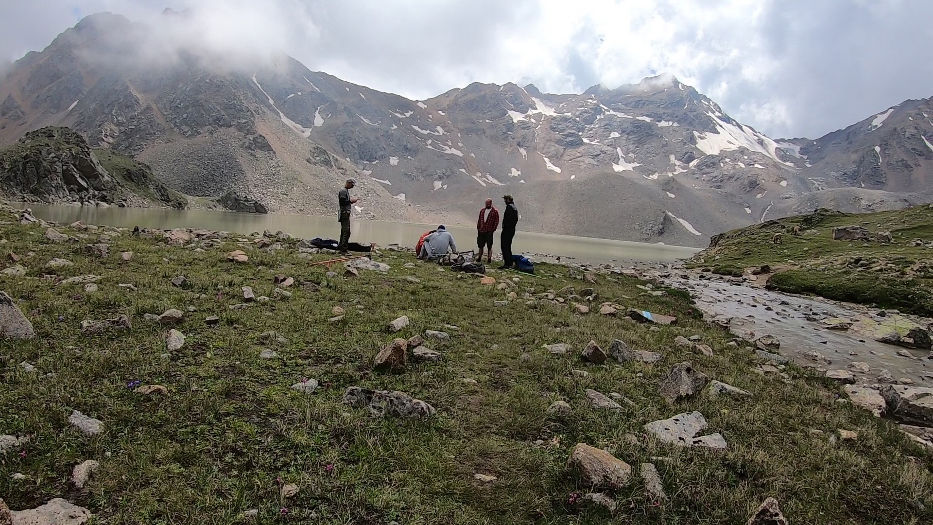
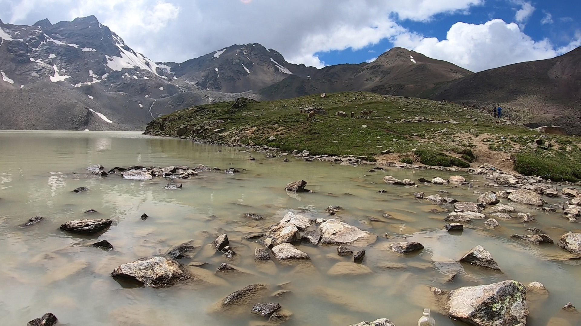
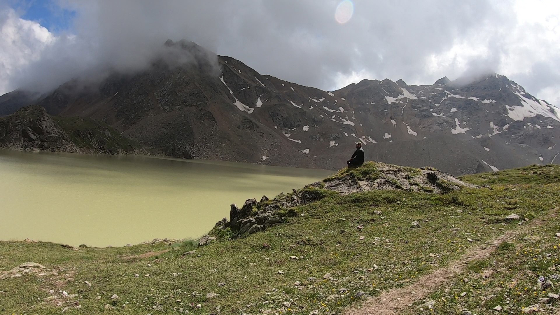
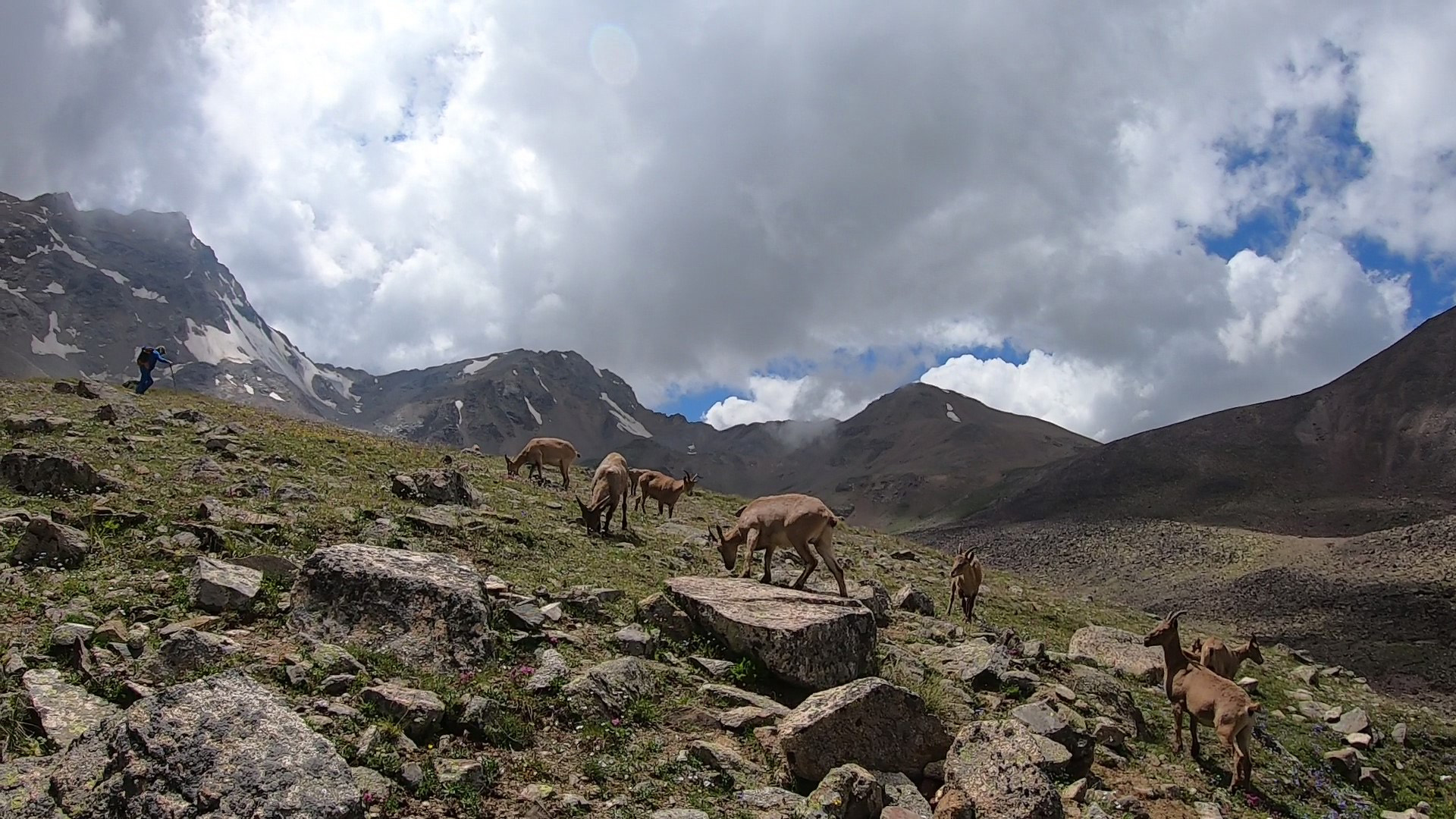
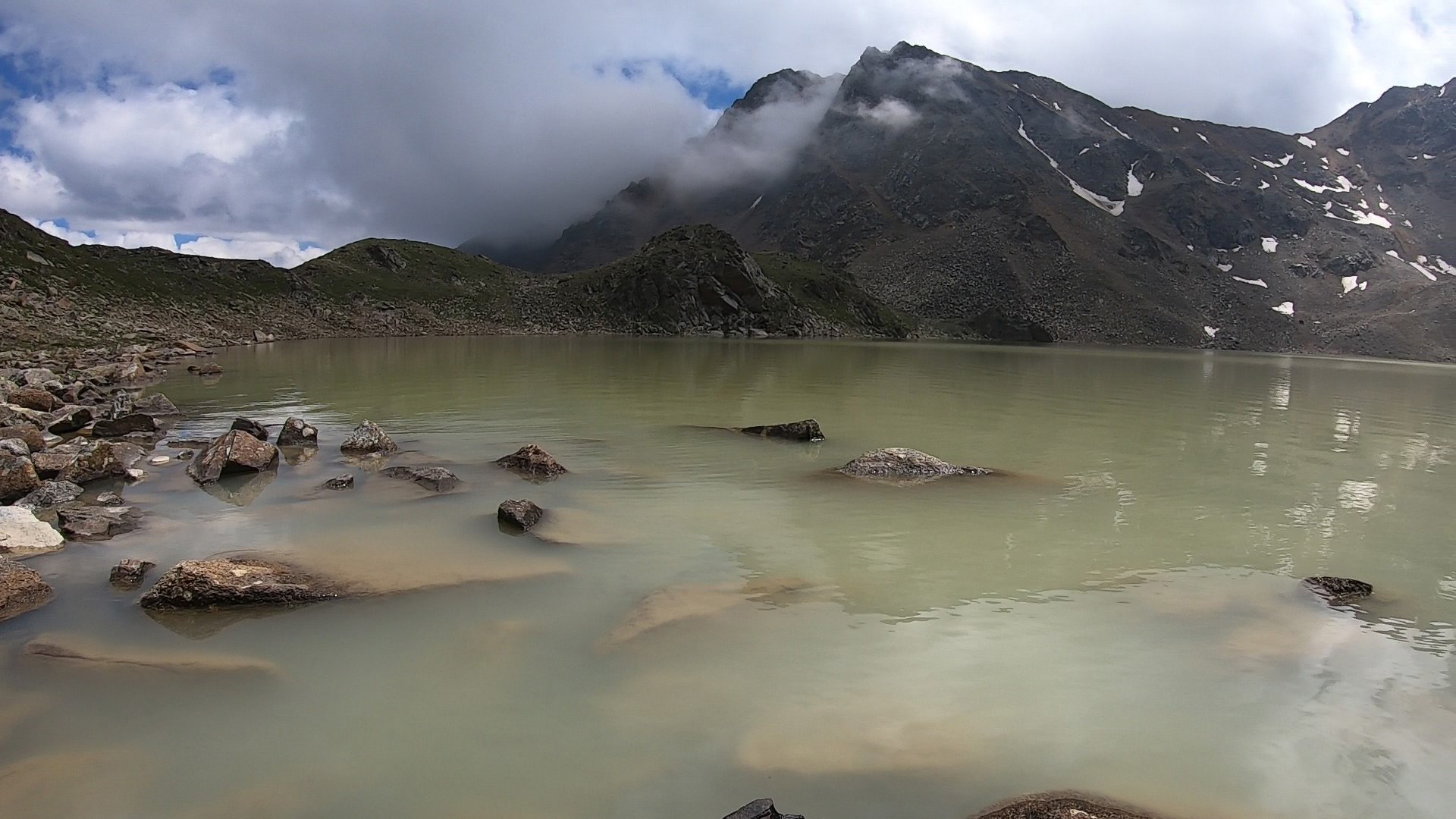
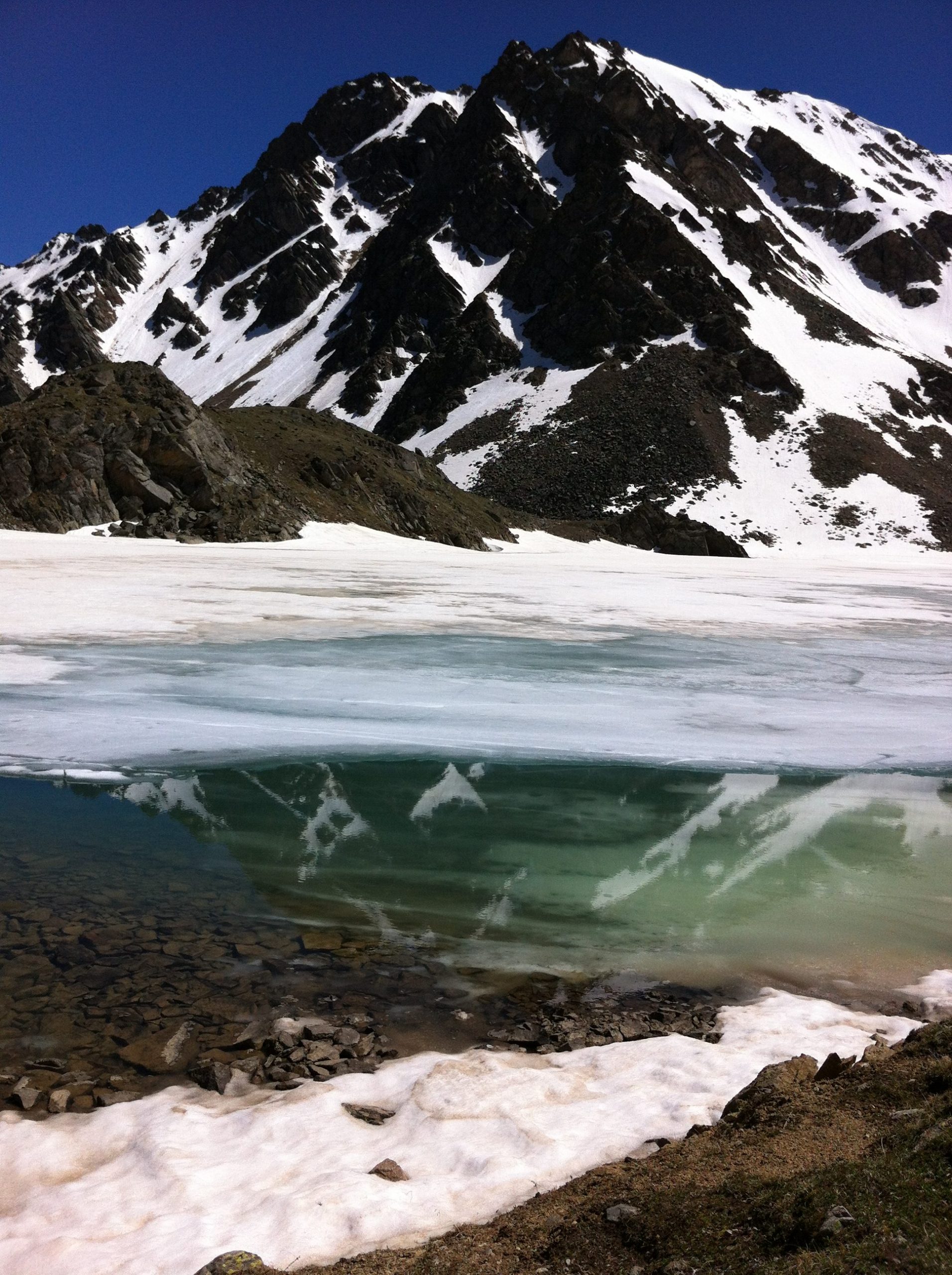
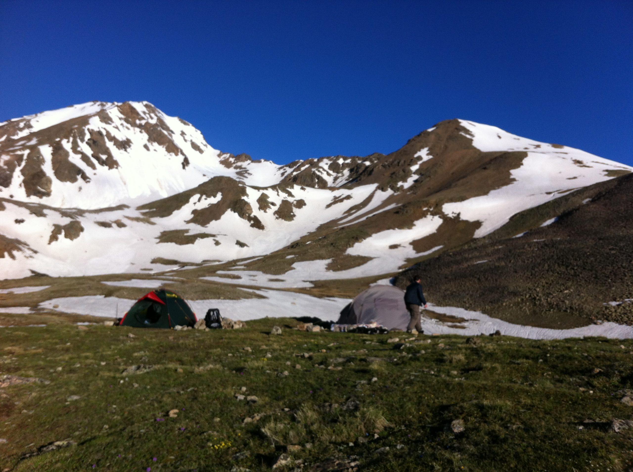
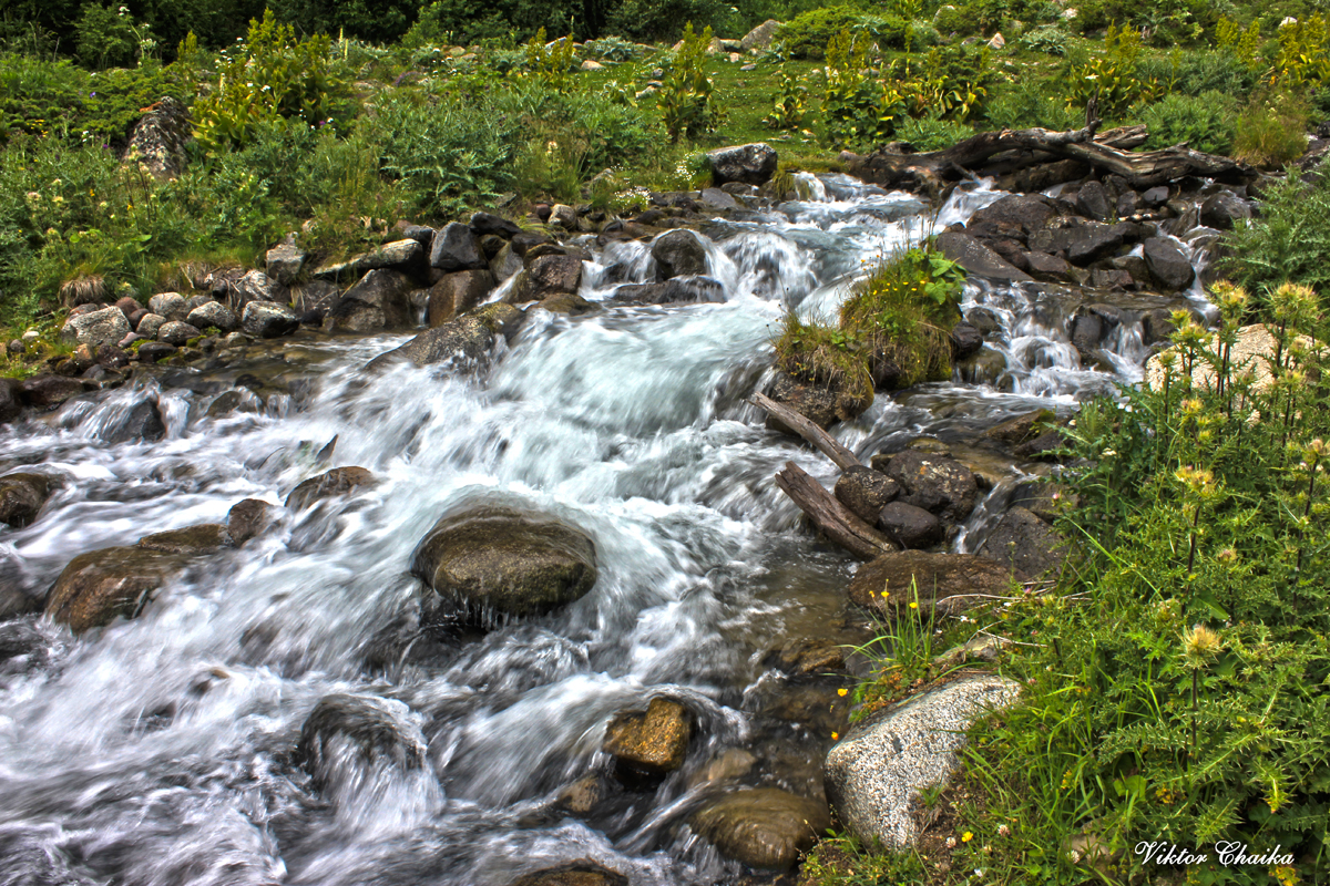
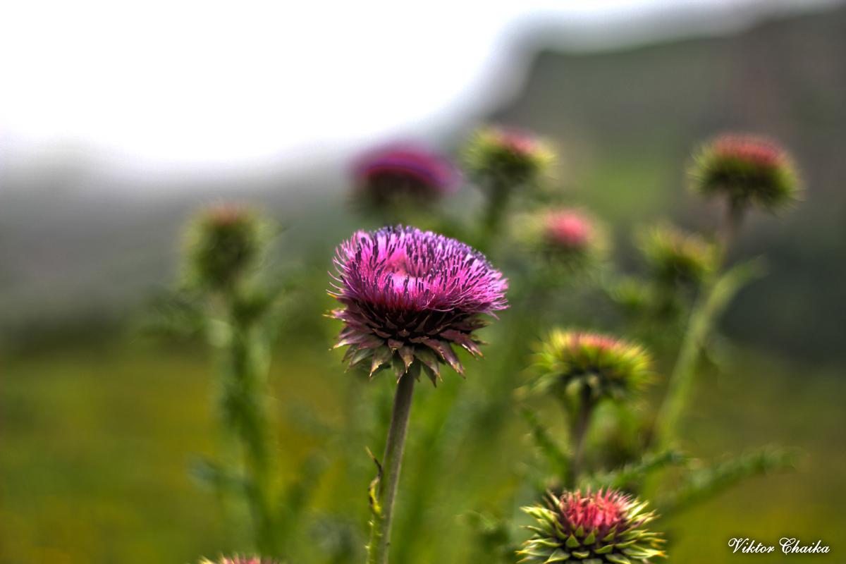
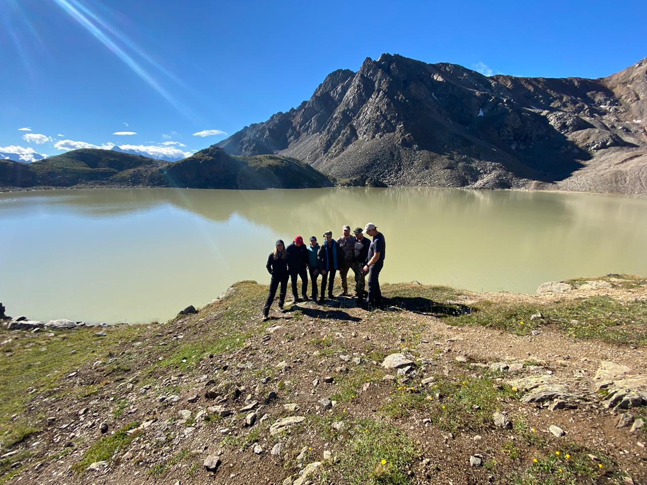
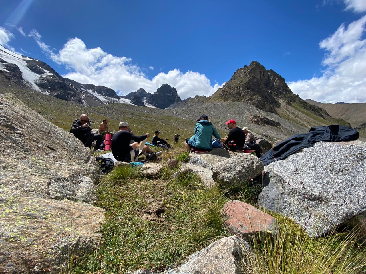
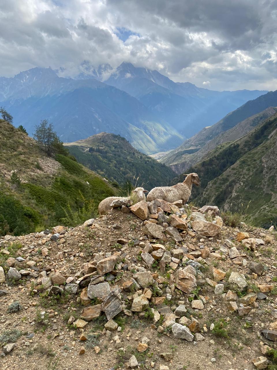
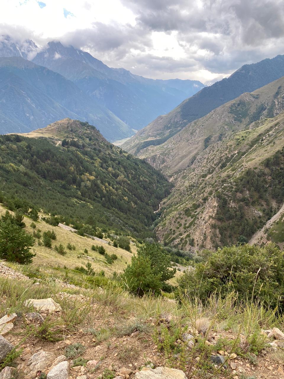
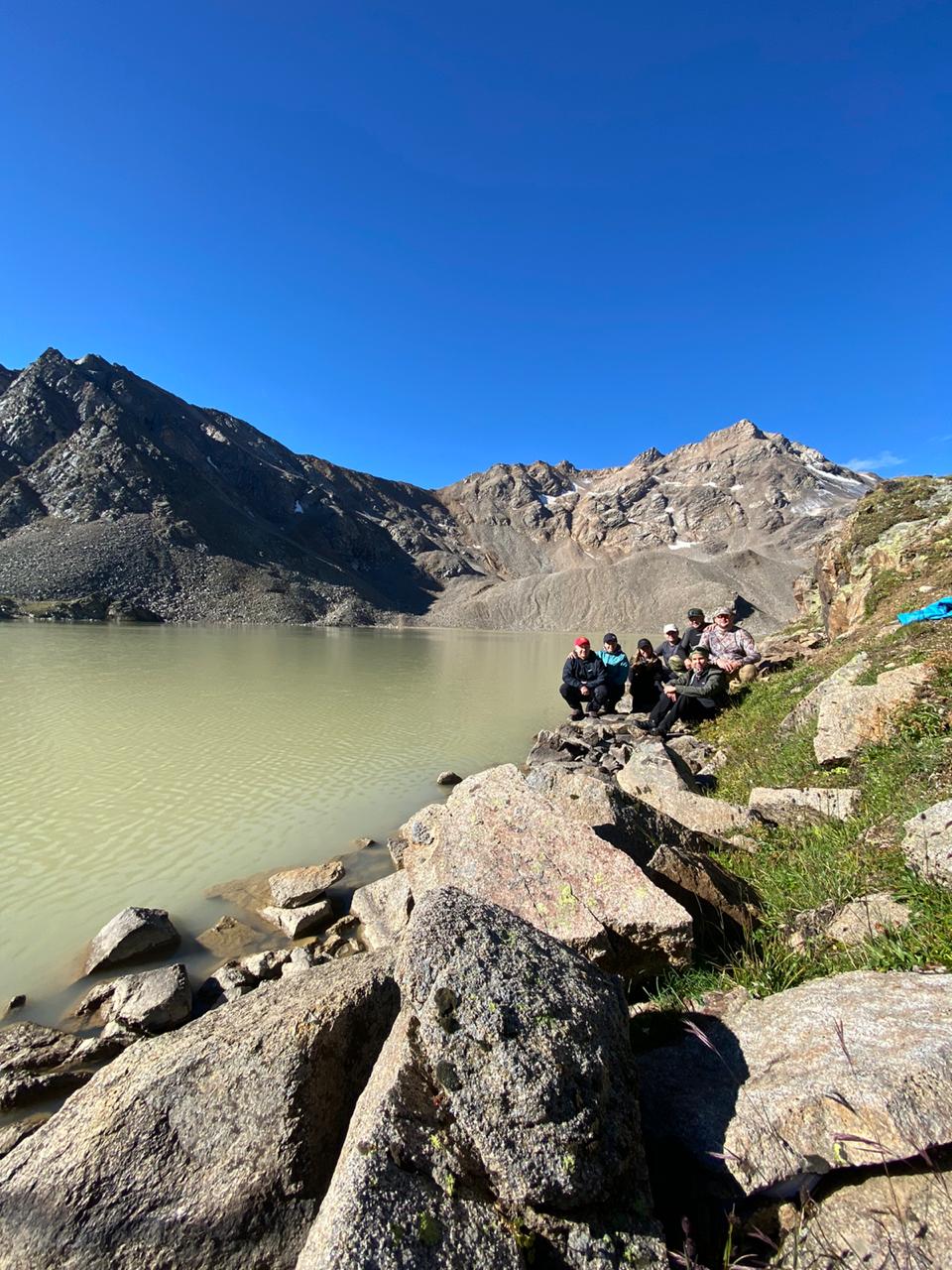
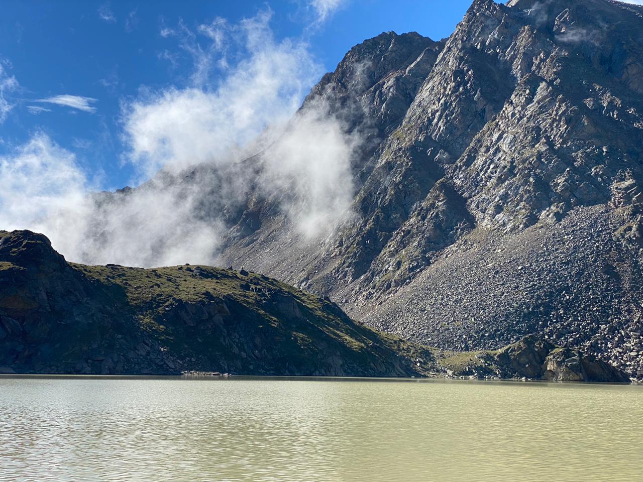
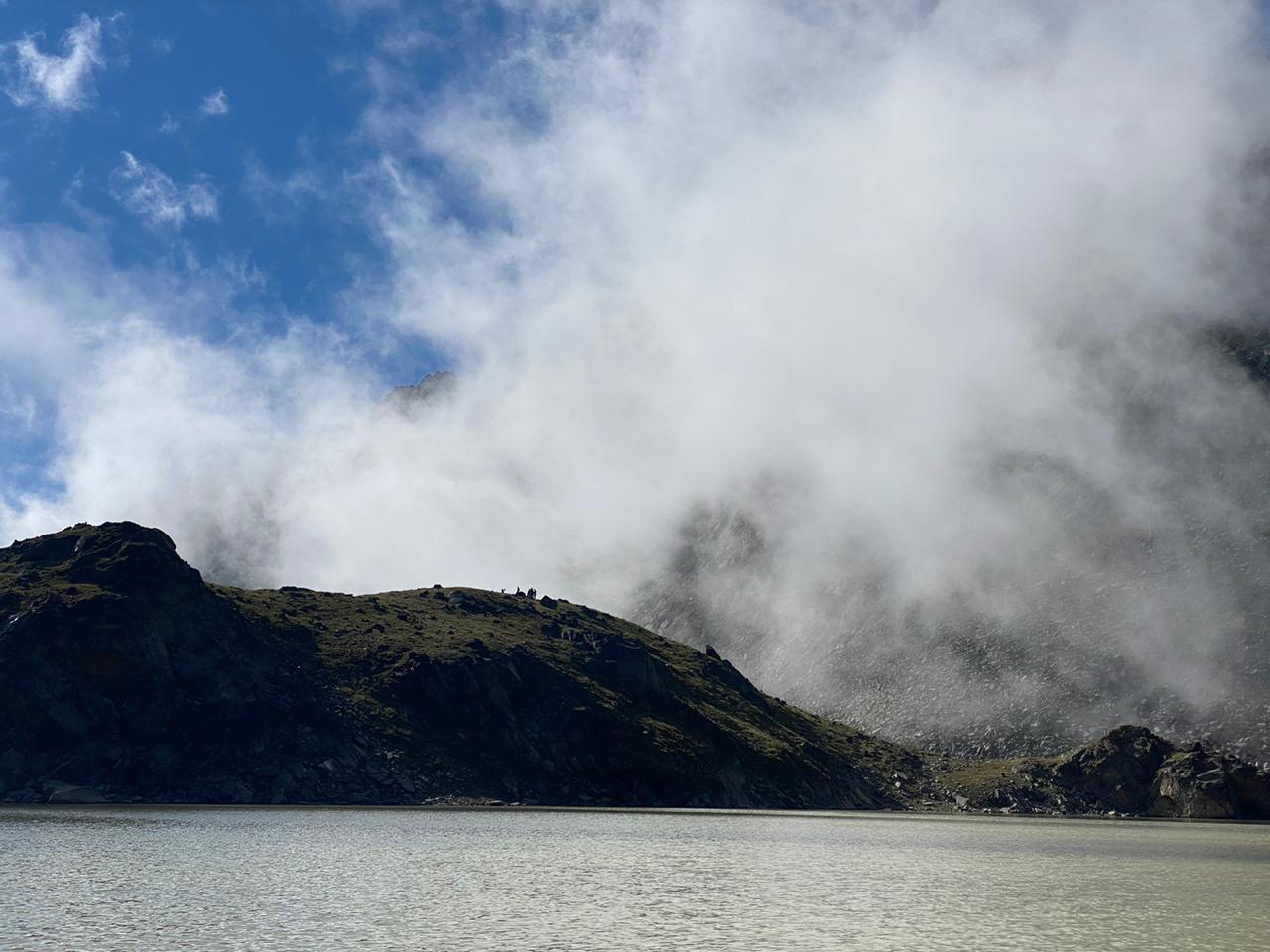
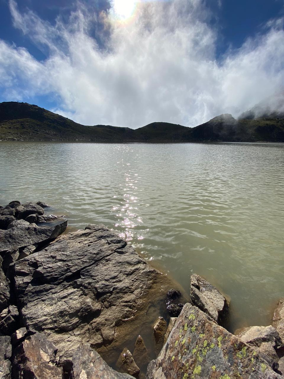
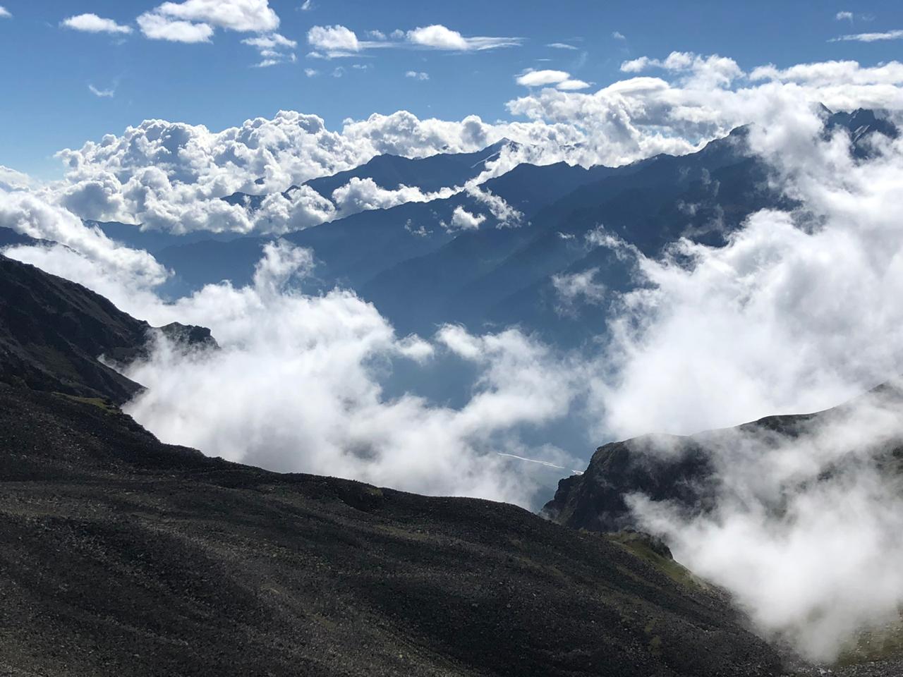
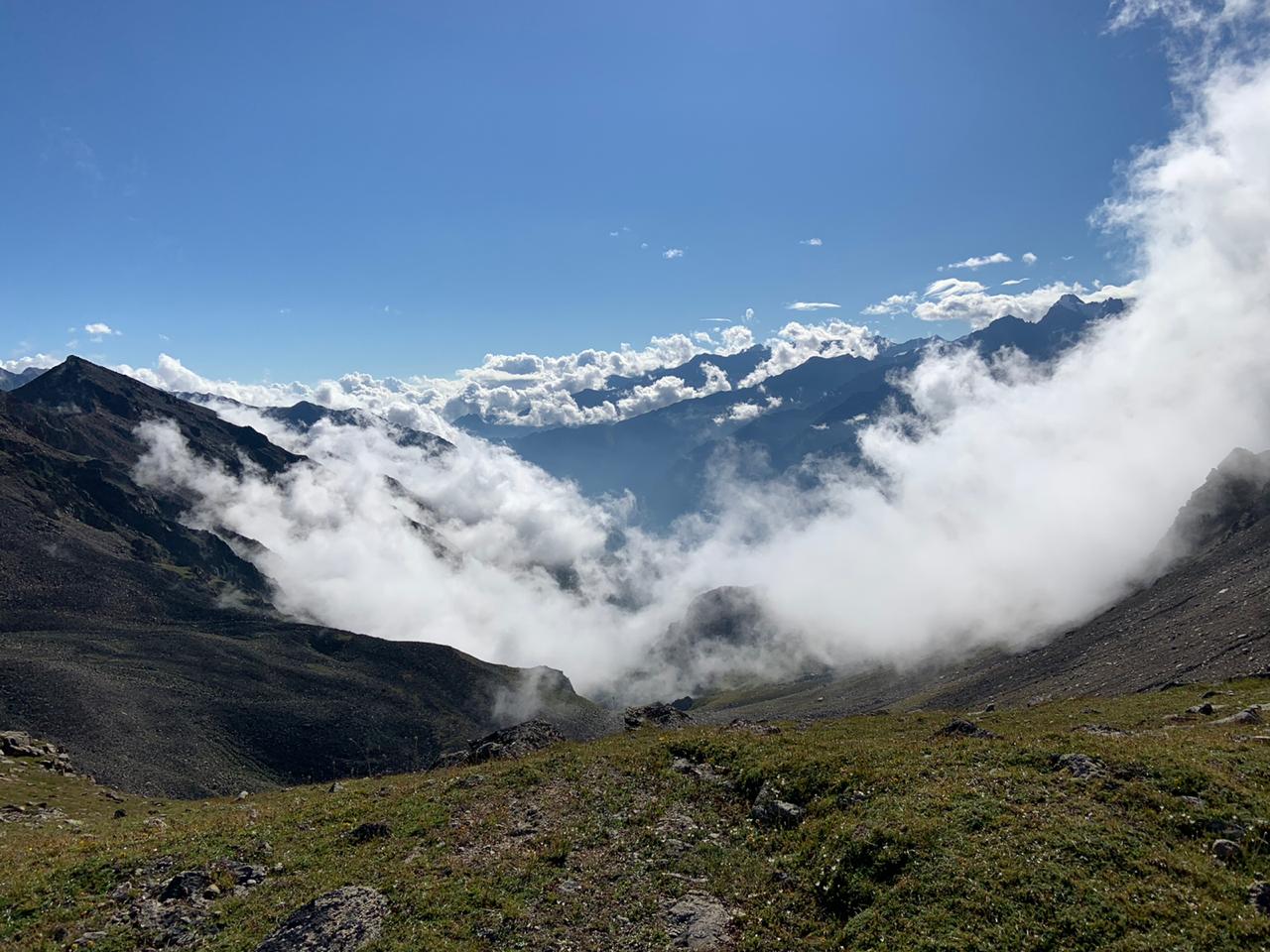
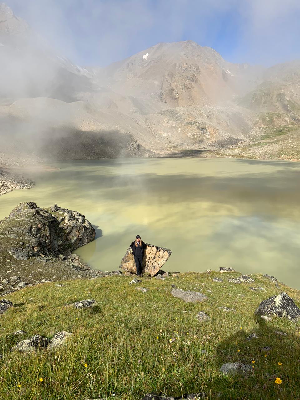
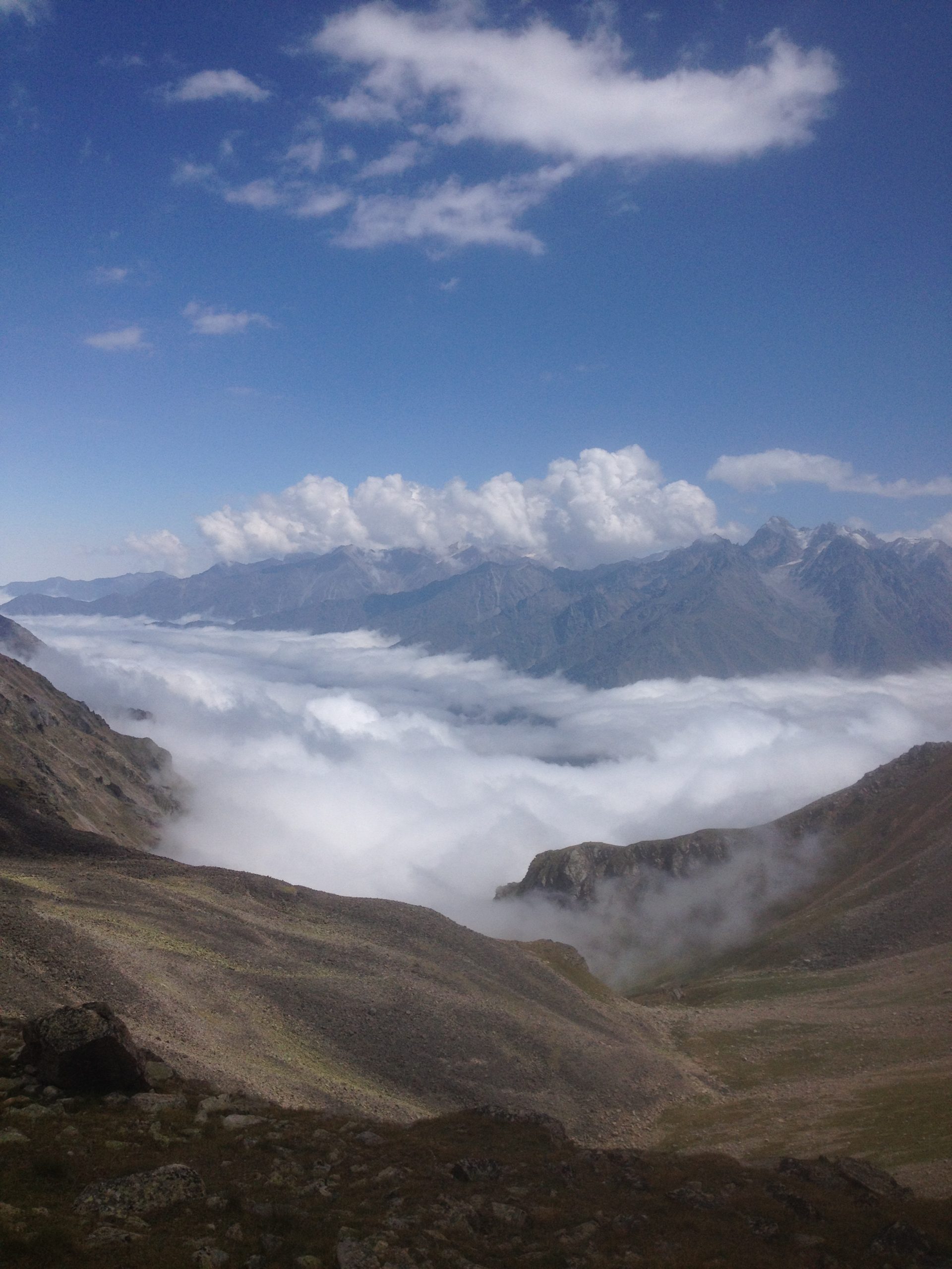
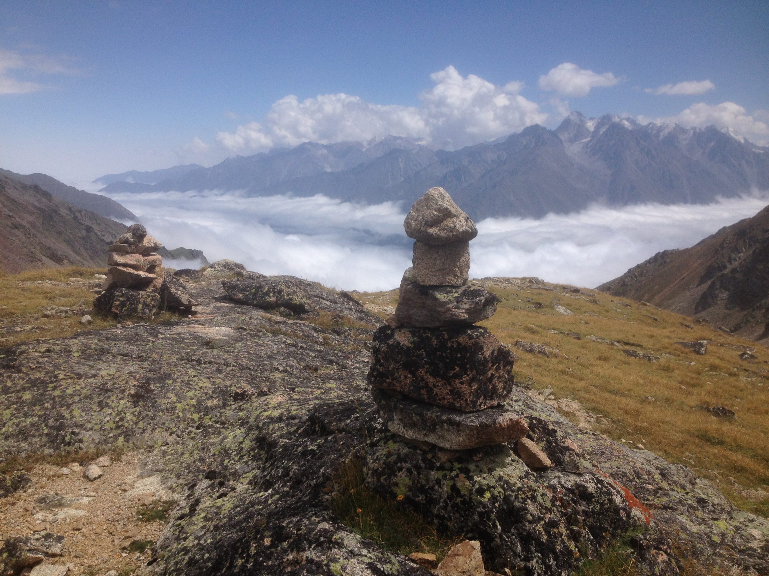
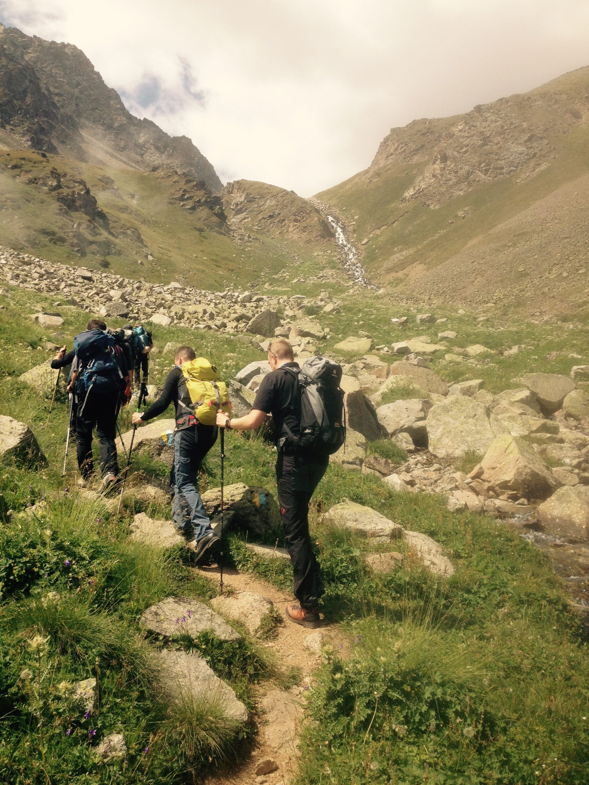
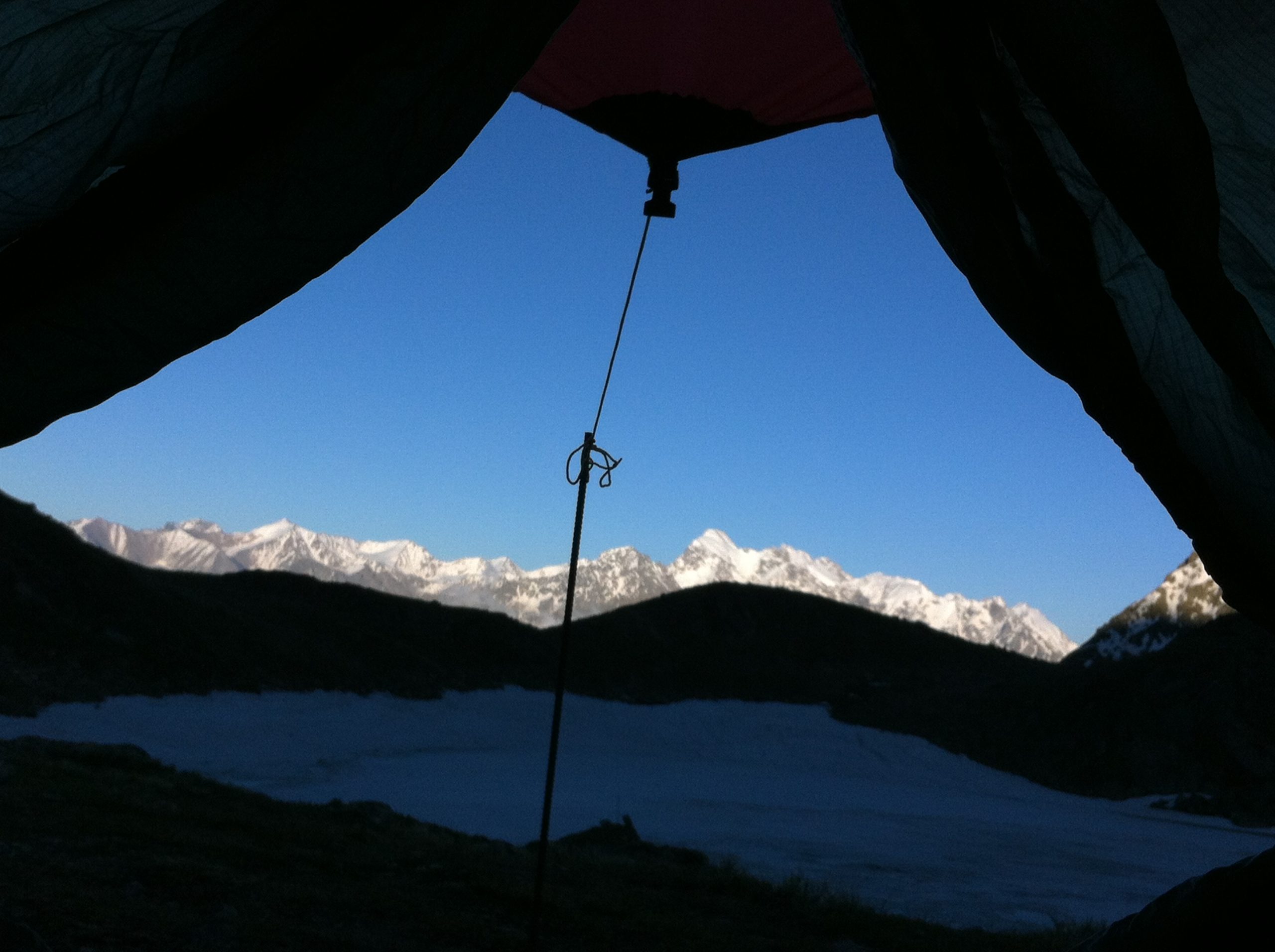
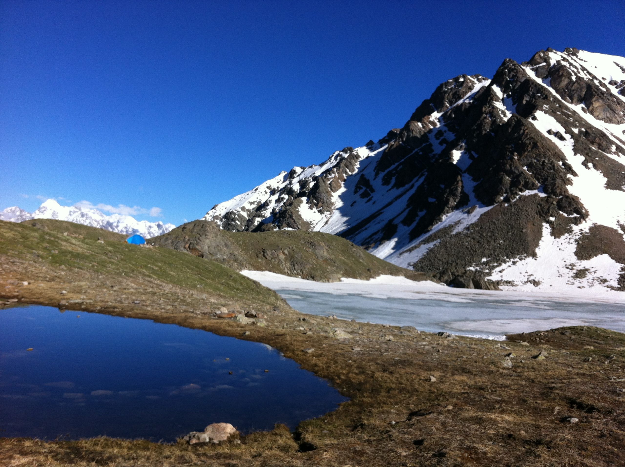
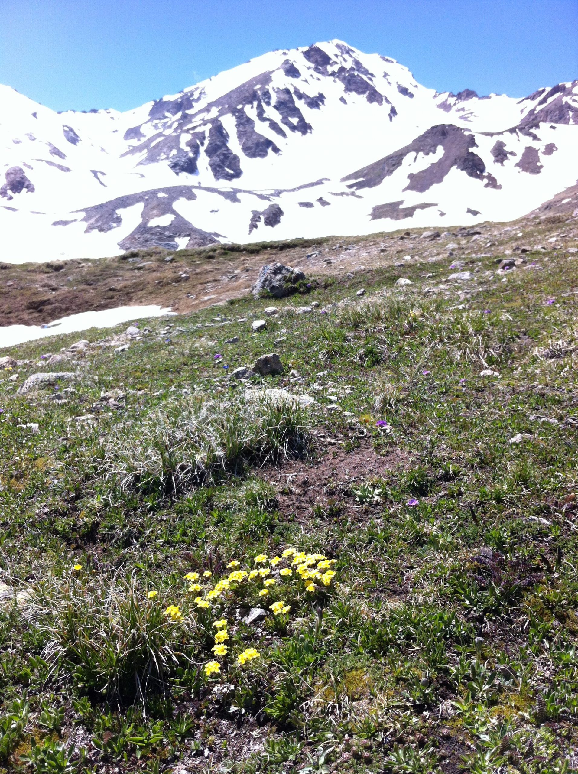
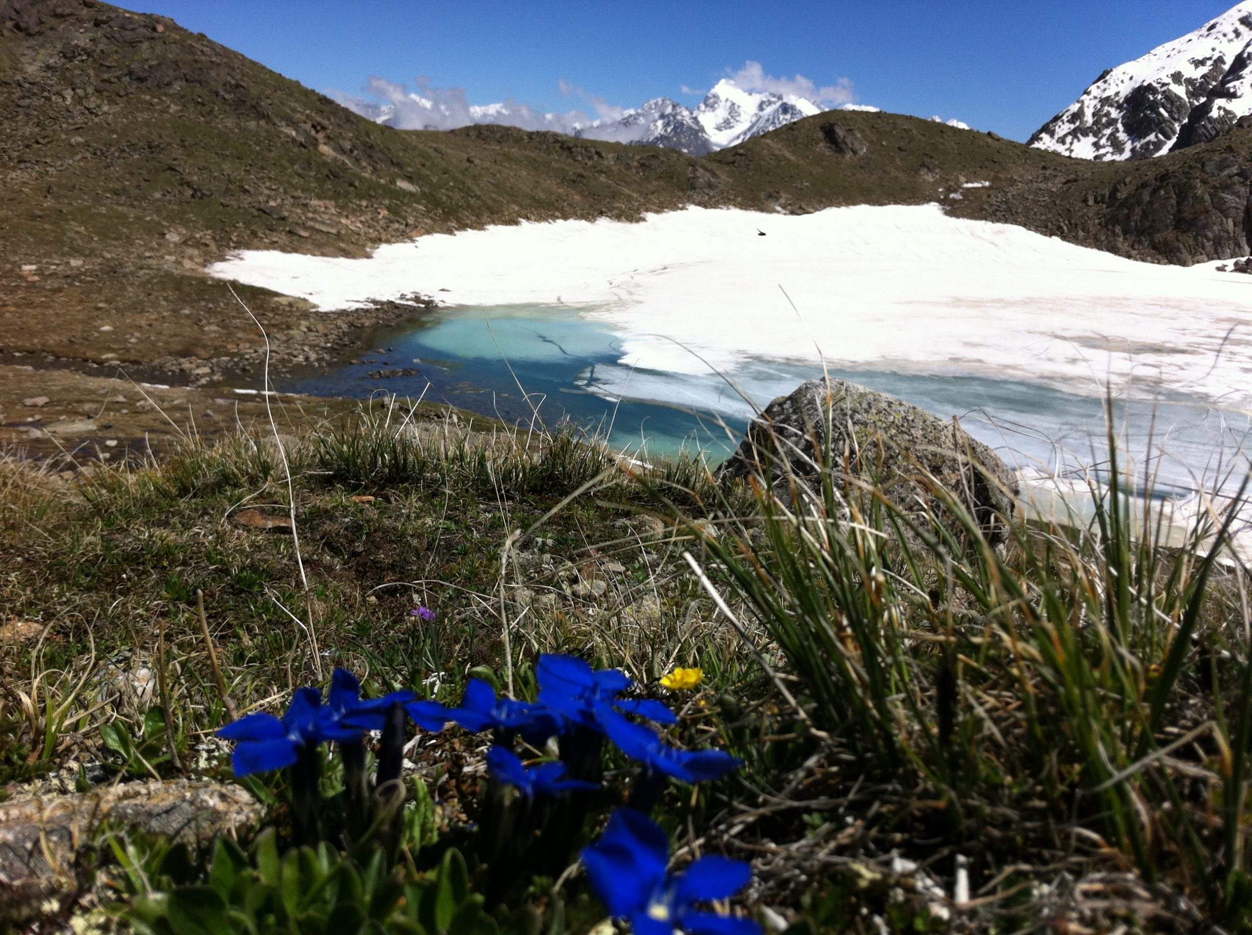
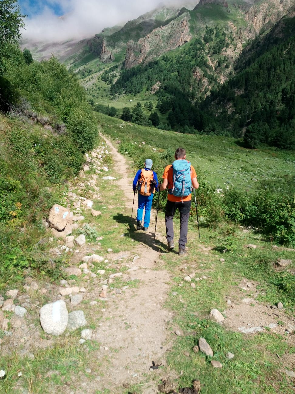
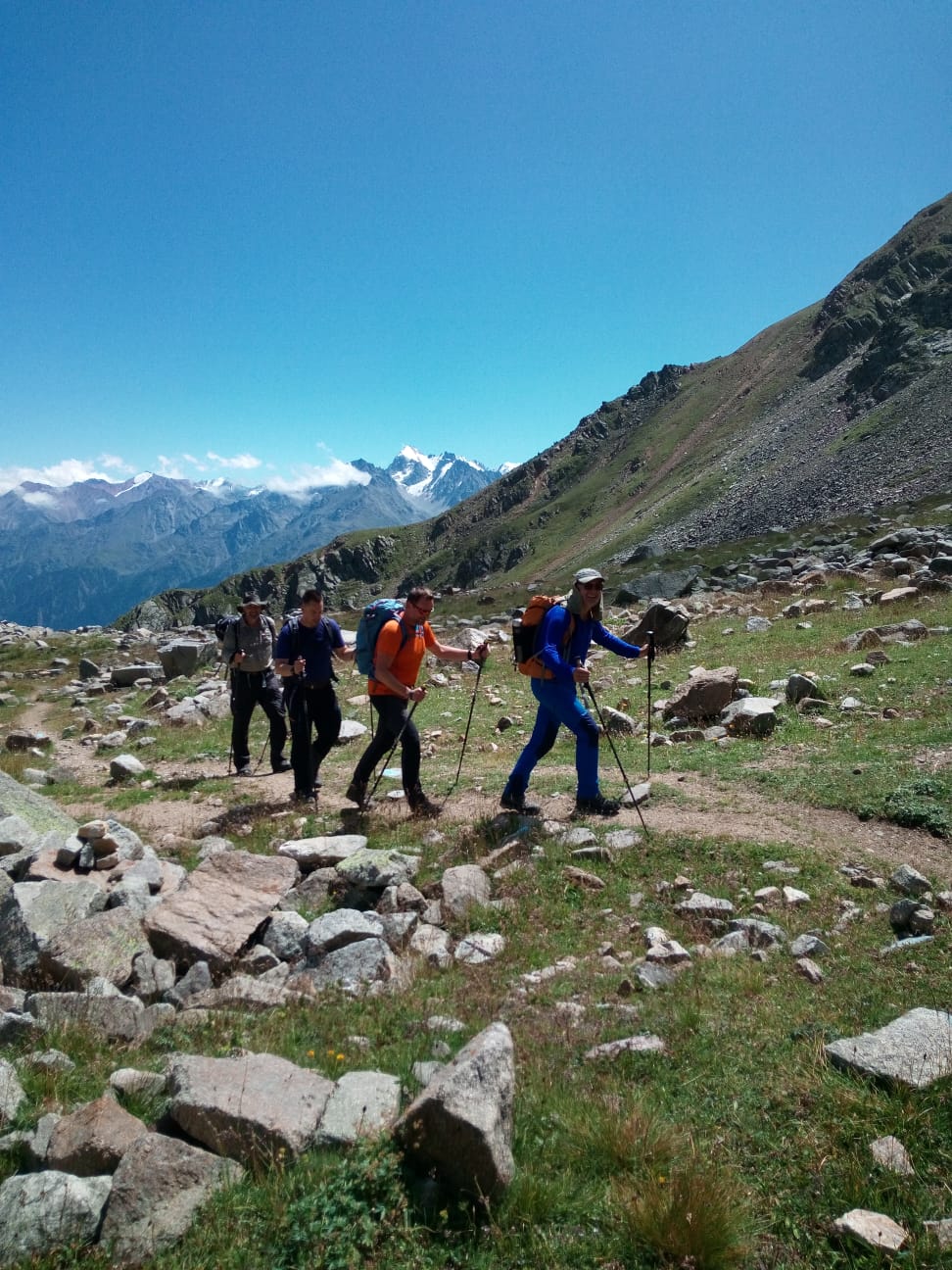
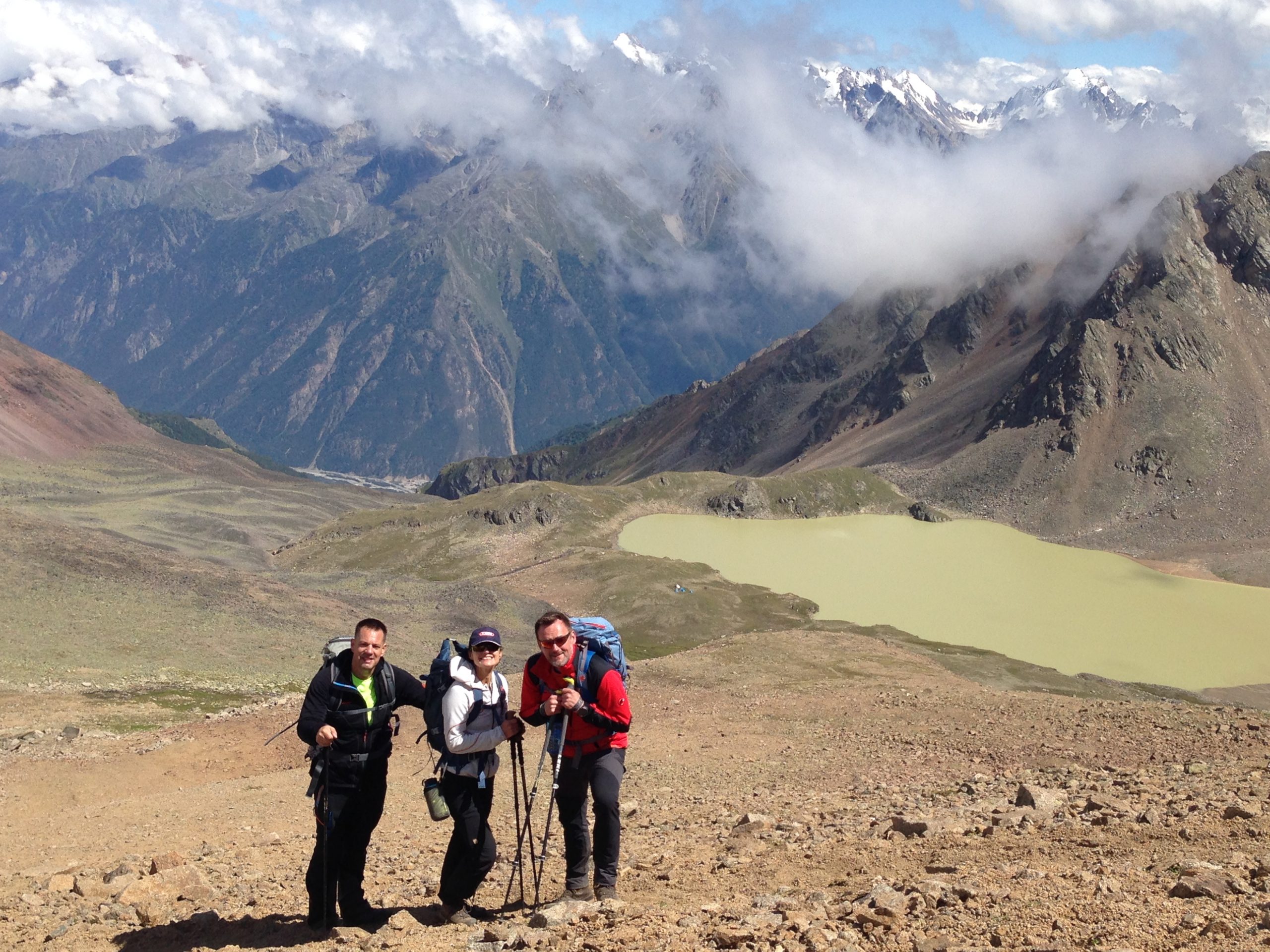
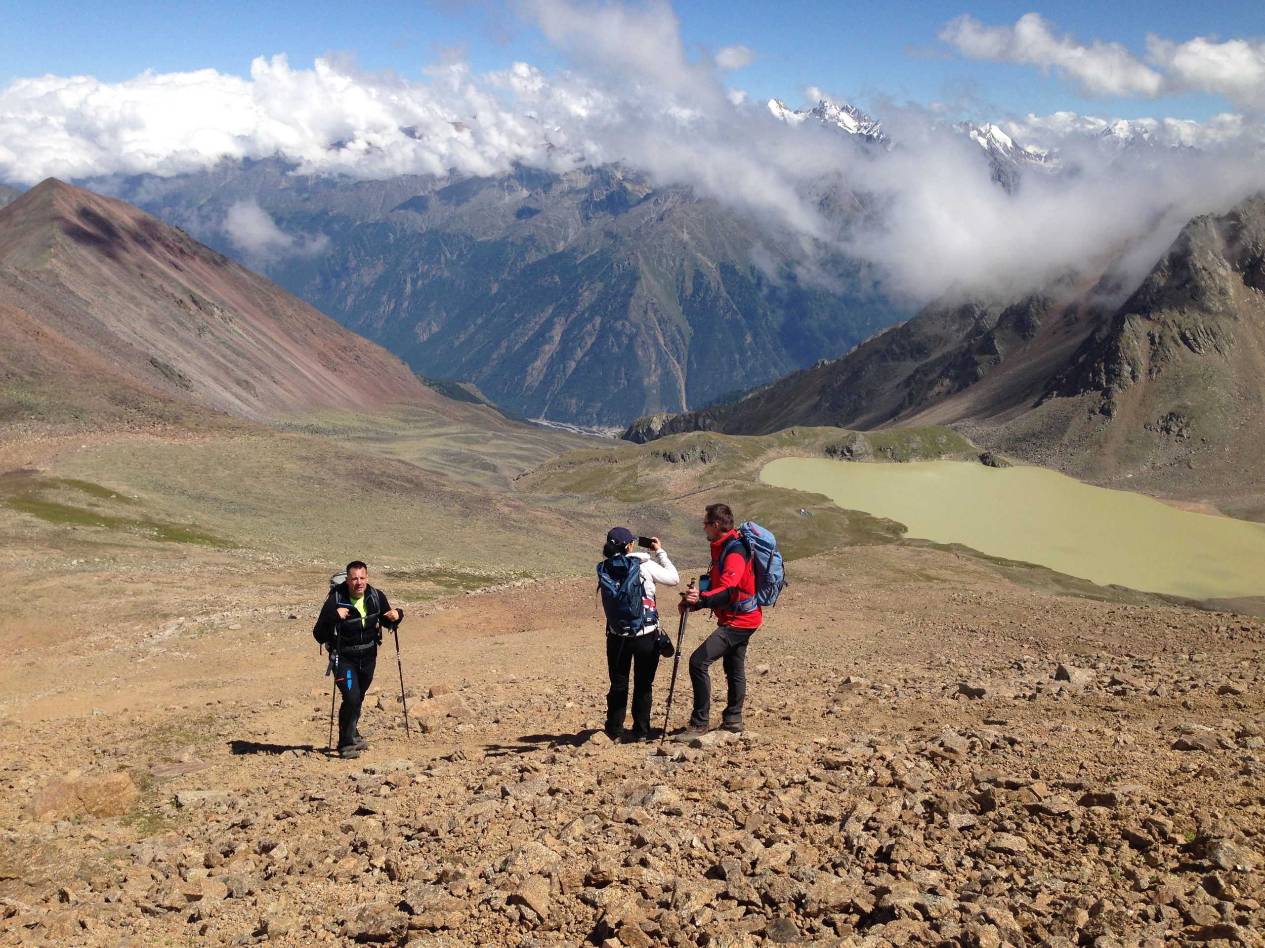
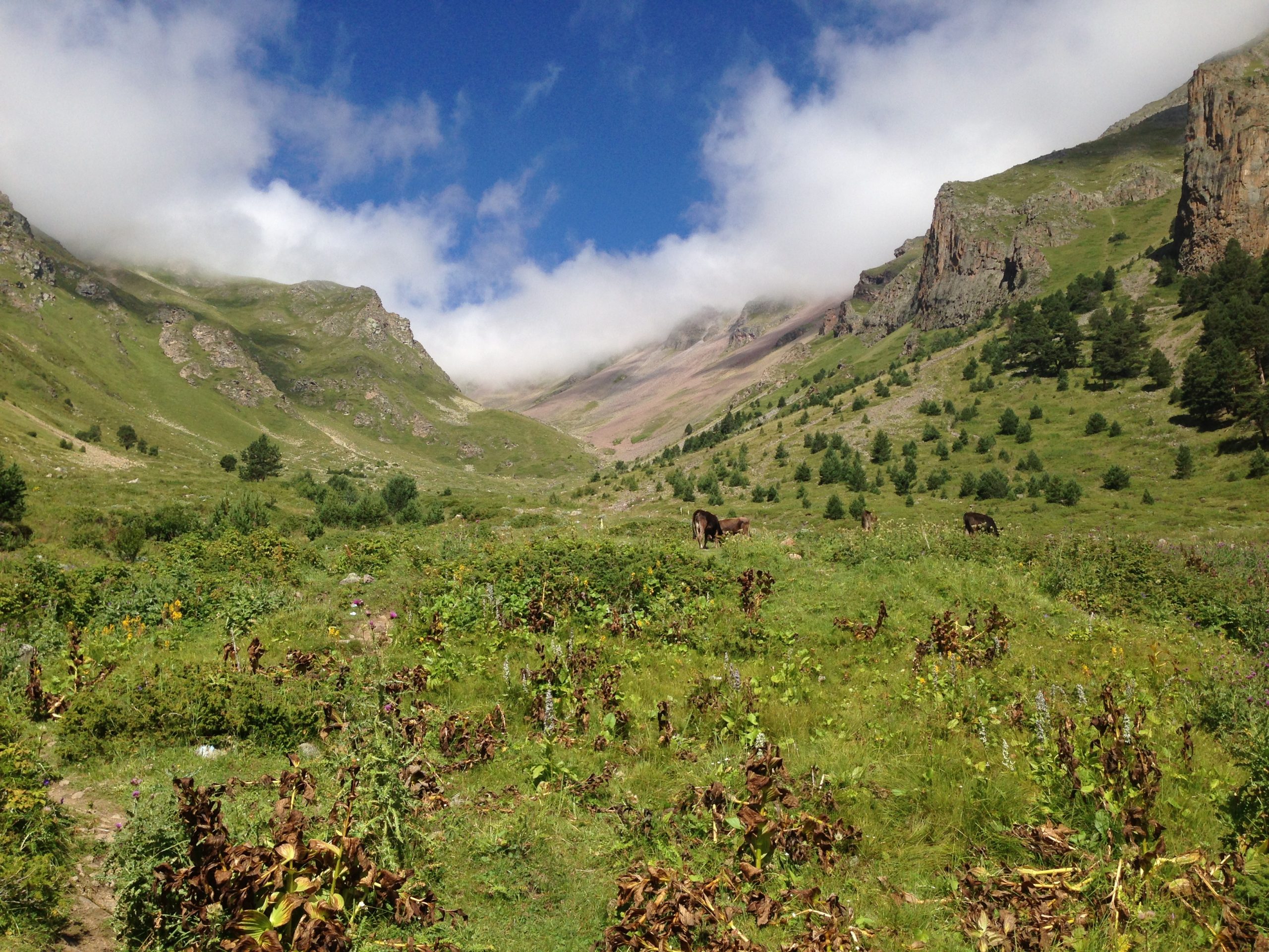
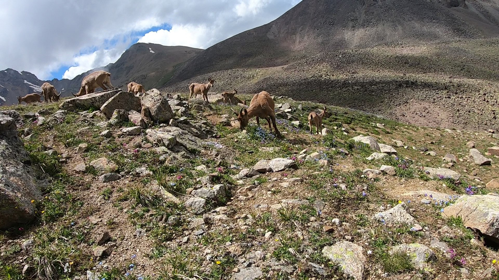
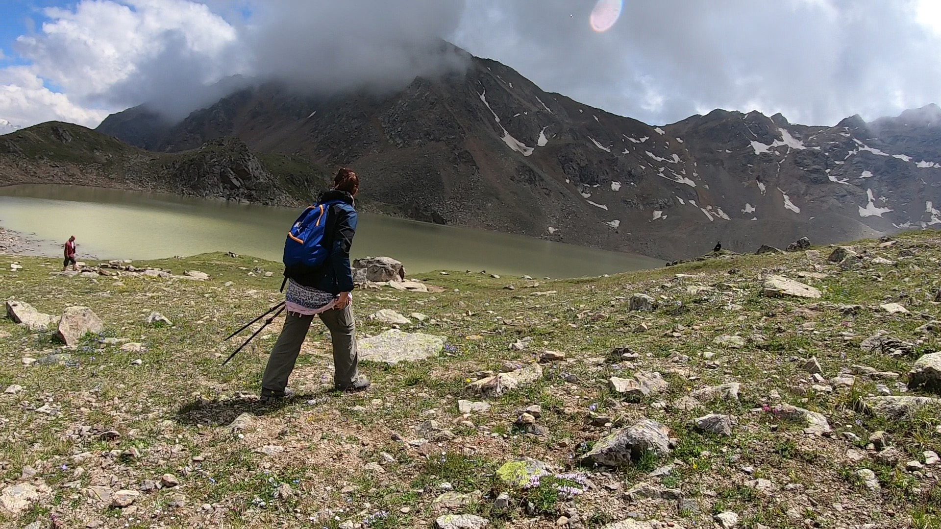
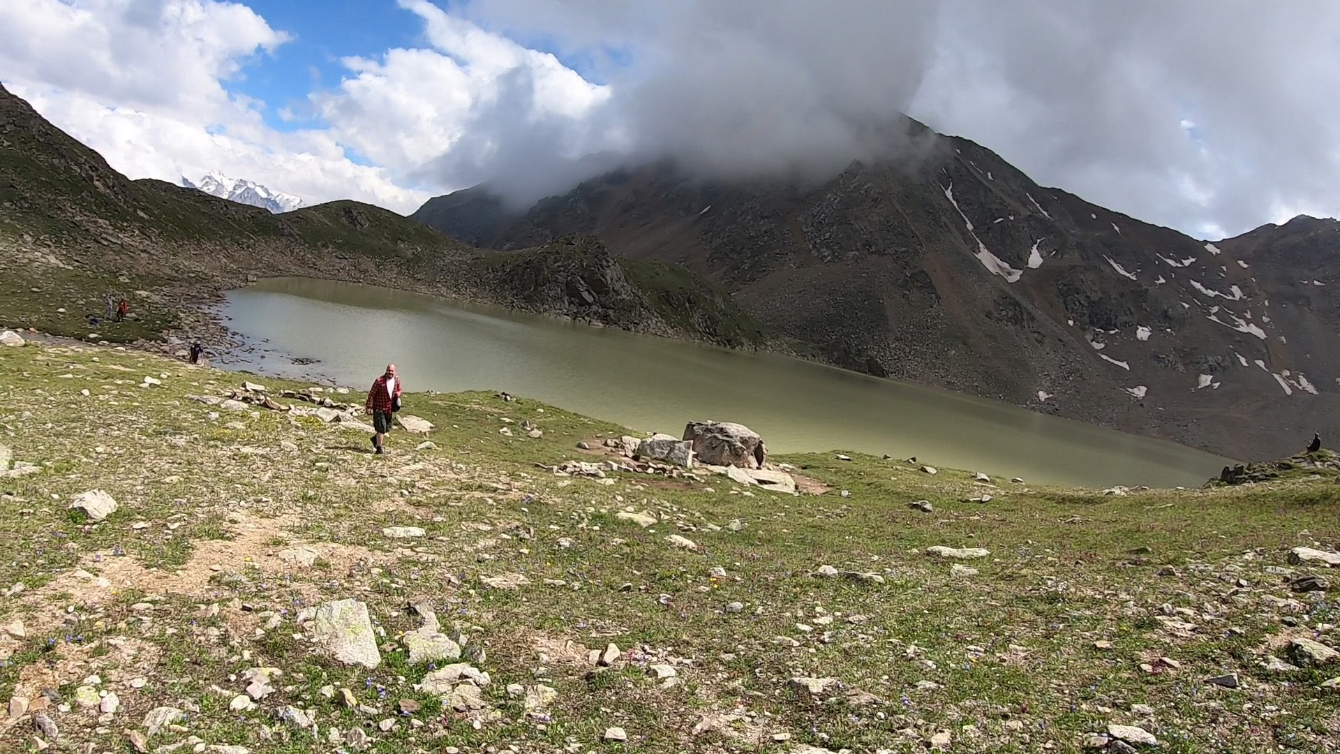
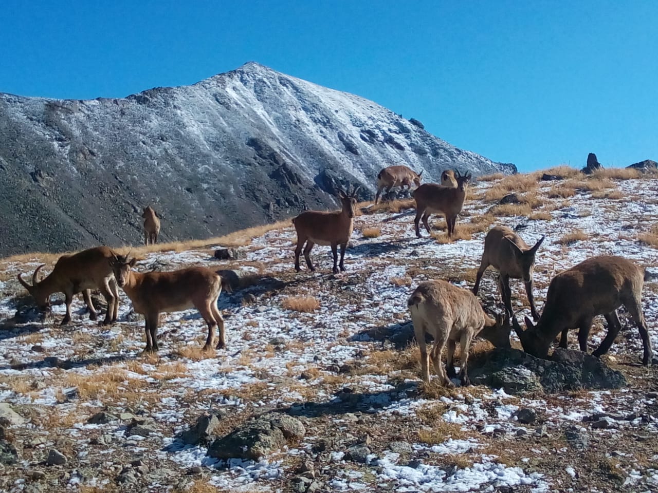
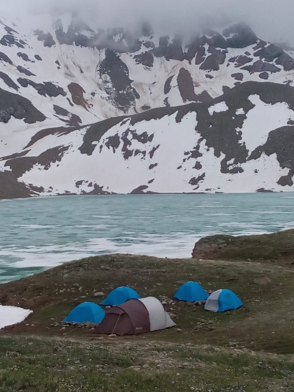
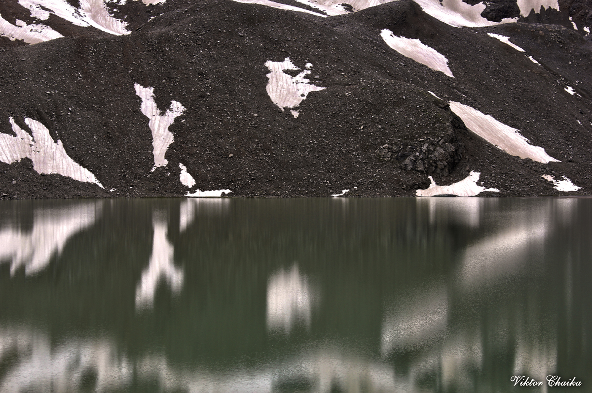
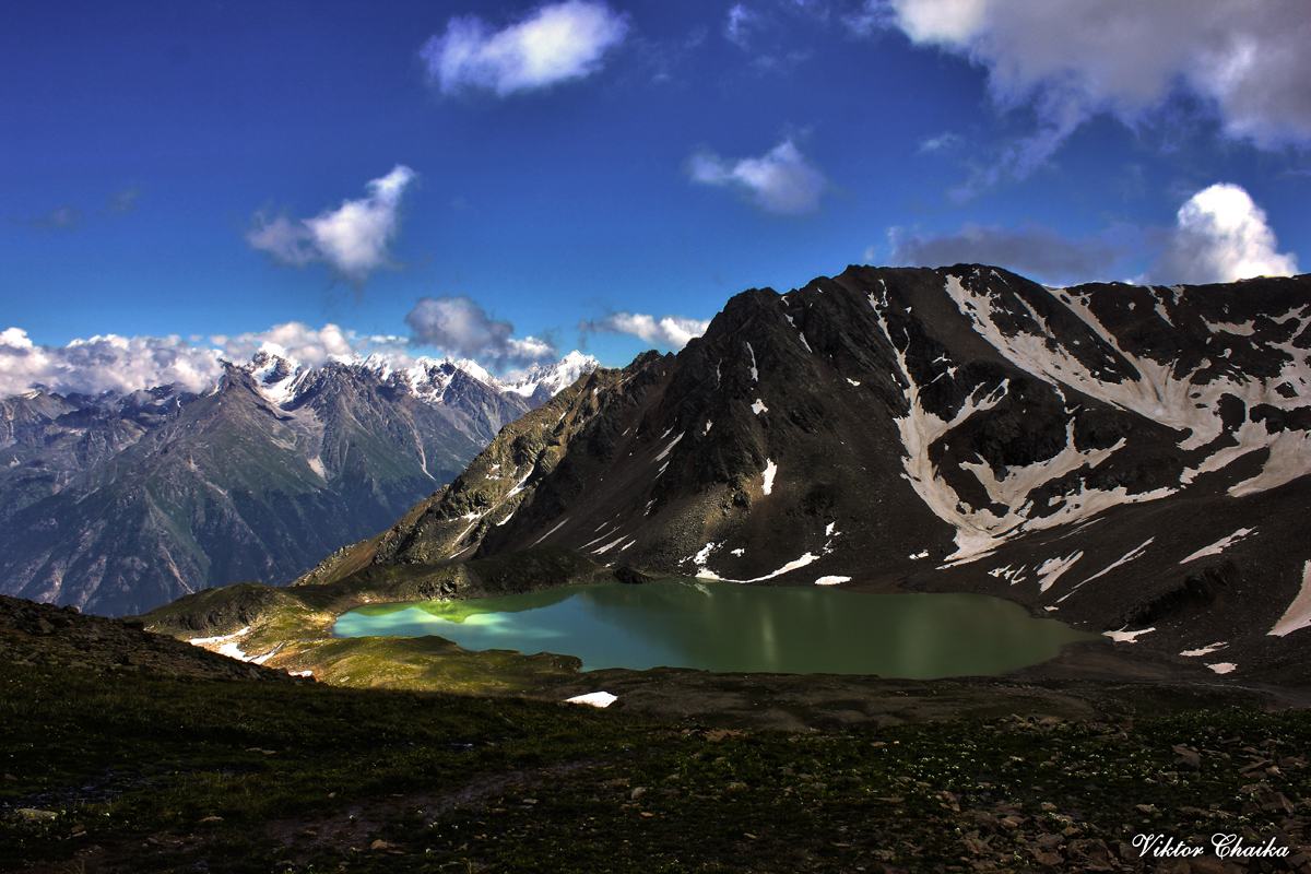
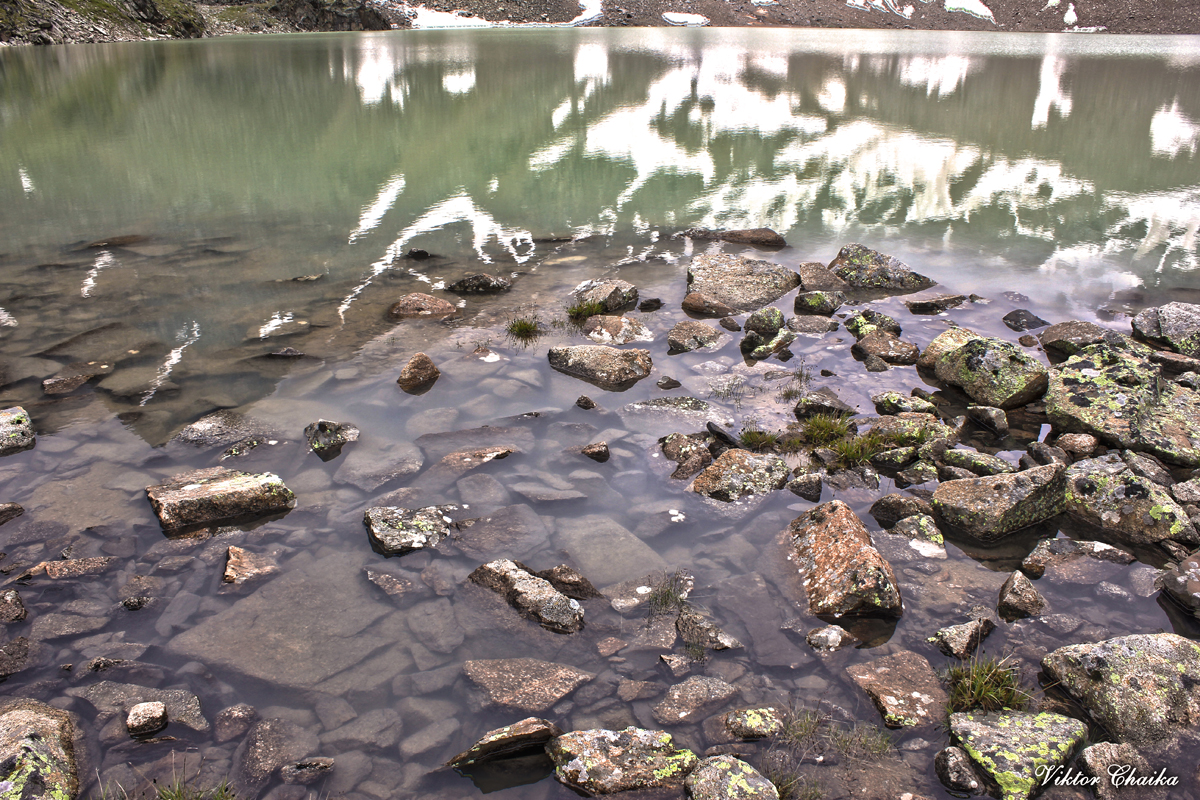
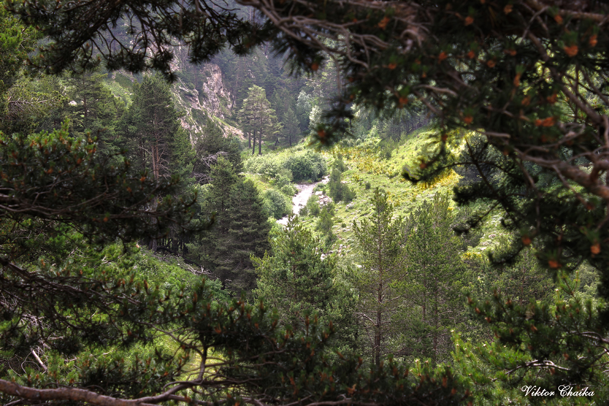
Just imagine: a great walk through the forest, where the legendary Baksan pines fill the entire space with their aroma. It’s so great to feel all this to the fullest when you walk along the path among them, with a team of like-minded people. There are hares, foxes, lynx, bears here. Overnight on the shore of Lake Syltrankel. Lake, the beauty of which no photo can convey. Set up camp. It’s not difficult, and even fun. Your little thousand-star hotels. Thousands of stars of the Caucasian mountain sky overhead. And in the evening there will be tea, and it will be possible to talk with people. With comrades. Look at the stars. You can have a good rest from the transition in order to gain strength for tomorrow’s ascent. And you don’t have to rush headlong anywhere (you also have enough of this on the plain). In the morning you will go to the Mountain, you will gain another 800 — 900 meters, having slept, rested. From lake to lake it will take about 3-4 hours. With an almost similar height (Syltran — 3827, Mukal — 3899), the ascent to Syltrankelbashi is a little longer than to Mukal, which, although higher, is located closer to the camp. Perhaps, climbing one of the nearby peaks, like Syltrankelbashi or Mukal, is also worth it because from there the view of the lake and the surrounding expanse is simply stunning.

If we discard the romantic component of the question, and pay attention to the physiological, then this program is good in this sense:
From the car to the lake, a smooth, unhurried climb of 700 m, about 4-5 hours.
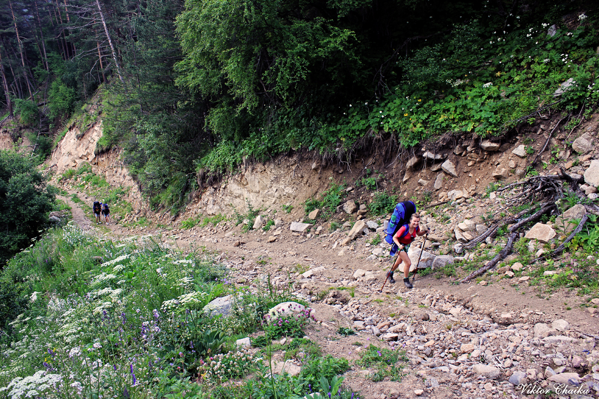
From Upper Baksan to the Lake — about 7 hours. (In general, a classic transition on this route, mountain tourists pass this segment in one day, in the sense that they do not break it into two days, but at the same time, usually the weight of their backpacks is rarely less than 30 kg, in our case, the weight will be a little over 10, maximum 15 kg). You can go not from the village itself (the climb is 1400 m, but from the lower border of the forest the climb is a little more than 1000 m).
Overnight stay at an altitude of 3000 m — (plus — the second half of the first day) sets an excellent stimulus for the body to further improve the quality of the blood, which will be necessary at the time of climbing the nearby mountain.
Smooth acclimatization schedule: First day: +1000m, second day: +800(900)m.

Optimal training/rest ratio: maximum 7 hours of working time (starting at 2300 about 5 hours), the whole second half of the day and the whole night — in order to restore the supply of nutrients in the muscles and give the nervous system a rest from physical stress. Climbing with fresh energy.
It should also be noted that climbing any of these peaks in itself is not particularly technically difficult, according to the Russian classification, these are routes of the 1B category of difficulty (the most initial and easiest).

Routes to Mounts Syltrankelbashi 3827 and Mukal 3899 m.
Vil. Verhny Baksan – the Syltrankel Lake – Mount Syltran or Mukal – vil. Verhny Baksan.
The first part of the route to the lake Syltrankel is described here — Lake Syltran-Kol
DESCRIPTION
Day 1: Trek till Lake Syltrankel 3000 m.
Trekking trip in the Syltran gorge with an overnight stay at the Syltrankel lake and traverse of one of the peaks — Syltrankelbashi 3827 m and/or Mukal 3899 m
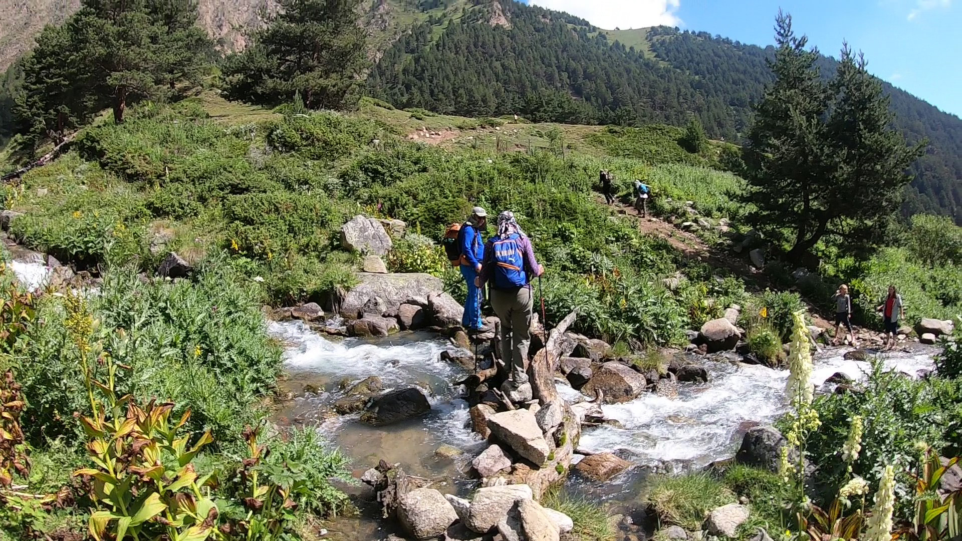
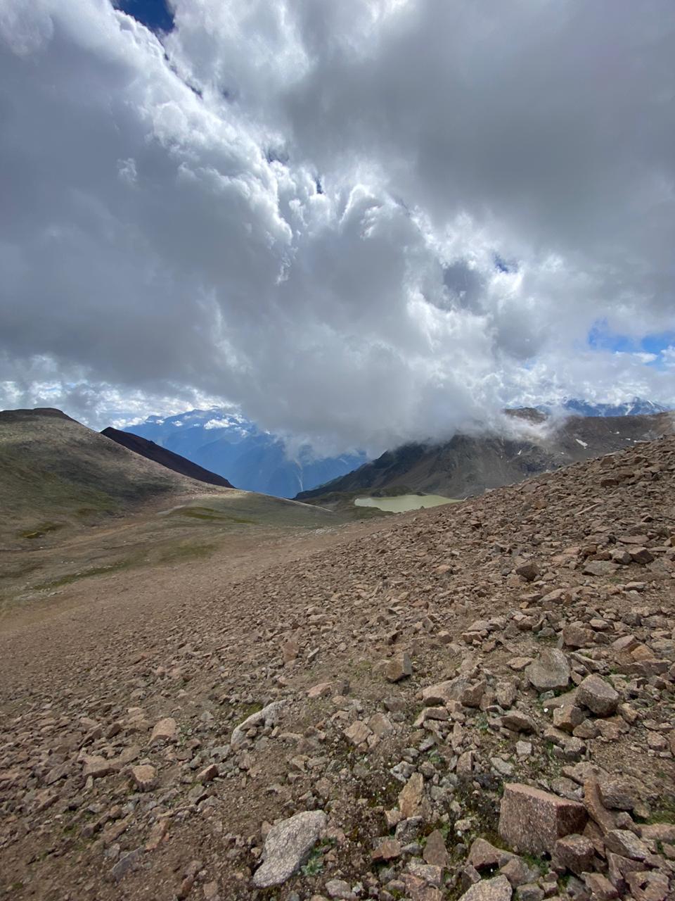
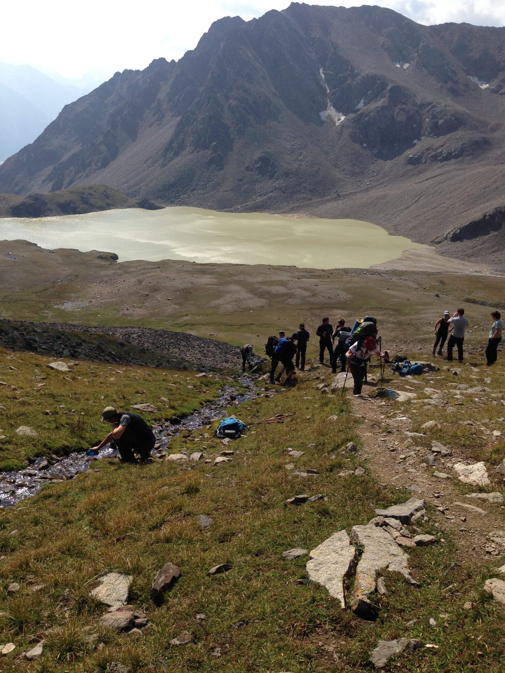
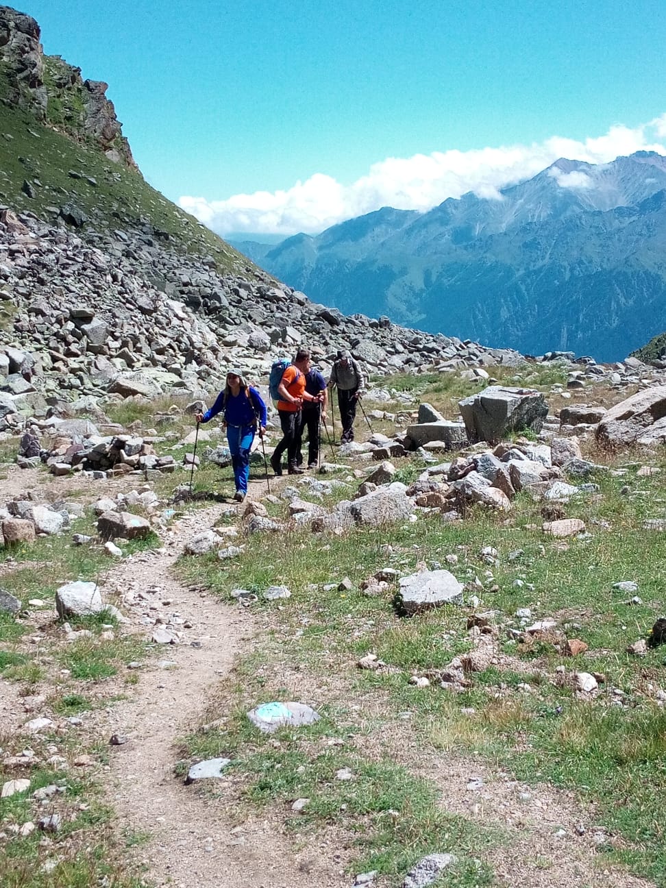
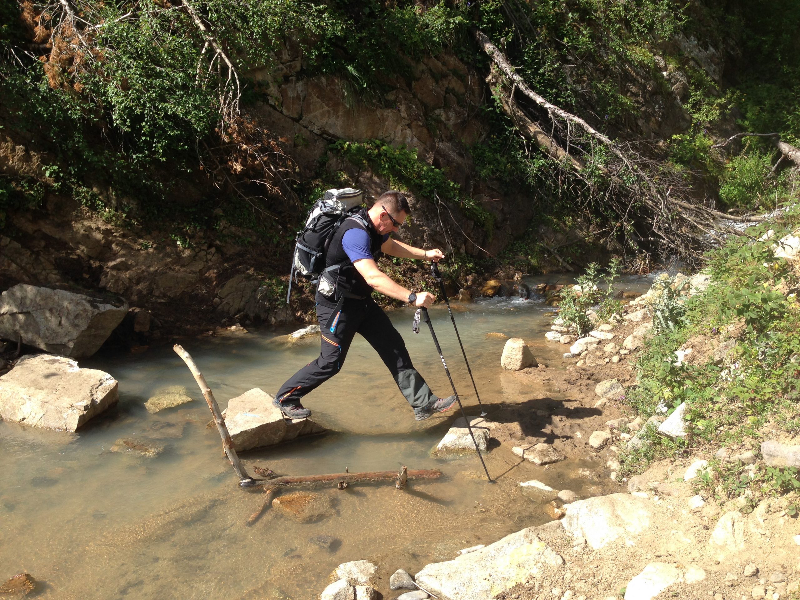
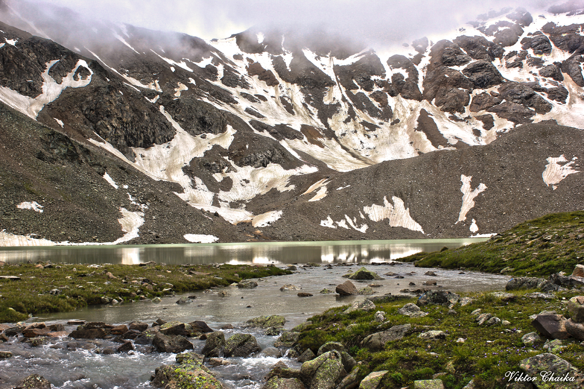
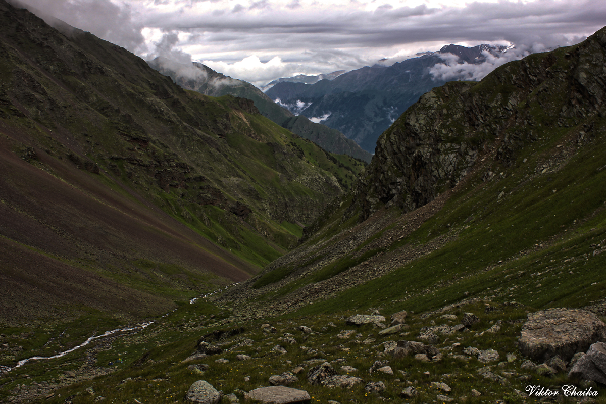
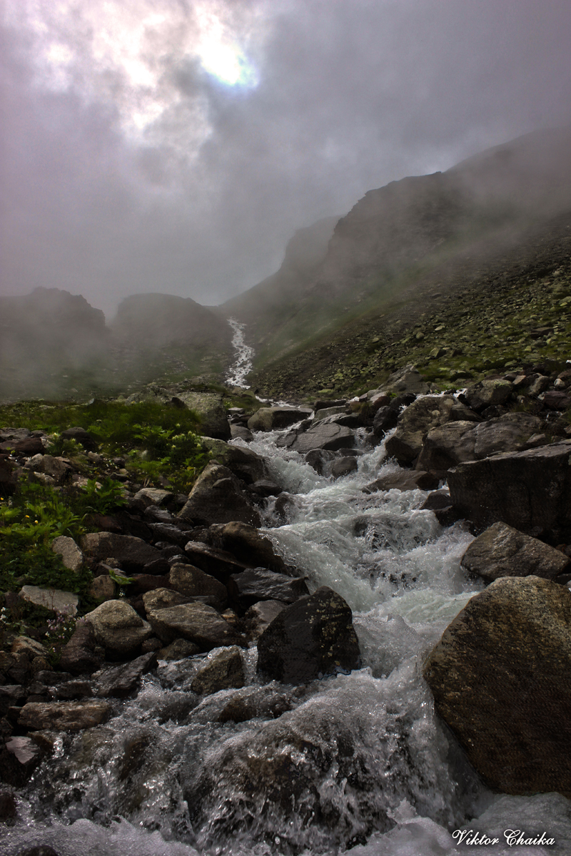
Trekking route to the camp: V.Baksan — lake Syltran — V.Baksan (18 km, 6-7 hours, elevation difference 1500 m). From the village of Verkhny Baksan (1600 m) we go up on an off-road vehicle to a pine forest and stop in a water clearing (2300 m). Further along the road we leave the forest, cross the Syltran River and continue along a good path along the stream. We rise to the first stage (2600 m, 1.5 hours). Further, the canyon narrows and the trail becomes steeper. Overcoming the second stage and exit to the lake Syltran (3050 m). Here rest and lunch. It is possible to climb the Syltran pass on this day (3441 m, 1 hour). From the car to the lake 3-4 hours.
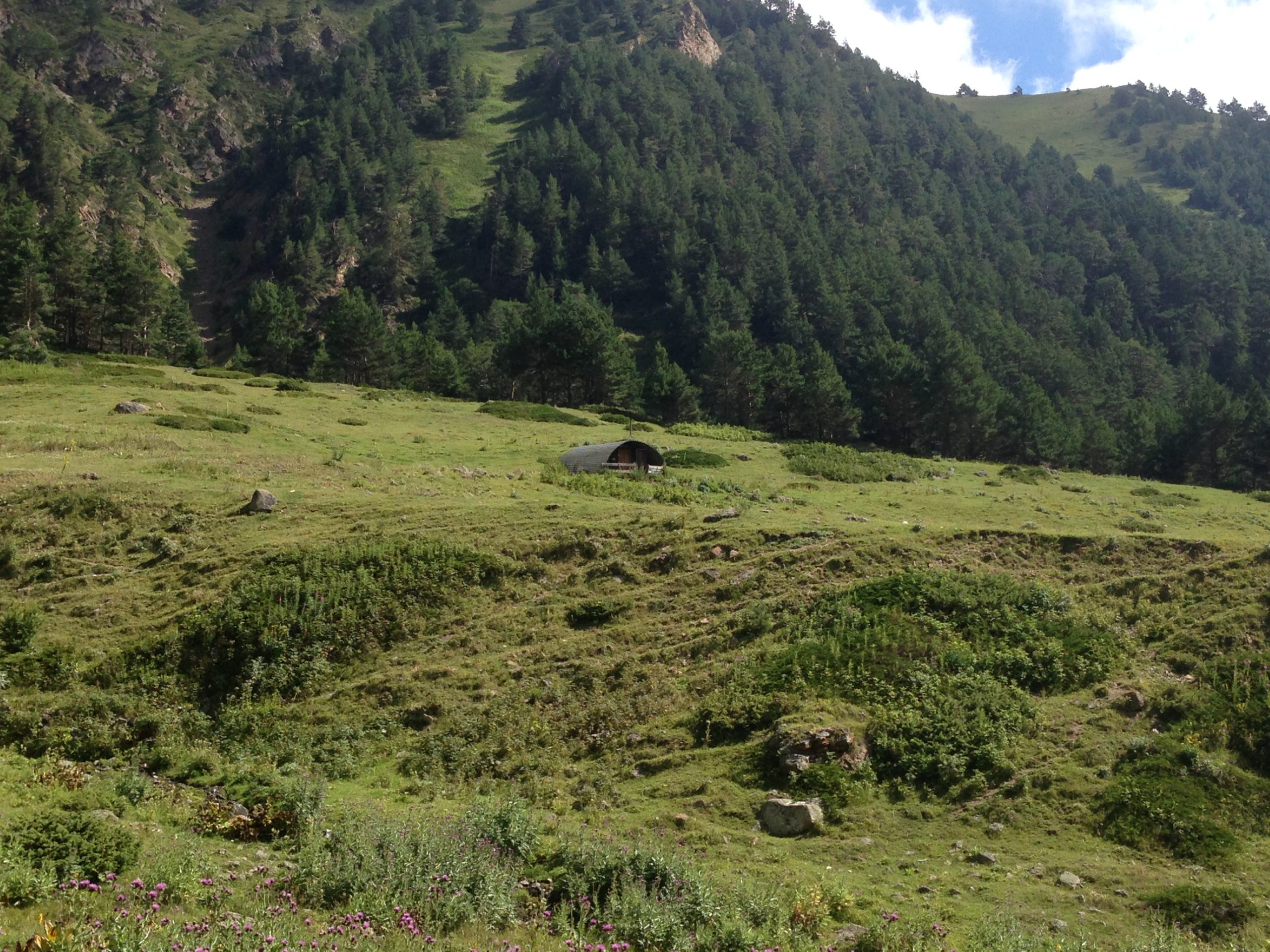
If without SUVs from village Verkhny Baksan the road goes to the left gorge. The left gorge is the gorge of the Syltrans-su river. From the store, we go over the bridge located below the confluence of the Syltrans-su and Kyrtyk rivers, and along the northern outskirts of the village, go to the path that goes along the left slope of the gorge. The path leads to the forest. The trail is well developed. The river remains far to the right, along the way. The forest zone is walked along the trail in 2 hours. Leaving the forest zone, the trail goes to the right to the river. There is a bridge across the river. To the right of the bridge is a kosh (farm yard). Kosh remains on the right, along the way. Above the forest zone along alpine meadows, the path leads to a green take-off and further along the river to the next take-off, which is overcome from left to right. The last take-off leads to overnight stays located under a natural dam, behind which there is Lake Syltrankel. From the village of Upper Baksan 5-6 hours.
Day 2: Ascent to the summit of Syltran and/or Mukal.
Route to the peaks of Syltrankelbashi 3827 and Mukal 3899.
Below is a detailed description of the highlights of the program, with some comparison of options and weather conditions. The description of the routes to Mukal and Syltrankelbashi is given separately.

To the top of Syltrankelbashi 3827 m :
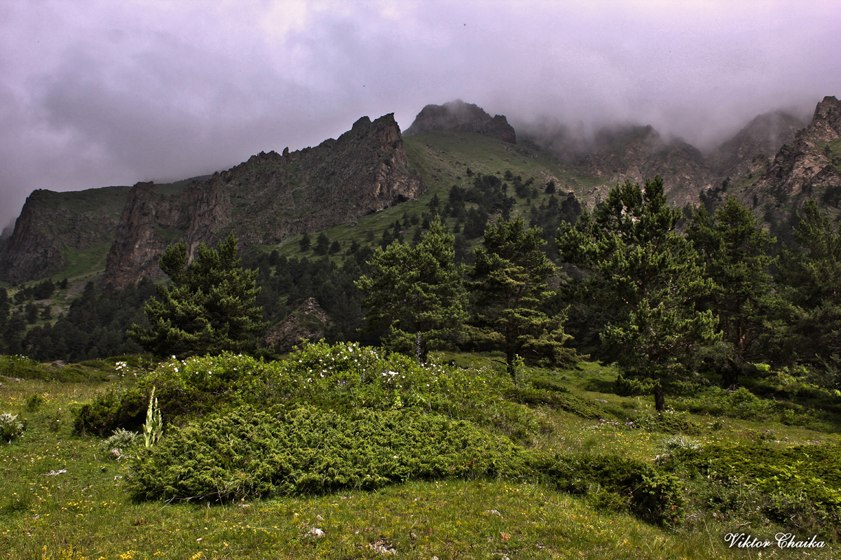
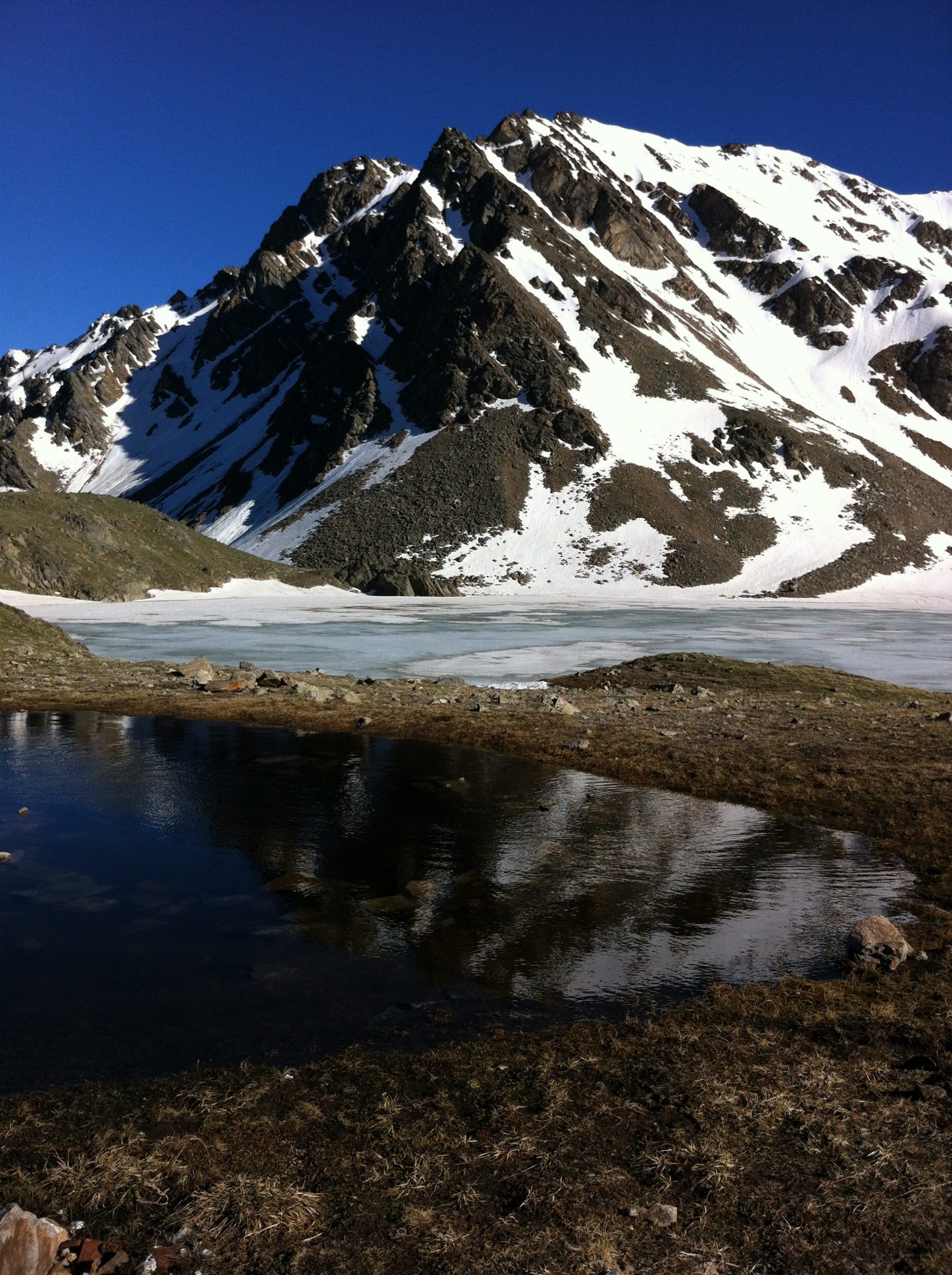
The northern slopes of the Syltran peak descend steeply to the lake in the south. From east to west the circus is located peaks Syltran and Mukal. In the northwest there is a wide scree saddle of pass Syltran. To the east of the top of Syltran there is a scree depression — pass Zurbagan.
To the north of the peak of Mukal (above the lake) between peak Mukal and nameless peak (3621m) — pass Grach, from which the Eastern ridge of Mukal peak departs. Between the peaks of Mukal and Syltran there is a high snow-ice saddle — pass Mukal. To the east of the top of Syltran there is a scree depression — pass Zurbagan.
From Lake Syltrankel we climb to the Zurbagan pass, from which the Eastern ridge of the Syltran peak departs and then along the Eastern ridge we reach the summit of Syltran. Descent from the summit through the Mukal pass between the peaks of Syltran and Mukal.
From overnight camp along the path to the right descend in the dam. Lake Syltrankel opens in 30 minutes. Overnight stay on the shore of the lake. Spending the night under the dam is preferable, as it is protected from the winds.
The ascent time from the lake to the top is 1.5 — 2 hours.
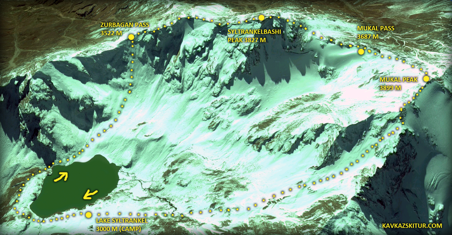
To the top of Mukal 3899 m :
From the lake rise along a steep path along the stream and further along wide steep slopes, with a small scree to the Grach pass. From the pass, climb to the top of Mukal along the Eastern ridge.
Ascent time from the lake to the pass is 30 minutes, to the top of Mukal 30-35 minutes. Descent from the summit to the Mukal pass between the peaks of Syltran and Mukal, and further from the pass down to the lake Syltrankel.
Syltrankelbashi 3827 on the eastern ridge, the descent-ascent will take about 3, maximum 4 hours, depending from the weather.
Mukal along the eastern ridge 3899 m. Descent — ascent in general will take less time than on Syltrankelbashi, the summit is closer (although everything is nearby), the route is shorter.
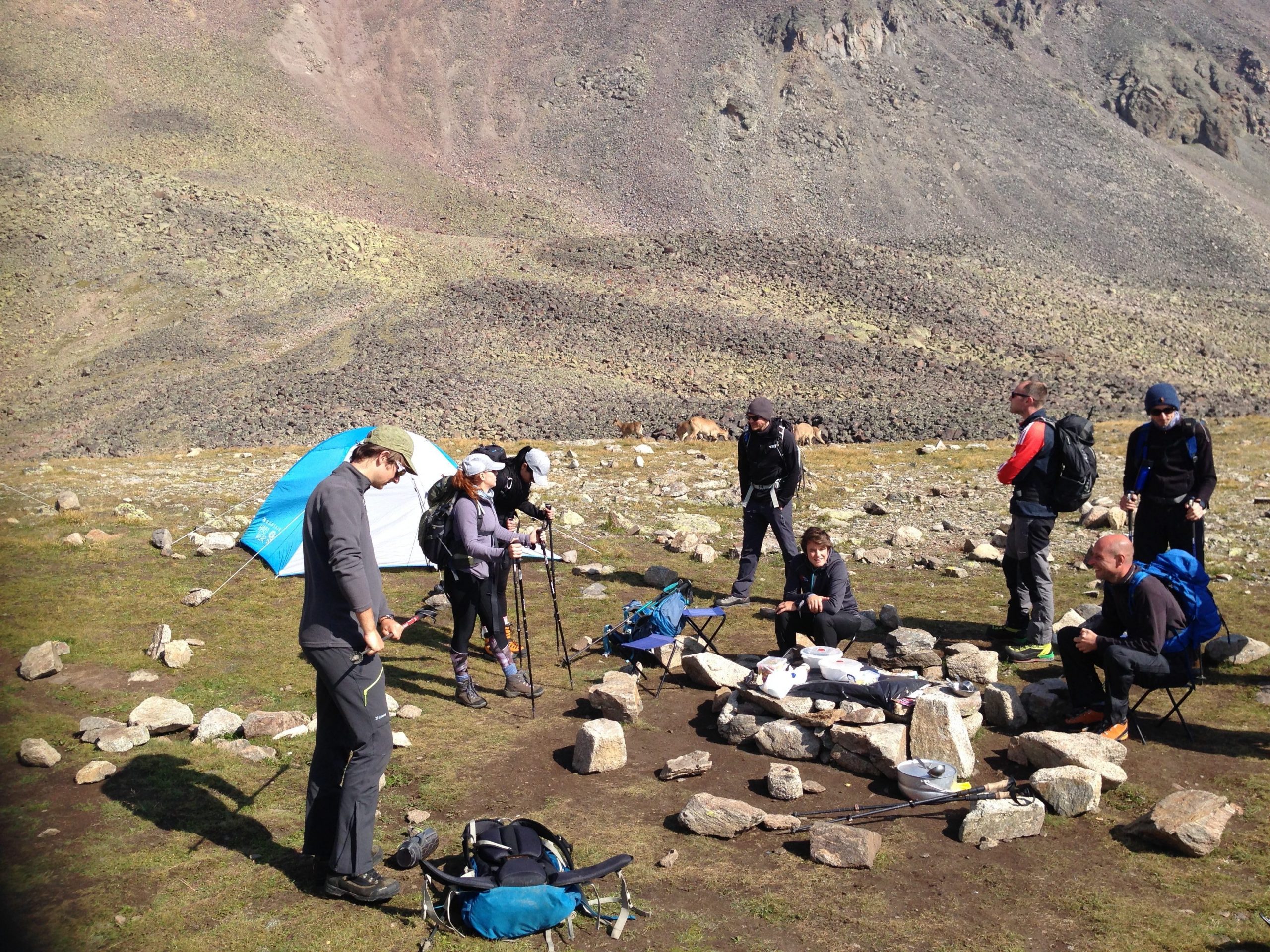
Return to camp. Dinner. Overnight in tents.
Weather. Often, the classic version of the weather of «medium applicability» is when everything is fine in the morning, everything is bad in the afternoon. The second half of the day can begin at one o’clock in the afternoon and at twelve o’clock. It is advisable to go down by this time, at least from the top (from the Lake, even in poor visibility and rain, the path will lead out).


Day 3: Descent down from overnight camp under Lake Syltran.
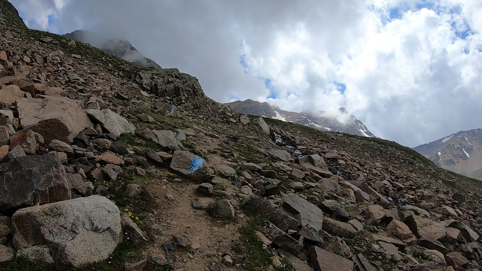
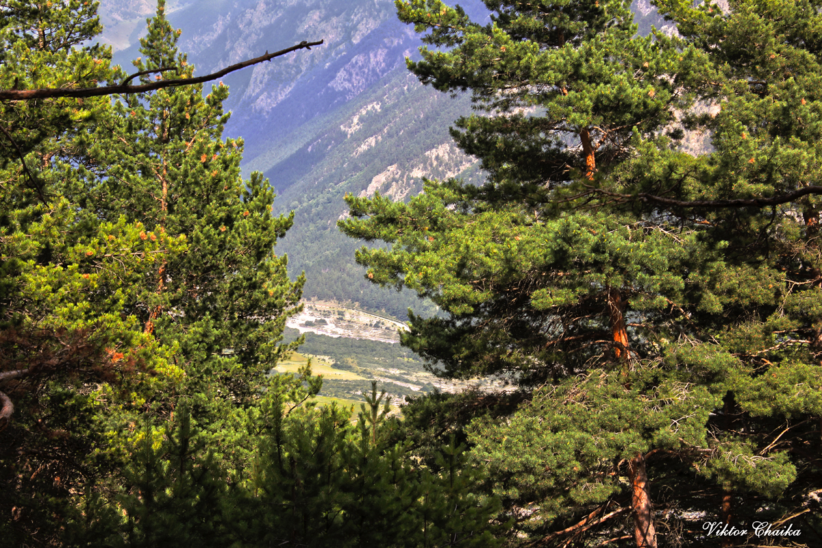
Departure (descent from the lake back to the Upper Baksan village). Descent along the ascent path to the forest zone, to the place where the car is waiting (conditionally 2300 m). Usually the descent is about one third of the time spent on the ascent. But it is better to lay down HALF of the time spent on the rise. Due to the fact that the speed of movement in the mountains is only partially dependent on whether you are going up or down. To no lesser extent, the “construction” of the trail also affects the speed of movement. The trail from Upper Baksan to the lake is marked with blue paint. And it’s pretty well stuffed in places. But in some places there are take-offs, there are also transitions along areas of large talus (on stones), which can significantly affect the speed of movement.
Descent to 2300 m will take about 3 hours, departure by car to the city and further according to the program.

*The tour can be realized with a group from 4 pax.
Tour price includes:
tents and camping for 2 nights (delivery and setting)
all food in camp: breakfasts and dinners, lunch packages
Qualified guide-instructor;
Trekking pole rental;
all program transport services;
transfers (to/from city or airport).
Additional costs:
personal equipment rental.
Trekking tour does not require exceptional physical fitness, just good health is enough. From the equipment you also do not need any specialized things, here is a short list of what you need:
Sleeping bag and mat. Comfortable clothing for movement, preferably with covered arms and legs, for hiking. Warm clothes, the temperature in the evening at these altitudes can drop to zero degrees even in summer (usually around +10 in the evening, but it can be humid). Raincoat, or waterproof layer of clothing, in case of rain. A cap, (can be buff, or another headdress), can be with a visor to better protect your face from the sun. Sunglasses. Sunscreen. A middle backpack (for clothes, water and food on a hike). Headlamp. Trekking poles or regular ski poles (can be rented from us).
Full list of equipment and clothes please see in a tab.
| PRICE | 20’000 rubles per person | |||||
| DEPARTURE TIME | any day by booking | |||||
| DURATION | 3 days / 2 nights | |||||
| AMOUNT IN THE GROUP | from 4 pax | |||||
| INCLUDED IN THE PRICE |
|
|||||
| ADDITIONALLY PAID |
|
|||||
| You must have all gear enumerated in equipment list. Important to know! If weather conditions are unfavorable for the tour, then changes to the planned route are possible, including the day and time of departure. |
||||||
Booking
List of personal trekking equipment
Clothes and shoes
Jacket, windproof coat, light.
Lightweight shirt with long sleeves (protects against burning of the arms and neck)
T-shirt
Hiking pants, light
Cap / panama hat
Socks
Flip flops
Hat, gloves
Waterproof clothing and/or raincoat
baseball cap for trekking (with protective brim covering the neck from the sun).
Fleece cap.
Balaclava
Thermal underwear.
Fleece 2 pcs (thin and thicker)
Fleece gloves.
Trekking socks (medium and thick) 2-3 pairs.
Equipment
Sleeping bag
Sleeping mat
Trekking telescopic poles (rental included)
Trekking boots
Jacket Gore-Tex or any other membrane
Pants Gore-Tex or any other membrane
Alpine sunglasses (protection 3-4)
Backpack 60 l.
Thermos 0.5-1 l.
Safety & Personal Care
Sunglasses
Toilet paper
Shoe dryers
Sunscreen and lipstick (Prot 50).
Individual first aid kit. Mandatory: elastic bandage, plaster.
Personal care products
Plastic bottle 0.5 l (for drinking water on the route)
Mug, spoon, plate, knife (for caming in the mountains, for tea a non-breakable mug)
Torch
Backpack for walking (20-25 liters). In the backpack — personal belongings and products for lunch, which are issued by the instructor (400-600 gr)
*Equipment can be rented on the spot for an additional fee.
| SERVICES | |
| Transfer airport (city) Nalchik/Minvody — airport or city | |
| Tents and camping 2 nights | |
| Qualified guide-instructor | |
| Trekking pole rental | |
| Intra-route transport services | |
| Resort fees, Elbrus National Park, Visa support | |
| Breakfast, lunch bags, dinners | |
| Additional personal equipment | |
| COST | 20 000 Rubles |