

 +7 928 691 44 05
  Russia, KBR, city Nalchik


Bezengi canyon – glaciers, summits
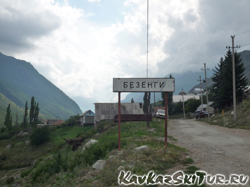 village Bezengi
|
 village Bezengi
|
 village Bezengi
|
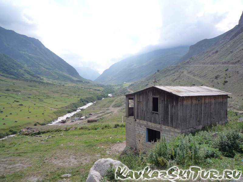
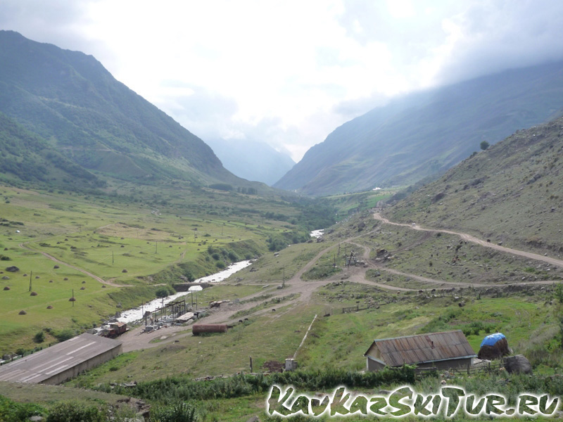 way to camp Bezengi
|
 way to camp Bezengi
|
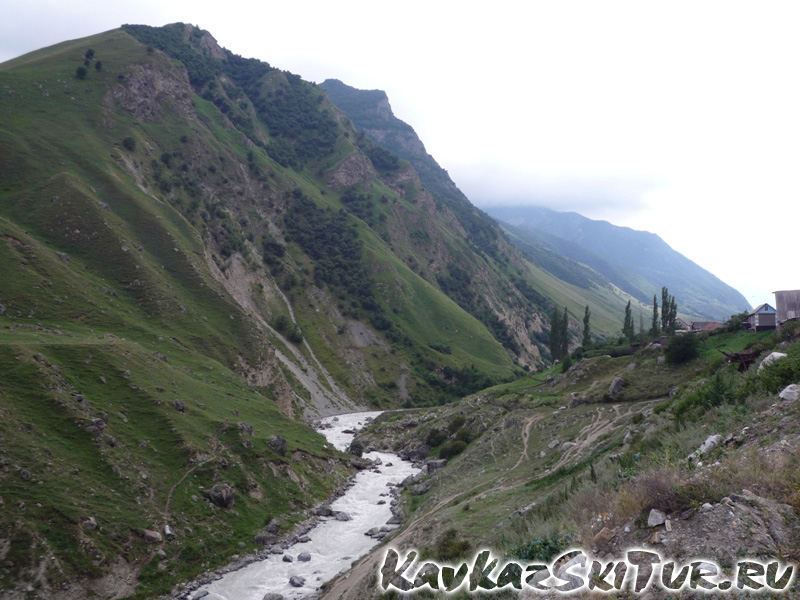 river Bezengi
|
The Caucasus is a vast mountain area consisting of many ranges. It stretches for 1,500 kilometers from the Black Sea to the Caspian Sea. Among the mountain ranges practically parallel to one another, the principal one, the axis of the whole Caucasus is the Main Range whose highest peaks reach over 5000 meters. These are: Dykh-Tau, Koshtan-Tau, Shkara and other giants. 8 summits in the Caucasus are five thousand meters high. All of them accept two, Elbrus and Kazbek, are situated in the Bezengi area.
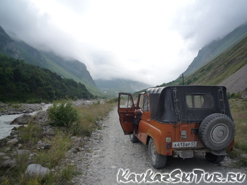
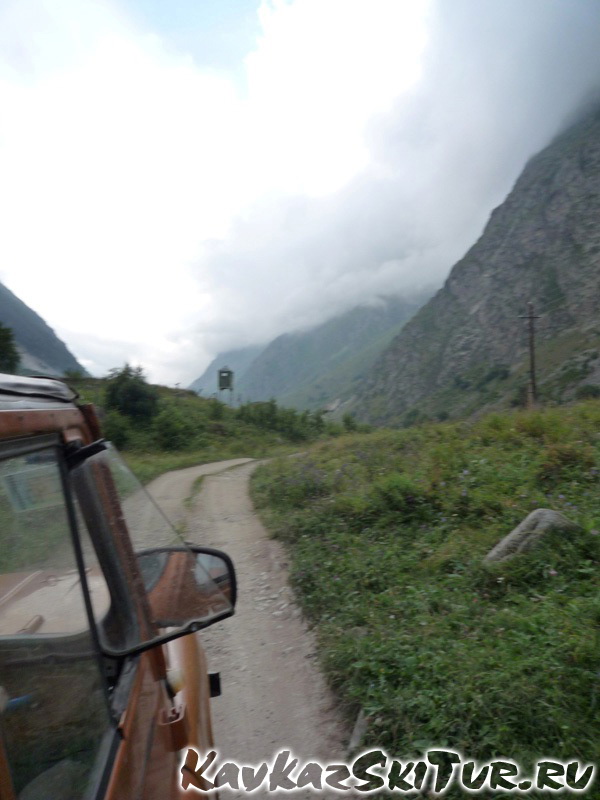
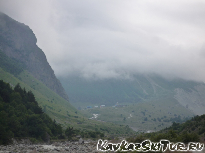
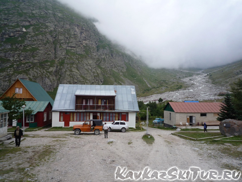
There is a road more or less normal bus route along the Besengi river till vill. Bezengi.  The transport leisurely ascends the mountain road, lunching over potholes and at turns, taking its passengers through woods down to the damp cold of the noisy river or ups above it in a cloud of dust, bringing the passengers to their destination, the village of Besengi. From there goes a dirty road which ends at the mountaineering camp “Besengi”.
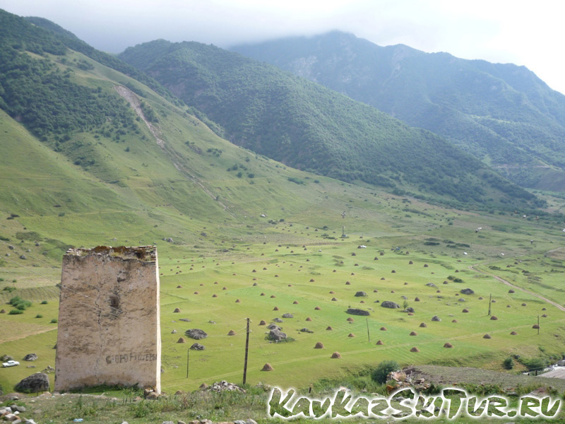
Many more things had ended even earlier: the heat and dust of civilization, shops and cinemas. There are no woods there. Instead there are huge mountains, ice and the roaring water. There is also the famous Besengi Wall – the 13 kilometers of ice, snow and cliffs rising to a height of five thousand meters. Even the very names of its peaks sound mysterious, far removed from the fuss of everyday life, and seem to carry one into a stern pure world: Lyalver – 4,350; Gestola – 4,860; Katyn-Tau – 4,986; Jangi-Tau – 5,040 and 5,051; the Peak of Shota Rustaveli – 4,960; Shkhara – 5,201.
It is here that the Besengi Cherek (river), also known as the Khulam Cherek, rises from the 13-kilometre Besengi glacier, the longest in the Caucasus, and the entire gorge is known as the Khulamo-Besengi Gorge. From the camp the climbers go on specially graded training routes and ascents, and the beginners train closer to the camp. In this forbidding region back in 1935 the first ever school of mountaineering in the Soviet Union was organized. The summits of the Besengi Range are within the reach of experienced climbers able to track long, difficult routes. In addition to Russian climbers, Besengi attracts many from other countries, who come to attack the peaks or for contests in rock-climbing and in rescue operations.
 way to camp Bezengi
|
 way to camp Bezengi
|
 camp Bezengi
|
 camp Bezengi
|
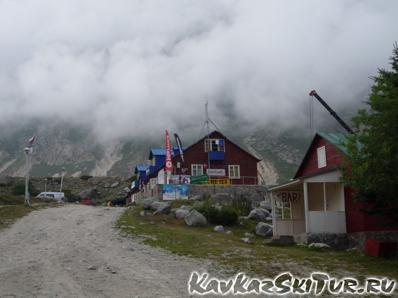
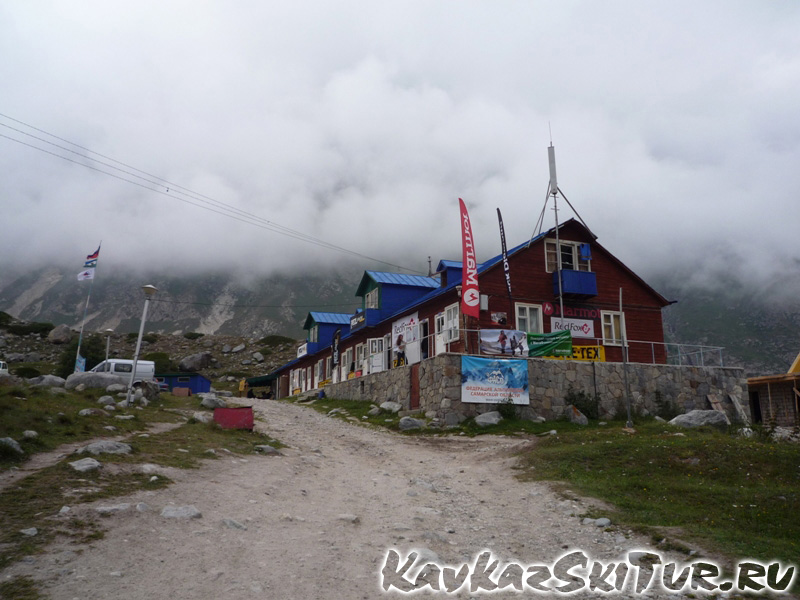
Alpcentre “Bezengi”
Alpine Training Centre (ATC) Bezengi is situated at the altitude of 2200 m above s.l. on the slope of The Great Caucasus Range where the Bezengi gorge sides with great rock-massif Bezengi-Wall by name. This place is the most attractive for all mountaineers having any level of qualification as there are a lot of routes to the peaks higher than 5000 m with exception of Elbrus and Kazbek. ATC Bezengui offers both easy enough routes for the beginners and the ones for high-qualified climbers.
ATC Bezengi disposes the hotel with the rooms of different comfort. All the places are 220 in quantity, among them 28 places are in the double-rooms with toilet and bath, 32 places are in the rooms for two, three, four persons with the facilities situated on the same floor. The rest of the places (160) are in the little houses for two, three, four persons who makes use of the facilities situated out-door.
ATC Bezengi proposes to rent all kinds of equipment. As for the rest and training, there are the sport-grounds, tennis-courts, billiard-hall, sauna with swimming-bath and bar in ATC Bezengi.
This centre has the old traditions and reach practice of climbing that’s why its’ guides are high-qualified, the descriptions of the routes are done in details a lot, the level of safety is high. Besides that a porter can help to conserve the strength. It is possible to connect to the telephone-line through the radio, also one can use three huts belonging to ATC Bezengui to organise the support of the complicated and difficult routes.
KavkazSkiTur Ltd. invites to ATC Bezengi, offers the transfer from the airports of Mineralny-Vody and Nalchik and from the railway stations of Patigorsk and the same towns also. The firm ensures the hotel, guide-service, porters, foodstuff, equipment and consultations.
KavkazSkiTur Ltd. provides the processing of the documents for the transit of the Bezengi region in a boundary control zone.
 camp Bezengi
|
 camp Bezengi
|
 camp Bezengi
|
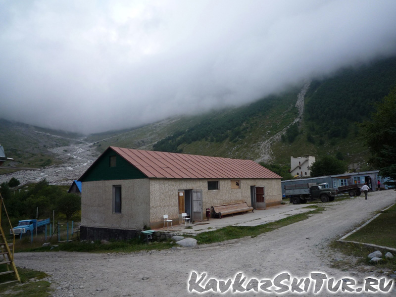 camp Bezengi
|
 camp Bezengi
|
 camp Bezengi
|
 camp Bezengi
|
 dinning room
|
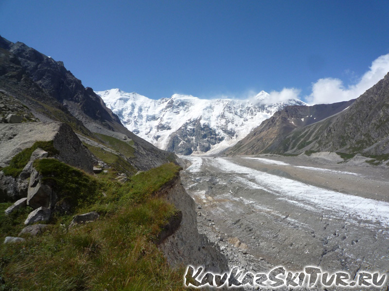 Bezengi glacier
|
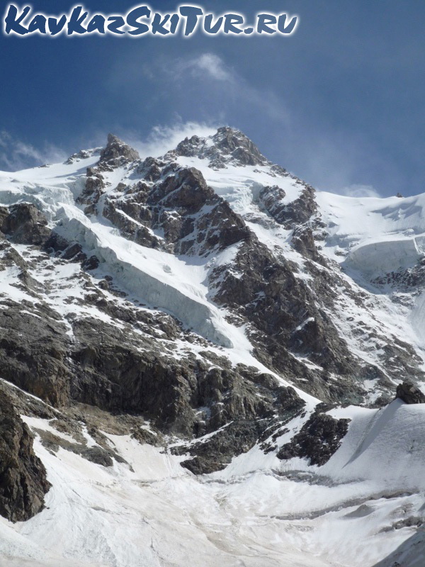
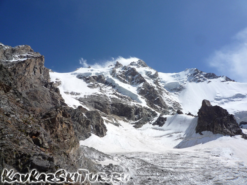
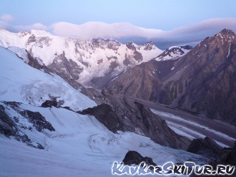
The Besengi Wall
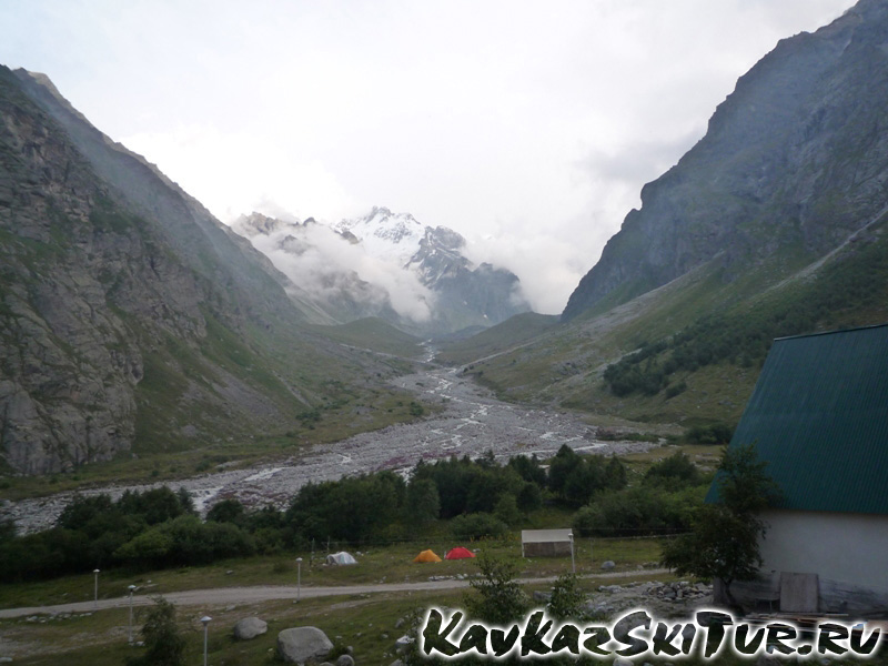
 If the weather allows,
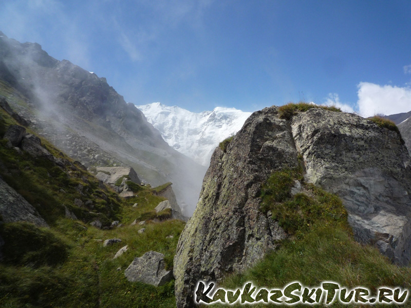
  the residents of the Bezengi camp can see the same picture from morning till night: a nearly regular triangle towering in the alignment of the canyon. It is the legendary Gestola, one of the gems of the famous Bezengi Wall.
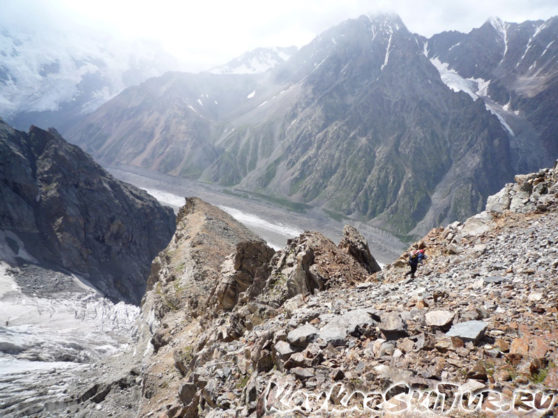
From the camp one can see only a small part of the 12-km-long mountain range called the Bezengi Wall. To reach it, you should descend from the camp straight to the tongue of the Bezengi glacier, walk along the moraine pocket, get to the glacier a little below the way up to Misses-kosh and walk along its wide plane surface for several hours. In 3-4 hours you are to get to the bottom of the Wall.

MISSES-KOSH
In about one hour walk from the camp, to the north from the glacier, there is the legendary Misses-kosh: a glade on top the green moraine, which had served as a Base Camp for many generations of climbers ascending the Bezengi Summits since 1930s.
Now it is not used any more after the mountaineering base was built. The glade became memorial: on the lower terrace there is a mountaineers’ cemetery (including the graves of famous brothers Maleinov – Aleksei, died in 1935 at Dykh-tau, and Andrei, died in 1984); on the upper terrace there is a memorial rock with individual memorial boards of Russian and foreign mountaineers as well as a habitable cabin for 8-10 people. In this corner in fine weather you understand what the paradise on earth is: sun and sky, flowers and grass, the views to snow-white summits, volume and air.
BARAN-KOSH. KARGASHILSKY MOUNTAIN RANGE
In a 2-3 hours walk from Misses-Kosh (but in the pocket of the right-side moraine of the glacier) there is another paradise place called Baran-Kosh. It is a notable place with two lakes; you should only accurately pass from the glacier to the moraine ridge and move along it towards the Wall while the path leads you straight to the lakes. From these overnight camps one can ascend the Kel pass. From this place mountaineers of old times used to ascend to the summits of the Kargashilsky mountain range which you passed while walking along the Bezengi glacier. Shaurtu, Salynan, Orto-Kara had good routes of 2-3 grade of difficulty. However, due to the general warming of the climate, these routes and even approaches to them became rather dangerous. That is why, nearly nobody visit the summits of the Kargashilsky mountain range nowadays.
THE BEZENGI WALL. JUNGI-KOSH
Having passed the traverse of Baran-Kosh, in about 30-50 minutes, you are to come to the place where one could install a guiding stone: “To the right – you’ll get to Tsanner; to the left – you’ll get to Jungi-kosh”. The wall has already opened, but you still cannot see its left shoulder – the shoulder of Shkhara. Here you can turn to the Tsanner pass and to the overnight camps on the Black Screes. These are where one could climb the western wall from and go the Lyalver and Gestola summits. The way to the right leads to the Austrian overnight camps and to the Jungi-kosh hut. To get there you should ascend along the moraine’s nose as if changing your direction by 90 degrees. To the left behind your back there is the Semenovsky peak. Part of the routes (to south-east) has also become dangerous; but others are good to climb (some 1-2 grade routes from the circus). As you have come up the moraine, have a rest. You are nearly in the centre of the Wall. Here it is, the beauty!
In about an hour an even path along the moraine ridge will lead you to a hut. The three-leveled construction in the alpine style big enough to accommodate 20 people is situated at the altitude of 3,200 metres. Around it there are a lot of places for tents. These are so called Austrian overnight camps. The hut is standing opposite the western summit of Shkhara and a wonderful view to the whole Wall – up to the Tsanner pass – opens from here. From left to right you can see the Main Shkhara, 5068 m; Western Shkhara, 5057 m; Shota Rustaveli peak, 4960 m; Main Jungi-tau, 5085 m; Katyn, 4974 m; Gestola, 4860 m; Lyalver, 4350 m; 4310 Peak.
The Wall, mailed in a snow-ice armour, with a height difference of about 2 km makes a great impression.
Routes of 4B-5B grade of difficulty (there are some of 2-3 from Lyalver). Two routes of 6 grade.
 Bezengi wall
|
 Bezengi wall
|
 Bezengi wall
|
 Bezengi wall
|
 Bezengi wall
|
 Bezengi wall
|
The Northern Massiv
The Northern Massif is a huge 15-km-long “horseshoe” range consisting of nine main summits, five of which are higher than five thousand metres. From east to west, there are Koshtantau – 5151 m; Tikhonov Peak – 4670 m; Krumkol – 4676 m; Eastern Mijirghi – 4927 m; Western Mijirghi – 5025 m; Borovikov Peak – 4888 m; Pushkin Peak – 5100 m; Eastern Dykh-tau – 5180 m; and the Main Dykh-tau – 5204 m.
Toward the South, the Northern Massif falls in rock walls, counterforts, and crests. From the north, the Massif is girdled with several layers of overhanging huge ice falls. The crest of the Massif is covered with ice and snow with sharp rock conglomerations, steep ice walls and snow cornices.
The northern side of the Massif receives a lot of precipitation which causes considerable freezing of the crest from the north. As a rule, strong gusty icy winds blow during the second half of the day. Storm fronts and thick fogs are often seen. Snow storms start and frozen rain falls down. One of the evident signs of an approaching storm is the arriving of dark clouds from the Georgian side from the ‘muggy corner’ – from Gestola and Lalver.
Nearly all routes from the north are classified as the 5 A-B category of difficulty (c/d). Five routes have the 6-A c/d.
The routes from the south are easier (4-5 c/d) as the slopes have less ice and are less steep. In all, the routes of the Northern Massif are long with a large – up to 2000 m – difference of altitudes and a large number of technically complicated combined ice-snow and rock sections covered with ice.
The northern slopes of the Massif have often been used for large competitions: the ice-snow classes of the Championships of the USSR and Russia. Many times the mountaineers who had conquered these routes became winners of the national championships.<>br The Krumkolsky Gap (4250 m) is popular among mountain tourists.
One can approach the circus of the Northern Massif from both right- and left-hand side moraine of the Kundyum-Mijirghi glacier. The march with rucksacks along convenient marked paths takes from 3 to 5 hours on average.
Those who like tracking can be advised to enjoy ‘Saratovskaya Krugosvetka’ (‘Saratov Round-the-World Tour’) – a one-day route with an ascent along a path at any side, crossing the glacier at the second level, and the descent at the other side. It is the favourite walk route of Yuri Sergeevich Saratov, The Head of the Bezengi rescue service.
CAMPS ‘3900’
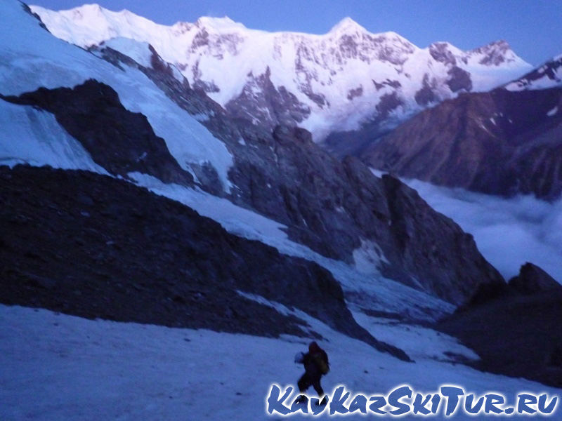
From the Krumkolsky overnight camps situated on the second level moraine of the Kundyum-Mijirghi glacier, a brave mountaineer would go across the ice-fall to the third level and then to the so called camps ‘3900’. Experienced people call the ice-fall “The Bezengi’s Khumbu”. Being inferior to its Nepal brother in length and area, the Bezengi ice-fall is as chaotic, unpredictable, and dangerous as Khumbu. In some years, it was impossible to cross it.
Those who succeeded in it would come to the mark 3900 m where they would make a camp at the slope of the moraine. A marvelous view opens from here to the huge pyramid of Koshtan-tau. A number of routes of 2-3 category of difficulty start from the circus. The chain of summits (Panoramny Peak – 4176 m, Ullu-auz – 4675 m, Kundyum-Mijirghi – 4500 m, Ptitsy (Birds)) is connected to the north-east crest of Koshtan-tau, where the route 4B c/d goes.
At present, the Bezengi area is not so often visited as before: for all that, the march with the load from the base to the camps ‘3900’ takes from 7 to 9 hours on average and usually demands an intermediate overnight staying at the second level.
UKYU CANYON – ‘WARM CORNER’
Approximately in an hour and a half of an ascent along the left-side moraine of the Kundyum-Mijirghi glacier, the traveller arrives to a turn to the Ukyu canyon, better known as the ‘Warm Corner’.
However in order to get there, one have to overcome a rather steep ascent covered with grass and scree. After an hour and a half from the crossing, you will see the red roof of the ‘Ukyu’ hut, 3900 m. This durable spacious (for up to 20 people) two-store structure was built in the beginning of the 1980s by ordinal mountaineers from the Bezengi camp.
Those who are prepared to stay overnight at the hut should remember that the nearby stream gets dry in the morning and one should fetch some water in the evening for the morning needs. Although the place chosen for the hut is safe but not perfect. Having passed one more 30-minute ascent, you get close to the main routes of this area. Here at the lower and upper terraces, there are lots of comfortable places for tents and another hut for 2-3 people. But you cannot rely on it; during the high season it is usually occupied by the rescue service team for it is their official ‘working space’.
To the north of the canyon, there are Gidan – 4167 m, Small Ukyu – 4240 m, Ukyu – 4346 m. To the right, one can see the massif of the Archimedes Peak – 4100 m – with a glacier hanging over the camp, Western Urals – 4300 m, Eastern Urals – 4150 m, Maly Urals – 4200 m, Dumala – 4557 m. Bending on its way, the Ukyu glacier leads to the 9th of May Pass. Up there, behind one more pass, one starts a descent to the Dumala valley. In the Ukyu area one can find routes from 1st to 5th category of difficulty. This district is very popular; passages from the tents are short (30-45 minutes), the routes are comparatively easy, the altitude difference is not large. The place is good for the beginners to pass their first classes (up to the 3rd class). Other visitors can find interesting routes for them too.
This corner is called ‘Warm’ because the Sun descending behind the opposite standing summits of the Kargashilsky mountain range shines up to the end of the day. Besides, the fog crawling over the place during the second half of the day usually passes aside from the tents standing on the lower terrace in complex air flows and, while it is gray and wet around, you can see the blue sky above your head.
Having passed the turn to the Ukyu canyon, in 30-40 minutes you will come to the ‘Third lane’. In this small canyon the ways to the southern wall of the Urals summit as well as some popular routes of the northern wall of the Ullu-auz.
ALONG THE BRNO PEAK
Having left the camp along the path of the right moraine of the Kundyum-Mijirghi glacier, in one hour you will reach a glade called ‘the 1st football field’. This place is convenient for climbing lessons. Further you will walk along the slopes of the Brno Peak; after that, in 1.5-2 hours, you will arrive to the ‘2nd football field’ where you can set up a camp. Also, you can find places for tents 15 minutes higher than that place. While on the glade, try to keep to its left half as from the overhanging wall some occasional stones can fall down. However, they do not reach farther than the middle line of the lawn. Every evening, one can watch the same TV program – ‘In the World of Animals’ with the same goats as the main heroes. They are rude and vulgar in this region as well as everywhere throughout the Bezengi district. Sometimes one can enjoy another TV program – ‘Extreme’. It is when the goats travel above the tents on the rock wall that looks virtually upright. I suggest you to look at it!
From these camps it is convenient to go for ice-climbing trainings. The path goes higher, to the 5th-category route to the Misses, and along the bed of a stream to the circus where the 1-2-category routes start leading to the Brno Peak (4100 m), Kursantov Peak (3850 m) or to the 4th-category route to Misses-tau (4427 m).